Datyane

Last updated

Datyane
town
India Maharashtra location map.svg
Red pog.svg
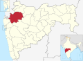
Datyane
Location in Maharashtra, India
Coordinates: 20°4′48″N73°58′41″E / 20.08000°N 73.97806°E / 20.08000; 73.97806 Coordinates: 20°4′48″N73°58′41″E / 20.08000°N 73.97806°E / 20.08000; 73.97806
CountryFlag of India.svg  India
State Maharashtra
District Nashik
Languages
  Official Marathi
Time zone UTC+5:30 (IST)

Datyane is a village in the Niphad taluka, Nashik district of Maharashtra, India, [1] situated on the river Banganga and on the Ozar-Kasabe Sukena connecting road. It shares borders with Narayangaon (Kherawadi) to the south, Shirasgaon to the north, Dixi and Ozar to the west and Owne and Theragaon to the east.

Economy

The population of this farming community is slightly over 3000. The village itself has 1,285 people (Male: 679, Female: 606). [2] Major crops include grapes, sugarcane, onions, vegetables, wheat, jwar, bajra, ground nuts, and pulses, and villagers work in other vineyards in the area. Water is plentiful: farmers have access to irrigation supported by Kolhapur-type bunds and wells and the Gangapur, Maharashtra left canal. A few of the larger farmers also use irrigation siphons. The village is near both of the taluka's sugar factories and the Hindustan Aeronautics Limited plant in Ozar.

Schools are the Gram Panchayat primary school and the Maratha Vidyaprasarak Samaj high school.

Related Research Articles

<span class="mw-page-title-main">Sindhudurg district</span> District of Maharashtra in India

Sindhudurg district is an administrative district of the Konkan division in India, which was carved out of the erstwhile Ratnagiri district. The district headquarters are located at Oros and the district occupies an area of approximately 5,207 km2 and has a population of 849,651, of which 12.59% were urban. As of 2011, it's the least populous district of Maharashtra.

<span class="mw-page-title-main">Nashik district</span> District of Maharashtra in India

Nashik district, also known as Nasik district, is a district in Maharashtra, India. The city of Nashik is the administrative headquarters of the district. Nashik is well known for the production of wine. Nashik is also known as Mini Maharashtra, because the climate and soil conditions of Surgana, Peth, Igatpuri resembles with Konkan. Niphad, Sinnar, Dindori, Baglan blocks are like Western Maharashtra and Yeola, Nandgaon, Chandwad blocks are like Vidarbha Region. Nashik is the biggest city in the district while Malegaon is the second biggest city. Manmad, Igatpuri, sinnar are some of the big cities situated in the Nashik District. Manmad is one of the biggest railway junction in india while the city of Malegaon is famous for its powerloom.

Niphad Town in Nashik, India

Niphad is the name both of the town and the Taluka headquartered there. It is within the Nashik District of Maharashtra, India. The Marathi name signifies "a place without mountains", and indeed the taluka's topography is fairly level, with hardly any hills. It is served by Niphad railway station. Niphad's latitude and longitude coordinates are 20°5′0″N74°7′0″E. Located northeast of Nashik city, the Taluka borders Sinnar, Nashik, Dindori, Chandwad, and Yeola Talukas and Ahmednagar District, and has no direct access to the sea. The Niphad Sub-Division is composed of Niphad, Sinnar and Yeola Talukas.

Narkhed is a town and a municipal council in Nagpur district in the Indian state of Maharashtra. It is about 87 km north-west of Nagpur. It is the administrative headquarters of Narkhed taluka, one of the 14 talukas of this district. It is located in the "orange belt" and is a major center for orange-trading.

Peth or Peint is the smallest tehsil of Nashik subdivision of Nashik district in Maharashtra, India. It belongs to Northern Maharashtra region. It belongs to Nashik Division. Peth is a Taluka headquarter. It is located 54 km to the West of Nashik District headquarters. It is also called as Peint. Pin code of Peth is 422208 and postal head office is Peth.

<span class="mw-page-title-main">Painganga River</span>

The Painganga River is the chief river of the Buldhana district, Hingoli district, Nanded district, Yavatmal district, Chandrapur district and Washim district in the Maharashtra state in India. It flows along the southeast boundaries of the district in a winding, meandering course. It is deeply entrenched and difficult to navigate. It rises in the Ajantha range and is a major tributary of the Wardha River, the other major river in the district. It is also divided Marathwada and Vidarbha near Umarkhed.

Soundane is a small village located in western Maharashtra in India. Taluka place for the village is Mohol. Post office for Soundane is located in a nearby village Tambole . Soundane is part of the Solapur District.

Jalgaon is a city in western India. It may also refer to:

Pimpri Gawali is a village in Parner taluka in Ahmednagar district of the state of Maharashtra, India.

Pimpalgaon Baswant is a city in Nashik district, Maharashtra, India. It lies 30 km north of Nashik on the NH3. With the new national highway numbering, it lies on NH60. It is well connected with a six lane motorway with Nashik. Its geographical coordinates are 20° 10' 0" North, 73° 59' 0" East. It is situated on the banks of a small river Parashari. It derives its name Baswant from the local deity Baswanteshwar located inside the old town, this also helps to distinguish this town from other towns having the same first name.

Khadak Malegaon, Subdistrict-Niphad, District-Nashik, Maharashtra, India, 422304. The village is well known for production of quality grapes. Khadak Malegaon contributes a remarkable supply quantity of grapes every year to the country and abroad. Khadak Malegaon is situated on banks of river Shelu and on Niphad-Chandwad Connecting Road and shares border with Pimplad in East, Khangaon in South, Deorgaon in North-West, Sarole Kh. in South-West and Vanasgaon.

<span class="mw-page-title-main">Narkhed taluka</span> Tehsil in Maharashtra, India

Narkhed taluka is one of the 14 taluka of Nagpur district in state of Maharashtra, India.

<span class="mw-page-title-main">Pench River</span> River in India

The Pench River is an Indian tributary of the Kanhan River. It originates in the Chhindwara district of Madhya Pradesh and flows across Pench National Park, which is a reserve for the Tiger Project of India.

Chorachiwadi is a panchayat village in Maharashtra, India. Administratively, Chorachiwadi is in the Shrigonda taluka of Ahmadnagar District in Maharashtra.

Pimapalas Town in Nashik, India

Pimpalas is the name both of a town in the Nashik District of Maharashtra, India. The Marathi name signifies "a place without mountains", and indeed the taluka's topography is fairly level, with hardly any hills. It is served by Kasabe Sukena railway station.pimpalas's latitude and longitude coordinates are 20°5′0″N74°7′0″E. Located northeast of Nashik city, the Taluka borders Sinnar, Nashik, Dindori, Chandwad, and Yeola Talukas and Ahmednagar District, and has no direct access to the sea.

Banganga is a small tributary of the Godavari River in the Nashik district, in the state of Maharashtra in western India.

Saykheda is a village in India in Niphad, Nashik district in the Indian state of Maharashtra.

<span class="mw-page-title-main">Bhendali</span> Village in Maharashtra State, India.

Bhendali village is situated in Niphad Taluka of Nashik district, Maharashtra State, India.

Shingave is a village in Rahata taluka of Ahmednagar district in the Indian state of Maharashtra. It is one of the largest village by area in Rahata.

North Maharashtra or Uttar Maharashtra is a geographical region in the Maharashtra state of India. It comprises the Nashik, Dhule, Nandurbar, and Jalgaon districts. It borders the state of Gujarat to the northwest, also Paschim Maharashtra to the south and Konkan to the west, Vidarbha & Marathwada regions of Maharashtra to the east.

References

  1. "Taluka Name : Niphad" Maharashtra Government. Retrieved 21 Feb 2009
  2. "Datyane Village" Our Village India. Retrieved 21 Feb 2009.