Johnson City, Oregon

Last updated

Johnson City, Oregon
Lake Leona in Johnson City, Oregon.jpg
Lake Leona in Johnson City, Oregon
Clackamas County Oregon Incorporated and Unincorporated areas Johnson City Highlighted.svg
Location in Oregon
Coordinates: 45°24′17″N122°34′51″W / 45.40472°N 122.58083°W / 45.40472; -122.58083
Country United States
State Oregon
County Clackamas
Incorporated 1970
Government
   Mayor Vince Whitehead
Area
[1]
  Total0.07 sq mi (0.18 km2)
  Land0.07 sq mi (0.17 km2)
  Water0.00 sq mi (0.01 km2)
Elevation
60 ft (20 m)
Population
 (2020) [2]
  Total539
  Density8,292.31/sq mi (3,204.59/km2)
Time zone UTC-8 (Pacific)
  Summer (DST) UTC-7 (Pacific)
ZIP code
97267
Area code(s) 503 and 971
FIPS code 41-37650 [3]
GNIS feature ID1639428 [4]

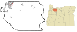
Johnson City is a city in Clackamas County, Oregon, United States. The population was 566 at the 2010 census. Because of its small area, its population density is over 8,000 per square mile, making it the most densely populated city in Oregon. [5]

Contents

History

On June 16, 1970, the residents of a trailer court owned by Delbert Johnson voted 49-to-10 to incorporate. Johnson had started the development in 1959, and in 1968 was unsuccessful in having the area annexed to Gladstone. The 55th Oregon Legislative Assembly in 1969 established a boundary review board to prevent an increase in small incorporated cities, but proponents of Johnson City's incorporation had filed for an election before the law took effect. [6]

Johnson City residents are not eligible to participate in the Clackamas County library system (LINCC), and subsequently any of its county partners. [7] They are also not eligible for North Clackamas Parks and Recreation (NCPRD) programs, [8] which includes Meals on Wheels. [9]

In an effort to join the Library District of Clackamas County, the Johnson City Tenant Collective (JCTC) put Measure 3-585 on the 2022 November General Election Ballot. [10] It did not pass, and there is an open investigation against the owner of Johnson Mobile Estates for possible voter intimidation. [11]

Geography

According to the United States Census Bureau, the city has a total area of 0.07 square miles (0.18 km2), all of it land. [12]

Demographics

Historical population
CensusPop.Note
1980 378
1990 58655.0%
2000 6348.2%
2010 566−10.7%
2020 539−4.8%
U.S. Decennial Census [13] [2]

2010 census

As of the census of 2010, there were 566 people, 268 households, and 141 families living in the city. The population density was 8,085.7 inhabitants per square mile (3,121.9/km2). There were 278 housing units at an average density of 3,971.4 per square mile (1,533.4/km2). The racial makeup of the city was 84.3% White, 0.4% African American, 1.4% Native American, 1.9% Asian, 7.4% from other races, and 4.6% from two or more races. Hispanic or Latino of any race were 15.4% of the population. [3]

There were 268 households, of which 19.8% had children under the age of 18 living with them, 36.9% were married couples living together, 13.1% had a female householder with no husband present, 2.6% had a male householder with no wife present, and 47.4% were non-families. 40.3% of all households were made up of individuals, and 14.9% had someone living alone who was 65 years of age or older. The average household size was 2.09 and the average family size was 2.84. [3]

The median age in the city was 47.1 years. 18.7% of residents were under the age of 18; 6.2% were between the ages of 18 and 24; 22.8% were from 25 to 44; 33.8% were from 45 to 64; and 18.6% were 65 years of age or older. The gender makeup of the city was 48.8% male and 51.2% female. [3]

2000 census

As of the census of 2000, there were 634 people, 275 households, and 169 families living in the city. The population density was 11,061.5 inhabitants per square mile (4,270.9/km2). There were 286 housing units at an average density of 4,989.9 per square mile (1,926.6/km2). The racial makeup of the city was 93.69% White, 1.10% African American, 1.10% Native American, 0.47% Asian, 1.58% from other races, and 2.05% from two or more races. Hispanic or Latino of any race were 3.79% of the population. [3]

There were 275 households, out of which 24.4% had children under the age of 18 living with them, 44.4% were married couples living together, 13.1% had a female householder with no husband present, and 38.2% were non-families. 32.4% of all households were made up of individuals, and 12.0% had someone living alone who was 65 years of age or older. The average household size was 2.28 and the average family size was 2.84. [3]

In the city, the population was spread out, with 22.2% under the age of 18, 6.2% from 18 to 24, 30.0% from 25 to 44, 26.5% from 45 to 64, and 15.1% who were 65 years of age or older. The median age was 39 years. For every 100 females, there were 98.7 males. For every 100 females age 18 and over, there were 93.3 males. [3]

The median income for a household in the city was $35,517, and the median income for a family was $36,985. Males had a median income of $32,500 versus $23,523 for females. The per capita income for the city was $16,967. About 6.1% of families and 8.1% of the population were below the poverty line, including 9.9% of those under age 18 and 10.7% of those age 65 or over. [3]

Management

Johnson City is also known as Johnson Mobile Estates, a mobile home park. It has a high turnover rate, and houses are often replaced instead of resold. Rent is increased every year, with the most recent increases at $60 a month.

The Johnson City Tenant Collective (JCTC) was formed in 2021, when Johnson Mobile Estates tried to evict a resident for yard decorations.

See also

Related Research Articles

<span class="mw-page-title-main">Clackamas County, Oregon</span> County in Oregon, United States

Clackamas County is one of the 36 counties in the U.S. state of Oregon. As of the 2020 census, the population was 421,401, making it Oregon's third-most populous county. Its county seat is Oregon City. The county was named after the American Indians living in the area, the Clackamas people, who are part of the Chinookan peoples.

<span class="mw-page-title-main">Richland, Oregon</span> City in Oregon, United States

Richland is a city in Baker County, Oregon, United States. The population was 156 at the 2010 census.

<span class="mw-page-title-main">Unity, Oregon</span> City in Oregon, United States

Unity is a city in Baker County, Oregon, United States, located in the Burnt River Valley. The population was 71 at the 2010 census.

<span class="mw-page-title-main">Barlow, Oregon</span> City in Oregon, United States

Barlow is a city in Clackamas County, Oregon, United States. The population was 133 at the 2020 census. The mayor of Barlow is Michael Lundsten, as of the most recent election in 2018.

<span class="mw-page-title-main">Canby, Oregon</span> City in Oregon, United States

Canby is a city in Clackamas County, Oregon, United States. The population was 18,171 at the 2020 census. It is along Oregon Route 99E, 2 miles (3 km) northeast of Barlow.

<span class="mw-page-title-main">Clackamas, Oregon</span> Unincorporated community in the state of Oregon, United States

Clackamas is an unincorporated community and former census-designated place (CDP) in Clackamas County, Oregon, United States, and is a suburb of Portland. The population was approximately 7,000 as of 2010.

<span class="mw-page-title-main">Estacada, Oregon</span> City in Oregon, USA

Estacada is a city in Clackamas County, Oregon, United States, about 30 miles (48 km) southeast of Portland. The 2020 population is estimated to be 3,700. According to the 2010 census, the population in 2010 was 2,695.

<span class="mw-page-title-main">Happy Valley, Oregon</span> City in Oregon, United States

Happy Valley is a suburban city in the Portland, Oregon metropolitan area. Happy Valley is near the northwest edge of Clackamas County, Oregon, United States approximately 10 miles to the southeast of downtown Portland, Oregon. The population was 23,733 at the 2020 census.

<span class="mw-page-title-main">Jennings Lodge, Oregon</span> Unincorporated community in the state of Oregon, United States

Jennings Lodge is a census-designated place and unincorporated community in Clackamas County, Oregon, United States, between Milwaukie and Gladstone. For statistical purposes, the United States Census Bureau has defined Jennings Lodge as a census-designated place (CDP). The census definition of the area may not precisely correspond to local understanding of the area with the same name. As of the United States Census, 2010, it had a total population of 7,315.

<span class="mw-page-title-main">Oak Grove, Oregon</span> Unincorporated community in the state of Oregon, United States

Oak Grove is an unincorporated community in Clackamas County, Oregon, United States, in the Portland metropolitan area. For statistical purposes, the United States Census Bureau has defined Oak Grove as a census-designated place (CDP). The census definition of the area may not precisely correspond to local understanding of the area with the same name. The population was 16,629 at the 2010 census.

<span class="mw-page-title-main">Oatfield, Oregon</span> Unincorporated community in the state of Oregon, United States

Oatfield is an unincorporated community and census-designated place in Clackamas County, Oregon, United States. It is in the Portland metropolitan area. As of the 2010 census, the population of the CDP was 13,415.

<span class="mw-page-title-main">Sunnyside, Clackamas County, Oregon</span> Unincorporated community in the state of Oregon, United States

Sunnyside is a former census-designated place in Clackamas County in the U.S. state of Oregon. Located in the Portland metropolitan area along Interstate 205, the population was 6,791 at the 2000 census. The area was not recorded as a distinct place for the 2010 census.

<span class="mw-page-title-main">Lakeside, Oregon</span> City in Oregon, United States

Lakeside is a city in Coos County, Oregon, United States. The population was 1,699 at the 2010 census.

<span class="mw-page-title-main">Butte Falls, Oregon</span> City in Oregon, United States

Butte Falls is a city in Jackson County, Oregon, United States. The population was 423 at the 2010 census. As of July 1, 2018, the city's population was estimated to be 450.

<span class="mw-page-title-main">Dunes City, Oregon</span> City in Oregon, United States

Dunes City is a city in Lane County, Oregon, United States. The population was 1,303 at the 2010 census.

<span class="mw-page-title-main">Siletz, Oregon</span> City in Oregon, United States

Siletz is a city in Lincoln County, Oregon, United States. The population was 1,212 at the 2010 census. The city is located next to the Siletz Reservation and is the site of the annual Nesika Illahee Pow Wow in August.

<span class="mw-page-title-main">Stanfield, Oregon</span> City in Oregon, United States

Stanfield is a city in Umatilla County, Oregon, United States. The population was 2,043 at the 2010 census. It is part of the Pendleton–Hermiston Micropolitan Statistical Area.

<span class="mw-page-title-main">Rivergrove, Oregon</span> City in Oregon, United States

Rivergrove is a city in Clackamas County, Oregon, United States. A small portion of the city extends into nearby Washington County. Its name is a portmanteau of the Tualatin River, which forms its southern border, and Lake Grove, a community that is now part of Lake Oswego. The population was 370 at the 2010 census.

<span class="mw-page-title-main">Gates, Oregon</span> City in Oregon, United States

Gates is a city on the border of Linn and Marion counties in Oregon, United States. The population was 548 at the 2020 census. The greater part of Gates' population is in Marion County and the city is primarily under Marion County's jurisdiction.

<span class="mw-page-title-main">Sutherlin, Oregon</span> City in Oregon, United States

Sutherlin is a city in Douglas County, Oregon, United States. As of the 2010 Census, the population was 7,810, making it the second most populous city in Douglas County. Located off of I-5, nearby features include Cooper Creek Reservoir, Ford's pond, the Umpqua River, a golf course, and numerous vineyards.

References

  1. "ArcGIS REST Services Directory". United States Census Bureau. Retrieved October 12, 2022.
  2. 1 2 "Census Population API". United States Census Bureau. Retrieved October 12, 2022.
  3. 1 2 3 4 5 6 7 8 "U.S. Census website". United States Census Bureau . Retrieved December 21, 2012.
  4. "US Board on Geographic Names". United States Geological Survey. October 25, 2007. Retrieved January 31, 2008.
  5. Bureau, US Census. "Decennial Census by Decades". www.census.gov. Retrieved August 13, 2019.
  6. McArthur, Lewis A.; McArthur, Lewis L. (2003) [1928]. Oregon Geographic Names (7th ed.). Portland, Oregon: Oregon Historical Society Press. p. 515. ISBN   978-0875952772.
  7. "How to Get a Library Card".
  8. "Are you in the District? - North Clackamas Parks & Recreation District".
  9. "Milwaukie Community Center Services - North Clackamas Parks & Recreation District".
  10. "Johnson City's 540 residents consider joining library system".
  11. "Oregon mobile home community owner under investigation for possible voter intimidation". November 2022.
  12. "US Gazetteer files 2010". United States Census Bureau. Archived from the original on January 25, 2012. Retrieved December 21, 2012.
  13. "Census of Population and Housing". Census.gov. Retrieved June 4, 2015.