
The Loop, one of Chicago's 77 designated community areas, is the central business district of the city and is the main section of Downtown Chicago. Home to Chicago's commercial core, it is the second largest commercial business district in North America and contains the headquarters and regional offices of several global and national businesses, retail establishments, restaurants, hotels, and theaters, as well as many of Chicago's most famous attractions. It is home to Chicago's City Hall, the seat of Cook County, and numerous offices of other levels of government and consulates of foreign nations. The intersection of State Street and Madison Street, located in the area, is the origin of the address system of Chicago's street grid. Most of Grant Park's 319 acres (1.29 km2) are in the eastern section of the community area. The Loop community area is bounded on the north and west by the Chicago River, on the east by Lake Michigan, and on the south by Roosevelt Road.

Riverside is a suburban village in Cook County, Illinois, United States. A significant portion of the village is in the Riverside Landscape Architecture District, designated a National Historic Landmark in 1970. The population of the village was 9,298 at the 2020 census, up from 8,875 at the 2010 census. It is a suburb of Chicago, located roughly 9 miles (14 km) west of downtown Chicago and 2 miles (3 km) outside city limits.

Humboldt Park, one of 77 designated community areas, is on the West Side of Chicago, Illinois. The Humboldt Park neighborhood is known for its dynamic social and ethnic demographic change over the years. The Puerto Rican community has identified strongly with the area since the 1970s. Humboldt Park is also the name of a 207-acre (0.8 km2) park adjacent to the community area.

Logan Square is an official community area, historical neighborhood, and public square on the northwest side of the City of Chicago. The Logan Square community area is one of the 77 city-designated community areas established for planning purposes. The Logan Square neighborhood, located within the Logan Square community area, is centered on the public square that serves as its namesake, located at the three-way intersection of Milwaukee Avenue, Logan Boulevard and Kedzie Boulevard.

Hermosa is one of 77 designated Chicago community areas and is located on the northwest side of Chicago, Illinois. The Hermosa community area contains the Kelvyn Park and Hermosa neighborhoods. The area includes the birthplace of Walt Disney and is the former headquarters of the Schwinn Bicycle Company. While being one of the smaller community areas, Hermosa is one of the city's most densely populated neighborhoods.

Irving Park is one of 77 officially designated Chicago community areas, and is located on the Northwest Side. It is bounded by the Chicago River on the east, the Milwaukee Road railroad tracks on the west, Addison Street on the south and Montrose Avenue on the north, west of Pulaski Road stretching to encompass the region between Belmont Avenue on the south and, roughly, Leland Avenue on the north. It is named after the American author Washington Irving.

The Near South Side is a community area of Chicago, Illinois, United States, just south of the downtown central business district, the Loop. The Near South Side's boundaries are as follows: North—Roosevelt Road ; South—26th Street; West—Chicago River between Roosevelt and 18th Street, Clark Street between 18th Street and Cermak Road, Federal between Cermak Road and the Stevenson Expressway just south of 25th Street, and Clark Street again between the Stevenson and 26th Street; and East—Lake Michigan.

West Town, northwest of the Loop on Chicago's West Side, is one of the city's officially designated community areas. Much of this area was historically part of Polish Downtown, along Western Avenue, which was then the city's western boundary. West Town was a collection of several distinct neighborhoods and the most populous community area until it was surpassed by Near West Side in the 1960s. The boundaries of the community area are the Chicago River to the east, the Union Pacific railroad tracks to the south, the former railroad tracks on Bloomingdale Avenue to the North, and an irregular western border to the west that includes the city park called Humboldt Park. Humboldt Park is also the name of the community area to West Town's west, Logan Square is to the north, Near North Side to the east, and Near West Side to the south. The collection of neighborhoods in West Town along with the neighborhoods of Bucktown and the eastern portion of Logan Square have been referred to by some media as the "Near Northwest Side".

West Garfield Park on the West Side of Chicago, Illinois, is one of 77 officially designated Chicago community areas. It is directly west of Garfield Park.

North Lawndale is one of the 77 community areas of the city of Chicago, Illinois, located on its West Side. The area contains the K-Town Historic District, the Foundation for Homan Square, the Homan Square interrogation facility, and the greatest concentration of greystones in the city. In 1968, Rev. Dr. Martin Luther King Jr. stayed in an apartment in North Lawndale to highlight the dire conditions in the area and used the experience to pave the way to the Fair Housing Act.

U.S. Route 66 was a United States Numbered Highway in Illinois that connected St. Louis, Missouri, and Chicago, Illinois. The historic Route 66, the Mother Road or Main Street of America, took long distance automobile travelers from Chicago to Southern California. The highway had previously been Illinois Route 4 and the road has now been largely replaced with Interstate 55 (I-55). Parts of the road still carry traffic and six separate portions of the roadbed have been listed on the National Register of Historic Places.

Illinois's 2nd congressional district is a congressional district in the U.S. state of Illinois. Based in the south suburbs of Chicago, the district includes southern Cook county, eastern Will county, and Kankakee county, as well as the city of Chicago's far southeast side.

Kostner, formerly known as Kildare, is an 'L' station on the CTA's Pink Line. It is located in the K-Town neighborhood of the North Lawndale community area, often just referred to as Lawndale. Kostner station was originally opened as Kildare. During reconstruction in 2003, its primary entrance was moved one block west to Kostner Avenue and the Kildare entrance became an auxiliary entrance.

Pulaski Road is a major north-south street in the city of Chicago, at 4000 W., or exactly five miles west of State Street. It is named after Polish hero of the American Revolutionary War Casimir Pulaski.

Cermak Road, also known as 22nd Street, is a 19-mile, major east–west street on Chicago's near south and west sides and the city's western suburbs. In Chicago's street numbering system, Cermak is 2200 south, or twenty-two blocks south of the baseline of Madison Street. Normally, one mile comprises eight Chicago blocks, but the arterial streets Roosevelt Road, formerly named Twelfth Street and at 1200 South, and Cermak Road were platted before the eight-blocks-per-mile plan was implemented. Roosevelt Road is one mile south of Madison Avenue and there are twelve blocks within that mile. Cermak Road is two miles south of Madison Avenue and there are ten blocks within the mile between Roosevelt and Cermak Roads.

The Villa District, also known as Villa Historic District, is a historic district in Chicago, Illinois, United States. It is located on Chicago's Northwest Side within the community area of Irving Park. Its borders are along Pulaski Road to the west, the Union Pacific/Northwest rail line to the north, Hamlin Avenue to the east, and Addison Street to the south. Located directly north of the Wacławowo area of Avondale, the Villa District is serviced by the Blue Line's Addison street station.
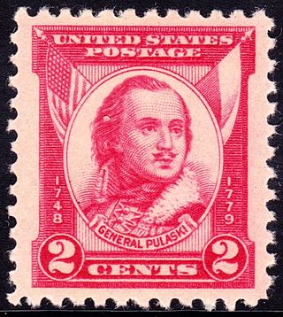
Casimir Pulaski was a Polish nobleman, soldier and military commander who has been called "the father of the American cavalry". He has had hundreds of monuments, memorial plaques, streets, parks and similar objects named after him.

The Cermak branch, formerly known as the Douglas branch, is a 6.6 mi (10.6 km) long section of the Pink Line of the Chicago "L" system in Chicago, Illinois. It was built by the Metropolitan West Side Elevated west of the Loop. As of February 2013, it serves an average of 17,474 passengers every weekday. The branch serves the Near West Side, Pilsen, Lower West Side, South Lawndale, and North Lawndale neighborhoods of Chicago, and the west suburb Cicero, Illinois. The branch operates from 4:05 a.m. to 1:25 a.m., weekdays, and Saturdays from 5:05 a.m. to 1:25 a.m., and Sundays from 5:00 a.m. to 1:25 a.m., including holidays.
The West Side is one of the three major sections of the city of Chicago, Illinois, U.S. The other two sections within Chicago that associate with the West Side are the North Side and the South Side. The West Side consists of communities that are of historical, cultural, and ideological importance to the history and development of Chicago. On the flag of Chicago, the West Side is represented by the central white stripe.

The historic Chicago park and boulevard system is a ring of parks connected by wide, planted-median boulevards that winds through the north, west, and south sides of the City of Chicago. The neighborhoods along this historic stretch include, Logan Square, Humboldt Park, Englewood, Back of the Yards, Lawndale, and Bronzeville. It reaches as far west as Garfield Park and turns south east to Douglas Park. In the south, it reaches Washington Park and Jackson Park, including the Midway Plaisance, used for the 1893 World's Fair.


