
Pathanamthitta District, is one of the 14 districts in the Indian state of Kerala. The district headquarters is in the town of Pathanamthitta. There are four municipalities in Pathanamthitta: Adoor, Pandalam, Pathanamthitta and Thiruvalla.
Adoor is a municipality in the Pathanamthitta district of Kerala, India. It is the headquarters of the Adoor Taluk and Adoor Revenue Division. Adoor is located 18 km (11.2 mi) southwest of the district headquarters Pathanamthitta and 85 km (52.8 mi) north of the state capital Thiruvananthapuram.

Kottarakkara, also transliterated as Kottarakara, is a town and municipality in the Kollam district of the Kerala, India. Kottarakkara lies 27 kilometres (17 mi) to the east of Kollam city centre.

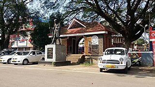
Pathanamthitta, is a municipality situated in the Southern Kerala, India, spread over an area of 23.50 km2. It is the administrative capital of Pathanamthitta district. The town has a population of 37,538. The Hindu pilgrim centre Sabarimala is situated in the Pathanamthitta district; as the main transport hub to Sabarimala, the town is known as the 'Pilgrim Capital of Kerala'. Pathanamthitta District, the thirteenth revenue district of the State of Kerala, was formed with effect from 1 November 1982, with headquarters at Pathanamthitta. Forest covers more than half of the total area of the District. Pathanamthitta District ranks the 7th in area in the State. The district has its borders with Allepey, Kottayam, Kollam and Idukki districts of Kerala and Tamil Nadu. Nearest city Is Thiruvalla, located at a distance of 30 km. Thiruvalla railway station Is 30 km via Thiruvalla-Kumbazha highway. Buses ply every 5 Minutes from Thiruvalla To Pathanamthitta & vice versa.

Konni, also spelt Konny, is a town and taluk headquarters in Pathanamthitta district of Kerala, India. Konni is known for its elephant cages, forests, and rubber plantations. It is also known as "Aanakoodinte Nadu". Nearest town is Pathanamthitta. Konni is located 32 km (20 mi) from Chengannur railway station and NH 183 in Chengannur. It is well-connected via Muvattupuzha - Punalur state highway. Buses ply frequently from Pathanamthitta KSRTC bus station to Konni.
Padanilam is a town located in Onattukara region of Alappuzha district, Kerala. The word Padanilam means "land of battles". It is located on the banks of river Achankovil. The Padanilam temple is one of the important centres of worship in Kerala. Nooranad is named as the Nandikesha Paithruka Gramam by the Government of Kerala due to its importance in kettukala construction, which is an icon of Onattukara region.

Elavumthitta is a town in Pathanamthitta district of Kerala, India. The majority of its inhabitants are from Hindu and Christian backgrounds. The primary crops are rubber, coconut, black pepper and plantain. The terrain is hilly with plenty of paddy fields in between. It is the commercial centre of Mezhuveli and Chenneerkara panchayaths.

Vazhamuttom is a village township near to Pathanamthitta Town in Pathanamthitta District, Kerala, India. River Achankovil split Vazhamuttom in to two parts West Vazhamuttom and East Vazhamuttom. Thazhoor Kadavu Palam (bridge) connect both places together near Thazhoor Temple.

Koodal is the second largest town in Konni Taluk at Pathanamthitta District, located in Kerala state, India.Koodal Situates On Main Eastern Highway.
Chittar is a village in Pathanamthitta district, located in Kerala state, India. It is a Panchayat and is situated in the Konni Thaluk and in Konni constituency in Pathanamthitta District. Nearest Railway Station Is Thiruvalla,Located At A Distance Of 53 km.It is located 29 km away from Pathanamthitta town at its east. Nearby Panchayats are Seethathodu, Perunad, Vadaserikkara and Thannithodu. Chittar was formerly represented in the Ranni legislative assembly, but now in Konni assembly. Its previous parliament constituency was Idukki. Chittar was given the Nirmal Gram award from former president Pratibha Patil.
Seethathodu is a village in the Pathanamthitta district, state of Kerala, India, near Chittar Town. Predominantly it is a rural region where agriculture being the most important sector. Both state-run and privately operated buses connect Seethathodu to various parts of Pathanamthitta district.
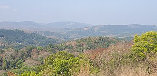
Perunad (Ranni-Perunad) is a scenic hilly village in Pathanamthitta district, Kerala state, India. Thiruvalla is the nearest railway station located at a distance of 58 km (36 mi). It's located on the banks of Pamba River and Kakkad River.

Chengara is a small village situated in the Pathanamthitta district in Kerala, India. It is known for its natural environment, hills and climate, and was found to have the cleanest air, in terms of concentration of dust particles. Chengara is surrounded on three sides by Harrisons Malayalam Limited, a rubber plantation company.
Kudassanad is a village near Pandalam in the State of Kerala in India. Geographically it is situated in the eastern ending of Alappuzha District and western part of Pathanamthitta District. The southern end of Kudassanad is on the verge of Kollam District. Part of Palamel Panchayat and Mavelikara Taluk, Kudassanad comes under the Mavelikara Parliamentary and Mavelikara Assembly Constituencies.

Angamoozhy is a village in Pathanamthitta district in the Indian state of Kerala. Angamoozhy is located near the Kakkad power station and the Sabarimala temple. Geographically Angamoozhy is High-range area.
Cherickal is a locality in the city of Pandalam. It is geographically situated on the eastern end of the Alappuzha district and the western part of the Pathanamthitta district. The southern end of Cherickal is on the verge of the Alappuzha District. Part of Pandalam Municipality and Adoor Taluk, Cherickal comes under the Pathanamthitta Parliamentary and Adoor Assembly Constituencies.

Nariyapuram is a village in Vallicode Panchayat of Pathanamthitta district in Kerala, India. Nariyapuram is located in the northern part of Pathanamthitta. Pandalam, which is seven km away is the nearest town. The district headquarters Pathanamthitta is eight km away. There are regular bus services via Nariyapuram. Schools, hospitals, places of worship and all other necessities are also available. The population here is not too large. There are vast areas of paddy fields and most of the villagers are farmers. Borders of Nariyapuram are Thattayil along the south, Thumpamon along the west, Achankovil river along the north and Kaipattoor along the east. One of the existing sugarcane cultivation in Central Travancore is in Nariyapuram.
National Highway 183A, also known as NH 183A, is a National Highway in the Indian state of Kerala that runs from Chavara Titanium Junction, Kollam, to Vandiperiyar via Adoor and Pathanamthitta. It is the 4th National Highway passing through the Kollam district.
Most of the schools and colleges in Pathanamthitta district are in Pandalam Kozhencherry, Thiruvalla, Ranni, Adoor and Pathanamthitta.
The Pathanamthitta district has four types of administrative hierarchies:
