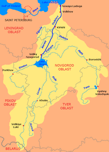
The Mologa is a river in Maksatikhinsky, Bezhetsky, Lesnoy, and Sandovsky Districts of Tver Oblast, Pestovsky District in Novgorod Oblast, and Ustyuzhensky and Cherepovetsky Districts in Vologda Oblast Russia. It is a left tributary of the Volga. The lower course of the Mologa has been turned into the Rybinsk Reservoir. It is 456 kilometres (283 mi) long, and the area of its basin 29,700 square kilometres (11,500 sq mi). The principal tributaries of the Mologa are the Osen (right), the Volchina (left), the Kobozha (left), the Chagodoshcha (left) and the Sit.
Borok is the name of several rural localities in Russia.
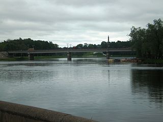
The Lovat is a river in Vitebsk Oblast of Belarus, Usvyatsky, Velikoluksky, and Loknyansky Districts, as well as of the city of Velikiye Luki, of Pskov Oblast and Kholmsky, Poddorsky, Starorussky, and Parfinsky Districts of Novgorod Oblast in Russia. The source of the Lovat is Lake Lovatets in northeastern Belarus, and the Lovat is a tributary of Lake Ilmen. Its main tributaries are the Loknya (left), the Kunya (right), the Polist (left), the Redya (left), and the Robya (right). The towns of Velikiye Luki and Kholm, as well as the urban-type settlement of Parfino, are located on the banks of the Lovat.
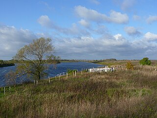
The Shelon is a river in the northwest part of European Russia, in Dedovichsky, Porkhovsky, and Dnovsky Districts of Pskov Oblast and Soletsky and Shimsky Districts of Novgorod Oblast. The Shelon is one of the principal tributaries of Lake Ilmen. It has a length of 248 kilometres (154 mi) and drains a basin of 9,710 square kilometres (3,750 sq mi). The towns of Porkhov and Soltsy, as well as urban-type settlements of Dedovichi and Shimsk, are located on the banks of the Shelon. The principal tributaries of the Shelon are the Sudoma (left), the Belka (right), the Polonka (right), the Uza (left), the Udokha (left), the Sitnya (left), and the Mshaga (left).

The Mezha is a river in Nelidovsky, Zharkovsky, and Zapadnodvinsky Districts of Tver Oblast and Velizhsky District of Smolensk Oblast in Russia. It flows out of the Valdai Hills and continues west into the Daugava. The town of Nelidovo and the urban-type settlement of Zharkovsky are located along the Mezha. The Mezha is 259 kilometres (161 mi) long, and drains a basin of 9,080 square kilometres (3,510 sq mi). Its main tributaries are the Bereza, the Luchesa, the Obsha, and the Yelsha.

Andreapolsky District is an administrative and municipal district (raion), one of the thirty-six in Tver Oblast, Russia. It is located in the Valdai Hills in the west of the oblast and borders with Maryovsky District of Novgorod Oblast in the north, Penovsky District in the northeast, Selizharovsky District in the east, Nelidovsky District in the south, Zapadnodvinsky District in the southwest, Toropetsky District in the west, and with Kholmsky District of Novgorod Oblast in the northwest. The area of the district is 3,051 square kilometers (1,178 sq mi). Its administrative center is the town of Andreapol. Population: 13,756 ; 16,213 (2002 Census); 17,900 (1989 Soviet census). The population of Andreapol accounts for 60.2% of the district's total population.
Administratively, Tver Oblast is divided into two urban-type settlements under the federal government management, five cities and towns of oblast significance, and thirty-six districts.
Western Oblast was an administrative-territorial unit (oblast) of the Russian SFSR from 1929 to 1937. Its seat was in the city of Smolensk. The oblast was located in the west of European Russia, and its territory is currently divided between Bryansk, Kaluga, Pskov, Smolensk, and Tver Oblasts.
Ustye is a placename in Russia. Literally it means "river mouth". It may refer to several places in Russia:
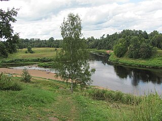
Kholmsky District is an administrative and municipal district (raion), one of the twenty-one in Novgorod Oblast, Russia. It is located in the south of the oblast and borders with Poddorsky District in the north, Maryovsky District in the east, Andreapolsky District of Tver Oblast in the southeast, Toropetsky District of Tver Oblast in the south, Loknyansky District of Pskov Oblast in the southwest, and with Bezhanitsky District of Pskov Oblast in the northwest. The area of the district is 2,178.69 square kilometers (841.20 sq mi). Its administrative center is the town of Kholm. Population: 6,177 (2010 Census); 7,712 ; 9,174 (1989 Soviet census). The population of Kholm accounts for 62.0% of the district's total population.

Kunyinsky District is an administrative and municipal district (raion), one of the twenty-four in Pskov Oblast, Russia. It is located in the southeast of the oblast and borders with Toropetsky District of Tver Oblast in the north, Zapadnodvinsky District of Tver Oblast in the east, Velizhsky District of Smolensk Oblast in the south, Usvyatsky District in the southwest, and Velikoluksky District in the northwest. The area of the district is 2,621.4 square kilometers (1,012.1 sq mi). Its administrative center is the urban locality of Kunya. Population: 10,277 (2010 Census); 12,928 ; 17,698 (1989 Soviet census). The population of Kunya accounts for 30.4% of the district's total population.

Loknyansky District is an administrative and municipal district (raion), one of the twenty-four in Pskov Oblast, Russia. It is located in the east of the oblast and borders with Kholmsky District of Novgorod Oblast in the northeast, Toropetsky District of Tver Oblast in the southeast, Velikoluksky District in the south, Novosokolnichesky District in the southwest, and with Bezhanitsky District in the northwest. The area of the district is 2,412 square kilometers (931 sq mi). Its administrative center is the urban locality of Loknya. Population: 9,535 (2010 Census); 13,268 ; 16,782 (1989 Soviet census). The population of Loknya accounts for 40.6% of the district's total population.
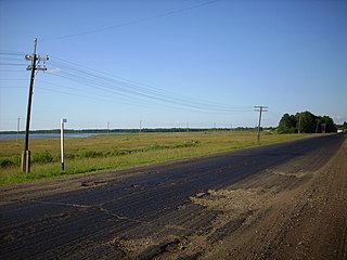
Usvyatsky District is an administrative and municipal district (raion), one of the twenty-four in Pskov Oblast, Russia. It is located in the south of the oblast and borders with Velikoluksky District in the north, Kunyinsky District in the east, Velizhsky District of Smolensk Oblast in the southeast, Vitebsk and Haradok Districts of Belarus in the southwest, and Nevelsky District in the west. The area of the district is 1,100 square kilometers (420 sq mi). Its administrative center is the urban locality of Usvyaty. Population: 5,598 (2010 Census); 6,360 ; 7,905 (1989 Soviet census). The population of Usvyaty accounts for 52.9% of the district's total population.

Velikoluksky District is an administrative and municipal district (raion), one of the twenty-four in Pskov Oblast, Russia. It is located in the southeast of the oblast and borders with Loknyansky District in the north, Toropetsky District of Tver Oblast in the northeast, Kunyinsky District in the east, Usvyatsky District in the south, Nevelsky District in the southwest, and with Novosokolnichesky District in the west. The area of the district is 2,960 square kilometers (1,140 sq mi). Its administrative center is the town of Velikiye Luki. Population: 22,121 (2010 Census); 24,035 ; 31,911 (1989 Soviet census).

Toropetsky District is an administrative and municipal district (raion), one of the thirty-six in Tver Oblast, Russia. It is located in the west of the oblast and borders with Kholmsky District of Novgorod Oblast in the north, Andreapolsky District in the east, Zapadnodvinsky District in the south, Kunyinsky District of Pskov Oblast in the southwest, Velikoluksky District of Pskov Oblast in the west, and with Loknyansky District of Pskov Oblast in the northwest. The area of the district is 3,373 square kilometers (1,302 sq mi). Its administrative center is the town of Toropets. Population: 20,526 ; 25,235 (2002 Census); 31,228 (1989 Soviet census). The population of Toropets accounts for 63.4% of the district's total population.

Pskov Governorate was an administrative-territorial unit (guberniya) of the Russian Empire and the Russian SFSR, which existed in 1772–1777 and 1796–1927. Its seat was located in Opochka between 1772 and 1776, and in Pskov after 1776. The governorate was located in the west of the Russian Empire and bordered Saint Petersburg Governorate in the north, Novgorod Governorate in the northeast, Tver Governorate in the east, Smolensk Governorate in the southeast, Belarusian Governorate in the south, and Governorate of Livonia in the west.

Velikiye Luki Oblast was an oblast of the Russian SFSR from 1944 to 1957. Its seat was in the city of Velikiye Luki. The oblast was located in the northwest of European Russia, and its territory is currently divided between Novgorod, Pskov, and Tver Oblasts.
Pskov Viceroyalty was an administrative-territorial unit (namestnichestvo) of the Russian Empire, which existed in 1777–1796. The seat of the Viceroyalty was located in Pskov. Both the predecessor and the successor of the viceroyalty was Pskov Governorate. In terms of modern administrative division of Russia, the area of the viceroyalty is currently split between Pskov, Leningrad, Tver, and Novgorod Oblasts.
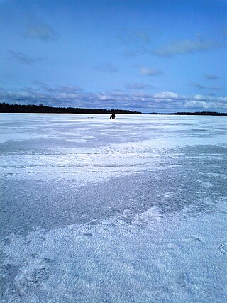
Lake Zhizhitskoye is a brackish lake, located in Kunyinsky District of Pskov Oblast in Russia. It is the second biggest lake in Pskov Oblast after Lake Peipus. The area of the lake is 51.3 square kilometres (19.8 sq mi). Lake Undozero is the source of the Zhizhitsa River, a right tributary of the Western Dvina River, and thus belongs to the Baltic Sea basin.
The Korozhechna is a river in Sonkovsky Kesovogorsky, and Kashinsky Districts of Tver Oblast and in Myshkinsky and Uglichsky District of Yaroslavl Oblast in Russia. It is a left tributary of the Volga. It is 147 kilometres (91 mi) long, and the area of its basin 1,690 square kilometres (650 sq mi).

