List of Sites of Special Scientific Interest in Humberside

Last updated
View of the Humber Estuary, the largest SSSI in the area, across the western end of Sunk Island Sands Humber Estuary at Sunk Island.jpg
View of the Humber Estuary, the largest SSSI in the area, across the western end of Sunk Island Sands

This is a list of the Sites of Special Scientific Interest (SSSIs) in Humberside (sic), England. In England the body responsible for designating SSSIs is Natural England, which chooses a site because of its fauna, flora, geological or physiographical features. [1] Although the county of Humberside no longer exists, Natural England curiously uses its former borders to mark an Area of Search. [2] As of 2012, there are 72 sites designated in this Area of Search, of which 51 have been designated due to their biological interest, 17 due to their geological interest, and 4 for both. [3]

Humberside non-metropolitan and ceremonial county of England

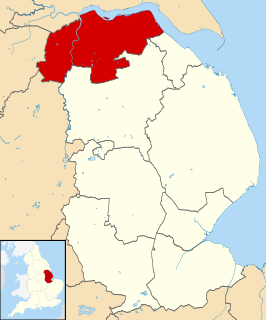
Humberside was a non-metropolitan and ceremonial county in Northern England from 1 April 1974 until 1 April 1996. It was composed of land from either side of the Humber Estuary, created from portions of East Riding of Yorkshire, West Riding of Yorkshire, and the district of Lindsey, Lincolnshire. The county council's headquarters was County Hall at Beverley, inherited from the East Riding, and its largest settlement and only city was Kingston upon Hull. The county stretched from Wold Newton in its northern tip to a different Wold Newton at its most southern point.

Natural England is a non-departmental public body in the United Kingdom sponsored by the Department for Environment, Food and Rural Affairs. It is responsible for ensuring that England's natural environment, including its land, flora and fauna, freshwater and marine environments, geology and soils, are protected and improved. It also has a responsibility to help people enjoy, understand and access the natural environment.

Fauna set of animal species in any particular region and time

Fauna is all of the animal life present in a particular region or time. The corresponding term for plants is flora. Flora, fauna and other forms of life such as fungi are collectively referred to as biota. Zoologists and paleontologists use fauna to refer to a typical collection of animals found in a specific time or place, e.g. the "Sonoran Desert fauna" or the "Burgess Shale fauna". Paleontologists sometimes refer to a sequence of faunal stages, which is a series of rocks all containing similar fossils. The study of animals of a particular region is called faunistics.

Contents

Natural England took over the role of designating and managing SSSIs from English Nature in October 2006 when it was formed from the amalgamation of English Nature, parts of the Countryside Agency and the Rural Development Service. Natural England, like its predecessor, uses the 19741996 county system [4] and as such the same approach is followed here. There are four unitary authorities in the Area of Search: Kingston upon Hull and East Riding of Yorkshire cover East Yorkshire, and North Lincolnshire and North East Lincolnshire cover south of the Humber. The SSSI list for Lincolnshire does not include the sites on this list.

English Nature was the United Kingdom government agency that promoted the conservation of wildlife, geology and wild places throughout England between 1990 and 2006. It was a non-departmental public body funded by the Department for Environment, Food and Rural Affairs (DEFRA) and gave statutory advice, grants and issued licences.

Countryside Agency

The Countryside Agency was a statutory body set up in England in 1999 with the task of improving the quality of the rural environment and the lives of those living in it. The Agency was formed by merging the Countryside Commission and the Rural Development Commission. Its powers were inherited from those bodies.

The Rural Development Service (RDS) was formerly part of the UK Government's Department for Environment, Food and Rural Affairs (Defra). It ceased to exist on 1 October 2006 following the creation of Natural England.

The data in the table is taken from Natural England in the form of citation sheets for each SSSI, and the County Background Datasheet for Humberside. [5]

For other counties, see List of Sites of Special Scientific Interest by Area of Search.

Sites

Site nameReason for designationArea [A] Coordinates & Grid ref [B] Year in which notifiedOther designationsMap [C] & Citation
Biological interestGeological interestHectaresAcres
Allerthorpe Common Green check.svg12.831.7 53°55′01″N0°50′35″W / 53.917°N 0.843°W / 53.917; -0.843 (Allerthorpe Common)
     SE761474
1951 WT Map [6]
Barn Hill Meadows Green check.svg8.621.3 53°44′53″N0°53′24″W / 53.748°N 0.89°W / 53.748; -0.89 (Barn Hill Meadows)
     SE733285
1987 Map [7]
Beckhead Plantation Green check.svg3.79.1 53°58′19″N0°45′25″W / 53.972°N 0.757°W / 53.972; -0.757 (Beckhead Plantation)
     SE816536
1968 WT Map [8]
Belshaw Green check.svg0.20.5 53°32′38″N0°50′31″W / 53.544°N 0.842°W / 53.544; -0.842 (Belshaw)
     SE768059
1988 Map [9]
Bishop Wilton Deep Dale Green check.svg43.4107.3 53°59′38″N0°45′18″W / 53.994°N 0.755°W / 53.994; -0.755 (Bishop Wilton Deep Dale)
     SE817560
1954 Map [10]
Bishop Wilton Poor Land Green check.svg2.15.1 53°59′28″N0°48′54″W / 53.991°N 0.815°W / 53.991; -0.815 (Bishop Wilton Poor Land)
     SE778557
1988 Map [11]
Boynton Willow Garth Green check.svg5.112.7 54°05′28″N0°16′48″W / 54.091°N 0.28°W / 54.091; -0.28 (Boynton Willow Garth)
     TA126675
1984 GCR Map [12]
Brantingham Dale Green check.svg15.839 53°46′05″N0°33′47″W / 53.768°N 0.563°W / 53.768; -0.563 (Brantingham Dale)
     SE948311
1986 Map [13]
Broughton Alder Wood Green check.svg0.82 53°34′37″N0°33′07″W / 53.577°N 0.552°W / 53.577; -0.552 (Broughton Alder Wood)
     SE960099
1986 Map [14]
Broughton Far Wood Green check.svg17.844 53°34′59″N0°33′04″W / 53.583°N 0.551°W / 53.583; -0.551 (Broughton Far Wood)
     SE960106
1957 Map [15]
Bryan Mills Field Green check.svg1.33.2 53°54′04″N0°27′36″W / 53.901°N 0.46°W / 53.901; -0.46 (Bryan Mills Field)
     TA013461
1986 Map [16]
Burton Bushes Green check.svg11.428.1 53°50′24″N0°28′01″W / 53.84°N 0.467°W / 53.84; -0.467 (Burton Bushes)
     TA010393
1968 Map [17]
Castlethorpe Tufas Green check.svg0.51.3 53°33′25″N0°31′30″W / 53.557°N 0.525°W / 53.557; -0.525 (Castlethorpe Tufas)
     SE978077
1989 GCR Map [18]
Cinquefoil Brow and Wood Dale Green check.svg11.528.5 54°03′54″N0°32′20″W / 54.065°N 0.539°W / 54.065; -0.539 (Cinquefoil Brow and Wood Dale)
     SE957642
1989 Map [19]
Cleatham Quarry Green check.svg5.814.2 53°30′04″N0°35′02″W / 53.501°N 0.584°W / 53.501; -0.584 (Cleatham Quarry)
     SE940014
1986 Map [20]
Cliff Farm Pit Green check.svg1.12.8 53°29′42″N0°34′59″W / 53.495°N 0.583°W / 53.495; -0.583 (Cliff Farm Pit)
     SE941008
1985 GCR Map [21]
Conesby (Yorkshire East) Quarry Green check.svg0.92.2 53°37′19″N0°38′10″W / 53.622°N 0.636°W / 53.622; -0.636 (Conesby (Yorkshire East) Quarry)
     SE903148
1995 GCR Map [22]
Cottam Well Dale Green check.svg23.959 54°03′40″N0°30′36″W / 54.061°N 0.51°W / 54.061; -0.51 (Cottam Well Dale)
     SE976638
1985 Map [23]
Crowle Borrow Pits Green check.svg4.912.2 53°35′10″N0°48′29″W / 53.586°N 0.808°W / 53.586; -0.808 (Crowle Borrow Pits)
     SE790106
1986 Map [24]
Derwent Ings Green check.svg667.71650 53°52′59″N0°56′02″W / 53.883°N 0.934°W / 53.883; -0.934 (Derwent Ings)
     SE702435
1975 SPA, WT, NNR, NP, NCR, Ramsar site, SAC Map [25]
Dimlington Cliff Green check.svg34.284.4 53°40′30″N0°06′04″E / 53.675°N 0.101°E / 53.675; 0.101 (Dimlington Cliff)
     TA389219
1990 GCR Map [26]
Drewton Lane Pits Green check.svg5.212.8 53°46′59″N0°36′18″W / 53.783°N 0.605°W / 53.783; -0.605 (Drewton Lane Pits)
     SE920328
1988 GCR Map [27]
Eastoft Meadow Green check.svg0.82.1 53°37′05″N0°48′47″W / 53.618°N 0.813°W / 53.618; -0.813 (Eastoft Meadow)
     SE786142
1985 Map [28]
Enthorpe Railway Cutting Green check.svg3.48.4 53°54′00″N0°37′01″W / 53.9°N 0.617°W / 53.9; -0.617 (Enthorpe Railway Cutting)
     SE910458
1981 GCR Map [29]
Epworth Turbary Green check.svg32.981.3 53°31′34″N0°51′50″W / 53.526°N 0.864°W / 53.526; -0.864 (Epworth Turbary)
     SE754039
1951 WT Map [30]
Everthorpe Quarry Green check.svg3.79.1 53°46′44″N0°36′47″W / 53.779°N 0.613°W / 53.779; -0.613 (Everthorpe Quarry)
     SE915323
1959 GCR Map [31]
Flamborough Head Green check.svgGreen check.svg326.9807.8 54°07′48″N0°06′54″W / 54.13°N 0.115°W / 54.13; -0.115 (Flamborough Head)
     TA233721
1952 SPA, GCR, LNR, NCR, RSPB, SAC Map [32]
Flamborough Railway Cutting Green check.svg1.64 54°07′05″N0°10′30″W / 54.118°N 0.175°W / 54.118; -0.175 (Flamborough Railway Cutting)
     TA194707
1986 Map [33]
Fordon Chalk Grasslands Green check.svg55.7137.6 54°10′08″N0°24′29″W / 54.169°N 0.408°W / 54.169; -0.408 (Fordon Chalk Grasslands)
     TA040760
1975 WT, NCR Map [34]
Hatfield Chase Ditches Green check.svg44.2109.2 53°32′31″N0°53′17″W / 53.542°N 0.888°W / 53.542; -0.888 (Hatfield Chase Ditches)
     SE738056
1999 Map [35]
Haxey Grange Fen Green check.svg13.332.8 53°27′58″N0°53′24″W / 53.466°N 0.89°W / 53.466; -0.89 (Haxey Grange Fen)
     SK738972
1988 Map [36]
Haxey Turbary Green check.svg14.435.6 53°30′29″N0°52′26″W / 53.508°N 0.874°W / 53.508; -0.874 (Haxey Turbary)
     SE748018
1951 WT Map [37]
Hewson's Field Green check.svg0.51.2 53°29′10″N0°49′05″W / 53.486°N 0.818°W / 53.486; -0.818 (Hewson'S Field)
     SK785995
1991 Map [38]
Hoddy Cows Spring Green check.svg24.9 54°08′46″N0°11′35″W / 54.146°N 0.193°W / 54.146; -0.193 (Hoddy Cows Spring)
     TA181737
1984 Map [39]
Hornsea Mere Green check.svg232.3573.9 53°54′11″N0°11′31″W / 53.903°N 0.192°W / 53.903; -0.192 (Hornsea Mere)
     TA189467
1951 SPA, NCR, RSPB Map [40]
Horse Dale and Holm Dale Green check.svg43.8108.2 54°00′00″N0°40′01″W / 54°N 0.667°W / 54; -0.667 (Horse Dale and Holm Dale)
     SE875568
1985 Map [41]
Hotham Meadow Green check.svg1.84.4 53°48′14″N0°38′28″W / 53.804°N 0.641°W / 53.804; -0.641 (Hotham Meadow)
     SE896351
1989 Map [42]
Humber Estuary Green check.svgGreen check.svg37000.691430.5 53°34′41″N0°01′48″E / 53.578°N 0.03°E / 53.578; 0.03 (Humber Estuary)
     TA345110
2004 SPA, GCR, MOD, NNR, Ramsar site, SAC Map [43]
Keasey Dale Green check.svg3.69 53°58′23″N0°40′16″W / 53.973°N 0.671°W / 53.973; -0.671 (Keasey Dale)
     SE873538
1989 Map [44]
Kelsey Hill Gravel Pits Green check.svg10.626.1 53°43′12″N0°07′30″W / 53.72°N 0.125°W / 53.72; -0.125 (Kelsey Hill Gravel Pits)
     TA238265
1952 GCR Map [45]
Kiplingcotes Chalk Pit Green check.svg410 53°52′44″N0°36′40″W / 53.879°N 0.611°W / 53.879; -0.611 (Kiplingcotes Chalk Pit)
     SE914434
1968 LNR, WT Map [46]
Kirmington Pits Green check.svg9.122.5 53°35′20″N0°20′06″W / 53.589°N 0.335°W / 53.589; -0.335 (Kirmington Pits)
     TA103116
1951 GCR Map [47]
Lambwath Meadows Green check.svg29.673.1 53°50′20″N0°09′36″W / 53.839°N 0.16°W / 53.839; -0.16 (Lambwath Meadows)
     TA212396
1989 Map [48]
Leven Canal Green check.svg21.352.6 53°53′20″N0°21′04″W / 53.889°N 0.351°W / 53.889; -0.351 (Leven Canal)
     TA085449
1962 Map [49]
Manton and Twigmoor Green check.svg88.9219.6 53°31′34″N0°34′59″W / 53.526°N 0.583°W / 53.526; -0.583 (Manton and Twigmoor)
     SE940042
1951 Map [50]
Manton Stone Quarry Green check.svg17.543.2 53°30′36″N0°35′02″W / 53.51°N 0.584°W / 53.51; -0.584 (Manton Stone Quarry)
     SE940024
1986 GCR Map [51]
Melbourne and Thornton Ings Green check.svg200494.3 53°53′56″N0°52′59″W / 53.899°N 0.883°W / 53.899; -0.883 (Melbourne and Thornton Ings)
     SE735453
1985 SPA, NCR, Ramsar site, SAC Map [52]
Melton Bottom Chalk Pit Green check.svg87.2215.5 53°43′48″N0°32′02″W / 53.73°N 0.534°W / 53.73; -0.534 (Melton Bottom Chalk Pit)
     SE968270
1968 GCR Map [53]
Messingham Heath Green check.svg17.843.9 53°31′08″N0°40′55″W / 53.519°N 0.682°W / 53.519; -0.682 (Messingham Heath)
     SE875033
1965 Map [54]
Messingham Sand Quarry Green check.svg51.8128 53°31′12″N0°37′34″W / 53.52°N 0.626°W / 53.52; -0.626 (Messingham Sand Quarry)
     SE912035
1987 WT Map [55]
Millington Wood and Pastures Green check.svg343.5848.9 53°58′48″N0°41′42″W / 53.98°N 0.695°W / 53.98; -0.695 (Millington Wood and Pastures)
     SE857546
1954 GCR Map [56]
Newbald Becksies Green check.svg1.94.8 53°49′19″N0°36′25″W / 53.822°N 0.607°W / 53.822; -0.607 (Newbald Becksies)
     SE918371
1990 Map [57]
Newton Mask Green check.svg17.643.5 53°56′31″N0°55′34″W / 53.942°N 0.926°W / 53.942; -0.926 (Newton Mask)
     SE706501
1986 SPA, NCR, Ramsar site, SAC Map [58]
North Killingholme Haven Pits Green check.svg21.653.4 53°39′40″N0°14′13″W / 53.661°N 0.237°W / 53.661; -0.237 (North Killingholme Haven Pits)
     TA166197
1996 WT, SPA Map [59]
Pocklington Canal Green check.svg21.453 53°54′04″N0°48′14″W / 53.901°N 0.804°W / 53.901; -0.804 (Pocklington Canal)
     SE787456
1987 Map [60]
Pulfin Bog Green check.svg17.142.1 53°52′55″N0°24′22″W / 53.882°N 0.406°W / 53.882; -0.406 (Pulfin Bog)
     TA049440
1954 WT Map [61]
Rifle Butts Quarry Green check.svgGreen check.svg0.30.8 53°52′19″N0°38′10″W / 53.872°N 0.636°W / 53.872; -0.636 (Rifle Butts Quarry)
     SE898426
1952 GCR, WT Map [62]
Risby Warren Green check.svgGreen check.svg157.1388.2 53°36′36″N0°36′32″W / 53.61°N 0.609°W / 53.61; -0.609 (Risby Warren)
     SE921135
1966 GCR, NCR, Map [63]
River Derwent [D] Green check.svg408.3 [E] 1008.8 [E] 53°56′28″N0°55′37″W / 53.941°N 0.927°W / 53.941; -0.927 (River Derwent)
     SE705500
1986 SPA, NCR, SAC Map [64]
River Hull Headwaters Green check.svg122301.4 53°59′42″N0°25′34″W / 53.995°N 0.426°W / 53.995; -0.426 (River Hull Headwaters)
     TA033566
1962 NCR Map [65]
Roos Bog Green check.svg1.94.8 53°44′24″N0°04′16″W / 53.74°N 0.071°W / 53.74; -0.071 (Roos Bog)
     TA273288
1990 GCR Map [66]
Rush Furlong Green check.svg0.51.2 53°29′42″N0°49′34″W / 53.495°N 0.826°W / 53.495; -0.826 (Rush Furlong)
     SE780004
1985 WT Map [67]
Skipsea Bail Mere Green check.svg43.9108.4 53°59′N0°14′W / 53.98°N 0.23°W / 53.98; -0.23 (Skipsea Bail Mere)
     TA162552
1998 SAM, GCR Map [68]
South Cliffe Common Green check.svg61.4151.7 53°48′47″N0°41′53″W / 53.813°N 0.698°W / 53.813; -0.698 (South Cliffe Common)
     SE858360
1988 Map [69]
South Ferriby Chalk Pit Green check.svg85209.9 53°40′01″N0°29′10″W / 53.667°N 0.486°W / 53.667; -0.486 (South Ferriby Chalk Pit)
     TA001200
1987 GCR Map [70]
The Lagoons Green check.svg70.2173.4 53°38′10″N0°07′59″E / 53.636°N 0.133°E / 53.636; 0.133 (The Lagoons)
     TA411176
1968 SPA Map [71]
Thorne Crowle and Goole Moors Green check.svg19194742.1 53°37′59″N0°54′04″W / 53.633°N 0.901°W / 53.633; -0.901 (Thorne Crowle and Goole Moors)
     SE728157
1970 SPA, WT, NNR, NCR, Ramsar site, SAC Map [72]
Tophill Low Green check.svg34.685.5 53°55′30″N0°21′50″W / 53.925°N 0.364°W / 53.925; -0.364 (Tophill Low)
     TA075489
1989 Map [73]
White Carr Meadow Green check.svg1.12.7 53°54′04″N0°48′18″W / 53.901°N 0.805°W / 53.901; -0.805 (White Carr Meadow)
     SE786456
1990 Map [74]
Withow Gap, Skipsea Green check.svg8.420.7 53°58′26″N0°11′56″W / 53.974°N 0.199°W / 53.974; -0.199 (Withow Gap, Skipsea)
     TA182546
1987 GCR Map [75]
Wrawby Moor Green check.svg18.545.6 53°35′06″N0°26′38″W / 53.585°N 0.444°W / 53.585; -0.444 (Wrawby Moor)
     TA031109
1966 Map [76]
Wyedale Green check.svg12.530.8 53°48′18″N0°36′14″W / 53.805°N 0.604°W / 53.805; -0.604 (Wyedale)
     SE920352
1986 Map [77]

Notes

A Data rounded to one decimal place.
B Grid reference is based on the British national grid reference system, also known as OSGB36, and is the system used by the Ordnance Survey. [78]
C Link to maps using the Nature on the Map service provided by Natural England.
D The River Derwent site extends into the county of North Yorkshire and so can be found on the list of SSSIs in North Yorkshire.
E Recorded as 86.2 kilometres (53.6 mi) in length, where the River Derwent forms the then district boundaries the length is included in both directions.

Related Research Articles

Derbyshire Wildlife Trust is one of 47 local Wildlife Trusts around the UK working to promote and protect local wildlife. It covers the whole of Derbyshire and was founded in 1962 in response to environmental threats to the local countryside, since when it has continued to grow. The Trust is now based at East Mill on the River Derwent in the town of Belper, Derbyshire. It is a Registered Charity, supported by more than 14,000 members and over 500 volunteers.

North Lincolnshire Unitary Authority and Borough in England

North Lincolnshire is a unitary authority area in Lincolnshire, England, with a population of 167,446 at the 2011 census. There are three significant towns: Scunthorpe, the administrative centre, Brigg and Barton-upon-Humber.

Flamborough Head promontory on the Yorkshire coast of England

Flamborough Head is a promontory, 8 miles (13 km) long on the Yorkshire coast of England, between the Filey and Bridlington bays of the North Sea. It is a chalk headland, with sheer white cliffs. The cliff top has two standing lighthouse towers, the oldest dating from 1669 and Flamborough Head Lighthouse built in 1806. The older lighthouse was designated a Grade II* listed building in 1952 and is now recorded in the National Heritage List for England, maintained by Historic England. The cliffs provide nesting sites for many thousands of seabirds, and are of international significance for their geology.

Boothferry (district)

The Borough of Boothferry was, from 1 April 1974 to 1 April 1996, a local government district with borough status within the non-metropolitan county of Humberside. The district is now split between the East Riding of Yorkshire and North Lincolnshire.

Beckhead Plantation

Beckhead Plantation is a Site of Special Scientific Interest (SSSI) and nature reserve in the East Riding of Yorkshire, England. It is located close to the village of Great Givendale on the Yorkshire Wolds. The site, which was designated a SSSI in 1968, is managed as a nature reserve by the Yorkshire Wildlife Trust. It lies on chalk land in Given Dale. The site is important because it demonstrates many of the characteristic features of a northern ash woodland on chalk. The tree canopy is dominated by ash with some wych elm, field maple and rowan while the understorey contains shrub species including hazel, guelder rose, elder, gooseberry and fly honeysuckle.

Derwent Ings

Derwent Ings is a Site of Special Scientific Interest (SSSI) divided between North Yorkshire and the East Riding of Yorkshire, England. Derwent Ings is of international significance and has been designated a Wetland of International Importance under the Ramsar Convention and as a Special Protection Area under the terms of the European Community Directive. Part of the site is owned by the Yorkshire Wildlife Trust and is managed in conjunction with English Nature. It lies adjacent to the River Derwent between Sutton upon Derwent and Menthorpe. The site, which was designated a SSSI in 1975, consists of a series of neutral alluvial flood meadows, fen and swamp communities and freshwater habitats. It is one of the most important examples of agriculturally unimproved species-rich alluvial flood meadow habitat remaining in the UK.

Totternhoe nature reserve nature reserve in the United Kingdom

Totternhoe nature reserve is managed by the Wildlife Trust for Bedfordshire, Cambridgeshire and Northamptonshire (WTBCN). The 31 hectare site is in Totternhoe in Bedfordshire, and it includes parts of three Sites of Special Scientific Interest (SSSIs). Totternhoe Knolls is a biological SSSI owned by Central Bedfordshire Council and leased to the National Trust. Most of it is managed jointly by the National Trust and the WTBCN, excluding Totternhoe Castle, the earthworks of a Norman motte-and-bailey castle which is part of the SSSI but not of WTBCN's nature reserve. Totternhoe nature reserve also includes the geological SSSI, Totternhoe Stone Pit, which is not open to the public, and other areas owned by WTBCN, including part of Totternhoe Chalk Quarry, another biological SSSI.

References

  1. "Notification of SSSIs". English Nature. Retrieved 22 June 2009.
  2. Nature Conservancy Council (1989) Guidelines for selection of biological SSSIs ISBN   0-86139-544-1
  3. "SSSIs in Humberside". English Nature. Retrieved 22 June 2009.
  4. "County search of SSSIs". English Nature. Retrieved 2009-06-22.
  5. "Natural England County Background datasheet for Humberside SSSIs" . Retrieved 30 November 2012.
  6. "Allerthorpe Common SSSI citation" (PDF).
  7. "Barn Hill Meadows SSSI citation" (PDF).
  8. "Beckhead Plantation SSSI citation" (PDF). Archived from the original (PDF) on 2011-07-16.
  9. "Belshaw SSSI citation" (PDF). Archived from the original (PDF) on 2011-07-16.
  10. "Bishop Wilton Deep Dale SSSI citation" (PDF).
  11. "Bishop Wilton Poor Land SSSI citation" (PDF).
  12. "Boynton Willow Garth SSSI citation" (PDF).
  13. "Brantingham Dale SSSI citation" (PDF).
  14. "Broughton Alder Wood SSSI citation" (PDF).
  15. "Broughton Far Wood SSSI citation" (PDF).
  16. "Bryan Mills Field SSSI citation" (PDF).
  17. "Burton Bushes SSSI citation" (PDF).
  18. "Castlethorpe Tufas SSSI citation" (PDF).
  19. "Cinquefoil Brow and Wood Dale SSSI citation" (PDF).
  20. "Cleatham Quarry SSSI citation" (PDF).
  21. "Cliff Farm Pit SSSI citation" (PDF).
  22. "Conesby (Yorkshire East) Quarry SSSI citation" (PDF).
  23. "Cottam Well Dale SSSI citation" (PDF).
  24. "Crowle Borrow Pits SSSI citation" (PDF).
  25. "Derwent Ings SSSI citation" (PDF).
  26. "Dimlington Cliff SSSI citation" (PDF).
  27. "Drewton Lane Pits SSSI citation" (PDF).
  28. "Eastoft Meadow SSSI citation" (PDF).
  29. "Enthorpe Railway Cutting SSSI citation" (PDF).
  30. "Epworth Turbary SSSI citation" (PDF).
  31. "Everthorpe Quarry SSSI citation" (PDF).
  32. "Flamborough Head SSSI citation" (PDF).
  33. "Flamborough Railway Cutting SSSI citation" (PDF).
  34. "Fordon Chalk Grasslands SSSI citation" (PDF).
  35. "Hatfield Chase Ditches SSSI citation" (PDF).
  36. "Haxey Grange Fen SSSI citation" (PDF).
  37. "Haxey Turbary SSSI citation" (PDF).
  38. "Hewson'S Field SSSI citation" (PDF).
  39. "Hoddy Cows Spring SSSI citation" (PDF).
  40. "Hornsea Mere SSSI citation" (PDF).
  41. "Horse Dale and Holm Dale SSSI citation" (PDF).
  42. "Hotham Meadow SSSI citation" (PDF).
  43. "Humber Estuary SSSI citation" (PDF).
  44. "Keasey Dale SSSI citation" (PDF).
  45. "Kelsey Hill Gravel Pits SSSI citation" (PDF).
  46. "Kiplingcotes Chalk Pit SSSI citation" (PDF).
  47. "Kirmington Pits SSSI citation" (PDF).
  48. "Lambwath Meadows SSSI citation" (PDF).
  49. "Leven Canal SSSI citation" (PDF).
  50. "Manton and Twigmoor SSSI citation" (PDF).
  51. "Manton Stone Quarry SSSI citation" (PDF).
  52. "Melbourne and Thornton Ings SSSI citation" (PDF).
  53. "Melton Bottom Chalk Pit SSSI citation" (PDF).
  54. "Messingham Heath SSSI citation" (PDF).
  55. "Messingham Sand Quarry SSSI citation" (PDF).
  56. "Millington Wood and Pastures SSSI citation" (PDF).
  57. "Newbald Becksies SSSI citation" (PDF).
  58. "Newton Mask SSSI citation" (PDF).
  59. "North Killingholme Haven Pits SSSI citation" (PDF).
  60. "Pocklington Canal SSSI citation" (PDF).
  61. "Pulfin Bog SSSI citation" (PDF).
  62. "Rifle Butts Quarry SSSI citation" (PDF).
  63. "Risby Warren SSSI citation" (PDF).
  64. "River Derwent SSSI citation" (PDF).
  65. "River Hull Headwaters SSSI citation" (PDF).
  66. "Roos Bog SSSI citation" (PDF).
  67. "Rush Furlong SSSI citation" (PDF).
  68. "Skipsea Bail Mere SSSI citation" (PDF).
  69. "South Cliffe Common SSSI citation" (PDF).
  70. "South Ferriby Chalk Pit SSSI citation" (PDF).
  71. "The Lagoons SSSI citation" (PDF).
  72. "Thorne Crowle and Goole Moors SSSI citation" (PDF).
  73. "Tophill Low SSSI citation" (PDF).
  74. "White Carr Meadow SSSI citation" (PDF).
  75. "Withow Gap, Skipsea SSSI citation" (PDF).
  76. "Wrawby Moor SSSI citation" (PDF).
  77. "Wyedale SSSI citation" (PDF).
  78. "Guide to National Grid". Ordnance Survey. Archived from the original on 27 October 2007. Retrieved 3 March 2007.
Map all coordinates using: OpenStreetMap  
Download coordinates as: KML  ·  GPX