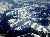
The Tatra Mountains, Tatras, or Tatra, is a mountain range that forms a natural border between Slovakia and Poland. They are the highest mountain range in the Carpathian Mountains. The Tatras are distinct from the Low Tatras, a separate Slovak mountain range further south.
Ski and winter sports in Slovakia are very prominent and popular given the mountainous topography of the region and the fact that much of the country is covered by snow for a long part of the year.
Martin is a city in northern Slovakia, situated on the Turiec river, between the Malá Fatra and Veľká Fatra mountains, near the city of Žilina. The population numbers approximately 54,000, which makes it the ninth-largest city in Slovakia. It is the center of the Turiec region and the District of Martin.

Divisions of the Carpathians are a categorization of the Carpathian mountains system.

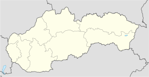
The Žilina Region is one of the eight Slovak administrative regions and consists of 11 districts (okresy) and 315 municipalities, from which 18 have a town status. The region was established in 1923, however, in its present borders exists from 1996. It is a more industrial region with several large towns. Žilina is the region administrative center and there is a strong cultural environment in Martin.

The High Tatras or High Tatra Mountains, are a mountain range along the border of northern Slovakia in the Prešov Region, and southern Poland in the Lesser Poland Voivodeship. They are a range of the Tatra Mountains chain.
Fatra is the old or imprecise name of two mountain ranges in Slovakia.

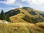
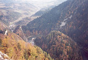
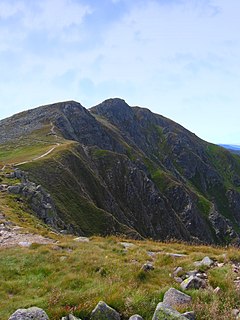
Veľká Fatra is a mountain range in the Western Carpathians in Slovakia. The Veľká Fatra lie to the southeast of the better known Malá (Lesser) Fatra mountains and are less developed, as well as being lower.

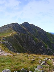
Malá Fatra is a mountain range in the Western Carpathians in the north-west of Central Slovakia. In the geomorphological system, it is a part of the Fatra-Tatra Area.

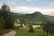
Donovaly is a village in the Banská Bystrica Region of central Slovakia. Being situated in an important pass between the mountains of Veľká Fatra and Starohorské vrchy, on the route connecting Banská Bystrica with Ružomberok, it became a prominent centre of winter and summer sports.

Selec is a village and municipality in Trenčín District in the Trenčín Region of north-western Slovakia.

Varín is a village and municipality in Žilina District in the Žilina Region of northern Slovakia. It is located at the Malá Fatra National Park and also serves as a tourist resort.

The Staré Hory Mountains is a small mountain range in Central Slovakia, near the town of Banská Bystrica. It is a part of the Low Tatra, which is part of the Fatra-Tatra Area and the Inner Western Carpathians. The mountain range is named after the village of Staré Hory.
Protected areas of Slovakia are areas that need protection because of their environmental, historical or cultural value to the nation. Protected areas in Slovakia are managed by institutions and organizations governed by the Ministry of the Environment.
Low Tatras National Park is a national park in Central Slovakia, between the Váh River and the Hron River valleys. The park and its buffer zone cover the whole Low Tatras mountain range. The National Park covers an area of 728 km² and its buffer zone covers an area of 1,102 km², which makes it the largest national park in Slovakia.

Liptov is a historical and geographical region in central Slovakia with around 140,000 inhabitants. The area is also known by the German name Liptau, the Polish Liptów, the Hungarian Liptó and the Latin name Liptovium.
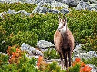
The Tatra chamois is a subspecies of the chamois of the genus Rupicapra. Tatra chamois live in the Tatra Mountains in Slovakia and Poland.

The Podtatranská kotlina is a basin in northern Slovakia, part of the Fatra-Tatra Area, which belongs to the Inner Western Carpathians.

The Mountain Rescue Service of Slovakia provides nationwide Mountain Rescue operations and Search and Rescue operations in difficult terrains in close cooperations with the Air Rescue Service. It is a part of the integrated rescue system in Slovakia.
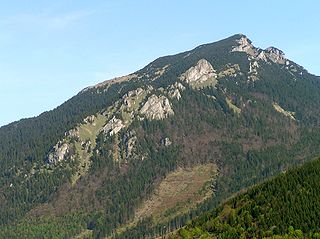
The Choč Mountains are a range of mountains in north-central Slovakia, a portion of the Fatra-Tatra Area of the Inner Western Carpathians. The range is 24 kilometers long and on average only 4 kilometers wide. Highest peak is Veľký Choč at 1 611 metres above sea level.
This page is based on this
Wikipedia article Text is available under the
CC BY-SA 4.0 license; additional terms may apply.
Images, videos and audio are available under their respective licenses.