
Eldora, previously known as "Eldorado" then "El-Dora", then Eldora or Camp Eldorado, and still called Happy Valley, is an unincorporated community and a census-designated place (CDP) located in and governed by Boulder County, Colorado, United States. The CDP is a part of the Boulder, CO Metropolitan Statistical Area. The population of the Eldora CDP was 140 at the United States Census 2020. The Nederland post office serves the area.

The Town of Erie is a Statutory Town located in Weld and Boulder counties, Colorado, United States. The town population was 30,038 at the 2020 United States Census, a +65.64% increase since the 2010 United States Census. At the 2020 census, 17,387 (58%) Erie residents lived in Weld County and 12,651 (42%) lived in Boulder County. Erie is a part of the Denver-Aurora, CO Combined Statistical Area and the Front Range Urban Corridor.
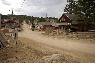
Gold Hill is an unincorporated community and a census-designated place (CDP) located in and governed by Boulder County, Colorado, United States. The CDP is a part of the Boulder, CO Metropolitan Statistical Area. The population of the Gold Hill CDP was 218 at the United States Census 2020. The Boulder post office serves the area.

The Town of Lyons is a Statutory Town in Boulder County, Colorado, United States. The town population was 2033 at the 2010 United States Census, up from 1585 at the 2000 United States Census. Lyons is located at the confluence of North St. Vrain Creek and South St. Vrain Creek, 20 miles (32 km) east of Rocky Mountain National Park. Due to its location at the intersection of State Highway 7 and U.S. Highway 36 which lead to Rocky Mountain National Park, it is sometimes referred to as "The Double Gateway to the Rockies".

Parker is a home rule municipality in Douglas County, Colorado, United States. As a self-declared "town" under the home rule statutes, Parker is the second most populous town in the county; Castle Rock is the most populous. In recent years, Parker has become a commuter town at the southeasternmost corner of the Denver metropolitan area. As of the 2020 census the town population was 58,512. Parker is now the 19th most populous municipality in the state of Colorado.

Lake City is a statutory town that is the county seat, the most populous community, and the only incorporated municipality in Hinsdale County, Colorado, United States. The population was 432 at the 2020 census. It is located in the San Juan Mountains in a valley formed by the convergence of Henson Creek and the headwaters of the Lake Fork of the Gunnison River about seven miles (11 km) east of Uncompahgre Peak, a Colorado fourteener. Lake City is named after nearby Lake San Cristobal. This area lies at the southern end of the Colorado Mineral Belt and when rich mineral deposits were discovered the native population was pushed from their tribal lands and the town of Lake City was incorporated in 1873.

Malakoff Diggins State Historic Park is a state park unit preserving the largest hydraulic mining site in California, United States. The mine was one of several hydraulic mining sites at the center of the 1882 landmark case Woodruff v. North Bloomfield Mining and Gravel Company. The mine pit and several Gold Rush-era buildings are listed on the National Register of Historic Places as the Malakoff Diggins-North Bloomfield Historic District. The "canyon" is 7,000 feet (2,100 m) long, as much as 3,000 feet (910 m) wide, and nearly 600 feet (180 m) deep in places. Visitors can see huge cliffs carved by mighty streams of water, results of the mining technique of washing away entire mountains of gravel to wash out the gold. The park is a 26-mile (42 km) drive north-east of Nevada City, California, in the Gold Rush country. The 3,143-acre (1,272 ha) park was established in 1965.

Dearfield is a ghost town and a historically black majority settlement in Weld County, Colorado, United States. It is 30 miles (48 km) east of Greeley. The town was formed by Oliver Toussaint Jackson, who desired to create a colony for African Americans. In 1910, Jackson, a successful businessman from Boulder, filed on the homestead that later became the town and began to advertise for "colonists." The name Dearfield was suggested by one of the town's citizens, Dr. J.H.P. Westbrook, who was from Denver. The word dear was chosen as the foundation for the town's name due to the precious value of the land and community to the town's settlers.

The Central City/Black Hawk Historic District is a National Historic Landmark District that encompasses the developed areas of Central City and Black Hawk, Colorado, United States. They are adjacent former gold mining camps in the Front Range of the Rocky Mountains in Gilpin County, Colorado. For a time, the area was known as the Richest Square Mile on Earth, and was the largest urban area of the Colorado Territory in the 1870s.
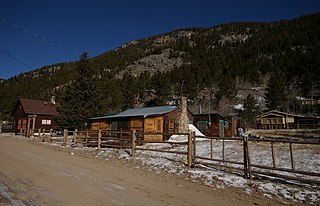
Eldora Historic District is a 30 acres (12 ha) historic district in Eldora, Colorado. Other names of the district and/or other historic names of places in the district are Happy Valley, Eldorado Camp, and 5BL758. It was listed on the National Register of Historic Places in 1989. The listing included 55 contributing buildings and 12 non-contributing ones.

The Leadville Historic District is in the mining town of Leadville, Colorado. The National Historic Landmark District includes 67 mines in the mining district east of the city up to the 12,000 foot level, and a defined portion of the village area. It was designated in 1961. Then, when the National Register of Historic Places (NRHP) program was started in 1966, Leadville's National Historic District was included in its first day's listings, along with all other existing National Historic Landmarks. The NRHP district was later expanded, adding a number of structures along the Harrison Avenue corridor, and making them eligible for historic preservation grants and tax subsidies, too.

This is a list of the National Register of Historic Places listings in Pitkin County, Colorado.

The Switzerland Trail is the site of a historic 3 ft narrow gauge railroad line that was operated at different times by the Greeley, Salt Lake and Pacific Railway, the Colorado and Northwestern Railroad, and the Denver, Boulder, and Western Railroad around the turn of the 20th century in the Colorado front range mining area near Nederland, Gold Hill, and Ward. The west end of the trail is listed on the National Register of Historic Places as the "Denver, Boulder and Western Railway Historic District".
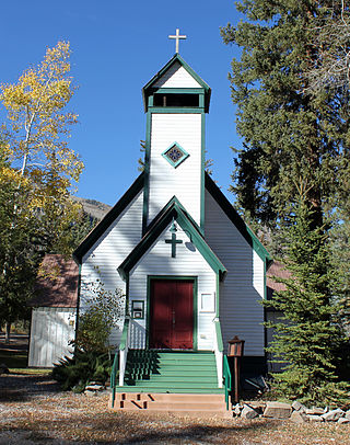
Marble Community Church, formerly called St. Paul's Church, is a historic Episcopal church at 123 State Street in Marble, Colorado. The church's main building was originally the building of the St. John's Episcopal Chapel, which was built in Aspen, Colorado in 1886. The church was listed on the National Register of Historic Places in 1989.
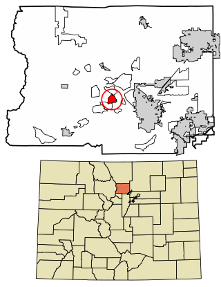
Crisman is an unincorporated community and a census-designated place (CDP) located in and governed by Boulder County, Colorado, United States. The CDP is a part of the Boulder, CO Metropolitan Statistical Area. The population of the Crisman CDP was 179 at the United States Census 2020. The Boulder post office serves the area.

Salina is a former mining town in Boulder County, Colorado, United States approximately 7 miles (11 km) west of Boulder. Established in 1874, after Colorado's first gold discovery in 1859, Salina was founded by miners who migrated to Boulder from Salina, Kansas. It is located at the junction of Four Mile Canyon and Gold Run roads. The mining camp was originally accessible only by horseback or wagons pulled by mules but later became part of Colorado's Switzerland Trail when the Greeley, Salt Lake, & Pacific narrow gauge railroad was built in the early 1880s. Today, most of Salina's original structures still stand, including the one-room schoolhouse, Salina School, and church, the Little Church in the Pines, despite some impact from the Fourmile Canyon wildfire in 2010 and historic flooding during the 2013 Colorado floods.
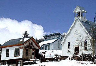
Ward Congregational Church, at 41 Modoc in Ward, Colorado, was built in 1894-95 and is listed on the National Register of Historic Places.

The Salina School, also known as the Salina Schoolhouse, is a one-room schoolbuilding in the former mining town of Salina in Boulder County, Colorado, built around 1875 or 1876. It was listed on the National Register of Historic Places in 1989.

The Downtown Boulder Historic District, in Boulder, Colorado, is a 48 acres (19 ha) historic district which was listed on the National Register of Historic Places in 1980. Additional significance for the district was recognized in 2018 for association of the Boulder County Courthouse with events of 1975, when Boulder County clerk Clela Rorex issued marriage licenses to six same-sex couples.
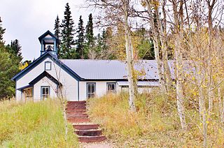
The Ward School, at 66 Columbia St. in Ward, Colorado, is a historic school building later used as the town hall, public library, and post office of Ward Township, and also has been known as Ward Townhall and Post Office. It was built in 1898 and was listed on the National Register of Historic Places as "Ward School" in 1989.


