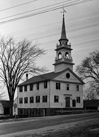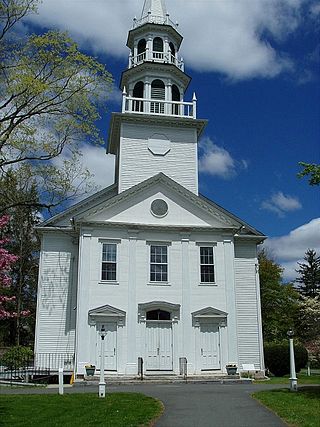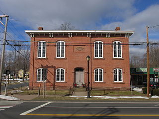
This is intended to be a complete list of the properties and districts on the National Register of Historic Places in Fairfield County, Connecticut, United States. The locations of National Register properties and districts for which the latitude and longitude coordinates are included below may be seen in an online map.

This is intended to be a complete list of properties and districts listed on the National Register of Historic Places in Orleans County, New York. The locations of National Register properties and districts may be seen in a map by clicking on "Map of all coordinates". Two listings, the New York State Barge Canal and the Cobblestone Historic District, are further designated a National Historic Landmark.

Downtown Stamford, or Stamford Downtown, is the central business district of the city of Stamford, Connecticut, United States. It includes major retail establishments, a shopping mall, a university campus, the headquarters of major corporations and Fortune 500 companies, as well as other retail businesses, hotels, restaurants, offices, entertainment venues and high-rise apartment buildings.

Preston City is a village and the original town center of the town of Preston, Connecticut. The core of the village around the junction of Old Northwest Road and Route 164 is designated as the Preston City Historic District, a historic district that is listed on the National Register of Historic Places. The district is located along Old Shetucket and Amos Roads, which, prior to the 1930s, were major thoroughfares.

The South Britain Historic District encompasses the core of the unincorporated village of South Britain in Southbury, Connecticut, United States. The village arose in the 18th century as an industrial center serving the surrounding agricultural community, powered by the Pomperaug River, and rivalled the town center of Southbury in importance. The district was listed on the National Register of Historic Places in 1987.

The Hazardville Historic District is a historic district in the Hazardville section of Enfield, Connecticut, United States, that is listed on the National Register of Historic Places.

The Tariffville Historic District is a 93 acres (38 ha) historic district in the town of Simsbury, Connecticut. It was listed on the National Register of Historic Places in 1993. It is part of the Tariffville section of Simsbury. The district includes 165 contributing buildings and two contributing sites. It also includes 26 non-contributing buildings and 4 non-contributing sites. There are several houses in the district of Gothic Revival style, probably following designs from pattern books of architect Andrew Jackson Downing. The Trinity Episcopal Church is the only building in the district designed by an architect of national standing, namely Henry C. Dudley. Many of the homes in the area were built by the Tariff Manufacturing Company, which opened a carpet mill along the Farmington River, and needed housing for workers.

Glenville Historic District, also known as Sherwood's Bridge, is a 33.9 acres (13.7 ha) historic district in the Glenville neighborhood of the town of Greenwich, Connecticut. It is the "most comprehensive example of a New England mill village within the Town of Greenwich". It "is also historically significant as one of the town's major staging areas of immigrants, predominantly Irish in the 19th century and Polish in the 20th century" and remains "the primary settlement of Poles in the town". Further, "[t]he district is architecturally significant because it contains two elaborate examples of mill construction, designed in the Romanesque Revival and a transitional Stick-style/Queen Anne; an excellent example of a Georgian Revival school; and notable examples of domestic and commercial architecture, including a Queen Anne mansion and an Italianate store building."

The Hotchkissville Historic District is a historic district in the town of Woodbury, Connecticut, that was listed on the National Register of Historic Places in 1995. The district encompasses most of the historic village of Hotchkissville, which is centered at the junction of Washington and Weekeepeemee roads. The village began as a dispersed rural agricultural community, but developed in the 19th century with the arrival of industry, primarily the manufacture of textiles. Despite this, the village has retained a significantly rural character, and includes a broad cross-section of 18th- and 19th-century architectural styles.

The Union Green is the town green of the New England town of Union, Connecticut. The Green is a small town-owned wedge at the north end of a triangle park area formed by Town Hall Road, Buckley Highway and Kinney Hollow Road. The Green, Union Grove, and properties to the north along Route 190 are listed on the National Register of Historic Places as the Union Green Historic District. The historic district contains 16 buildings, 3 sites, and 2 objects over an area of 300 acres (1.2 km2).

The Tolland Green Historic District is a historic district that includes the town green, Tolland Green, of Tolland, Connecticut.

March Route of Rochambeau's Army: Plainfield Pike is a 3.6 mile-long road segment in Plainfield and Sterling, Connecticut which forms a portion of the historic march route of Comte de Rochambeau's army in June 1781 on its way to Yorktown, Virginia, and again of the returning army in November 1782. It was listed on the National Register of Historic Places (NRHP) in 2003.

This is intended to be a complete list of properties and districts listed on the National Register of Historic Places in Rochester, New York, United States. The locations of National Register properties and districts may be seen in an online map by clicking on "Map of all coordinates".

The Boston Post Road Historic District encompasses a cross-section of residential architectural styles representative of much of the history of Darien, Connecticut. Centered on the junction of Boston Post Road and Brookdale Road, the district also includes two civic landmarks: the town hall and the Greek Revival First Congregational Church. The district was listed on the National Register of Historic Places in 1982.

The Bradley Edge Tool Company Historic District encompasses the surviving remnants of a historic 19th-century industrial village in Weston, Connecticut. Extending along Lyons Plain Road near White Birch Road and the Saugatuck River, the area was home to the Bradley Edge Tool Company, which flourished here between 1834 and 1870. The principal surviving elements are residences which were built for the owners and workers of the company; the factory itself burned in 1911. The district was listed on the National Register of Historic Places in 1995.

The New Preston Hill Historic District encompasses a small rural 19th-century village center in the New Preston area of the town of Washington, in Litchfield County, Connecticut. Settled in the late 18th century, it is distinctive for its examples of stone architecture, include a rare Federal period stone church. The district, located at the junction of New Preston Road with Gunn Hill and Findlay Roads, was listed on the National Register of Historic Places in 1985.

The Deacon John Davenport House is a historic house at 129 Davenport Ridge Road in Stamford, Connecticut, United States. Built in 1775, it is significant for its architecture and for its association with the locally prominent Davenport family, descended from John Davenport, one of the founders of New Haven. The house was listed on the National Register of Historic Places in 1982.
This is a list of the properties and historic districts in Stamford, Connecticut that are listed on the National Register of Historic Places. The locations of National Register properties and districts for which the latitude and longitude coordinates are included below, may be seen in an online map.
This is a list of the National Register of Historic Places listings in Greenwich, Connecticut.


