Lumb, Rawtenstall

Last updated

Lumb
St Michael on the Hill - geograph.org.uk - 682375.jpg
St Michael on the Hill Church
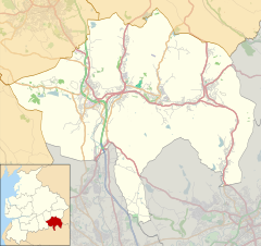
Location map United Kingdom Borough of Rossendale.svg
Red pog.svg
Lumb
Location within Rossendale
Lancashire UK location map.svg
Red pog.svg
Lumb
Lumb shown within Lancashire
OS grid reference SD837248
District
Shire county
Region
Country England
Sovereign state United Kingdom
Post town ROSSENDALE
Postcode district BB4
Dialling code 01706
Police Lancashire
Fire Lancashire
Ambulance North West
EU Parliament North West England
UK Parliament
List of places
UK
England
Lancashire
53°43′12″N2°14′49″W / 53.720°N 2.247°W / 53.720; -2.247 Coordinates: 53°43′12″N2°14′49″W / 53.720°N 2.247°W / 53.720; -2.247

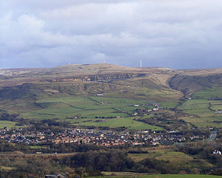
Lumb is a small village in the Rossendale district of Lancashire, England. It lies in the valley of the Whitewell Brook, 3 miles (5 km) north east of Rawtenstall. It should not be confused with the hamlet of Lumb near Edenfield, also in the Rossendale district.

Borough of Rossendale Borough and Non-metropolitan district in England

Rossendale is a district with borough status in Lancashire, England, holding a number of small former mill towns centred on the valley of the River Irwell in the industrial North West. Rossendale combines modest size urban development with rural villages and is immediately south of the more populated town of Burnley, east of Blackburn and north of Bolton, Bury, Manchester and Rochdale, centred 15 miles (24 km) north of Manchester.

Lancashire County of England

Lancashire is a ceremonial county in North West England. The administrative centre is Preston. The county has a population of 1,449,300 and an area of 1,189 square miles (3,080 km2). People from Lancashire are known as Lancastrians.

Whitewell Brook River in Lancashire, England

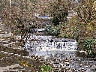
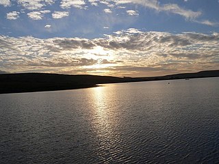
Whitewell Brook is a minor river in Lancashire, England. It is 4.34 miles (6.99 km) long and has a catchment area of 7.67 square miles (19.86 km2).

Lumb was historically in the large ancient parish of Whalley. In 1846 it was constituted a chapelry within the parish of Whalley, which also included the village of Water. [1] In 1866 it became part of the civil parish of Newchurch, [2] and in 1894 was transferred to the municipal borough and civil parish of Rawtenstall. [3]

Whalley, Lancashire village in Lancashire, England

Whalley is a large village and civil parish in the Ribble Valley on the banks of the River Calder in Lancashire, England. It is overlooked by Whalley Nab, a large wooded hill over the river from the village. The population of the civil parish was 2,645 at the census of 2001, and increased to 3,629 at the census of 2011. Watercolour artist Thomas Frederick Worrall painted two scenes entitled Whalley from the Nab and Whalley Nab from Stoneyhurst, c. 1900, which are available on the Watercolour World web site.

A chapelry was a subdivision of an ecclesiastical parish in England and parts of Lowland Scotland up to the mid 19th century.

Civil parish territorial designation and lowest tier of local government in England, UK

In England, a civil parish is a type of administrative parish used for local government, they are a territorial designation which is the lowest tier of local government below districts and counties, or their combined form, the unitary authority. Civil parishes can trace their origin to the ancient system of ecclesiastical parishes which historically played a role in both civil and ecclesiastical administration; civil and religious parishes were formally split into two types in the 19th century and are now entirely separate. The unit was devised and rolled out across England in the 1860s.

St Michael's parish church was founded in 1846. [4]

See also

Related Research Articles

Bacup town in England

Bacup is a town in Lancashire, England, in the South Pennines close to Lancashire's boundary with West Yorkshire. The town is in the Rossendale Valley and the upper Irwell Valley, 3.5 miles (5.6 km) east of Rawtenstall, 6.4 miles (10.3 km) north of Rochdale, and 7 miles (11 km) south of Burnley. At the 2011 Census, Bacup had a population of 13,323.

Blackburn Hundred

Blackburn Hundred is a historic sub-division of the county of Lancashire, in northern England. Its chief town was Blackburn, in the northwest of the hundred. It covered an area similar to modern East Lancashire, including the current districts of Ribble Valley, Pendle, Burnley, Rossendale, Hyndburn, Blackburn with Darwen, and South Ribble.

Haslingden town in Rossendale, Lancashire, England

Haslingden is a town in Rossendale, Lancashire, England. It is 19 miles (31 km) north of Manchester. The name means 'valley of the hazels'. At the time of the 2001 census the town had a population of 16,849.

Dunnockshaw village and civil parish in the United Kingdom

Dunnockshaw or Dunnockshaw and Clowbridge is a civil parish in the borough of Burnley, in Lancashire, England. The parish is situated between Burnley and Rawtenstall.

Gambleside abandoned village in Lancashire, England

Gambleside is an abandoned village located in northern Rossendale close to the boundary with Burnley's Dunnockshaw and Clowbridge parish.

Rossendale Valley

The Rossendale Valley also known as the Valley of Rossendale, is situated in the Rossendale area of Lancashire, England, between the West Pennine Moors and the main range of the Pennines. The area includes the steep-sided valleys of the River Irwell and its tributaries, which flow southwards into Greater Manchester. The rivers cut through the moorland of the Rossendale Hills, generally characterized by open unwooded land, despite the ancient designation of "forest".

Edenfield village in United Kingdom

Edenfield is a village within the Rossendale borough of Lancashire, England. Lying on the River Irwell, it is around 1.25 miles (2.0 km) north of Ramsbottom, 2.5 miles (4.0 km) south of Rawtenstall, and 6.0 miles (9.7 km) west of Norden, and has a total population of 2,080, reducing to 2,053 at the 2011 Census.

Rawtenstall town at the centre of the Rossendale Valley, in Lancashire, England

Rawtenstall is a town at the centre of the Rossendale Valley in Lancashire, England, with a population of 22,000. It is the seat for the borough of Rossendale, in which it is located. The town lies 17.4 miles north of Manchester, 22 miles east of Preston and 45 miles south east of the county town of Lancaster. Nearby towns include Bacup, Haslingden and Ramsbottom.

Waterfoot, Lancashire village in England

Waterfoot is a small Rossendale mill town between Rawtenstall and Bacup in Lancashire, England, where the B6238 road from Burnley meets the A681 road. It is where the Whitewell Brook meets the River Irwell.

Newchurch, Lancashire village in the United Kingdom

Newchurch is a village within the Rossendale borough of Lancashire, England. It is around one mile east of Rawtenstall and half a mile north of Waterfoot.

Waterfoot railway station served Waterfoot near Rawtenstall from 1848 until the line closed in 1966.

Roughlee human settlement in United Kingdom

Roughlee is a village in Pendle, Lancashire, England, in the civil parish of Roughlee Booth. It is close to Nelson, Barrowford and Blacko. The village lies at the foot of Pendle Hill, well known for the Pendle Witches, and includes the hamlet of Crowtrees. The parish adjoins the Pendle parishes of Blacko, Barrowford, Old Laund Booth, Goldshaw Booth and Barley-with-Wheatley Booth. It is part of the Forest of Bowland Area of Outstanding Natural Beauty (AONB).

Goldshaw Booth civil parish in Pendle, Lancashire, England

Goldshaw Booth is a civil parish in the Pendle district of Lancashire, England. It has a population of 248, and contains the village of Newchurch in Pendle and the hamlets of Spen Brook and Sabden Fold. Pendle Hill lies to the north.

Stubbins railway station

Stubbins railway station served the village of Stubbins in Rossendale, Lancashire, England. Opened by the East Lancashire Railway in 1846 on their line from Bury Bolton Street into Rossendale, it was situated next to the junction of the lines toward Accrington and to Rawtenstall and Bacup, but only had platforms on the latter route.

Habergham Eaves

Habergham Eaves is a civil parish in the borough of Burnley, in Lancashire, England. The parish consists of a rural area south of Burnley, and suburban areas on the outskirts of the town, including a large industrial estate in the north-west corner of the parish. Habergham is also the name of an area west of Burnley, although it is no longer within the parish. According to the United Kingdom Census 2011, the parish has a population of 1,466, a decrease from 1,581 in the 2001 census. The A646 Padiham to Todmorden road runs approximately along the northern boundary of the parish. Surrounding areas include the unparished areas of Burnley and Rossendale, and the parishes of Hapton, Dunnockshaw and Cliviger.

Lumb is a place name and surname. It may refer to

Stacksteads village in United Kingdom

Stacksteads is a village between the towns of Bacup and Waterfoot within the Rossendale borough of Lancashire, England. The population of this Rossendale ward at the 2011 census was 3,789. Stacksteads includes a mountain bike trail called Lee Quarry which had originally been a working quarry.

St Johns Church, Rawtenstall Church in Lancashire, England

St John's Church is a redundant Anglican church in Newchurch Road, Cloughfold, Rawtenstall, Lancashire, England. It is recorded in the National Heritage List for England as a designated Grade II listed building.

References

  1. John Marius Wilson's Imperial Gazetteer of England and Wales (1870-72), quoted on Vision of Britain website
  2. Vision of Britain: Newchurch CP boundary map
  3. Vision of Britain: Rawtenstall
  4. "St Michael's, Lumb". Genuki . Retrieved 24 September 2014.