

This is a list of the major rivers of the United Kingdom, as being prominent in length, flow volume (discharge rate), or both.
This is a list of the major rivers of the United Kingdom, as being prominent in length, flow volume (discharge rate), or both.
| Rank | River | Length (miles) | Length (km) | Mean flow (m3/s) [1] | Mouth | Country |
|---|---|---|---|---|---|---|
| 1 | River Severn [2] | 220 | 354 | 107.4 | Severn Estuary | Wales/England |
| 2 | River Thames [2] | 215 | 346 | 65.4 | Thames Estuary | England |
| 3 | River Trent [2] | 185 | 297 | 89.0 | The Humber | England |
| 4 | River Wye [3] | 155 | 250 | 73.1 | Severn Estuary | Wales/England |
| 5 | River Great Ouse [2] | 143 | 230 | 15.6 | The Wash | England |
| 6 | River Ure/River Ouse, Yorkshire | 129 | 208 | 69.8 | The Humber | England |
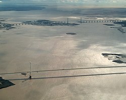
| 7 | River Tay [2] | 117 | 188 | 179.0 | Firth of Tay | Scotland |
| 8 | River Clyde | 109 | 176 | 48.5 | Firth of Clyde | Scotland |
| 9 | River Spey | 107 | 172 | 65.7 | Moray Firth | Scotland |
| 10 | River Nene [2] | 100 | 161 | 9.3 | The Wash | England |
| 11 | River Bann / Lough Neagh | 99 | 159 | 92.2 | Atlantic Ocean | Northern Ireland |
| 12 | River Tweed [2] | 96 | 155 | 81.7 | North Sea | Scotland/England |
| 13 | River Avon, Warwickshire | 96 | 154 | 17.3 | River Severn* | England |
| 14 | River Eden, Cumbria | 90 | 145 | 53.7 | Solway Firth | England |
| 15 | River Dee, Aberdeenshire | 87 | 140 | 47.8 | North Sea | Scotland |
| 16 | River Witham | 82 | 132 | 5.2 | The Wash | England |
| 17 | River Teme | 81 | 130 | 18.2 | River Severn* | Wales/England |
| 18= | River Don, Aberdeenshire [2] | 80 | 129 | 21.3 | North Sea | Scotland |
| 18= | River Foyle | 80 | 129 | 58.8 | Atlantic Ocean | Northern Ireland/Republic of Ireland |
| 20 | River Usk [4] | 78 | 125 | 28.6 | Severn Estuary | Wales |
| 21 | River Teifi [5] | 76 | 122 | 29.5 | Cardigan Bay | Wales |
| 22= | River Towy | 75 | 121 | 39.9 | Carmarthen Bay | Wales |
| 22= | River Ribble | 75 | 120 | 34.0 | Irish Sea | England |
| 22= | River Avon, Bristol | 75 | 120 | 22.2 | Mouth of the Severn | England |
| 25= | River Tyne [2] | 73 | 118 | 45.2 | North Sea | England |
| 25= | River Swale | 73 | 118 | 20.2 | River Ure | England |
| 27 | River Derwent, Yorkshire | 72 | 115 | 17.4 | River Ouse, Yorkshire | England |
| 28= | River Aire | 71 | 114 | 36.5 | River Ouse, Yorkshire | England |
| 28= | River Nith | 71 | 114 | 36.5 | Solway Firth | Scotland |
| 30= | River Tees | 70 | 113 | 22.2 | North Sea | England |
| 30= | River Medway | 70 | 113 | 11.7 | Thames Estuary | England |
| 30= | River Mersey | 70 | 113 | 37.1 | Irish Sea | England |
| 33= | River Dee, Wales [2] | 70 | 112 | 34.1 | Dee Estuary | Wales/England |
| 33= | River Don, South Yorkshire | 70 | 112 | 16.3 | River Ouse, Yorkshire | England |
| 35= | River Welland | 65 | 105 | 8.72 | The Wash | England |
| 35= | River Wharfe | 65 | 105 | 17.6 | River Ouse, Yorkshire | England |
| 37= | River Tamar | 61 | 98 | 22.9 | English Channel | England |
| 37= | River Stour, Dorset | 61 | 98 | 13.8 | Christchurch Harbour | England |
| 39= | River Avon, Hampshire | 60 | 96 | 20.0 | Christchurch Harbour | England |
| 39= | River Exe | 60 | 96 | 25.4 | English Channel | England |
| 39= | River Wear | 60 | 96 | 14.9 | The North Sea | England |
| N/A | River Ness | 6 | 10 | 90.7 | Beauly Firth | Scotland |
There seems to be little consensus in published sources as to the lengths of rivers, nor much agreement as to what constitutes a river. Thus the River Ure and River Ouse can be counted as one river system or as two rivers. If it is counted as one, the River Aire/ River Ouse/Humber system would come fourth in the list, with a combined length of 161 miles (259 km); and the River Trent/Humber system would top the list with their combined length of 222 miles (357 km). [6] Also, the Thames tributary, the River Churn, sourced at Seven Springs, adds 14 miles (23 km) to the length of the Thames (from its traditional source at Thames Head). The Churn/Thames' length at 229 miles (369 km) is therefore greater than the Severn's length of 220 miles (354 km). Thus, the combined Churn/Thames river would top the list. Sue Owen et al., in their book on rivers, generally restrict the length to the parts that bear the same name. Thus the River Nene is quoted at 100 miles (160 km), but would be around 5 miles (8 km) more if the variously named sources were included. Many of the above lengths are considerably different from Sue Owen's list, some longer and some shorter. [2]
Where a river ends in an estuary the conventional British approach has been to treat the river as ending at the end of the administrative zone. Thus the Severn ends at the mouth of the Bristol Avon and the Thames at the Yantlet Line. The currently accepted end of the Severn Estuary is about 18.5 miles (29.8 km) further, and the Port of London's authority stretches now to Margate, 30 miles (48 km) further. Other countries have different conventions, making comparisons of limited value. Those rivers which empty into other (non-tidal sections of) rivers are indicated in the table thus*. In Yorkshire, the Aire, Derwent, Don, and Wharfe all empty into a tidal section of the Yorkshire Ouse.
The calculation of mean flow presents its own challenges, relying on sampling at a limited number of gauging stations. The data presented in the table are derived from those offered up by the National River Flow Archive, in particular the flow measured at the lowermost gauging stations on each named watercourse. Sometimes the figures of further downstream tributaries are combined with those of the main stem river to provide a more realistic flow figure for the lowermost non-tidal stretch of a watercourse.