Mapleton (CDP), Maine

Last updated

Mapleton, Maine
Aroostook County Maine incorporated and unincorporated areas Mapleton (CDP) highlighted.svg
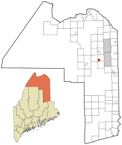
Location of Mapleton, Maine
Coordinates: 46°40′54″N68°9′42″W / 46.68167°N 68.16167°W / 46.68167; -68.16167
Country United States
State Maine
County Aroostook
Town Mapleton
Area
[1]
  Total
3.00 sq mi (7.78 km2)
  Land3.00 sq mi (7.78 km2)
  Water0.00 sq mi (0.00 km2)
Elevation
554 ft (169 m)
Population
 (2020)
  Total
623
  Density207.46/sq mi (80.10/km2)
Time zone UTC-5 (Eastern (EST))
  Summer (DST) UTC-4 (EDT)
ZIP code
04757
Area code 207
FIPS code 23-43220
GNIS feature ID2583561

Mapleton is a census-designated place (CDP) comprising the main village within the town of Mapleton in Aroostook County, Maine, United States. The population of the CDP was 683 at the 2010 census, [2] out of a population of 1,948 for the entire town.

Contents

Geography

The Mapleton CDP is located in the southwestern part of the town of Mapleton, along Maine State Route 163. It is 5 miles (8 km) east to Presque Isle and 14 miles (23 km) west to Ashland.

According to the United States Census Bureau, the CDP has a total area of 3.0 square miles (7.8 km2), all land. [2]

Demographics

Historical population
CensusPop.Note
2020 623
U.S. Decennial Census [3]

Education

The school district for this community is School Administrative District 01. [4]

References

  1. "2020 U.S. Gazetteer Files". United States Census Bureau. Retrieved April 8, 2022.
  2. 1 2 "Geographic Identifiers: 2010 Demographic Profile Data (G001): Mapleton CDP, Maine". U.S. Census Bureau, American Factfinder. Archived from the original on February 12, 2020. Retrieved May 22, 2013.
  3. "Census of Population and Housing". Census.gov. Retrieved June 4, 2016.
  4. Geography Division (January 14, 2021). 2020 CENSUS - SCHOOL DISTRICT REFERENCE MAP: Aroostook County, ME (PDF) (Map). U.S. Census Bureau. p. 2 (PDF p. 3/4). Retrieved July 12, 2025. - Text list