Houlton (CDP), Maine

Last updated
Houlton, Maine
Aroostook County Maine incorporated and unincorporated areas Houlton (CDP) highlighted.svg
Location of Houlton, Maine
Coordinates: 46°7′20″N67°50′21″W / 46.12222°N 67.83917°W / 46.12222; -67.83917 Coordinates: 46°7′20″N67°50′21″W / 46.12222°N 67.83917°W / 46.12222; -67.83917
Country United States
State Maine
County Aroostook
Town Houlton
Area
[1]
  Total5.26 sq mi (13.61 km2)
  Land5.26 sq mi (13.61 km2)
  Water0.00 sq mi (0.00 km2)
Elevation
361 ft (110 m)
Population
 (2020)
  Total4,743
  Density902.40/sq mi (348.42/km2)
Time zone UTC-5 (Eastern (EST))
  Summer (DST) UTC-4 (EDT)
ZIP codes
04730, 04761
Area code 207
FIPS code 23-33945
GNIS feature ID0568348

Houlton is a census-designated place (CDP) comprising the main village within the town of Houlton in Aroostook County, Maine, United States. The population of the CDP was 4,856 at the 2010 census, [2] out of a population of 6,123 for the entire town. Houlton is the county seat of Aroostook County. The northern terminus of Interstate 95 and eastern terminus of U.S. Route 2 are just east of the CDP at the Canada–United States border.

Contents

Geography

The Houlton CDP is located near the center of the town of Houlton, along the Meduxnekeag River. U.S. Route 1 and U.S. Route 2 intersect at the center of the CDP, and Interstate 95 passes along the northern edge, with access at Exit 302 (Route 1). It is 42 miles (68 km) north along Route 1 to Presque Isle, 120 miles (190 km) southwest along I-95 to Bangor, 90 miles (140 km) southeast along Route 1 to Calais and 16 miles (26 km) east along I-95 and New Brunswick Route 95 to Woodstock, New Brunswick.

According to the United States Census Bureau, the CDP has a total area of 5.3 square miles (13.6 km2), all land. [2]

Demographics

Historical population
CensusPop.Note
2020 4,743
U.S. Decennial Census [3]

As of the census [4] of 2000, there were 5,270 people, 2,203 households, and 1,310 families residing in the CDP. The population density was 687.3 inhabitants per square mile (265.4/km2). There were 2,472 housing units at an average density of 124.4 persons/km2 (322.4 persons/sq mi). The racial makeup of the CDP was 95.48% White, 0.34% African American, 2.81% Native American, 0.53% Asian, 0.09% Pacific Islander, 0.11% from other races, and 0.63% from two or more races. Hispanic or Latino of any race were 0.49% of the population.

There were 2,203 households, out of which 28.3% had children under the age of 18 living with them, 45.0% were married couples living together, 11.3% had a female householder with no husband present, and 40.5% were non-families. 36.6% of all households were made up of individuals, and 19.2% had someone living alone who was 65 years of age or older. The average household size was 2.24 and the average family size was 2.92.

In the CDP, the population was spread out, with 23.1% under the age of 18, 7.4% from 18 to 24, 25.1% from 25 to 44, 21.8% from 45 to 64, and 22.6% who were 65 years of age or older. The median age was 41 years. For every 100 females, there were 87.0 males. For every 100 females age 18 and over, there were 81.1 males.

The median income for a household in the CDP was $25,162, and the median income for a family was $33,864. Males had a median income of $27,534 versus $21,778 for females. The per capita income for the CDP was $13,875. About 1.31% of families and 17.6% of the population were below the poverty line, including 20.3% of those under the age of 18 and 16.0% ages 65 or older.

Related Research Articles

<span class="mw-page-title-main">Aroostook County, Maine</span> County in Maine, United States

Aroostook County is a county in the U.S. state of Maine along the Canada–U.S. border. As of the 2020 census, the population was 67,105. Its county seat is Houlton, with offices in Caribou and Fort Kent.

<span class="mw-page-title-main">Terramuggus, Connecticut</span> Census-designated place in Connecticut, United States

Terramuggus is a census-designated place (CDP) in the town of Marlborough, Hartford County, Connecticut, United States. It contains the town center village and surrounding areas. The population was 1,025 at the 2010 census.

<span class="mw-page-title-main">Amity, Maine</span> Town in the state of Maine, United States

Amity is a town in Aroostook County, eastern Maine, United States, near the Canada–United States border. The population was 253 at the 2020 census.

<span class="mw-page-title-main">Hodgdon, Maine</span> Town in the state of Maine, United States

Hodgdon is a rural town in Aroostook County, Maine, United States. The town borders the province of New Brunswick, Canada to the east and Houlton to the north. Hodgdon's population was 1,290 at the 2020 census.
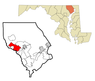
<span class="mw-page-title-main">Pleasant Hills, Maryland</span> Census-designated place in Maryland, United States

Pleasant Hills is a census-designated place (CDP) in Harford County, Maryland, United States. The population was 3,379 at the 2010 census, up from 2,851 in 2000. There is no post office with the designation "Pleasant Hills"; most of the residents have either Fallston or Kingsville addresses and consider themselves as belonging to those communities.

<span class="mw-page-title-main">Suncook, New Hampshire</span> Census-designated place in New Hampshire, United States

Suncook is a census-designated place (CDP) in Merrimack County, New Hampshire, United States. The population was 5,501 at the 2020 census. Approximately two-thirds of Suncook is located in the town of Pembroke, with the remainder in Allenstown.

<span class="mw-page-title-main">Tillson, New York</span> CDP in New York, United States

Tillson is a hamlet in Ulster County, New York, United States. The population was 1,516 at the 2020 census.

<span class="mw-page-title-main">Central Aroostook, Maine</span> Unorganized territory in Maine, United States

Central Aroostook is an unorganized territory in Aroostook County, Maine, United States. The population was 164 at the 2020 census.

<span class="mw-page-title-main">Van Buren (CDP), Maine</span> Census-designated place in Maine, United States

Van Buren is a census-designated place (CDP) comprising the main village within the town of Van Buren in Aroostook County, Maine, United States. The population of the CDP was 1,937 at the 2010 census, out of a population of 2,171 for the entire town.

<span class="mw-page-title-main">Houlton, Maine</span> Town in Maine, United States

Houlton is a town in Aroostook County, Maine, on the Canada–United States border. As of the 2020 census, the town's population was 6,055. It is perhaps best known for being at the northern terminus of Interstate 95 and as the birthplace of Samantha Smith, a goodwill ambassador as a child during the Cold War. The town hosts the annual Houlton Agricultural Fair.

<span class="mw-page-title-main">Plymouth (CDP), New Hampshire</span> Census-designated place in New Hampshire, United States

Plymouth is a census-designated place (CDP) and the main village in the town of Plymouth in Grafton County, New Hampshire, United States. Its population was 4,730 at the 2020 census, out of 6,682 in the entire town. The CDP includes the campus of Plymouth State University.

<span class="mw-page-title-main">Greenville (CDP), New Hampshire</span> Census-designated place in New Hampshire, United States

Greenville is a census-designated place (CDP) and the main village in the town of Greenville in Hillsborough County, New Hampshire, United States. The population of the CDP was 1,074 at the 2020 census, out of 1,974 in the entire town.

<span class="mw-page-title-main">Hampton (CDP), New Hampshire</span> Census-designated place in New Hampshire, United States

Hampton is a census-designated place (CDP) comprising the town center and surrounding developed areas of the town of Hampton, Rockingham County, New Hampshire, United States. The population of the CDP was 9,597 at the 2020 census, out of 16,214 in the entire town.

<span class="mw-page-title-main">Bradford (CDP), New Hampshire</span> Census-designated place in New Hampshire, United States

Bradford is a census-designated place (CDP) and the main village in the town of Bradford in Merrimack County, New Hampshire, United States. The population of the CDP was 372 at the 2020 census, out of 1,662 in the entire town.

<span class="mw-page-title-main">Fort Fairfield (CDP), Maine</span> Census-designated place in Maine, United States

Fort Fairfield is a census-designated place (CDP) comprising the main village within the town of Fort Fairfield in Aroostook County, Maine, United States. The population of the CDP was 1,825 at the 2010 census, out of a population of 3,496 for the entire town.

<span class="mw-page-title-main">Fort Kent (CDP), Maine</span> Census-designated place in Maine, United States

Fort Kent is a census-designated place (CDP) that comprises the main village in the town of Fort Kent in Aroostook County, Maine, United States. In 2010, Fort Kent's population was 2,488 of 4,097 for the entire town.

<span class="mw-page-title-main">Limestone (CDP), Maine</span> Census-designated place in Maine, United States

Limestone is a census-designated place (CDP) comprising the main village within the town of Limestone in Aroostook County, Maine, United States. The population was 1,075 at the 2010 census, out of a population of 2,314 for the entire town.

<span class="mw-page-title-main">Madawaska (CDP), Maine</span> Census-designated place in Maine, United States

Madawaska is a census-designated place (CDP) comprising the main village within the town of Madawaska in Aroostook County, Maine, United States. The population of the CDP was 2,967 at the 2010 census, out of a population of 4,035 for the entire town.

<span class="mw-page-title-main">Oakland (CDP), Maine</span> Census-designated place in Maine, United States

Oakland is a census-designated place (CDP) comprising the main population center in the town of Oakland in Kennebec County, Maine, United States. The population was 2,602 at the 2010 census, out of 6,240 in the entire town of Oakland.

<span class="mw-page-title-main">Winthrop (CDP), Maine</span> Census-designated place in Maine, United States

Winthrop is a census-designated place (CDP) comprising the primary settlement in the town of Winthrop in Kennebec County, Maine, United States. The population was 2,650 at the 2010 census, out of 6,092 in the town of Winthrop as a whole.

References

  1. "2020 U.S. Gazetteer Files". United States Census Bureau. Retrieved April 8, 2022.
  2. 1 2 "Geographic Identifiers: 2010 Demographic Profile Data (G001): Houlton CDP, Maine". U.S. Census Bureau, American Factfinder. Archived from the original on February 12, 2020. Retrieved May 22, 2013.
  3. "Census of Population and Housing". Census.gov. Retrieved June 4, 2016.
  4. "U.S. Census website". United States Census Bureau . Retrieved 2008-01-31.