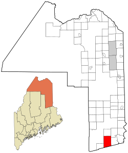
Reed Plantation, Maine

Last updated
Reed Plantation, Maine
Aroostook County Maine incorporated and unincorporated areas Reed Plantation highlighted.svg
Location of Reed Plantation, Maine
Coordinates: 45°43′25″N68°08′32″W / 45.72361°N 68.14222°W / 45.72361; -68.14222
Country United States
State Maine
County Aroostook
Area
  Total59.2 sq mi (153.3 km2)
  Land59.0 sq mi (152.7 km2)
  Water0.23 sq mi (0.6 km2)
Elevation
492 ft (150 m)
Population
 (2020)
  Total129
  Density2.2/sq mi (0.84/km2)
Time zone UTC-5 (Eastern (EST))
  Summer (DST) UTC-4 (EDT)
ZIP code
04497
Area code 207
FIPS code 23-62400
GNIS feature ID0582694

Reed Plantation is a plantation in Aroostook County, Maine, United States. The population was 129 at the 2020 census. [1]

Contents

Geography

According to the United States Census Bureau, the plantation has a total area of 59.2 square miles (153.3 km2), of which 59.0 square miles (152.7 km2) is land and 0.23 square miles (0.6 km2), or 0.38%, is water. [2]

Demographics

Historical population
CensusPop.Note
1860 72
1870 54−25.0%
1880 109101.9%
1890 20386.2%
1900 39996.6%
1910 53734.6%
1920 63919.0%
1930 495−22.5%
1940 433−12.5%
1950 351−18.9%
1960 325−7.4%
1970 273−16.0%
1980 2740.4%
1990 2968.0%
2000 207−30.1%
2010 161−22.2%
2020 129−19.9%
U.S. Decennial Census [3]

At the 2000 census there were 207 people, 74 households, and 58 families living in the plantation. The population density was 3.5 inhabitants per square mile (1.4/km2). There were 108 housing units at an average density of 1.8 per square mile (0.69/km2). The racial makeup of the plantation was 96.14% White, 1.93% Asian, and 1.93% from two or more races. [4] Of the 74 households 29.7% had children under the age of 18 living with them, 63.5% were married couples living together, 10.8% had a female householder with no husband present, and 20.3% were non-families. 16.2% of households were one person and 6.8% were one person aged 65 or older. The average household size was 2.80 and the average family size was 3.03.

The age distribution was 25.6% under the age of 18, 3.4% from 18 to 24, 26.6% from 25 to 44, 29.5% from 45 to 64, and 15.0% 65 or older. The median age was 41 years. For every 100 females, there were 91.7 males. For every 100 females age 18 and over, there were 92.5 males.

The median household income was $21,979 and the median family income was $24,375. Males had a median income of $38,500 versus $15,313 for females. The per capita income for the plantation was $10,155. About 16.4% of families and 16.9% of the population were below the poverty line, including 14.7% of those under the age of 18 and 11.1% of those 65 or over.

History

Reed Plantation was first settled in the early 1830s by four families, Clifford, Rollins, Prouty, and Plummer. The matriarchs of these families were four Spaulding sisters, Edith Clifford, Susan Spaulding, Lavinia Prouty, and Phoebe Plummer. They were the daughters of Seth Spaulding of the Dover-Foxcroft area. Many of their descendants still live in Reed or the village of Wytopitlock today.

Related Research Articles

<span class="mw-page-title-main">Aroostook County, Maine</span> County in Maine, United States

Aroostook County is a county in the U.S. state of Maine along the Canada–U.S. border. As of the 2020 census, the population was 67,105. Its county seat is Houlton, with offices in Caribou and Fort Kent.

<span class="mw-page-title-main">Amity, Maine</span> Town in the state of Maine, United States

Amity is a town in Aroostook County, eastern Maine, United States, near the Canada–United States border. The population was 253 at the 2020 census.

<span class="mw-page-title-main">Ashland, Maine</span> Town in Maine, United States

Ashland is a town in Aroostook County, Maine, United States. The population was 1,202 at the 2020 census.

<span class="mw-page-title-main">Cary, Maine</span> Township in Maine, United States

Cary is an unorganized township in Aroostook County, Maine, United States, and part of the state's Unorganized Territory. As of the 2010 census, it had a population of 218.

<span class="mw-page-title-main">Castle Hill, Maine</span> Town in the state of Maine, United States

Castle Hill is a town in Aroostook County, Maine, United States. The population was 373 people at the 2020 census.

<span class="mw-page-title-main">Caswell, Maine</span> Town in the state of Maine, United States

Caswell is a town in Aroostook County, Maine, United States. The population was 293 at the 2020 census.

<span class="mw-page-title-main">Cyr Plantation, Maine</span> Plantation in Maine, United States

Cyr Plantation is a plantation in Aroostook County, Maine, United States. The population was 78 at the 2020 census.

<span class="mw-page-title-main">Eagle Lake, Maine</span> Town in the state of Maine, United States

Eagle Lake is a town in Aroostook County, Maine, United States. The population was 772 at the 2020 census. The town was named by a body of troops heading from Bangor to the Aroostook War for the many eagles that they saw around the lake. A total of 49.0% of the population speaks French, reflecting a trend in Northeastern Maine.

<span class="mw-page-title-main">Garfield Plantation, Maine</span> Plantation in Maine, United States

Garfield Plantation is a plantation in Aroostook County, Maine, United States. The population was 79 at the 2020 census.

<span class="mw-page-title-main">Macwahoc Plantation, Maine</span> Plantation in Maine, United States

Macwahoc Plantation is a plantation in Aroostook County, Maine, United States. The population was 62 at the 2020 census.

<span class="mw-page-title-main">Moro Plantation, Maine</span> Plantation in Maine, United States

Moro Plantation is a plantation in Aroostook County, Maine, United States. The population was 44 at the 2020 census.

<span class="mw-page-title-main">Nashville Plantation, Maine</span> Plantation in Maine, United States

Nashville Plantation is a plantation in Aroostook County, Maine, United States. The population was 27 at the 2020 census.

<span class="mw-page-title-main">Oxbow, Maine</span> Township in Maine, United States

Oxbow, officially Oxbow North and Township 9 Range 6, is an unincorporated township in Aroostook County, Maine, United States and part of the state's Unorganized Territory. The population was 66 at the 2010 census. As of 2016, the population was estimated to be 50.

<span class="mw-page-title-main">Portage Lake, Maine</span> Town in the state of Maine, United States

Portage Lake is a town in Aroostook County, Maine, United States. The population was 359 at the 2020 census.

<span class="mw-page-title-main">Saint John Plantation, Maine</span> Plantation in Maine, United States

Saint John Plantation is a plantation in Aroostook County, Maine, United States, on the banks of the Saint John River. The population was 263 at the 2020 census.

<span class="mw-page-title-main">Westmanland, Maine</span> Town in the state of Maine, United States

Westmanland is a town in Aroostook County, Maine, United States. The population was 79 at the 2020 census.

<span class="mw-page-title-main">Winterville Plantation, Maine</span> Plantation in Maine, United States

Winterville Plantation is a plantation in Aroostook County, Maine, United States. The population was 194 at the 2020 census.

Baring Plantation is a plantation in Washington County, Maine, United States. The population was 201 at the 2020 census. The plantation is named for Alexander Baring, 1st Baron Ashburton, the British negotiator of the Webster–Ashburton Treaty which ended the Aroostook War in 1838–1839.

<span class="mw-page-title-main">South Aroostook, Maine</span> Unorganized territory in Maine, United States

South Aroostook is an unorganized territory in Aroostook County, Maine, United States. The population was 579 at the 2020 census.

<span class="mw-page-title-main">Fort Fairfield, Maine</span> Town in the state of Maine, United States

Fort Fairfield is a town in Aroostook County, eastern Maine, United States, located along the Canada–US border. The population was 3,322 at the 2020 census.

References

  1. "Census - Geography Profile: Reed plantation, Aroostook County, Maine". United States Census Bureau . Retrieved January 9, 2022.
  2. "Geographic Identifiers: 2010 Demographic Profile Data (G001): Reed plantation, Aroostook County, Maine". U.S. Census Bureau, American Factfinder. Archived from the original on February 12, 2020. Retrieved May 21, 2013.
  3. "Census of Population and Housing". Census.gov. Retrieved June 4, 2015.
  4. "U.S. Census website". United States Census Bureau . Retrieved 2008-01-31.