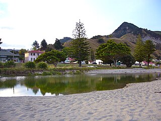
Maungatapu, Tauranga

Last updated

Maungatapu
Welcome Bay Link shared path bridge 004.jpg
Shared pathway bridge adjacent to the Maungatapu roundabout
Maungatapu, Tauranga
Coordinates: 37°43′19″S176°10′27″E / 37.721844°S 176.174029°E / -37.721844; 176.174029
CountryNew Zealand
City Tauranga
Local authority Tauranga City Council
Electoral wardWelcome Bay General Ward
Area
[1]
  Land168 ha (415 acres)
Population
 (June 2023) [2]
  Total3,150
(Tauranga Harbour) Matapihi
Pfeil oben.svg
Pfeil links.svgMaungatapuPfeil rechts.svg
Pfeil unten.svg
(Rangataua Bay)
Hairini Welcome Bay

Maungatapu is a suburb and peninsula of Tauranga in the Bay of Plenty region of New Zealand's North Island. It is north-east of Hairini and south-east of Matapihi.

Contents

The Maungatapu Peninsula and Matapihi Peninsula are connected by the Maungatapu Bridge. State Highway 29A runs through both suburbs.

Demographics

Maungatapu covers 1.68 km2 (0.65 sq mi) [1] and had an estimated population of 3,150 as of June 2023, [2] with a population density of 1,875 people per km2.

Historical population
YearPop.±% p.a.
20062,625    
20132,676+0.28%
20182,892+1.56%
Source: [3]

Maungatapu had a population of 2,892 at the 2018 New Zealand census, an increase of 216 people (8.1%) since the 2013 census, and an increase of 267 people (10.2%) since the 2006 census. There were 1,068 households, comprising 1,386 males and 1,509 females, giving a sex ratio of 0.92 males per female. The median age was 43.2 years (compared with 37.4 years nationally), with 555 people (19.2%) aged under 15 years, 486 (16.8%) aged 15 to 29, 1,245 (43.0%) aged 30 to 64, and 606 (21.0%) aged 65 or older.

Ethnicities were 79.0% European/Pākehā, 25.1% Māori, 2.9% Pacific peoples, 5.4% Asian, and 1.0% other ethnicities. People may identify with more than one ethnicity.

The percentage of people born overseas was 17.0, compared with 27.1% nationally.

Although some people chose not to answer the census's question about religious affiliation, 49.0% had no religion, 35.6% were Christian, 6.3% had Māori religious beliefs, 0.8% were Hindu, 0.2% were Muslim, 0.5% were Buddhist and 2.0% had other religions.

Of those at least 15 years old, 411 (17.6%) people had a bachelor's or higher degree, and 405 (17.3%) people had no formal qualifications. The median income was $33,000, compared with $31,800 nationally. 345 people (14.8%) earned over $70,000 compared to 17.2% nationally. The employment status of those at least 15 was that 1,128 (48.3%) people were employed full-time, 348 (14.9%) were part-time, and 69 (3.0%) were unemployed. [3]

Marae

The local Opopoti Marae and Wairakewa meeting house is a meeting place for the Ngāi Te Rangi hapū of Ngāti He. [4] [5]

Education

Maungatapu School is a co-educational state primary school for Year 1 to 6 students, [6] with a roll of 517 as of February 2024. [7]

Related Research Articles

<span class="mw-page-title-main">Tokomaru Bay</span> Town in the North Island of New Zealand

Tokomaru Bay is a small beachside community on the remote East Coast of New Zealand's North Island. It is 91 km north of Gisborne, on State Highway 35, and close to Mount Hikurangi. The district was originally known as Toka-a-Namu, which refers to the abundance of sandflies. Over the years the name was altered to Tokomaru Bay.

<span class="mw-page-title-main">Māhia Peninsula</span> Peninsula in Hawkes Bay, New Zealand

Māhia Peninsula is located on the east coast of New Zealand's North Island, in the Hawke's Bay region, between the towns of Wairoa and Gisborne.

<span class="mw-page-title-main">Te Kauwhata</span> Town in Waikato, New Zealand

Te Kauwhata is a small town in the north of the Waikato region of New Zealand, situated close to the western shore of Lake Waikare, some 40 km north of Hamilton and approximately 58 km south of Manukau City.

<span class="mw-page-title-main">Pōrangahau</span> Settlement in Hawkes Bay Region, New Zealand

Pōrangahau is a small township close to the Pacific Ocean coast in the south-east of the North Island of New Zealand. It lies in the southernmost part of Hawke's Bay, 45 kilometres south of Waipukurau, and close to the mouth of the Porangahau River. The settlement includes a marae and a school.
<span class="mw-page-title-main">Clive, New Zealand</span> Town in New Zealand

Clive is a small town, ten kilometres from the city centres of both Napier and Hastings in the Hawke's Bay region of New Zealand's North Island. It is close to the mouth of the Ngaruroro River.

<span class="mw-page-title-main">Seatoun</span> Suburb of Wellington City, New Zealand

Seatoun, an eastern suburb of Wellington, the capital city of New Zealand, lies on the east coast of the Miramar Peninsula, close to the entrance to Wellington Harbour, some seven kilometres southeast of the CBD. The suburb sits on an exposed promontory close to Barrett Reef, a dangerous area of rocky shallows upon which many ships have foundered, most notably the inter-island ferry TEV Wahine in 1968.

<span class="mw-page-title-main">Te Horo</span> Settlement in Wellington Region, New Zealand

Te Horo and Te Horo Beach are two localities on the Kāpiti Coast of New Zealand's North Island. Te Horo Beach is the larger of the two settlements and, as its name implies, is located on the Tasman Sea coast. Te Horo is located to the east, a short distance inland. They are situated between Peka Peka and Waikanae to the south and Ōtaki to the north. "Te Horo" in the Māori language means "the landslide".

<span class="mw-page-title-main">Ōmokoroa</span> Settlement in the Bay of Plenty, New Zealand

Ōmokoroa is a small urban area in the Western Bay of Plenty District of New Zealand. The suburb is considered part of Greater Tauranga, and is within the Coromandel electorate. Ōmokoroa began as a small rural holiday village, but is expanding to be a commuter town, with a 25-minute drive to Tauranga City.

<span class="mw-page-title-main">Herekino</span> Place in Northland Region, New Zealand

Herekino is a locality in Northland, New Zealand. It lies 26 km south west of Kaitaia. The Herekino Harbour, also called the Herekino River, is an estuary and inlet from the Tasman Sea to the west. The Herekino Forest, which contains a stand of large kauri, is to the north, and the Tauroa Peninsula lies to the north west.

<span class="mw-page-title-main">Wharekahika</span> Town in Gisborne District, New Zealand

Wharekahika or Hicks Bay is a bay and coastal area in the Gisborne District of the North Island of New Zealand. It is situated 150 km east of Ōpōtiki and 186 km north of Gisborne city, along State Highway 35 between Potaka and Te Araroa.

<span class="mw-page-title-main">Whangaruru</span> Place in Northland Region, New Zealand

Whangaruru is a rural community and harbour on the east coast of Northland, New Zealand. Mokau, Helena Bay, Whakapara, Hikurangi and Whangarei are to the south and the Bay of Islands is to the northwest.

Awapuni is a suburb of the New Zealand city of Gisborne, located in the southwest of the city. It is named after the Awapuni lagoon, where the Waipaoa River runs into the ocean. The New Zealand Ministry for Culture and Heritage gives a translation of "blocked-up river" for Awapuni.

<span class="mw-page-title-main">Tahuna, Waikato</span> Locality in Waikato, New Zealand

Tahuna is a small rural settlement located 18 km north of Morrinsville. In the Māori language Tahuna means sandbank, likely to refer to the sandbanks along the nearby Piako River, where a Māori settlement started. Tahuna is seen as the upper limit for navigatable travel on the Piako River. The settlement has a rugby club, a lawn bowls club, a golf course and various shops.

Waioeka is a rural community in the Ōpōtiki District and Bay of Plenty Region of New Zealand's North Island. It is on the east bank of the Waioeka River.

<span class="mw-page-title-main">Matapihi</span> Suburb of Tauranga, New Zealand

Matapihi is a suburb and peninsula of Tauranga in the Bay of Plenty region of New Zealand's North Island, surrounded on most sides by the Tauranga Harbour.

Rangiuru is a rural community in the Bay of Plenty of New Zealand's North Island.

Pokuru is a rural community in the Waipa District and Waikato region of New Zealand's North Island.

Waitahanui is a village in the Taupō District, Waikato region, New Zealand. The village is on the eastern shore of Lake Taupō, 14 km (9 mi) south of the district seat of Taupō.
<span class="mw-page-title-main">Ngāhinapōuri</span> Settlement in Waikato, New Zealand

Ngāhinapōuri is a rural community in the Waipa District and Waikato region of New Zealand's North Island. It is located on State Highway 39, between Whatawhata and Pirongia.

Manawaru or Manawarū is a rural community in the Matamata-Piako District and Waikato region of New Zealand's North Island.

References

  1. 1 2 "ArcGIS Web Application". statsnz.maps.arcgis.com. Retrieved 23 December 2022.
  2. 1 2 "Population estimate tables - NZ.Stat". Statistics New Zealand . Retrieved 25 October 2023.
  3. 1 2 "Statistical area 1 dataset for 2018 Census". Statistics New Zealand. March 2020. Maungatapu (195900). 2018 Census place summary: Maungatapu
  4. "Te Kāhui Māngai directory". tkm.govt.nz. Te Puni Kōkiri.
  5. "Māori Maps". maorimaps.com. Te Potiki National Trust.
  6. "Maungatapu School Ministry of Education School Profile". educationcounts.govt.nz. Ministry of Education.
  7. "Maungatapu School Education Review Office Report". ero.govt.nz. Education Review Office.