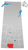
Fife Lake is a hamlet located between Coronach and Rockglen within Rural Municipality of Poplar Valley No. 12 in south-central Saskatchewan, Canada near the border with the United States. Approximately 40 people inhabited the village of Fife Lake in 2006. It is about 11 kilometres (6.8 mi) east of Rockin Beach Park and Fife Lake.
Arena was once a hamlet in the southwestern part of the province of Saskatchewan, Canada.

Brooking was once a community in the province of Saskatchewan, Canada. It was named after Brookings, South Dakota.
Piapot is a hamlet within the Rural Municipality of Piapot No. 110, Saskatchewan, Canada. Listed as a designated place by Statistics Canada, the hamlet had a population of 50 in the Canada 2016 Census.

Meyronne is a special service area in the Canadian province of Saskatchewan.
Jans Bay is a northern hamlet in the Canadian province of Saskatchewan.

Meacham is a village in the Canadian province of Saskatchewan within the Rural Municipality of Colonsay No. 342 and Census Division No. 11. It is located 69 kilometres east of the City of Saskatoon on Highway 2.

Penzance is a special service area in the Rural Municipality of Sarnia No. 221, in the Canadian province of Saskatchewan. It held village status prior to January 31, 2008. The community is located 88 km north of the City of Moose Jaw on Highway 2. Penzance was named after the original Penzance, in Cornwall, England.
Crystal Hill is a hamlet in Terrell Rural Municipality No. 101 in the province of Saskatchewan, Canada. The hamlet is located 21 km east of Highway 36 on Highway 713. Very little remains of Crystal Hill.
St. Boswells is a hamlet in Glen Bain Rural Municipality No. 105, Saskatchewan, Canada. The hamlet is about 8 km east of Highway 19, and about 25 km northwest of the town of Gravelbourg. Very little remains of the former village except a well known as the best water around, and sidewalks which mark the once prosperous business section of St. Boswells.
Ardill is a hamlet in RM of Lake Johnston No. 102, Saskatchewan, Canada. Listed as a designated place by Statistics Canada, the hamlet had a listed population of 0 in the Canada 2006 Census.
Darlings Beach is a hamlet in Rural Municipality of Lac Pelletier No. 107, Saskatchewan, Canada. Listed as a designated place by Statistics Canada, the hamlet had a population of 0 in the Canada 2011 Census. The hamlet is located on the eastern shore of Lac Pelletier, within the Lac Pelletier Regional Park. It is approximately 48.1 kilometres (29.9 mi) south and west of Swift Current, 4.4 kilometres (2.7 mi) south of Highway 343.

Canora Beach is a hamlet in the RM of Good Lake No. 274, Canadian province of Saskatchewan. The hamlet is located on the north-eastern shore of Good Spirit Lake and is accessed from Township Road 303, which is off of Highway 746. The town of Canora is approximately 15 km west to the east.

Nelson Beach is an unincorporated community within the Rural Municipality of Hoodoo No. 401, Saskatchewan, Canada. The hamlet is located 2 km east of the town of Wakaw, approximately 95 kilometres (59 mi) northeast of the city of Saskatoon, and about an equal distance south of Prince Albert, on the southwest shore of Wakaw Lake.
Dana is a hamlet in Saskatchewan located at the intersection of Saskatchewan Highway 637 and Saskatchewan Highway 5. The hamlet is an un-incorporated place within the Rural Municipality of Bayne.
Cardross, originally named Grace, is an unincorporated hamlet in Terrell Rural Municipality No. 101, Saskatchewan, Canada. The hamlet is located approximately 45 km north-east of Assiniboia on Township road 102 & Range road 274.

Lemsford is an unincorporated hamlet in the Rural Municipality of Clinworth No. 230, Saskatchewan, Canada. It previously held the status of village until January 1, 1951. The hamlet is located 42 km east of the town of Leader at the intersection of Highway 32 and Highway 649. The hamlet is also serviced by the Great Western Railway.
Chipperfield is a hamlet in Monet Rural Municipality No. 257, Saskatchewan, Canada. The hamlet is located at the junction of Highway 752 and Range road 170 approximately 50 km south-west of the Town of Rosetown, only 170 km south-west of the City of Saskatoon.
Carlyle Lake Resort, also known as White Bear Lake Resort, is a hamlet in White Bear Band Indian reserve, Saskatchewan, Canada. The community is situated on the southern shore of White Bear (Carlyle) Lake on a forested plateau called Moose Mountain Upland. On 31 December 1972, Carlyle Lake Resort was dissolved as a village; it was restructured as a hamlet under the jurisdiction of the Reservation of White Bear Band on that date. The hamlet is located about 14 km north of the town of Carlyle on highway 9.
Cullen is a former hamlet in Benson Rural Municipality No. 35, Saskatchewan, Canada.


