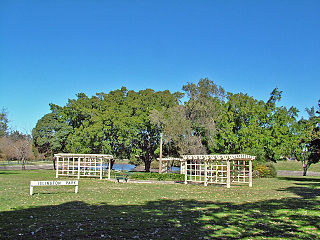
Charlestown is a suburb of the City of Lake Macquarie, New South Wales, Australia, and the largest suburb in Lake Macquarie and in the Greater Newcastle area. It is approximately 10 kilometres (6 mi) west-south-west of the central business district of Newcastle.

Waratah is a north-western residential suburb of Newcastle, New South Wales, Australia, 6 kilometres (3.7 mi) from Newcastle's central business district and bounded to the north by the Main North railway line. Waratah station was opened in 1858 and is served by NSW TrainLink's Hunter line.
Glendale is a suburb of the City of Lake Macquarie, New South Wales, Australia, located 15 kilometres (9 mi) west of Newcastle's central business district at the northern tip of Lake Macquarie city.

Mayfield is a north-western suburb of Newcastle, New South Wales, which takes its name from Ada May a daughter of the landowner there, John Scholey. Its boundaries are the Hunter River to the north, the Main Northern railway line to the south, the railway line to Newcastle Harbour to the east, and open ground to the west.

Sandgate is a suburb of Newcastle, New South Wales, Australia, located 11 kilometres (6.8 mi) from Newcastle's central business district. It is part of the City of Newcastle local government area. The Awabakal and Worimi people were the first to live in Newcastle.

The City of Newcastle is a local government area in the Hunter region of New South Wales, Australia. The City of Newcastle incorporates much of the area of the Newcastle metropolitan area.
Callaghan is a suburb of Newcastle, New South Wales, Australia 10 kilometres (6 mi) from Newcastle's central business district. It contains the main campus of the University of Newcastle, which is the entirety of the suburb. It is served by Warabrook railway station on NSW TrainLink's Hunter Line.
Argenton is a suburb of the city of Lake Macquarie, Greater Newcastle in New South Wales, Australia 16 kilometres (10 mi) west of the Newcastle's central business district in Lake Macquarie's West Ward.
Kotara South is a suburb of the City of Lake Macquarie, Greater Newcastle in New South Wales, Australia 11 kilometres (7 mi) from Newcastle's central business district.

Redhead is a coastal suburb of the City of Lake Macquarie, Greater Newcastle, New South Wales, Australia 16 kilometres (10 mi) south of Newcastle's central business district on the Pacific Ocean. It was named for the appearance of its headland, Redhead Bluff, when viewed from the sea.
Kilaben Bay is a suburb of the city of Lake Macquarie in the Hunter Region of New South Wales, Australia.
New Lambton Heights is a suburb of Newcastle, New South Wales, Australia, located 9 kilometres (6 mi) west of Newcastle's central business district. It is split between the City of Lake Macquarie and City of Newcastle local government areas.
Adamstown Heights is a southern suburb of Newcastle, New South Wales, Australia, located 8 kilometres (5 mi) west-southwest of Newcastle's central business district along the Pacific Highway. It is split between the City of Lake Macquarie and City of Newcastle local government areas. On 6 September 1991 Adamstown heights officially become a suburb of Newcastle.

Jesmond is a suburb of the City of Newcastle LGA, located about 9.5 km (6 mi) west of the Newcastle CBD in the Hunter Region of New South Wales, Australia. It is both a commercial centre and dormitory suburb of Newcastle. Residents include Australian and international students attending the University of Newcastle in adjacent Callaghan. The suburb also has numerous aged housing facilities. The suburb is very multicultural due to many international university students. According to the 2006 Census there were 2,442 people in 1,144 dwellings.
Rankin Park is a suburb of Newcastle, New South Wales, Australia, located 11 kilometres (7 mi) west of Newcastle's central business district. It is split between the City of Lake Macquarie and City of Newcastle local government areas.
Highfields is a residential suburb of Lake Macquarie, New South Wales, Australia, located 8 kilometres (5 mi) west-southwest of Newcastle's central business district near the Charlestown town centre.

Islington is a suburb of the city of Newcastle in the Hunter Region of New South Wales, Australia. Located only 3.4 kilometres (2.1 mi) from the Newcastle CBD on one of Newcastle's major arterial roads, it was initially developed as a residential suburb. Today it includes a small industrial area and is adjacent to the Newcastle campus of the Hunter Institute of Technology. Its southeastern border is occupied entirely by the Main Northern railway line. The suburb has one railway station, which is shared with, and named after, adjacent Hamilton.
Mayfield East is a suburb of Newcastle, New South Wales, Australia, located 5 kilometres (3 mi) from Newcastle's central business district. It is part of the City of Newcastle local government area.
Mayfield North is a suburb of Newcastle, New South Wales, Australia.
Waratah West is a suburb of Newcastle, New South Wales, Australia, located 8 kilometres (5 mi) from Newcastle's central business district. It is part of the City of Newcastle local government area.


