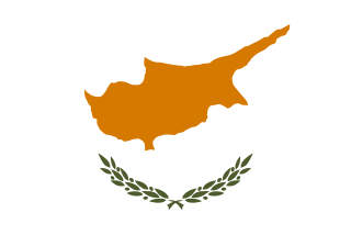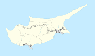
Cyprus, officially the Cypriot Republic, is an island country in the Eastern Mediterranean and the third largest and third most populous island in the Mediterranean, located south of Turkey, west of Syria and Lebanon, northwest of Israel, north of Egypt, and southeast of Greece.

The music of Cyprus includes a variety of traditional, Western classical and Western popular genres. Cypriot traditional music is similar to the traditional music of Greece and includes dances like sousta, syrtos, ballos, tatsia, antikristos, Karotseris and zeimbekiko.

Rizokarpaso is a town on the Karpas Peninsula in the northeastern part of Cyprus. While nominally part of the Famagusta District of the Republic of Cyprus, it has been under the de facto control of Northern Cyprus since the partition of the island in 1974.

Larnaca District is one of the six districts of Cyprus. Its capital is Larnaca. It is bordered on the east by Famagusta District, on the north by Nicosia District and on the west by Limassol District.

Kokkina is a coastal exclave (pene-exclave) of the de facto Northern Cyprus, and a former Turkish Cypriot village and enclave in Cyprus. It is surrounded by mountainous territory, with the Morphou Bay on its northern flank. Kokkina sits several kilometres west of the Northern Cyprus mainland and is a place with symbolic significance to Turkish Cypriots, because of the events of August 1964. In 1976, all Kokkina inhabitants were transferred to Gialousa and the exclave has since functioned as a North Cyprus Defence Force military camp.

Louroujina is a village in Cyprus, located within the salient that marks the southernmost extent of Northern Cyprus. It was one of the largest Turkish Cypriot villages in Cyprus before the Turkish invasion. In 1974, Louroujina was secured so as to be placed within a contiguous Turkish Cypriot zone, which later became Northern Cyprus. The United Nations Buffer Zone separates the Louroujina salient from the area controlled by the Republic of Cyprus. There is now a tunnel which has been designed to enter the village without going through any army points. The village is now open to everyone there are many historic untouched buildings in this village.
The Presidential Palace is the official residence and principal workplace of the President of the Republic of Cyprus. It is located close to the center of Nicosia, the capital of Cyprus, and is surrounded by a thick pine woodland.

Peristerona is a large village about 32 kilometres west of the capital Nicosia, on the foothills of the Troodos Mountain range in the Morphou basin. It is built on the west bank of the river that bears the same name, which is a tributary of the river Serrachis, at an average altitude of 250 meters.

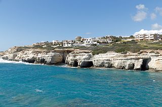
Pegeia is a town in the Paphos District of Cyprus. Pegeia is situated mainly on the steep slopes of the coastal hills inland from Coral Bay, at the southern end of the Akamas Peninsula, and it lies 14 km north of Paphos. It has a large population of British ex-pats and a growing number of holiday homes and apartments. In the town centre can be found a town hall, church, police station and several small shops, restaurants and banks. Due to its hillside location many parts of the town offer views over Coral Bay and Paphos.

Platres is a mountainous village in Cyprus. It is located on the southern slopes of the Troödos Mountains and is one of the Krasochoria. Platres is the largest Troodos resort, situated about 5km from Troodos square, 25 kilometers (16 mi) north-west of Limassol and 45 kilometers (28 mi) south-west of the capital Nicosia. Platres is a very old village and is mentioned among the 119 villages of the Limassol district that existed during the Lusignan Era and the Venetian Era. Platres or Pano Platres is the principal hill resort of Cyprus. The town has a resident population of fewer than 300, but this can swell to 10000 during tourist seasons.

Evrychou is a village in Cyprus. It is located in the Nicosia District and the agricultural centre of the "Solea" region located about 50 km south-west of Nicosia and 30 km from mount Troodos.

Prastio is a small village in Cyprus, 19 km west of Famagusta. De facto, it is under the control of Northern Cyprus. It is administered by the municipality of Sinta (İnönü).

Alaminos is a village in the Larnaca District of Cyprus, west of the city of Larnaca. In 1960, prior to the Turkish invasion of Cyprus, it had 564 inhabitants, with a roughly equal number of Greek and Turkish Cypriots. In 2011, its population was 345.

Skylloura is a village located in the Nicosia District of Cyprus, about halfway between the towns of Morphou and Nicosia. It is administered by the Lefkoşa District of Northern Cyprus. In the town the two main roads Morphou-Nicosia and Kyrenia-Lapithos-Skylloura meet.

Linou is a remote village in the Nicosia District of Cyprus, located south of the Skouriotissa mines and 5 km north of Evrychou with a population of 207, 25% of them refugees.

Marathovounos is a village in the Famagusta District of central Cyprus. It is under the de facto control of Northern Cyprus.
The Maronites in Cyprus are members of the Maronite Catholic Archeparchy of Cyprus whose ancestors migrated from present-day Lebanon during the Middle Ages. They traditionally speak their own variety of Arabic in addition to Greek. As Eastern Catholics of the West Syriac Rite, they are in full communion with the Catholic Church of Rome.

Neo Chorio is a village in the Paphos District of Cyprus, about 8 km west of Polis. Until 1958, it had a mixed Greek- and Turkish Cypriot population with a Greek Cypriot majority. Amid the intercommunal violence, the Turkish Cypriot inhabitants of Neo Chorio fled to Androlykou, a nearby Turkish Cypriot village. In 1975, following the Turkish invasion of the previous year and subsequent division of the island, most Turkish Cypriots of Neo Chorio resettled in Myrtou, now in Northern Cyprus. In 2011, Neo Chorio had a population of 519.
Turkish settlers in Northern Cyprus, also referred to as Turkish immigrants are a group of mainland Turkish people who have settled in Northern Cyprus since the Turkish invasion in 1974. It is estimated that these settlers and their descendants now make up about half the population of the North. The vast majority of the Turkish settlers were given houses and land that legally belong to Greek Cypriots by the internationally unrecognised, breakaway Northern Cypriot regime. The group is heterogeneous in nature and is composed of various sub-groups, with varying degrees of integration. Mainland Turks are generally considered to be more conservative than the highly secularized Turkish Cypriots, and tend to be more in favor of a two-state Cyprus. However, not all settlers support nationalist policies.

The Nestorian Church, officially known as the Church of St. George the Exiler is a church in the old town of Famagusta, Cyprus. Originally built as a church belonging to the Church of the East, an ancient nestorian branch of Eastern Christianity, it was converted to a Greek Orthodox Church in the British era after centuries of use as a stable for camels in the Ottoman era. It is one of the legendary "365 churches of Famagusta".


