Ormideia, sometimes also spelled Ormidhia, is a village in Larnaca District in south-eastern Cyprus. It is one of the four exclaves surrounded by the Eastern Sovereign Base Area of Akrotiri and Dhekelia, a British Overseas Territory administered as a Sovereign Base Area. The others are the village of Xylotymvou and Dhekelia Power Station. It is administered by the Republic of Cyprus. Its population in 2011 was 4,189.
Troulloi is a village in Larnaca District, Cyprus. It is one of only four villages located within the United Nations Buffer Zone, the other three being Pyla, Athienou and Deneia. In 2011 Troulloi had a population of 1,175 people according to the Statistical Service of the Republic of Cyprus, 2014-04-17. The village's patron saint is Saint Mamas, celebrated on 2 September each year.

Lakatamia is a southwestern suburb of Nicosia, Cyprus. In 2011 Lakatamia had a population of 38,345.

Vavla is a small village in Larnaca District, Cyprus. Its population in 2011 was 52.

Kolossi is a village on the outskirts of Limassol, Cyprus. It lies partly in the British Overseas Territory of Akrotiri and Dhekelia. Its population in 2011 was 5,651.
Geri is a large village in Cyprus, 10 kilometres (6.2 mi) south-east of the capital Nicosia. In 2001, it had a population of 6,643. As of 2011, its population was 8,235. Following a referendum in 2011, Geri has become a municipality.

Dali is a large village in Cyprus, located south east of the capital Nicosia and close to the ancient city of Idalion. In 2001, it had a population of 5,834. By 2011, the population had almost doubled to 10,466.
Astromeritis is a large village in the Morphou Department of the Nicosia District of Cyprus. It is located 30 km (18.64 mi) from the capital Nicosia. By the 2001 census it had a total population of 2,361.
Kokkinotrimithia is a town located west of Nicosia, Cyprus, close to the Green Line. It has an exit along the A9 motorway. In 2011, it had 4,077 inhabitants.
Kotsiatis is a village located in the Nicosia District of Cyprus.
Mathiatis is a village located in the Nicosia District of Cyprus. Before 1960, it had a mixed Greek- and Turkish-Cypriot population.
Agioi Trimithias is a village located in the Nicosia District of Cyprus.
Sia or Sha is a village in the Nicosia District of Cyprus. It is located 4 km south of Alampra.
Spilia is a small village in the Nicosia District of Cyprus, located near Kyperounta. The hamlet of Kourdali is part of it.
Menogeia is a village in the Larnaca District of Cyprus, located 2 km west of Anglisides. In 2011, it had a population of 50.
Odou is a village in the Larnaca District of Cyprus, 8 km northwest of Ora. Its population in 2011 was 213.
Mouttagiaka is a village in the Limassol District of Cyprus, located east of Germasogeia. Prior to 1960, the village was almost exclusively inhabited by Turkish Cypriots.
Tserkezoi is a village west of Limassol, Cyprus, lying partly in Limassol District, and partly in the British Overseas Territory of Akrotiri and Dhekelia.
Souni–Zanatzia or Souni–Zanakia is a community consisting of two villages, Souni and Zanatzia, in the Limassol District of Cyprus. Souni is located 8 km north of Erimi.

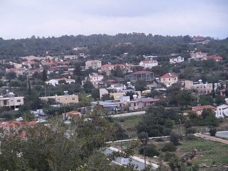
Kritou Terra is a village in the Paphos District of Cyprus, located 3 km east of Dhrousha.