Menogeia | |
---|---|
village | |
Coordinates: 34°50′34″N33°26′27″E / 34.84278°N 33.44083°E Coordinates: 34°50′34″N33°26′27″E / 34.84278°N 33.44083°E | |
Country | |
District | Larnaca District |
Area | |
• Metro | 60 sq mi (150 km2) |
Population (2011) [1] | |
• village | 50 |
Time zone | UTC+2 (EET) |
• Summer (DST) | UTC+3 (EEST) |
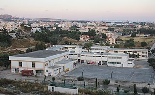
Menogeia (Greek : Μενόγεια; Turkish : Ötüken or Mennoya) is a village in the Larnaca District of Cyprus, located 2 km west of Anglisides. In 2011, it had a population of 50.
Greek is an independent branch of the Indo-European family of languages, native to Greece, Cyprus and other parts of the Eastern Mediterranean and the Black Sea. It has the longest documented history of any living Indo-European language, spanning more than 3000 years of written records. Its writing system has been the Greek alphabet for the major part of its history; other systems, such as Linear B and the Cypriot syllabary, were used previously. The alphabet arose from the Phoenician script and was in turn the basis of the Latin, Cyrillic, Armenian, Coptic, Gothic, and many other writing systems.
Turkish, also referred to as Istanbul Turkish, is the most widely spoken of the Turkic languages, with around ten to fifteen million native speakers in Southeast Europe and sixty to sixty-five million native speakers in Western Asia. Outside Turkey, significant smaller groups of speakers exist in Germany, Bulgaria, North Macedonia, Northern Cyprus, Greece, the Caucasus, and other parts of Europe and Central Asia. Cyprus has requested that the European Union add Turkish as an official language, even though Turkey is not a member state.
Larnaca District is one of the six districts of Cyprus. Its capital is Larnaca. It is bordered on the east by Famagusta District, on the north by Nicosia District and on the west by Limassol District.
Menogeia was a mixed Greek- and Turkish-Cypriot village until 1946. Between 1960 and 1974, it was inhabited exclusively by Turkish Cypriots. Following the Turkish invasion in 1974, they were all displaced; most settled in Spathariko in the north. [2]
Greek Cypriots are the ethnic Greek population of Cyprus, forming the island's largest ethnolinguistic community. According to the 2011 census, 659,115 citizens in Cyprus recorded their ethnicity as Greek Cypriot, forming 78% of the population in the internationally recognised territories.
The Turkish invasion of Cyprus, code-named by Turkey as Operation Attila, was a Turkish military invasion of the island country of Cyprus. It was launched on 20 July 1974, following the Cypriot coup d'état on 15 July 1974.
Spathariko is a village in the Famagusta District of Cyprus, located north of Famagusta. It is under the de facto control of Northern Cyprus.
Tseri, also known as Seri or Xeri, is a south suburb of Nicosia, Cyprus.
Lakatamia is a southwestern suburb of Nicosia, Cyprus. In 2011 Lakatamia had a population of 38,345.
Geroskipou is a coastal town in Cyprus, east of Paphos. Its current population is approximately 7,000 and it is the second largest municipality in the Paphos District. Yeroskipou, with its remarkable five-domed Byzantine church of Agia Paraskevi, and its Folk Art Museum, is a popular tourist destination. It is known especially for the production of Turkish Delight or "lokum". The town is the only place in the world which has protected geographical indication (PGI) for the popular dessert.
Kolossi is a village on the outskirts of Limassol, Cyprus. It lies partly in the British Overseas Territory of Akrotiri and Dhekelia. Its population in 2011 was 5,651.
Astromeritis is a large village in the Morphou Department of the Nicosia District of Cyprus. It is located 30 km (18.64 mi) from the capital Nicosia. By the 2001 census it had a total population of 2,361.
Dromolaxia is a village near Larnaca International Airport, in Larnaca District, Cyprus. In 2011, it had a population of 5,064.
Kotsiatis is a village located in the Nicosia District of Cyprus.
Mathiatis is a village located in the Nicosia District of Cyprus. Before 1960, it had a mixed Greek- and Turkish-Cypriot population.
Kofinou is a village located in the Larnaca District of Cyprus. It is situated where the roads from Nicosia, Larnaca and Limassol trisected, prior to the by-pass built in the 1990s.
Akanthou is a village in Famagusta District, on the northern coast of Cyprus. Akanthou is under the de facto control of Northern Cyprus. As of 2011, it had a population of 1,459.
Kalo Chorio is a village located in the Larnaca District of Cyprus, 10 km west of the town of Larnaca. Prior to 1974, the majority of the village consisted of Turkish Cypriots.
Sia or Sha is a village in the Nicosia District of Cyprus. It is located 4 km south of Alampra.
Deneia is a village in the Nicosia District of Cyprus, west of Mammari. It is one of only four villages located within the United Nations Buffer Zone, the other three being Pyla, Athienou and Troulloi.
Kellia is a village in the Larnaca District of Cyprus, located north of Larnaca. Prior to 1974, the village was inhabited mostly by Turkish Cypriots. In 2011, its population was 387.
Softades is a village in the Larnaca District of Cyprus, located 3 km west of Kiti. Prior to 1964 the village was inhabited almost exclusively by Turkish Cypriots.
Mari is a village in the Larnaca District of Cyprus, located 5 km west of Zygi. The village was largely populated by Turkish Cypriots before 1974. In Turkish, it is known as Tatlısu.
Lageia is a small village in the Larnaca District of Cyprus, 7 km west of Pano Lefkara. Its population in 2011 was 28.
Mouttagiaka is a village in the Limassol District of Cyprus, located east of Germasogeia. Prior to 1960, the village was almost exclusively inhabited by Turkish Cypriots.
Tserkezoi is a village west of Limassol, Cyprus, lying partly in Limassol District, and partly in the British Overseas Territory of Akrotiri and Dhekelia.
Kritou Terra is a village in the Paphos District of Cyprus, located 3 km east of Dhrousha.
This Cyprus location article is a stub. You can help Wikipedia by expanding it. |