
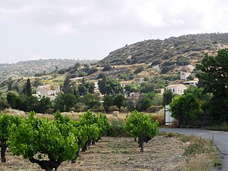
Pyla is a village in Larnaca District, Cyprus. It is one of only four villages located within the United Nations Buffer Zone, the other three being Athienou, Troulloi and Deneia. Pyla is located in the eastern part of the island, adjacent to the British Sovereign Base Area of Dhekelia. From a legal point of view, it is administered as all other areas controlled by the government of the Republic of Cyprus.

Mathiatis is a village located in the Nicosia District of Cyprus. Before 1960, it had a mixed Greek- and Turkish-Cypriot population.
Margi is a village located in the Nicosia District of Cyprus. Before 1960, the village population was made up almost exclusively of Turkish Cypriots.

Agia Varvara is a village located in the Paphos District of Cyprus. Prior to 1974, the village was largely inhabited by Turkish Cypriots. Afterwards, the Turkish Cypriot population was relocated to Karavas, Trachoni, Pentageia, Famagusta and Morphou and was partially replaced by displaced Greek Cypriots from the north.
Kalo Chorio is a village located in the Larnaca District of Cyprus, 10 km west of the town of Larnaca. Prior to 1974, the majority of the village consisted of Turkish Cypriots.

Agios Sozomenos is largely deserted village in the Nicosia District of Cyprus, located close to the Green Line south of Geri. Before 1974, the village was mostly inhabited by Turkish Cypriots. In 2001 there were only four registered inhabitants living here.
Alevga is an abandoned village in the Nicosia District of Cyprus, south of the Kokkina exclave but in an area still controlled by the Cypriot government. The village was almost exclusively inhabited by Turkish Cypriots prior to 1960.
Agios Epifanios is a village in the Nicosia District of Cyprus, located 3 km west of Linou. Prior to 1974, the village was inhabited primarily by Turkish Cypriots. Today the village is very insignificantly populated.
Pano Koutrafas is a small village in the Nicosia District of Cyprus, 3 km south of Kato Koutrafas. Before 1974 the village was inhabited almost exclusively by Turkish Cypriots. Today the village is largely uninhabited.
Petra tou Digeni is a village in the Nicosia District of Cyprus, located 7 km east of Kythrea. The village is under de facto control of Northern Cyprus. Even before 1974, the town was almost exclusively inhabited by Turkish Cypriots.

Agios Ioannis is a small village in the Paphos District of Cyprus, located 4 km (2.5 mi) north of Salamiou. Prior to 1974, the village was inhabited almost exclusively by Turkish Cypriots.
Mora is a village in the Nicosia District of Cyprus. The village is de facto under the control of Northern Cyprus. Before the Turkish invasion of Cyprus in 1974 it was inhabited almost exclusively by Turkish Cypriots
Marathovounos is a village in the Famagusta District of central Cyprus. It is under the de facto control of Northern Cyprus.
Softades is a village in the Larnaca District of Cyprus, located 3 km west of Kiti. Prior to 1964 the village was inhabited almost exclusively by Turkish Cypriots.

Mari is a village in the Larnaca District of Cyprus, located 5 km west of Zygi. The village was largely populated by Turkish Cypriots before 1974. In Turkish, it is known as Tatlısu.
Mouttagiaka is a village in the Limassol District of Cyprus, located east of Germasogeia. Prior to 1960, the village was almost exclusively inhabited by Turkish Cypriots.
Alektora is a village in the Limassol District of Cyprus, located 6 km north of Pissouri. Prior to 1960, the village was inhabited almost exclusively by Turkish Cypriots.

Platanisteia is a village in the Limassol District of Cyprus, located 6 km north of Pissouri. Prior to 1960, the village was inhabited almost exclusively by Turkish Cypriots.
Kantou is a village in the Limassol District of Cyprus, located 2 km north of Erimi. Prior to 1960, the village was almost exclusively inhabited by Turkish Cypriots.
Melandra is an abandoned Turkish Cypriot village in the Paphos District of Cyprus, located 2 kilometres (1.2 mi) southeast of Lysos. Prior to 1974, the village was inhabited by Turkish Cypriots. The village is completely destroyed, apparently by shelling. The only two buildings that were not touched are the mosque and the orthodox chapel.


