
Danville is an independent city in the Commonwealth of Virginia in the United States. The city is located in the Southside Virginia region and on the fall line of the Dan River. It was a center of tobacco production and was an area of Confederate activity during the American Civil War, due to its strategic location on the Richmond and Danville Railroad. In April 1865 it briefly served as the third and final capital of the Confederacy before its surrender later that year.

Lawrenceville is a town in Brunswick County, Virginia, United States. Per the 2020 census, the population was 1,014. Located by the Meherrin River, it is the county seat of Brunswick County. In colonial times, Lieutenant Governor Alexander Spotswood had a stockade built nearby, called Fort Christanna, where converted Native American allies were housed and educated.
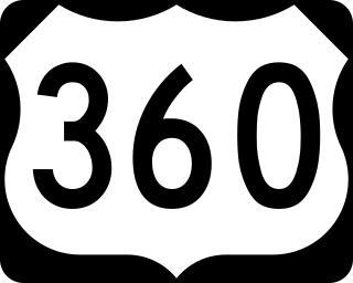
U.S. Route 360 is a spur route of US 60. The U.S. Highway runs 225.3 miles (362.6 km), entirely within the state of Virginia, from US 58 Business, Virginia State Route 293, and SR 360 in Danville east to SR 644 in Reedville. US 360 connects Danville, South Boston, Keysville and Burkeville in Southside Virginia with the state capital of Richmond. The highway connects Richmond with Tappahannock on the Middle Peninsula and the eastern Northern Neck, where it serves as the primary route through Northumberland County. US 360 is a four-lane divided highway for almost all of its length.

The Fan is a district of Richmond, Virginia, so named because of the "fan" shape of the array of streets that extend west from Belvidere Street, on the eastern edge of Monroe Park, westward to Arthur Ashe Boulevard. However, the streets rapidly resemble a grid after they go through what is now Virginia Commonwealth University. The Fan is one of the easterly points of the city's West End section, and is bordered to the north by Broad Street and to the south by VA 195, although the Fan District Association considers the southern border to be the properties abutting the south side of Main Street. The western side is sometimes called the Upper Fan and the eastern side the Lower Fan, though confusingly the Uptown district is located near VCU in the Lower Fan. Many cafes and locally owned restaurants are located here, as well as historic Monument Avenue, a boulevard formerly featuring statuary of the Civil War's Confederate president and generals. The only current statue is a more modern one of tennis icon Arthur Ashe. Development of the Fan district was strongly influenced by the City Beautiful movement of the late 19th century.

Fell's Point is a historic waterfront neighborhood in southeastern Baltimore, Maryland, established around 1763 along the north shore of the Baltimore Harbor and the Northwest Branch of the Patapsco River. Located 1.5 miles east of Baltimore's downtown central business district, Fells Point is known for its maritime history and character.

Manchester is a former independent city in Virginia in the United States. Prior to receiving independent status, it served as the county seat of Chesterfield County, between 1870 and 1876. Today, it is a part of the city of Richmond, Virginia.
The Greater Richmond, Virginia area has many neighborhoods and districts.
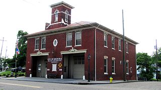
Mechanicsville is a neighborhood in Knoxville, Tennessee, United States, located northwest of the city's downtown area. One of the city's oldest neighborhoods, Mechanicsville was established in the late 1860s for skilled laborers working in the many factories that sprang up along Knoxville's periphery. The neighborhood still contains a significant number of late-19th-century Victorian homes, and a notable concentration of early-20th-century shotgun houses. In 1980, several dozen properties in Mechanicsville were added to the National Register of Historic Places as the Mechanicsville Historic District. The neighborhood was also designated as a local historic district in 1991, subject to historic zoning and design standards.

Originally a trolley car suburb in the years just before the dawn of the 20th century, the Fairmount neighborhood in Church Hill, Richmond, Virginia, is located just north of Union Hill. Much of the neighborhood was developed from the 1890s to the 1920s, and its buildings largely reflect Queen Anne, Italianate, and 1920s bungalow architecture. What is likely the oldest remaining residence, a frame house, probably dates from before 1870. A notable property in the Fairmount neighborhood is the Fairmount School. Annexed from Henrico County in 1906, Fairmount was first incorporated as an independent town on March 10, 1902.

Fletcher Place is a historic district and neighborhood in the city of Indianapolis, Indiana named after Calvin Fletcher, a prominent local banker, farmer and state senator.

The Alexandria Historic District is a National Historic Landmark District in Alexandria, Virginia. Encompassing all of the city's Old Town and some adjacent areas, this area contains one of the nation's best-preserved assemblages of the late-18th and early-19th century urban architecture. The district was locally designated in 1946 and was declared a National Historic Landmark in 1966.

The Virginia Park Historic District is located on the north side of New Center, an area in Detroit, Michigan, along both sides of Virginia Park Street from Woodward Avenue to the John C. Lodge Freeway access road. The district was listed on the National Register of Historic Places in 1982.

This is a list of the National Register of Historic Places listings in Detroit, Michigan.

This is a list of the National Register of Historic Places listings in Danville, Virginia.

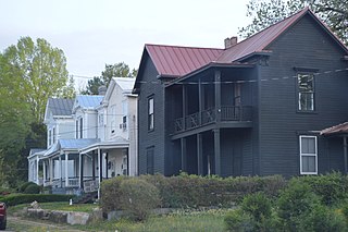
North Danville Historic District is a national historic district located in Danville, Virginia. The district includes 426 contributing buildings in a primarily residential area of Danville. The district includes three blocks of primarily two-story, brick commercial buildings. Buildings within the district were constructed from around 1880 until roughly 1955 and reflect a wide variety of architectural styles, including vernacular Victorian, Italianate, Queen Anne, Colonial Revival, Tudor Revival, and bungalow designs. Many of these buildings were built by Dan River Cotton Mills founder T.B. Fitzgerald. Notable buildings include the Calvary United Methodist Church (1886), Shelton Memorial Presbyterian Church (1889), Bellevue Public School (1898), Washington Street Methodist Episcopal Church (1910), Keen Street Baptist Church (1927), and Woodrow Wilson High School (1926).

Danville Municipal Building is a historic city hall building located at Danville, Virginia, USA. It was built in 1926 and is a three-story, brick and concrete building faced in limestone in the Classical Revival style. Its front facade has a colonnade with Ionic order columns.
Holbrook–Ross Street Historic District is a national historic district located in Danville, Virginia. The district includes 107 contributing buildings in a primarily African-American neighborhood of Danville. It includes a full range of late 19th and early 20th century residential, commercial, and institutional structures. The majority of the houses are single-family dwellings that were built between 1880 and 1910, and includes notable examples of vernacular Italianate and Queen Anne styles. Notable buildings include the Williams House, Hargraves-Geary House, Tisden House, Leroy Johnson House, Broadnax Apartment, Calvary Baptist Church (1896), Holbrook Street Presbyterian Church, Loyal Baptist Church (1924), Wesley AME Church (1939), Westmoreland Middle School (1936), and the Annex Building (1925). Located in the district are the separately listed Hotel Danville and the Danville Municipal Building.

The Danville Tobacco Warehouse and Residential District is a national historic district located at Danville, Virginia. The district includes 532 contributing buildings, 3 contributing sites, and 2 contributing structures in the city of Danville. The district reflects the late-19th century and early-20th development of Danville as a tobacco processing center and includes residential, commercial, and industrial buildings reflecting that growth. It also includes archaeological sites related to early Native American settlements in the area. Notable buildings include the American Tobacco's Harris Building, the Imperial Tobacco Company Building, Cabell Warehouse, Patton Storage Units, Crowell Motor Company, Municipal Power Station (1912), Riverside Cotton Mill #1 (1886), and a variety of "shotgun" houses and bungalow workers housing. Located in the district are the separately listed Danville Municipal Building and Danville Southern Railway Passenger Depot.
The Danville River District is a development project undertaken in the early 21st century by the City of Danville, Virginia; it is aimed at revitalizing the aging Danville Historic District and Tobacco Warehouse District. In partnership with private investors and with state funding, the city is beautifying its riverfront district to add a pedestrian walkway and visitor amenities. The city envisions the area as a venue for many local fairs, festivals and other events.


