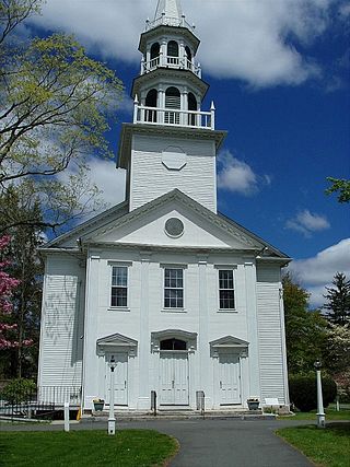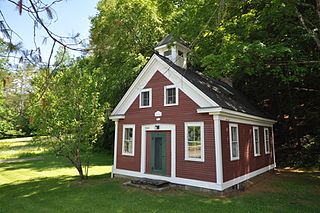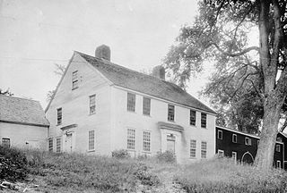
The South Britain Historic District encompasses the core of the unincorporated village of South Britain in Southbury, Connecticut, United States. The village arose in the 18th century as an industrial center serving the surrounding agricultural community, powered by the Pomperaug River, and rivalled the town center of Southbury in importance. The district was listed on the National Register of Historic Places in 1987.

The Cushman Village Historic District is a historic district encompassing a portion of the Cushman Village area of Amherst, Massachusetts, which was a significant mill village during the 19th century. It is centered on the triangle formed by Bridge, Henry, and Pine Streets in northeastern Amherst, and arose because of the presence of falls on the Mill River, whose water power was harnessed for mills as early as the mid-18th century. Two houses survive from the colonial period. The village, although it was defined for many years by the mills, no longer has any industrial buildings, as they were demolished or destroyed by fire. Most of the houses in the district were built before 1860, the peak of the village's industrial activity. The district was listed on the National Register of Historic Places in 1992.

The Taftsville Historic District encompasses a historic 19th-century industrial village that is mostly in Woodstock, Vermont. Flanking the Ottauquechee River and extending up Happy Valley Road, the area developed around a metal tool factory established by members of the Taft family in 1793. Important elements from its early history include the Taftsville Store, built by the Taft family in 1840, and the Taftsville Covered Bridge, built in 1836. The district was listed on the National Register of Historic Places in 2001.

The Waterville Village Historic District encompasses most of the history 19th and early 20th-century village center of Waterville, Vermont. The village grew from beginnings late in the 18th century to serve as a modest civic, commercial, and residential hub for the rural community. It was added to the National Register of Historic Places in 2007.

The Head of the River Historic District is a historic district encompassing a village area at the head of navigation of the Acushnet River, which separates Acushnet and New Bedford, Massachusetts. The village is centered at the junction of Tarkiln Hill Road, River Road, and Mill Road in New Bedford, and Main Street in Acushnet. The area went through two significant periods of development: the first was in the late 18th and early 19th century, and the second was in the early 20th century. The district was listed on the National Register of Historic Places in 2009.

The North Charlestown Historic District encompasses a 19th-century rural village in Charlestown, New Hampshire. Located about 5 miles (8 km) north of the town's center, the district includes a small cluster of buildings along New Hampshire Route 12A that is a remnant portion of a larger agricultural village. First settled in the 1750s, the oldest buildings in the district date to the 1790s, and most of the major buildings were built in the 19th century. Its economy was based on lumber and farming. The village was once considered a much larger, dispersed settlement, but construction of New Hampshire Route 11 in the 1960s separated some of the more remote parts of the village from its nucleus, which was bypassed by that construction.

The George–Pine–Henry Historic District encompasses a residential area of the village of Bellows Falls, Vermont. Located west of downtown Bellows Falls, the area has a significant concentration of well-preserved late 19th and early 20th-century residences. It was listed on the National Register of Historic Places in 2010.

The Grafton Village Historic District encompasses the historic village center of the town of Grafton, Vermont. The village was developed in the early-to-mid 19th century, and has retained the character of that period better than many small communities in the state. The district was listed on the National Register of Historic Places in 2010.

The Houghtonville Historic District encompasses a cluster of residential properties that are all that remain of one of the early industrial areas of Grafton, Vermont. Located west of Grafton Village on Houghtonville Road, it includes ten well-preserved 19th-century houses, some located on properties where early mills once stood. The district was listed on the National Register of Historic Places in 2015.

The Middletown Rural Historic District encompasses an area that was once the town center of Grafton, Vermont. Located northwest of Grafton Village along Middletown Road and adjacent roads, it includes nine well-preserved 19th-century properties, as well as the town's first cemetery and animal pound. The district was listed on the National Register of Historic Places in 2011.

The Rockingham Village Historic District encompasses the traditional village center of the town of Rockingham, Vermont. Settled in the 18th century, the district, located mainly on Meeting House Road off Vermont Route 103, includes a variety of 18th and 19th-century houses, and has been little altered since a fire in 1908. It notably includes the 18th-century National Historic Landmark Rockingham Meeting House. The district was listed on the National Register of Historic Places in 2008.

The Whitingham Village Historic District encompasses much of the current village center of Whitingham, Vermont. It was developed mainly in the second half of the 19th century around industries powered by local water sources, and includes well-preserved architecture from that period. It was listed on the National Register of Historic Places in 2006.

The Head Tide Historic District encompasses a formerly industrial, now rural village at the head of tide of the Sheepscot River in Alna, Maine. The area had been industrially active since the mid-18th century, but its mills declined and were all destroyed by 1949, leaving a predominantly residential area with a number of houses dating mainly to the period before 1860. The district was listed on the National Register of Historic Places in 1974.

The South Royalton Historic District encompasses the central portion of the village of South Royalton, Vermont. Now the town of Royalton's principal commercial center, it developed in the second half of the 19th century around the depot of the Vermont Central Railroad. The district includes fine examples of Greek Revival and Victorian architecture, and is home to the Vermont Law School. It was listed on the National Register of Historic Places in 1976.

The Thetford Center Historic District encompasses the village of Thetford Center in Thetford, Vermont. The village contains a well-preserved collection of early to mid-19th century architecture, a legacy of its period of greatest prosperity as an agricultural and industrial center. It was listed on the National Register of Historic Places in 1998.

The Tunbridge Village Historic District encompasses the early 19th-century village center of Tunbridge, Vermont. Stretched linearly along Vermont Route 110, the largely agricultural village reached its peak population around 1820, and was bypassed by the railroads, limiting later development. It was listed on the National Register of Historic Places in 1994.

The Jones–Pestle Farmstead is a historic farm property at 339 Bridge Street in Waitsfield, Vermont, United States. First developed in the 1820s, it is a well-preserved 19th-century disconnected farm complex. It was listed on the National Register of Historic Places in 2015.

The Mill Village Historic District encompasses a small 19th-century industrial village on Stowe Street in Waterbury, Vermont. The area is a compact and somewhat isolated example of a mill village of the mid-19th century; it is roughly bounded by Stowe Street, Graves Brook, and the northbound offramp of Exit 10 from Interstate 89. It was listed on the National Register of Historic Places in 1979.

The Plainfield Village Historic District encompasses a significant portion of the village of Plainfield, Vermont. Located in northernmost Plainfield on United States Route 2, the village grew in the 19th century as a mill town and service community for the surround agricultural areas, and has a well-preserved collection of Greek Revival and Italianate architecture. It was listed on the National Register of Historic Places in 1983.

The Newport Downtown Historic District encompasses most of the historic downtown area of the city of Newport, Vermont. The city developed as a transit hub and tourist area in the second half of the 19th century, spurred by the construction of a railroad to the area. The district, roughly bounded by Third Street, Coventry Street, and Lake Memphremagog, was listed on the National Register of Historic Places in 2006.


