
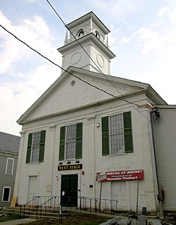
The Crystal Lake Falls Historic District, also known as the Brick Kingdom, is a historic industrial and residential area in Barton, Vermont, United States. It is located along Water Street and Main Street, roughly paralleling Willoughby Brook, whose waters powered the area's industries. It was added to the U.S. National Register of Historic Places on August 7, 1994.

North Becket Village Historic District is a historic district encompassing the historic village of North Becket in the Berkshire hill town of Becket, Massachusetts. The village developed rapidly as the main economic and civic center of the town in a 20-year period beginning in 1841 with the arrival of the Western Railroad, and retains many fine examples of Greek Revival architecture. It was listed on the National Register of Historic Places in 1988.

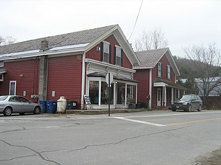
The Canal Street–Clark Street Neighborhood Historic District encompasses a compact 19th-century working-class neighborhood of Brattleboro, Vermont. Most of its buildings are modest vernacular wood-frame buildings, erected between 1830 and 1935; there are a few apartment blocks, and one church. The district was listed on the National Register of Historic Places in 1993.

The George–Pine–Henry Historic District encompasses a residential area of the village of Bellows Falls, Vermont. Located west of downtown Bellows Falls, the area has a significant concentration of well-preserved late 19th and early 20th-century residences. It was listed on the National Register of Historic Places in 2010.

The Grafton Village Historic District encompasses the historic village center of the town of Grafton, Vermont. The village was developed in the early-to-mid 19th century, and has retained the character of that period better than many small communities in the state. The district was listed on the National Register of Historic Places in 2010.
The Putney Village Historic District encompasses most of the main village and town center of Putney, Vermont. Settled in the 1760s, the village saw its major growth in the late 18th and early 19th century, and includes a cohesive collection with Federal and Greek Revival buildings, with a more modest number of important later additions, including the Italianate town hall. The district was listed on the National Register of Historic Places in 1986.

The Dorset Village Historic District encompasses a significant portion of the village center of Dorset, Vermont. Centered at the junction of Church Street, Kent Hill Road, and Vermont Route 30, the village was developed between the late 18th and early 20th centuries, and has a number of well-preserved unusual features, including sidewalks of marble from local quarries. The district was listed on the National Register of Historic Places in 1985, and was enlarged to the west in 1997.

The East Arlington Village Historic District encompasses the historic core of a 19th-century village in Arlington and Sunderland, Vermont, United States. It is centered on Old Mill Road, and developed as a mill village beginning in the 18th century. It was listed on the National Register of Historic Places in 1996.

The Danby Village Historic District encompasses much of the town center of Danby, Vermont. It is centered on a stretch of Main Street, roughly between Depot Street and Brook Road. The village has a cohesive collection of mid-19th century architecture, mostly residential, with a modest number of later additions. The district was listed on the National Register of Historic Places in 1983.

The Wallingford Main Street Historic District encompasses the historic portions of the village of Wallingford, Vermont. An essentially linear district extending along Main Street on either side of School Street, it has a well-preserved array of 19th and early-20th century residential, commercial, and civic buildings. It was listed on the National Register of Historic Places in 1984.

The Brookfield Village Historic District encompasses the 19th-century village center of Brookfield, Vermont. Arrayed on the eastern shore of Sunset Lake, it includes well-preserved examples of Greek Revival architecture, and is best known for the Sunset Lake Floating Bridge, a pontoon bridge that provides access to the village from the west. It was listed on the National Register of Historic Places in 1974.

The Thetford Center Historic District encompasses the village of Thetford Center in Thetford, Vermont. The village contains a well-preserved collection of early to mid-19th century architecture, a legacy of its period of greatest prosperity as an agricultural and industrial center. It was listed on the National Register of Historic Places in 1998.

The Thetford Hill Historic District encompasses the well-preserved 19th-century village center of Thetford Hill in Thetford, Vermont. Developed between 1792 and about 1860 and located at what is now the junction of Vermont Route 113 and Academy Road, it includes mainly residential buildings, as well as several buildings of Thetford Academy and the 1785-88 Thetford Meetinghouse, one of the state's oldest churches in continuous use. The district was listed on the National Register of Historic Places in 1988.
The Charlotte Center Historic District encompasses the historic 19th-century town center of Charlotte, Vermont. Settled c. 1790 and developed mainly in the mid-19th century, the village, stretched along Church Hill Road west of Hinesburg Road, retains a well-preserved 19th-century atmosphere of residential, civic, and commercial buildings. The district was listed on the National Register of Historic Places in 1984.
The Jericho Village Historic District encompasses the historic industrial and commercial center of the village of Jericho, Vermont. Stretched along Vermont Route 15 south of Browns River, which powered the village's industries for many years, the village center includes a well-preserved array of 19th and early 20th-century buildings. The district was listed on the National Register of Historic Places in 1992.
The North Calais Village Historic District encompasses a linear 19th-century mill village in Calais, Vermont. It extends mainly along North Calais Road, paralleling Pekin Brook below Mirror Lake, where ruins of its former industrial past are still evident. It was listed on the National Register of Historic Places in 2010.

The Plainfield Village Historic District encompasses a significant portion of the village of Plainfield, Vermont. Located in northernmost Plainfield on United States Route 2, the village grew in the 19th century as a mill town and service community for the surround agricultural areas, and has a well-preserved collection of Greek Revival and Italianate architecture. It was listed on the National Register of Historic Places in 1983.

The Warren Village Historic District encompasses the village center of Warren, Vermont. Stretched mainly along Main Street east of the Mad River, it is a well-preserved 19th-century mill village, although most of its period mill infrastructure has been lost. The district has good examples of Greek Revival, Italianate, and Second Empire architecture. It was listed on the National Register of Historic Places in 1992.

The Peacham Corner Historic District encompasses much of the historic village center of Peacham, Vermont. The village's period of greatest growth and importance between the town's founding as a hill town in the late 18th century, and 1860, when significant development effectively ended. As a result, the village lacks Victorian features often found in other rural communities. The district was listed on the National Register of Historic Places in 2003.
East Hardwick is an unincorporated village in the town of Hardwick, Caledonia County, Vermont, United States. It is part of what is known as the Northeast Kingdom (NEK) of Vermont. The community is located on the Lamoille River and along Vermont Route 16, 16 miles (26 km) west-northwest of St. Johnsbury. East Hardwick has a post office with ZIP code 05836, which opened on October 10, 1810. According to a 1937 WPA Federal Writers Project Guidebook, East Hardwick is a "side hill village spilling from the level of a plateau down a sharp incline in the valley of the Lamoille. It is surrounded by rich farm lands, Maple groves and forests."


