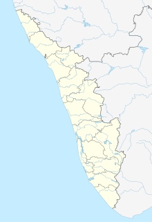
Elambilakode is a hamlet in Chaliyar Panchayath of Nilambur Taluk in Malappuram district, Kerala, South India.

Erumamunda is a small village located near Nilambur in Malappuram district of Kerala, India. It is situated in chungathara grama panchayath. Erumamunda includes 1st and 20th ward of Chungathara panchayath. currently the ward members are Mr. Libin Baby and Ms. Sainaba teacher respectively for 1st and 20th ward. It is situated river side of Chaliyar River and western ghats. 70% of the local people are directly or indirectly working with rubber products and rest of them are working abroad, Govt job and doing other professions. The main source of income of the people is from rubber or latex related industries. There is a Higher Secondary School called Nirmala Higher Secondary School. The school has contributed immensely for the educational development of erumamunda and near by villages. Erumamunda is one of the highly developed village in chungathara panchayath and Nilambur municipality.

Marutha Village of Gold Hills, Marutha is a most beautiful place in Nilambur taluk of Malappuram district.

Nediyiruppu is a region of the Kondotty municipality in Malappuram district, Kerala, India. It is situated 24 kilometres (15 mi) from Malappuram, the district headquarters. Important places in Nediyiruppu village are Musliyarangadi, Colony Road Junction, Kottukkara, Meleparambu, Chiryil Chungam, Kodangad, and Kuruppath. Historically, Nediyiruppu was important as the capital of the Zamorin dynasty. Nediyiruppu Swaroopam Road, in Poyilikkave, was named in remembrance of that heritage.
Vilayil is a small village in Kerala, India, near the cities of Kondotty, Kizhisseri and Areekode. The village is under the jurisdiction of the Muthuvallur and Cheekode Grama panchayats.
Kelunairpady is a location in Chokkad, Malappuram district, Kerala, India.
Narimadakkel is a place in Wandoor, Malappuram, Kerala, India. It is in Tiruvali Panchayath. It is believed that name was derived from the presence of nari (tiger). The majority of the population are Muslims. Wandoor Yatheem Khana is located near to Narimadakkel.

Poocholamad is a village in Kannamangalam in the Malappuram district, state of Kerala, India. It is part of the Gram Panchayat government. It is also included in Vengara Assembly constituency and Malappuram Lokhasabha constituency.
Anchachavadi is a village beside Madumala in Kalikavu Panchayat, Nilambur taluk in Malappuram district in the state of Kerala.

Pariyangadu is a village near Anchachavadi in Kalikavu Panchayat, Nilambur taluk in Malappuram district in the state of Kerala. The total population is 26,795.
Poongode is a small village in Kalikavu Panchayat, Nilambur taluk in Malappuram district in the state of Kerala..

Adakkakundu is a village in Kalikavu Panchayat, Nilambur taluk in Malappuram district in the state of Kerala in southwest India.

Kozhichena is a village in Malappuram district, Kerala, India.

Kinaradappan is a village in Malappuram district in the state of Kerala, India.

Thiruthiyad is a scenic village near Vazhayur in Malappuram district. It is also accessible from Mavoor town through the Oorkkadavu bridge.
Kottupadam is a village situated in the malappuram district in Kerala. Kottupadam is situated near to the village Peringave. Kakkov is another village near to Kottupadam.
Venniyour is a town situated in Malappuram district, Kerala, India.
Ambalakkadavu is a village in Kalikavu. It is located in the north of Kerala state.

West Chathalloor is a small village at Edavanna Grama Panchayat, Malappuram district of Kerala, India. Three sides of the village are surrounded by the hills and the other side is river Chaliyar which is the fourth longest river in Kerala.

Valenchery is a small town in Morayur Gram panchayat in Malappuram in Malappuram district of state of Kerala. Valenchery is divided into four Areas, they are Village Road, Colony Road, Madrasa Road and Hilltop Area.Four Wards from Morayur Panchayath partly belongs to Valenchery. Nearest places are Valluvambram Junction, Mongam, Morayur, Arimbra and Pookkottur. Nearest tourist spot is Mini Ooty.


