Mendon, Ohio | |
---|---|
Coordinates: 40°40′24″N84°31′03″W / 40.67333°N 84.51750°W | |
Country | United States |
State | Ohio |
County | Mercer |
Township | Union |
Area | |
• Total | 0.56 sq mi (1.44 km2) |
• Land | 0.55 sq mi (1.41 km2) |
• Water | 0.01 sq mi (0.03 km2) |
Elevation | 820 ft (250 m) |
Population (2020) | |
• Total | 628 |
• Density | 1,152.29/sq mi (444.58/km2) |
Time zone | UTC-5 (Eastern (EST)) |
• Summer (DST) | UTC-4 (EDT) |
ZIP code | 45862 |
Area code | 419 |
FIPS code | 39-49042 [3] |
GNIS feature ID | 2399312 [2] |
Website | http://villageofmendon.com |
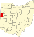
Mendon is a village in Mercer County, Ohio, United States. The population was 628 at the 2020 census.
Mendon was originally called Guilford, and under the latter name was platted in 1834. [4] A post office called Mendon has been in operation since 1839. [5]
Mendon's village hall, officially named the Mendon Town Hall, is listed on the National Register of Historic Places. [6]
According to the United States Census Bureau, the village has a total area of 0.57 square miles (1.48 km2), of which 0.56 square miles (1.45 km2) is land and 0.01 square miles (0.03 km2) is water. [7]
Census | Pop. | Note | %± |
---|---|---|---|
1870 | 164 | — | |
1880 | 242 | 47.6% | |
1890 | 400 | 65.3% | |
1900 | 599 | 49.8% | |
1910 | 621 | 3.7% | |
1920 | 571 | −8.1% | |
1930 | 502 | −12.1% | |
1940 | 547 | 9.0% | |
1950 | 614 | 12.2% | |
1960 | 663 | 8.0% | |
1970 | 672 | 1.4% | |
1980 | 749 | 11.5% | |
1990 | 717 | −4.3% | |
2000 | 697 | −2.8% | |
2010 | 662 | −5.0% | |
2020 | 628 | −5.1% | |
U.S. Decennial Census [8] |
As of the census [9] of 2010, there were 662 people, 255 households, and 182 families living in the village. The population density was 1,182.1 inhabitants per square mile (456.4/km2). There were 288 housing units at an average density of 514.3 per square mile (198.6/km2). The racial makeup of the village was 97.1% White, 0.3% African American, 0.9% Native American, 0.3% Pacific Islander, and 1.4% from two or more races. Hispanic or Latino of any race were 1.7% of the population.
There were 255 households, of which 32.9% had children under the age of 18 living with them, 57.3% were married couples living together, 8.6% had a female householder with no husband present, 5.5% had a male householder with no wife present, and 28.6% were non-families. 22.7% of all households were made up of individuals, and 10.2% had someone living alone who was 65 years of age or older. The average household size was 2.60 and the average family size was 2.97.
The median age in the village was 38.3 years. 25.2% of residents were under the age of 18; 8.5% were between the ages of 18 and 24; 25.2% were from 25 to 44; 28.4% were from 45 to 64; and 12.5% were 65 years of age or older. The gender makeup of the village was 50.0% male and 50.0% female.
As of the census [3] of 2000, there were 697 people, 262 households, and 190 families living in the village. The population density was 1,837.3 inhabitants per square mile (709.4/km2). There were 278 housing units at an average density of 732.8 per square mile (282.9/km2). The racial makeup of the village was 99.14% White, 0.57% Native American, 0.14% from other races, and 0.14% from two or more races. Hispanic or Latino of any race were 1.00% of the population.
There were 262 households, out of which 34.7% had children under the age of 18 living with them, 58.8% were married couples living together, 8.0% had a female householder with no husband present, and 27.1% were non-families. 22.5% of all households were made up of individuals, and 10.3% had someone living alone who was 65 years of age or older. The average household size was 2.66 and the average family size was 3.10.
In the village, the population was spread out, with 28.0% under the age of 18, 9.0% from 18 to 24, 29.0% from 25 to 44, 21.4% from 45 to 64, and 12.6% who were 65 years of age or older. The median age was 34 years. For every 100 females there were 102.0 males. For every 100 females age 18 and over, there were 97.6 males.
The median income for a household in the village was $34,231, and the median income for a family was $39,722. Males had a median income of $31,563 versus $22,727 for females. The per capita income for the village was $15,301. About 2.6% of families and 5.3% of the population were below the poverty line, including 7.0% of those under age 18 and none of those age 65 or over.
Mendon has a public library, a branch of the Mercer County District Library. [10]
Mercer County is located in the U.S. state of Ohio. As of the 2020 census, the population was 42,528. Its county seat is Celina. The county was created in 1820 and later organized in 1824. It is named for Hugh Mercer, an officer in the American Revolutionary War.
Mendon is a village in Adams County, Illinois, United States. The population was 872 at the 2020 census. It is part of the Quincy, IL–MO Micropolitan Statistical Area.
Mendon Township is a civil township of St. Joseph County in the U.S. state of Michigan. The population was 2,581 at the 2020 census. The Village of Mendon is located within the township.
Neville is a village in Clermont County, Ohio, United States, along the Ohio River. The population was 87 at the 2020 census.
Midland is a village in Clinton County, Ohio, United States. The population was 307 at the 2020 census.
Ithaca is a village in Darke County, Ohio, United States. The population was 81 at the 2020 census.
Pitsburg is a village in Monroe Township, Darke County, Ohio, United States. The population was 381 at the 2020 census.
Wayne Lakes is a village in Darke County, Ohio, United States. The population was 693 at the 2020 census.
Cleves is a village in Miami Township, Hamilton County, Ohio, United States. Located along the Ohio River, it is a western suburb of Cincinnati. The population was 3,414 at the 2020 census.
Jenera is a village in Hancock County, Ohio, United States. The population was 257 at the 2020 census. It is surrounded by Van Buren Township and is part of the Cory-Rawson Local School District.
Mowrystown is a village in Highland County, Ohio, United States. The population was 385 at the 2020 census.
Coalton is a village in Jackson County, Ohio, United States. The population was 445 at the 2020 census.
Hartford is a village in the township of the same name in Licking County, Ohio, United States. The population was 404 at the 2020 census.
Spencer is a village in Spencer Township located in Medina County, Ohio, United States. The population was 684 at the 2020 census.
Chickasaw is a village in Mercer County, Ohio, United States. The population was 358 at the 2020 census.
Montezuma is a village in Mercer County, Ohio, United States. The population was 152 at the 2020 census.
Jerusalem is a village in Monroe County, Ohio, United States. The population was 121 at the 2020 census.
Batesville is a village in Noble County, Ohio, United States. The population was 101 at the 2020 census. Batesville was originally called Williamsburg, and under the latter name was laid out in 1827.
Cloverdale is a village in Perry Township, Putnam County, Ohio, United States. The population was 170 at the 2020 census.
Burkettsville is a village in Darke and Mercer counties in the U.S. state of Ohio. The population was 272 at the 2020 census.