Hammond is a city in Lake County, Indiana, United States. It is part of the Chicago metropolitan area. First settled in the mid-19th century, it is one of the oldest cities of northern Lake County. As of the 2010 United States census, it is also the largest in population: the 2010 population was 80,830, replacing Gary as the most populous city in Lake County. From north to south, Hammond runs from Lake Michigan down to the Little Calumet River; from east to west along its southern border, it runs from the Illinois state line to Cline Avenue. The city is traversed by numerous railroads and expressways, including the South Shore Line, Borman Expressway, and Indiana Toll Road.

Corktown is a historic district located just west of Downtown Detroit, Michigan. It is the oldest extant neighborhood in the city. The current boundaries of the district include I-75 to the north, the Lodge Freeway to the east, Bagley and Porter streets to the south, and Rosa Parks Boulevard to the west. The neighborhood was listed on the National Register of Historic Places in 1978.

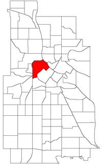
The North Loop is a neighborhood of the Central community of Minneapolis, Minnesota. The neighborhood is commonly known as the Warehouse District from the city's years as a midwestern shipping hub. It includes the Minneapolis Warehouse Historic District which is listed on the National Register of Historic Places. The North Loop is located northwest of the central business district between downtown Minneapolis and the Mississippi River. Streets in the North Loop are oriented to be parallel to the river, which means that they run at a 45-degree angle relative to the grid of the rest of the city.

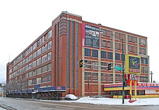
The Ford Piquette Avenue Plant is a former factory located within the Milwaukee Junction area of Detroit, Michigan, in the United States. Built in 1904, it was the second center of automobile production for the Ford Motor Company, after the Ford Mack Avenue Plant. At the Piquette Avenue Plant, the company created and first produced the Ford Model T, the car credited with initiating the mass use of automobiles in the United States. Prior to the Model T, several other car models were assembled at the factory. Early experiments using a moving assembly line to make cars were also conducted there. It was also the first factory where more than 100 cars were assembled in one day. While it was headquartered at the Piquette Avenue Plant, Ford Motor Company became the biggest U.S.-based automaker, and it would remain so until the mid-1920s. The factory was used by the company until 1910, when its car production activity was relocated to the new, bigger Highland Park Ford Plant.

The Near South Side is a community area of Chicago, Illinois, United States, just south of the downtown central business district, the Loop. The Near South Side's boundaries are as follows: North—Roosevelt Road ; South—26th Street; West—Chicago River between Roosevelt and 18th Street, Clark Street between 18th Street and Cermak Road, Federal between Cermak Road and the Stevenson Expressway just south of 25th Street, and Clark Street again between the Stevenson and 26th Street; and East—Lake Michigan.

Lower West Side is a community area on the West Side of Chicago, Illinois, United States. It is three miles southwest of the Chicago Loop and its main neighborhood is Pilsen. The Heart of Chicago is a neighborhood in the southwest corner of the Lower West Side.

Chatham is one of the 77 community areas of the city of Chicago, Illinois. It is located on the city's South Side. It includes the neighborhoods of Chatham-Avalon, Chatham Club, Chesterfield, East Chatham, West Chatham and the northern portion of West Chesterfield. Its residents are predominantly African American, and it is home to former Senator Roland Burris. Housing many city employees and other officials, Chatham has been a central area for Chicago's middle-class African Americans since the late 1950s.

The Magnificent Mile, sometimes referred to as The Mag Mile, is an upscale section of Chicago's Michigan Avenue, running from the Chicago River to Oak Street in the Near North Side. The district is located adjacent to downtown, and one block east of Rush Street. The Magnificent Mile serves as the main thoroughfare between Chicago's Loop business district and its Gold Coast. It is generally the western boundary of the Streeterville neighborhood, to its east and River North to the west.

Kensington is a neighborhood in Philadelphia, Pennsylvania. Its placement within the broader division of sections of Philadelphia is debated, but it is often considered as a dividing line between or belonging to both the Lower Northeast section of Philadelphia and North Philadelphia. It is generally considered part of the Philadelphia River Wards. Modern Kensington is larger than the former Kensington District, and unlike Kensington District it does not include Fishtown. As with all neighborhoods in Philadelphia, the lack of any official designation means the boundaries of the area vary between sources and over time. Traditionally, Kensington is known for its large working class Irish Catholic community. Kensington was the location of the Philadelphia Nativist Riots in the 19th century. Kensington is also the birthplace of the K&A Gang,, an Irish American organized crime network. Originally, Kensington was also home to a large, and largely invisible, English American community. For example, the five Episcopal parishes in the neighborhood were founded by 19th century immigrants from England.

The Ybor Factory Building is a historic site in Tampa, Florida, United States located at 1911 North 13th Street. The main factory and its surrounding support buildings cover an entire city block between 8th Avenue and 9th Avenues and 13th and 14th Streets in the Ybor City Historic District section of the Ybor City neighborhood. C. E. Parcell is credited as the building's architect.

Pullman National Monument, also known as The Pullman District and Pullman Historic District, is located in Chicago and was the first model, planned industrial community in the United States. The district had its origins in the manufacturing plans and organization of the Pullman Company, and became one of the most famous company towns in the United States, as well as the scene of the violent 1894 Pullman strike. It was built for George Pullman as a place to produce the famous Pullman sleeping cars.

The Central Manufacturing District of Chicago is a 265-acre (1.07 km2) area of the city in which private decision makers planned the structure of the district and its internal regulation, including the provision of vital services ordinarily considered to be outside the scope of private enterprise. It has been described as the United States' first planned industrial district.

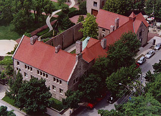
Prairie Avenue is a north–south street on the South Side of Chicago, which historically extended from 16th Street in the Near South Side to the city's southern limits and beyond. The street has a rich history from its origins as a major trail for horseback riders and carriages. During the last three decades of the 19th century, a six-block section of the street served as the residence of many of Chicago's elite families and an additional four-block section was also known for grand homes. The upper six-block section includes part of the historic Prairie Avenue District, which was declared a Chicago Landmark and added to the National Register of Historic Places.

The Crescent Warehouse Historic District is a 10.5-acre (4.2 ha) historic district in Downtown Davenport, Iowa, United States. The district is a collection of multi-story brick structures that formerly housed warehouses and factories. Most of the buildings have been converted into loft apartments. The district was listed on the National Register of Historic Places in 2003.

The Jackson Avenue Warehouse District is an historic district in the Old City section of Knoxville, Tennessee, USA, listed on the National Register of Historic Places in the 1970s. The district includes several warehouses along the 100-block of West Jackson Avenue, as well as the Sullivan's Saloon building on East Jackson. The buildings were listed for their architecture and their role in Knoxville's late-19th and early-20th century wholesaling industry.

The Austin, Nichols and Company Warehouse, also known as 184 Kent Avenue and Austin Nichols House, is a historic warehouse building on the East River between North 3rd and North 4th Streets in Williamsburg, Brooklyn, New York City. The structure, measuring 179 by 440 feet, was built in the Egyptian Revival style; it is one of the city's few buildings in that style. The building was designed by architect Cass Gilbert and erected by general contractor Turner Construction with the help of structural engineer Gunvald Aus.

Washington Avenue Historic District, or Washington Avenue Factory District, is a national historic district located in the Hawthorne and Bella Vista neighborhoods of South Philadelphia, Pennsylvania. It comprises the remaining four blocks of one of the last industrial neighborhoods in Philadelphia, and encompasses eight contributing buildings built between 1889 and 1927:

Midtown-Edmondson is a mixed-use neighborhood in western Baltimore City developed mostly between the 1880s and the 1910s. The neighborhood is mainly composed of residential rowhouses, with a mixed-used business district along Edmondson Avenue, and industrial warehouses and buildings dotted along the CSX railroads that bound its western edge.

The Morris Avenue Historic District is an industrial district in Birmingham, Alabama. The district covers Morris Avenue from 20th Street to 25th Street and First Avenue from 21st to 26th Street. The Morris Avenue section comprises a set of late 19th century masonry warehouses that were Birmingham's main food distribution center until the 1950s. The First Avenue section of the district comprises a mixed neighborhood of late 19th century offices and warehouses, built shortly after the Morris Avenue development. The combined areas include 63 contributing structures, of the 69 buildings in the district. Notable buildings include the Liberty Trouser Building and the A.C. Legg Building on Morris Avenue on either side of the Moskowitz Warehouse. On First Avenue the Birmingham Realty Building and the A.A. Adams Realty Building, as well as the Goodall-Brown Building are notable.

Ely Walker Lofts is a building located at 1520 Washington Avenue in St. Louis, Missouri.


