Buena Vista is an independent city located in the Blue Ridge Mountains region of Virginia in the United States. As of the 2010 census, the population was 6,650. The Bureau of Economic Analysis combines the independent cities of Buena Vista and Lexington, along with surrounding Rockbridge County, for statistical purposes.

Botetourt County is a United States county that lies in the Roanoke Region of the Commonwealth of Virginia. Located in the mountainous portion of the state, the county is bordered by two major ranges, the Blue Ridge Mountains and the Appalachian Mountains.

Bedford County is a United States county located in the Piedmont region of the Commonwealth of Virginia. Its county seat is the town of Bedford, which was an independent city from 1968 until rejoining the county in 2013.

Goshen is a town in Rockbridge County, Virginia, United States. The population was 361 in the 2010 census.

Boxerwood Nature Center and Woodland Garden is a 15-acre (6.1 ha) arboretum featuring both native and unusual plant specimens, located within a larger preserve at 963 Ross Road near Lexington in Rockbridge County, Virginia, United States in the Shenandoah Valley. Established as a private garden in 1952, it was listed on the National Register of Historic Places in 2015.

Virginia’s sixth congressional district is a United States congressional district in the Commonwealth of Virginia. It covers much of the west-central portion of the state, including Roanoke, Lynchburg and most of the Shenandoah Valley. The current representative is Ben Cline (R), who has held the seat since the 2019 retirement of incumbent Republican Bob Goodlatte.
Rocky Mountain is a peak of the Blue Ridge Mountains in Virginia. It is located about 2 miles (3.5 km) east of Irish Gap, on the border of Rockbridge County and Amherst County; it is the highest point of both counties. Rocky Mountain is flanked to the northeast by Elk Pond Mountain, to the southwest by Grapevine Ridge, and to the south by Tar Jacket Ridge.
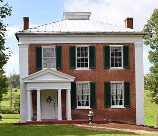
Marlbrook is an unincorporated community in Rockbridge County, Virginia, United States. It sits at an elevation of 1204 feet.
The Chessie Nature Trail is a rail trail linking Buena Vista, Virginia with Lexington, Virginia along the Maury River. The six-mile (9.7 km) trail follows the roadbed of a former Chesapeake and Ohio Railway (C&O) branch line which extended from Glasgow, Virginia, to Lexington, primarily following the Maury River.
Paul State Forest is a Virginia state forest located in Rockingham County. Its 173 acres (0.70 km2) are used for a variety of purposes including research.

Dabney S. Lancaster Community College (DSLCC) is a community college in Clifton Forge, Virginia, which is among the 23 public community colleges in the Virginia Community College System. It is named after Dr. Dabney S. Lancaster, an educator who served as Virginia's Superintendent of Public Instruction, and as president of Longwood College before retiring to Bath County.

Steeles Tavern is an unincorporated community in Augusta County and Rockbridge County, Virginia. It lies at an elevation of 1683 feet.
Buffalo Creek is a 16.0-mile-long (25.7 km) tributary of the Maury River in Rockbridge County in the U.S. state of Virginia. It is part of the James River watershed.
The Little Calfpasture River is a 23.7-mile-long (38.1 km) tributary of the Maury River in the U.S. state of Virginia. It is part of the James River watershed.
North Buffalo Creek is a 7.5-mile-long (12.1 km) tributary of Buffalo Creek in Rockbridge County in the U.S. state of Virginia. Via Buffalo Creek and the Maury River, it is part of the James River watershed.
South Buffalo Creek is a 9.9-mile-long (15.9 km) tributary of Buffalo Creek in Botetourt and Rockbridge counties in the U.S. state of Virginia. Via Buffalo Creek and the Maury River, it is part of the James River watershed.
The South River is a 20.3-mile-long (32.7 km) tributary of the Maury River in the U.S. state of Virginia. It is part of the James River watershed.
Cedar Forest is an unincorporated community in Pittsylvania County, in the U.S. state of Virginia.
Located in Rockbridge County, Virginia, House Mountain is a natural landmark of the area. The mountain consists of two peaks, one called "Little House Mountain" and the other "Big House Mountain". Situated five miles from Lexington, it is a popular hiking trail for the people of the city and the surrounding counties.