
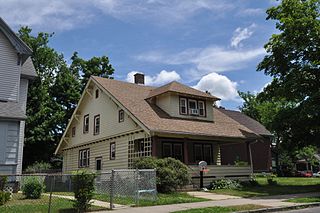
Hillcrest Historic District is a historic neighborhood in Little Rock, Arkansas that was listed on the National Register of Historic Places on December 18, 1990. It is often referred to as Hillcrest by the people who live there, although the district's boundaries actually encompass several neighborhood additions that were once part of the incorporated town of Pulaski Heights. The town of Pulaski Heights was annexed to the city of Little Rock in 1916. The Hillcrest Residents Association uses the tagline "Heart of Little Rock" because the area is located almost directly in the center of the city and was the first street car suburb in Little Rock and among the first of neighborhoods in Arkansas.
Maple Ridge is a historic district in Tulsa, Oklahoma. It is bounded by the Inner Dispersal Loop on the north, Hazel Boulevard on the south, Peoria Avenue on the east and the Midland Valley Railroad right of way on the west. The northern portion of the district, between 15th Street and 21st Street, has been zoned with Historic Preservation Overlay Zoning by the City of Tulsa and is called North Maple Ridge.

Capitol View/Stifft's Station is a neighborhood of Little Rock, Arkansas, in the west-central portion of the city with approximately 1500 homes. Roughly, its boundaries include the area south of West Markham, north of Interstate 630, east of Pine, and west of Summit, as well as south of Riverview between Park and Summit. Capitol View/Stifft's Station is just west of Downtown, north of the Central High School Historic District, southeast of Pulaski Heights and uses the 72205 ZIP code.
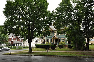
The McKnight District is a predominantly residential neighborhood northeast of downtown Springfield, Massachusetts. The area represents a planned residential development covering several hundred acres, which was built in the mid to late 19th century. The architects of the development were John and William McKnight, who, in addition to developing and enforcing construction guidelines in the area, built and landscaped many of the properties. The area was largely built by 1910, and there has been little new construction in the area since. Most of the houses built in the area were constructed in most of the architectural styles that were popular between 1880 and 1990, although there is a predominance of the Queen Anne style. The McKnights began to develop the area, which had previously been mainly farmland, in 1870 with the purchase of a 22 acres (8.9 ha) parcel on which they and a partner built their own homes. They proceeded over the following years to acquire additional parcels of land in the area, plat out roads, and either build houses themselves, or sell plots to other builders. They enforced some uniformity in the area through the use of deed restrictions, which required uniform setback requirements, banned fencing, and required a minimum cost of construction.

The Mahony Historic District encompasses a residential part of El Dorado, Arkansas north of its downtown area. It was an area of significant development in the years after the 1921 discovery of oil and the ensuing economic boom. The area is bounded on the south by Champagnolle Road, on the west by a line just east of North Madison Avenue, on the north by East 5th Street, and on the east by North Lee Avenue and railroad tracks. It is just over 14 acres (5.7 ha) in size, and includes 94 buildings that contribute to its significance. The streets in the district are laid out in grid form, accounting for the fact that Champagnolle Road runs diagonally from southwest to northeast. Most of the housing in the district consists of modest single-story houses, with simple styling. This is a contrast to the adjacent Murphy-Hill Historic District, a more affluent area with a longer history of development. Only five houses in the district were built before 1920, and all lie on Champagnolle Road; most of the rest were built in the decade after the oil discovery. There is one church in the district, St. Mary's Episcopal Church, completed in 1950. The district was listed on the National Register of Historic Places in 2011.

The Washington Street Historic District of Camden, Arkansas, encompasses an area that has been a fashionable residential area for much of the city's history. It includes six blocks of Washington Street, three of Graham Street, and three connecting streets. The oldest houses in this area are pre-Civil War Greek Revival houses, built in the 1840s and 1850s when Camden was at its height as a major regional center of the cotton trade. Another round of development took place late in the 19th century after the railroad arrived, resulting in a number of Queen Anne, Colonial Revival, and Classical Revival houses. The last major building spurt took place during southern Arkansas' oil boom in the 1920s and 1930s, when Mission/Spanish Revival, Mediterranean, and English Revival houses were built. The district included 68 contributing properties when it was first listed on the National Register of Historic Places in 2010. Six structures were previously listed separately on the National Register. The district was enlarged in 2018.

The Charlotte Street Historic District encompasses a historic residential subdivision in Fordyce, Arkansas. The district extends along Charlotte Street between Holmes and East 4th Streets, and includes a few properties on Broadway, as well as the remaining grounds of the estate of A. B. Banks, an insurance company owner who oversaw the area's development in the 1920s. The area originally consisted of a large tract of land outside the city, which was annexed to it in 1906. Charlotte Street was named for Banks' wife, and he had a handsome estate house built on this land which was designed by Charles L. Thompson, which burned in 1964. Many features of the estate, located between Broadway and East 4th, have been retained, including an inground swimming pool that was supposedly the first private pool in the state.

The Hope Historic Commercial District encompasses a two-block area of downtown Hope, Arkansas. The 18-acre (7.3 ha) district is bounded on the north by the railroad tracks, on the east by Walnut Street, the west by Elm Street, and the south by 3rd Street. The area consists for the most part of commercial brick buildings one or two stories in height, with relatively plain styling. Most of these were built between 1880 and 1945, the major period of Hope's development. The most architecturally significant buildings in the district are the Brundidge Building, an 1893 Romanesque Revival structure, and the Renaissance Revival former post office building.

The North Elm Street Historic District is a predominantly residential historic district in Hope, Arkansas. The district is rectangular in shape, roughly bounded on the north by Avenue G, on the west by Hervey Street, on the east by Hazel Street, and on the south by the railroad tracks. Most of the residential structures in this area were built between 1890 and 1945, and represent the city's greatest concentration of homes built during its boom years. The only major institutional building in the district is Hope City Hall, a Classical Revival structure.

Mount Vernon Triangle is a neighborhood and community improvement district in the northwest quadrant of Washington, D.C. The neighborhood is located adjacent to Mount Vernon Square. Originally a working-class neighborhood established in the 19th century, present-day Mount Vernon Triangle experienced a decline in the mid-20th century as it transitioned from residential to commercial and industrial use.

The West Main Street Residential Historic District of Blytheville, Arkansas, encompasses a seven-block residential stretch of West Main Street, which presents a well-preserved history of residential development during the first six decades of the 20th century. This time period includes Blytheville's most significant period of growth, which began with the arrival of the railroad in 1900. Most of the buildings in the district are residential wood-frame structures, one and two stories in height. Most of the buildings, including some that are no longer historically significant due to later alterations, were built between 1900 and 1930. Stylistically, the district includes a cross-section of architectural styles popular in the early 20th century, although there are a significant number of vernacular structures. The district extends from North 6th Street to Division Street, and includes fifty buildings, of which almost all are residential.

The Carl's Addition Historic District is a predominantly residential historic district in Siloam Springs, Arkansas. The area was developed between about 1895 and 1945, a period of growth brought about by the arrival of the railroad. It contains a concentration of Queen Anne and Craftsman style houses, although other popular revival styles are also represented to some degree. The district extends along South Wright Street between Twin Springs and Alpine Streets, and for single blocks along West Alpine and South College Streets.

The Fishback Neighborhood Historic District is a residential historic district located southeast of the central business district of Fort Smith, Arkansas. The district, originally bounded by Rogers, South Greenwood, and South 31st Streets and Dodson Avenue, was developed out of the former estate of William Meade Fishback in the first three decades of the 20th century. Most of the houses built are Colonial or Classical Revival, or Tudor Revival, although the Craftsman style is also well represented. The district was listed with these bounds in 2010; in 2015 it was enlarged to the west by the addition of properties as far west as South 24th Street.

Belle Grove Historic District is a predominantly residential historic district north of the central business district of Fort Smith, Arkansas. This area became an affluent residential area not long after Fort Smith was established in 1842, and was most heavily developed between about 1870 and 1930. It is one of the oldest residential neighborhoods in the state. It includes a cross-section of architectural styles popular in the late 19th and early 20th centuries, although its oldest building, the c. 1840 John Rogers House, is Greek Revival in style. The district is roughly bounded by North 4th, North 9th, North "B", and North "H" Streets.

The School Addition Historic District encompasses a middle-class residential area of Batesville, Arkansas that typifies its growth between about 1850 and 1950. It is located between Main Street and Poke Bayou, along two blocks each of Rock and Water Streets, and the intervening blocks of 7th and 8th Streets. Houses in this area are generally of a modest scale, built for tradesmen and craftsmen. They come in a variety of styles, including the traditional I-house, American Craftsman-style bungalows, and ranches. The district was platted out in 1849 and sold off by the town to raise funds for public education.

The Bellows Falls Neighborhood Historic District encompasses a residential area of the village of Bellows Falls, Vermont. Located south of downtown Bellows Falls, the area has one of the largest concentrations of well-preserved 19th century residences in southern Vermont. It was listed on the National Register of Historic Places in 2002, and enlarged in 2007.

The George–Pine–Henry Historic District encompasses a residential area of the village of Bellows Falls, Vermont. Located west of downtown Bellows Falls, the area has a significant concentration of well-preserved late 19th and early 20th-century residences. It was listed on the National Register of Historic Places in 2010.

The Robinson Historic District encompasses the oldest residential neighborhood of Conway, Arkansas. It is located just west of the city's downtown business district, and is bounded on the east by Faulkner Street, the south by Robinson Avenue, the west by Watkins Street, and the north by Ash, Caldwell, and Davis Streets. It contains a cross-section of residential architectural styles covering the city's development between 1890 and 1950. The district is named for Asa P. Robinson, Conway's founder.
The Sisson-South Whitney Historic District encompasses a neighborhood in the West End area of Hartford, Connecticut, that was built out between 1890 and 1930 as a streetcar suburb. It is roughly bounded by Farmington Avenue, South Whitney Street, West Boulevard, and Sisson Avenue, and includes a diversity of residential and commercial architecture, reflective of its initial development and subsequent growth. The district was listed on the National Register of Historic Places in 2013.

The Downtown Neighborhood is a neighborhood in Albuquerque, New Mexico, located between Downtown and Old Town. It is sometimes known as the Fourth Ward based on Albuquerque's former system of political wards. The neighborhood is a mostly residential area consisting largely of single-family dwellings in various sizes and styles constructed between the 1880s and 1940s. There is also a commercial district along Central Avenue which has been branded since 2017 as West Downtown.


