
Cumberland is the northeasternmost town in Providence County, Rhode Island, United States, first settled in 1635 and incorporated in 1746. The population was 36,405 at the 2020 census, making it the seventh-largest municipality and the largest town in the state.

Scituate is a town in Providence County, Rhode Island, United States. The population was 10,384 at the 2020 census.

Hopkinton is a town in Washington County, Rhode Island. The population was 8,398 at the 2020 census.

William Bradford was a physician, lawyer, and politician, serving as United States Senator from Rhode Island and deputy governor of the state.

Bristol is a town in Bristol County, Rhode Island, United States, as well as the county seat. The population of Bristol was 22,493 at the 2020 census. It is a deep water seaport named after Bristol, England. Major industries include boat building and related marine industries, manufacturing, and tourism. The town's school system is united with that of the neighboring town of Warren. Prominent communities include Portuguese-Americans, mostly Azoreans, and Italian-Americans.
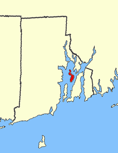
Prudence Island is the third-largest island in Narragansett Bay in the state of Rhode Island and part of the town of Portsmouth, Rhode Island, United States. It is located near the geographic center of the bay. It is defined by the United States Census Bureau as Block Group 3, Census Tract 401.03 of Newport County, Rhode Island. As of the 2010 census, the population was 278 people living on a land area of 14.43 km2.

Riverside is a neighborhood in the city of East Providence in the U.S. state of Rhode Island. Despite not being an incorporated city, Riverside has its own zip code, 02915, and is an acceptable mailing address according to the United States Postal Service. Riverside has a population of approximately 20,000 people.

The Mount Hope Bridge is a two-lane suspension bridge spanning the Mount Hope Bay in eastern Rhode Island at one of the narrowest gaps in Narragansett Bay. The bridge connects the Rhode Island towns of Portsmouth and Bristol and is part of Route 114. Its towers are 285 feet (87 m) tall, the length of the main span is 1,200 feet (370 m), and it offers 135 feet (41 m) of clearance over high water. The total length of the bridge is 6,130 feet (1,870 m).

Mount Hope Bay is a tidal estuary located at the mouth of the Taunton River on the Massachusetts and Rhode Island border. It is an arm of Narragansett Bay. The bay is named after Mount Hope, a small hill located on its western shore in what is now Bristol, Rhode Island. It flows into the East Passage of Narragansett Bay and also the Sakonnet River. Mount Hope Bay has played an important role to the history of the area, from pre-colonial times to the present. While many years of sewage and industrial pollution have severely degraded the quality of the shallow waters of the bay, there are currently major efforts underway to clean up and restore it.

Watson Farm in Jamestown, Rhode Island, United States, was established in 1789. Job Watson purchased a piece of the farmland, and for the next two centuries, five successive generations of the Watson family cultivated the land, changing their crops and practices as needed to adapt to the evolving market.

Colt State Park is a public recreation area that occupies 464 acres (188 ha) on Poppasquash Neck in the town of Bristol, Rhode Island, once owned by industrialist Samuel P. Colt, nephew of firearms manufacturer Samuel Colt. The park is a major component of the Poppasquash Farms Historic District, listed on the National Register of Historic Places, and is a stop on the East Bay Bike Path. The park includes trails, picnic groves, boat ramps, an observation tower, and an open air Chapel-by-the-Sea.
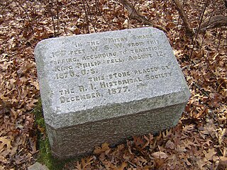
Mount Hope is a small hill in Bristol, Rhode Island overlooking the part of Narragansett Bay known as Mount Hope Bay. It is the highest point in Bristol County, RI. The 7000 acres that now make up the Town of Bristol in Rhode Island were called the Mt. Hope Lands. The elevation of Mt. Hope summit is 209 feet, and drops sharply to the bay on its eastern side. Mount Hope was the site of a Wampanoag (Pokanoket) village. It is remembered for its role in King Philip's War.

Belton Court is a historic estate on Middle Highway in Barrington, Rhode Island. The mansion was built for Frederick Stanhope Peck, a businessman, socialite, and Rhode Island political figure. Later in the twentieth century, the mansion and surrounding property served as the campus for Barrington College and the Zion Bible Institute.

Juniper Hill Cemetery is a historic cemetery at 24 Sherry Avenue in Bristol, Rhode Island founded by George R.Usher, James D'Wolf Perry, Byron Diman, Ambrose E. Burnside, James H. West, Charles H. R. Doringle, and Lemanuel W. Briggs. The original 22 acres (89,000 m2) were purchased from the descendants of Levi DeWolf, a local farmer and slave hauler, in 1855, and the cemetery corporation that owns it was chartered in January 1856. It is a fine example of the mid-19th century rural cemetery movement, with winding lanes and paths. The landscape was designed by Niles Bierragaard Schubarth, who had done similar work at other Rhode Island cemeteries. Its main entry is a massive stone gate built in 1876, and there is a gate house just inside, designed by Clifton A. Hall and constructed from granite quarried on site.

Benjamin Church House is a Colonial Revival house at 1014 Hope Street in Bristol, Rhode Island, U.S.A. It opened in 1909 as the "Benjamin Church Home for Aged Men" as stipulated by Benjamin Church's will. Beginning in 1934, during the Great Depression, it admitted women. The house was closed in 1968 and became a National Register of Historic Places listing in 1971. The non-profit Benjamin Church Senior Center was incorporated in June 1972 and opened on September 1, 1972. It continues to operate as a senior center.

The Wayland Historic District is a predominantly residential historic district on the east side of Providence, Rhode Island. It is a large area, covering about 122 acres (49 ha), bounded roughly on the north by Everett and Laurel Avenues, on the east by Blackstone Boulevard and Butler Avenue, on the west by Arlington Avenue, and on the south by Angell and South Angell Streets. This area, which was in the 19th century part of the Moses Brown farm, was platted for development in 1891, with most of the construction taking place in the early decades of the 20th century. Most of the residential properties in the district are single-family houses, typically built in revival styles popular at the time. They are set on similarly sized lots with fairly uniform setbacks, and were typically built without garages. There are a number of two-family houses, and a small number of apartment buildings, most of which are found on the arterial roads of the area. There are several religious buildings, including several churches; the most architecturally distinctive religious building is the Jewish Temple Beth El, built 1951–54.
Black Farm, also known as the Isaac Collins Farm, is a historic farm in Hopkinton, Rhode Island bounded by Woodville Alton Road and Wood Road. The 264-acre (107 ha) plot was developed by John Collins beginning in 1710 and saw agricultural use for over 200 years. The main house dates to the late 18th century, and is a 1-1/2 story gambrel-roofed post-and-beam structure. Outbuildings include 19th century barns, a corn crib, and a guest cottage added in the 1930s. Set some distance off from this complex is the foundational remains of what was probably an ice house; it consists of granite blocks and is eight feet high.
Edward I. Nickerson (1845–1908) was an American architect from Providence, Rhode Island, known for his work in the Queen Anne style in Providence.

The Samuel Clarke House is a residential structure dating to c. 1691. It's one of the earliest surviving houses in the State of Rhode Island. It is the central building of the “Samuel Clarke Farm”, now a 40-acre parcel in Kenyon, Rhode Island, within the Town of Richmond. The farm is bordered to the west by the Beaver River. This property was originally part of a larger parcel that was sold in 1662 by the Niantic Sachem Wanumachon. This historic land transaction is known as the Stanton Purchase.


