Mount Low, Queensland

Last updated

Mount Low
Queensland
Australia Queensland location map.svg
Red pog.svg
Mount Low
Coordinates 19°13′29″S146°40′51″E / 19.2247°S 146.6808°E / -19.2247; 146.6808 (Mount Low (centre of suburb))
Population5,488 (2021 census) [1]
 • Density481.4/km2 (1,247/sq mi)
Postcode(s) 4818
Area11.4 km2 (4.4 sq mi)
Time zone AEST (UTC+10:00)
Location
LGA(s) City of Townsville
State electorate(s) Hinchinbrook
Federal division(s) Herbert
Suburbs around Mount Low:
Beach Holm Bushland Beach Burdell
Beach Holm Mount Low Burdell
Jensen Deeragun Deeragun

Mount Low is a suburb of Townsville in the City of Townsville, Queensland, Australia. [2] In the 2021 census, Mount Low had a population of 5,488 people. [1]

Contents

Geography

The Bruce Highway and the Great Northern Railway form the southern boundary of the suburb. [3] Deeragun railway station serves the suburb ( 19°14′43″S146°40′38″E / 19.2452°S 146.6771°E / -19.2452; 146.6771 (Deeragun railway station) ). [4]

North Townsville Road runs along part of the southern boundary. [5]

History

The area was named 27 July 1991, [2] presumably named after the mountain Mount Low, which rises 54 metres (177 ft) above sea level ( 19°12′29″S146°40′58″E / 19.2081°S 146.6827°E / -19.2081; 146.6827 (Mount Low) ), just north of the suburb in neighbouring Bushland Beach. [6] [7] [3] On 28 February 2003, it was officially made a suburb. [2]

In 2008, the Maidment Development Group had a residential development for 1300 houses approved. [8]

Demographics

In the 2016 census, Mount Low had a population of 4,655 people. [9]

In the 2021 census, Mount Low had a population of 5,488 people. [1]

Education

There are no schools in Mount Low. The nearest government primary schools are Bohlevale State School and North Shore State School, both in neighbouring Burdell to the east. The nearest government secondary school is Northern Beaches State High School in neighbouring Deeragun to the south. [3]

Amenities

There are a number of parks in the area.

Kilcora Park in Kilcora Street ( 19°14′06″S146°40′28″E / 19.2349°S 146.6744°E / -19.2349; 146.6744 (Kilcora Park) ) has a half basketball court. [10] [11]

Sanctum Park on Sanctum Boulevard ( 19°13′07″S146°39′28″E / 19.2185°S 146.6578°E / -19.2185; 146.6578 (Sanctum Park) ) has outdoor exercise equipment, playground equipment and a dog park. [11]

Related Research Articles

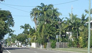
Wulguru is an outer southern suburb of Townsville in the City of Townsville, Queensland, Australia. In the 2021 census, Wulguru had a population of 4,389 people.

<span class="mw-page-title-main">Oonoonba, Queensland</span> Suburb of Townsville, Queensland, Australia

Oonoonba is a suburb of Townsville in the City of Townsville, Queensland, Australia. In the 2021 census, Oonoonba had a population of 2,050 people.

<span class="mw-page-title-main">South Townsville, Queensland</span> Suburb of Townsville, Queensland, Australia

South Townsville is a coastal suburb of Townsville in the City of Townsville, Queensland, Australia. In the 2021 census, South Townsville had a population of 2,424 people.

<span class="mw-page-title-main">Deeragun, Queensland</span> Town in Queensland, Australia

Deeragun is a town and outer western suburb of Townsville in the City of Townsville, Queensland, Australia. In the 2021 census, the suburb of Deeragun had a population of 4,273 people.

<span class="mw-page-title-main">Idalia, Queensland</span> Suburb of Townsville, Queensland, Australia

Idalia is a southern suburb in the City of Townsville, Queensland, Australia. In the 2021 census, Idalia had a population of 4,563 people.

<span class="mw-page-title-main">Bushland Beach, Queensland</span> Suburb of Townsville, Queensland, Australia

Bushland Beach is a coastal suburb in the northern beaches area of Townsville in the City of Townsville, Queensland, Australia. In the 2021 census, Bushland Beach had a population of 6,641 people.

Saunders Beach is a coastal town and suburb of Townsville in the City of Townsville, Queensland, Australia. In the 2021 census, the suburb of Saunders Beach had a population of 385 people.

Toolakea is a coastal town and suburb in the City of Townsville, Queensland, Australia. In the 2021 census, the suburb of Toolakea had a population of 218 people.

<span class="mw-page-title-main">Yabulu, Queensland</span> Town in Queensland, Australia

Yabulu is a town and coastal suburb in the City of Townsville, Queensland, Australia. In the 2021 census, the suburb of Yabulu had a population of 719 people.

<span class="mw-page-title-main">Rollingstone, Queensland</span> Town in Queensland, Australia

Rollingstone is a rural town and coastal locality in the City of Townsville, Queensland, Australia. In the 2021 census, the locality of Rollingstone had a population of 133 people.

<span class="mw-page-title-main">Balgal Beach, Queensland</span> Suburb of Townsville, Queensland, Australia

Balgal Beach is a coastal suburb and a beach in the City of Townsville, Queensland, Australia. The town of Balgal is within the locality. In the 2021 census, Balgal Beach had a population of 998 people.

Jensen is a suburb in the City of Townsville, Queensland, Australia. In the 2021 census, Jensen had a population of 1,797 people.

<span class="mw-page-title-main">Rosslea, Queensland</span> Suburb of Townsville, Queensland, Australia

Rosslea is a suburb of Townsville in the City of Townsville, Queensland, Australia. In the 2021 census, Rosslea had a population of 1,903 people.

<span class="mw-page-title-main">Town Common, Queensland</span> Suburb of Townsville, Queensland, Australia

Town Common is a coastal suburb of Townsville in the City of Townsville, Queensland, Australia. In the 2021 census, Town Common had "no people or a very low population".

<span class="mw-page-title-main">Castle Hill, Queensland</span> Suburb of Townsville, Queensland, Australia

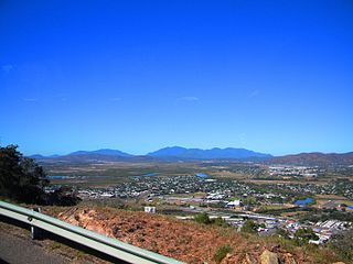
Castle Hill is a suburb of Townsville in the City of Townsville, Queensland, Australia. The suburb is based on and around the mountain of the same name. The Indigenous name for the mountain is Cootharinga, sometimes written as Cooderinga. In the 2021 census, Castle Hill had a population of 972 people.

Cosgrove is a suburb of Townsville in the City of Townsville, Queensland, Australia. In the 2021 census, Cosgrove had a population of 665 people.

<span class="mw-page-title-main">Bohle, Queensland</span> Suburb of Townsville, Queensland, Australia

Bohle is a northern suburb in the City of Townsville, Queensland, Australia. In the 2021 census, Bohle had a population of 121 people.

Beach Holm is a coastal locality in the City of Townsville, Queensland, Australia. In the 2021 census, Beach Holm had a population of 35 people.

<span class="mw-page-title-main">Burdell, Queensland</span> Suburb of Townsville, Queensland, Australia

Burdell is a suburb of Townsville in the City of Townsville, Queensland, Australia. In the 2021 census, Burdell had a population of 7,171 people.

Lynam is a rural locality in the City of Townsville, Queensland, Australia. In the 2021 census, Lynam had a population of 8 people.

References

  1. 1 2 3 Australian Bureau of Statistics (28 June 2022). "Mount Low (SAL)". 2021 Census QuickStats. Retrieved 28 February 2023. OOjs UI icon edit-ltr-progressive.svg
  2. 1 2 3 "Mount Low – suburb in City of Townsville (entry 50180)". Queensland Place Names. Queensland Government . Retrieved 29 December 2020.
  3. 1 2 3 "Queensland Globe". State of Queensland . Retrieved 17 January 2022.
  4. "Railway stations and sidings - Queensland". Queensland Open Data. Queensland Government. 2 October 2020. Archived from the original on 5 October 2020. Retrieved 5 October 2020.
  5. Google (23 April 2023). "Mount Low" (Map). Google Maps . Google. Retrieved 23 April 2023.
  6. "Mountain peaks and capes - Queensland". Queensland Open Data. Queensland Government. 12 November 2020. Archived from the original on 25 November 2020. Retrieved 25 November 2020.
  7. "Mount Low – mountain in Townsville City (entry 20168)". Queensland Place Names. Queensland Government . Retrieved 25 November 2020.
  8. "Mount Low". Queensland Places. University of Queensland. Archived from the original on 23 April 2021. Retrieved 17 January 2022.
  9. Australian Bureau of Statistics (27 June 2017). "Mount Low (SSC)". 2016 Census QuickStats. Retrieved 20 October 2018. OOjs UI icon edit-ltr-progressive.svg
  10. "Land for public recreation - Queensland". Queensland Open Data. Queensland Government. 20 November 2020. Archived from the original on 22 November 2020. Retrieved 22 November 2020.
  11. 1 2 "How to Get Active". Townsville City Council . 10 January 2022. Archived from the original on 27 March 2021. Retrieved 17 January 2022.