Mountain View Ranches, Arizona

Last updated

Mountain View Ranches, Arizona
USA Arizona location map.svg
Red pog.svg
Mountain View Ranches
Usa edcp location map.svg
Red pog.svg
Mountain View Ranches
Coordinates: 35°14′11″N111°28′19″W / 35.23639°N 111.47194°W / 35.23639; -111.47194
CountryUnited States
State Arizona
County Coconino
Area
[1]
  Total
4.92 sq mi (12.74 km2)
  Land4.92 sq mi (12.74 km2)
  Water0.00 sq mi (0.00 km2)
Elevation
6,368 ft (1,941 m)
Population
 (2020)
  Total
1,508
  Density306.69/sq mi (118.41/km2)
Time zone UTC-7 (MST)
  Summer (DST) UTC-6 (MDT)
ZIP Code
86004 (Flagstaff)
FIPS code 04-47925
GNIS feature ID2805221 [2]

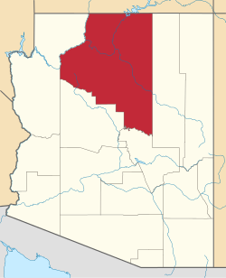
Mountain View Ranches is an unincorporated community and census-designated place (CDP) in Coconino County, Arizona, United States. It lies to the northeast of Flagstaff and was first listed as a CDP prior to the 2020 census.

Contents

Demographics

Historical population
CensusPop.Note
2020 1,508
U.S. Decennial Census [3]

Education

Mountain View Ranches is within the Flagstaff Unified School District. [4]

The zoned secondary schools are Sinagua Middle School and Coconino High School. [5]

References

  1. "2020 U.S. Gazetteer Files". United States Census Bureau. Retrieved October 29, 2021.
  2. 2805221
  3. "Census of Population and Housing". Census.gov. Retrieved June 4, 2016.
  4. "2020 census - school district reference map: Coconino County, AZ" (PDF). United States Census Bureau. p. 4 (PDF pp. 5/5). Archived (PDF) from the original on October 9, 2022. Retrieved September 12, 2024. - Text list
  5. "2010/2011 Middle (6–8) and High (9–12) School Attendance Areas" (PDF). Flagstaff Unified School District . Retrieved September 12, 2024. – Compare to the US Census Bureau maps.