
Kanowna is a ghost town in the Goldfields region of Western Australia, about 20 kilometres (12 mi) east of Kalgoorlie. It is sited on Maduwongga tribal lands. At the 2016 census, Kanowna had a population of 10 people.
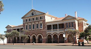
Coolgardie is a small town in Western Australia, 558 kilometres (347 mi) east of the state capital, Perth. It has a population of approximately 850 people.
Bonnie Vale is an abandoned goldfields townsite 14 km (8.7 mi) north of Coolgardie in the Shire of Coolgardie in Western Australia.
Yellowdine is a town located 402 kilometres (250 mi) east of Perth, Western Australia on the Great Eastern Highway. The townsite is in the Goldfields-Esperance region, situated in the Shire of Yilgarn.
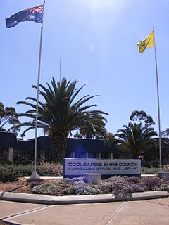
The Shire of Coolgardie is a local government area in the Goldfields–Esperance region of Western Australia, lying roughly west and south of the city of Kalgoorlie. The Shire covers an area of 30,400 square kilometres (11,738 sq mi), and its seat of government is the town of Coolgardie, although the twin towns of Kambalda East and Kambalda West contain two-thirds of the Shire's population.
Goongarrie is an abandoned town in Western Australia, located in the Goldfield region of Western Australia 84 kilometres (52 mi) north of Kalgoorlie.
Mount Morgans, known as Mount Morgan until 1899, is an abandoned town in Western Australia 900 kilometres (559 mi) northeast of Perth and 40 kilometres (25 mi) southwest of Laverton on the original Malcolm-Laverton Road, in the Goldfields-Esperance region of Western Australia.

Widgiemooltha is an abandoned town in Western Australia 631 kilometres (392 mi) east of Perth between Kambalda and Norseman in the Goldfields-Esperance region of Western Australia. It is found on the southern shoreline of Lake Lefroy.

Beria is an abandoned town in the Goldfields-Esperance region of Western Australia, located 8 kilometres (5 mi) north of Laverton on the Laverton-Leonora Road.
Dunnsville is an abandoned town in Western Australia located 46 km north-west of Coolgardie in the Goldfields-Esperance region of Western Australia.
Gindalbie is an abandoned town in the Goldfields-Esperance region of Western Australia. It is situated between Kalgoorlie and Laverton along the Donkey Rocks Road.
Kunanalling is an abandoned town in Western Australia located between Coolgardie and Balgarri along the Coolgardie North Road in the Goldfields-Esperance region of Western Australia. It is located in the Shire of Coolgardie.
Mulgarrie is a ghost town, located between Kalgoorlie and Leonora in the Shire of Menzies in the Goldfields-Esperance region of Western Australia.
Windanya is a ghost town located between Kalgoorlie and Leonora in the Goldfields–Esperance region of Western Australia.
Linden is an abandoned town located in the Goldfields-Esperance region in Western Australia. It is found between Kalgoorlie and Laverton near the southern edge of Lake Carey.
Callion is an abandoned town in the Goldfields-Esperance region in Western Australia. It is between Coolgardie and Leonora, in the Shire of Menzies.
Mulwarrie is an abandoned town in the North Coolgardie Goldfield of the Goldfields-Esperance region of Western Australia, 125 km northwest of Kalgoorlie, between Davyhurst and Mulline.
Niagara is an abandoned town located in the Goldfields-Esperance region in Western Australia, between Kalgoorlie and Leonora, 12 kilometres (7.5 mi) southwest of Kookynie.
Yarri is an abandoned town located in the Goldfields–Esperance region in Western Australia. It is found between Kalgoorlie and Laverton in the Shire of Menzies.
Yerilla is an abandoned town located in the Goldfields-Esperance region in Western Australia. It is found between Kalgoorlie and Laverton.
