
Anders Heger is a Norwegian publisher and writer, and is one of the six children of Wanda Hjort Heger and Bjørn Heger.

Agnar Mykle was a Norwegian author. He became one of the most controversial figures in Norwegian literature in the 20th century.
The Song of the Red Ruby is a Norwegian novel written by Agnar Mykle. It's a story of the young Ask Burlefot's personal ride through shame and letdowns that eventually leads to a closer and deeper understanding of himself. It was controversial in Norway and other countries at the time of publication and ended in court – as the so-called Mykle Case. This controversy was due to the explicit sexual descriptions in the adventures of the potent main character. In Norway, the publisher was acquitted, but for instance in Finland the book was confiscated and burnt.

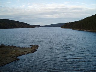
Øyeren is a lake in the Glomma River watershed, southeast of the city of Lillestrøm. It is located within the municipalities of Enebakk, Lillestrøm, and Rælingen in Akershus county and Indre Østfold municipality in Østfold county.

Fyresvatnet or Fyresvatn is a lake in Fyresdal Municipality in Telemark county, Norway. With a depth of 377 metres (1,237 ft), the lake is the fifth-deepest lake in Norway. The 49.7-square-kilometre (19.2 sq mi) lake stretches about 25 kilometres (16 mi) from the village of Kilegrend in the south to Moland in the north.

Storglomvatnet is a lake that lies in the municipality of Meløy in Nordland county, Norway. It is located about 10 kilometres (6.2 mi) southeast of the village of Glomfjord, on the northeast edge of the Svartisen glacier. Storglomvatnet is a reservoir that serves the Svartisen Hydroelectric Power Station. The lake is part of a large watershed system. The lake is regulated at a height of 460 to 585 metres above sea level. This lake is also known as Grandma's lake to some locals.
Steinbusjøen is a lake in Vang Municipality in Innlandet county, Norway. It is located just east of the large lake Tyin. The lake is part of the Begna watershed and it is regulated as a reservoir for the Ylja hydroelectric power station.
Kviteseidvatn or Kviteseidvatnet is a lake in the municipality of Kviteseid in Telemark county, Norway. The 15.76-square-kilometre (6.08 sq mi) lake is part of the Telemark Canal and lies in the Skien watershed. The lake's water level was first regulated in 1892.
Mingevannet is a lake in Østfold county, Norway. It forms a part of the Glomma watershed together with Ågårdselva and Visterflo.

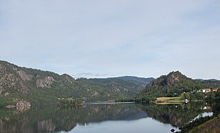
Totak is a lake in Vinje Municipality in Telemark county, Norway. The 37.26-square-kilometre (14.39 sq mi) lake is located in the Rauland area, about 10 kilometres (6.2 mi) to the north of the village of Åmot. The lake is part of the Skien river watershed (Skiensvassdraget), discharging via the river Tokke which flows into the lake Bandak to the south. At 306 metres (1,004 ft) deep, Totak is the 11th deepest lake in Norway. This tremendous overdeepening marks it as a glacially formed lake with characteristics similar to a fjord. Its volume of 2.35 cubic kilometres (1,910,000 acre⋅ft) makes it the 24th largest by volume as well. Totak is Norway's deepest lake; that isn't a cryptodepression. The lake's basin is well over sealevel. The lake is a reservoir that holds water for the Tokke Hydroelectric Power Station.
Hettefjorden is a lake in the municipality of Nore og Uvdal in Viken county, Norway. It is located east on Hardangervidda, just inside the border of Hardangervidda National Park. It is the Skiensvassdraget watershed.
Langesjøen is a lake in the municipality of Nore og Uvdal in Buskerud, Norway. Langesjøen is located ln Hardangervidda. Djupa flows out of Langesjøen to form part of the Numedalslågen watershed (Numedalsvassdraget).
Lauvnesvatnet is a fishing lake in the municipalities of Sigdal and Flesberg in Buskerud, Norway. It is located at an elevation of 366 meters above sea level. It forms part of the Drammensvassdraget watershed.
Ullerentjernet is a small lake located in the municipality of Ringerike in Buskerud, Norway. It is in the Skjærdalsvassdraget watershed formed by a number of smaller streams, rivers, ponds and marshes which drain into Tyrifjord. Ullerentjernet is situated in Holleia, a hilly terrain with a forest switching between spruce and pine.
Samsjøen is a lake in the municipalities of Ringerike in Buskerud county and Jevnaker in Akershus county.
Tingvollfjorden is a small fishing lake in the municipality of Ål in Buskerud county, Norway. The lake is located in the valley of Hallingdal, northwest of Honefoss on the watershed of the Hallingdalselva.
Geitsjøen is a lake in the municipality of Nore og Uvdal in Buskerud, Norway. It lies east of the Hardangervidda mountain plateau, at the lower end of the catchment area of the river Djupa in the Numedalslågen watershed.

Visterflo is a lake in Østfold county, Norway. It forms a part of the Glomma watershed together with Ågårdselva and Mingevannet.

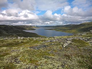
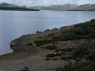
Rostojávri (Northern Sami), Råstojaure (Swedish), or Store Rostavatn (Norwegian) is a lake on the border between Norway and Sweden. The Norwegian side of the lake is located in Målselv Municipality in Troms county and the Swedish side of the lake is located in Kiruna Municipality in Norrbotten County. The Norwegian part of the lake lies inside Øvre Dividal National Park. The lake lies at an elevation of 680 metres (2,230 ft) and covers a total area of 34.24 square kilometres (13.22 sq mi); with 3.67 square kilometres (1.42 sq mi) located in Norway and the remaining 30.57 square kilometres (11.80 sq mi) are located in Sweden.
Kalhovdfjorden is a lake in Tinn Municipality in Telemark county, Norway. The lake lies about 20 kilometres (12 mi) to the north of the town of Rjukan and about 15 kilometres (9.3 mi) east of the Hardangervidda National Park. The lake is part of the Skien watershed. The river Mår is the main outflow of the lake. The lake Møsvatn lies to the southwest and the lake Tinnsjå lies to the southeast. The area of the lake is 20.39 square kilometers (7.87 sq mi) and it is located 1,084 meters (3,556 ft) above sea level.
