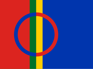
Sápmi is the cultural region traditionally inhabited by the Sámi people. Sápmi is in Northern and Eastern Europe and includes the northern parts of Fennoscandia, also known as the "Cap of the North".
Nordland is a county in Norway in the Northern Norway region, the least populous of all 11 counties, bordering Troms og Finnmark in the north, Trøndelag in the south, Norrbotten County in Sweden to the east, Västerbotten County to the south-east, and the Atlantic Ocean to the west. The county was formerly known as Nordlandene amt. The county administration is in the town of Bodø. The remote Arctic island of Jan Mayen has been administered from Nordland since 1995. In the southern part of the county is Vega, listed on the UNESCO World Heritage Site list.

Troms is a former county in northern Norway. On 1 January 2020 it was merged with the neighboring Finnmark county to create the new Troms og Finnmark county. This merger is expected to be reversed by the government resulting from the 2021 Norwegian parliamentary election.

Mo i Rana is a city, and the administrative centre of the municipality of Rana, in Nordland county, Norway. It is located in the Helgeland region of Nordland, just south of the Arctic Circle. Some of the city's suburbs include Båsmoen and Ytteren in the north, Selfors in the east, and Åga/Hauknes/Dalsgrenda in the south.
Rana is a municipality in Nordland county, Norway. It is part of the Helgeland traditional region. The administrative centre of the municipality is the town of Mo i Rana, which houses the National Library of Norway. Other population centers in Rana include Båsmoen, Dunderland, Eiteråga, Flostrand, Hauknes, Mæla, Myklebustad, Nevernes, Røssvoll, Selfors, Skonseng, Storforshei, Utskarpen, and Ytteren.
Northern Norway is a geographical region of Norway, consisting of the two northernmost counties Nordland and Troms og Finnmark, in total about 35% of the Norwegian mainland. Some of the largest towns in Northern Norway are Mo i Rana, Bodø, Narvik, Harstad, Tromsø and Alta. Northern Norway is often described as the land of the midnight sun and the land of the northern lights. Further north, halfway to the North Pole, is the Arctic archipelago of Svalbard, traditionally not regarded as part of Northern Norway.

Børgefjell National Park is an undeveloped national park in Norway, straddling the border between Trøndelag and Nordland counties, along the border with Sweden. The park is undeveloped with few trails or other facilities for visitors. Visitors can hike for extended periods without seeing another person. The 1,447-square-kilometre (559 sq mi) park was originally established in 1963, and it was enlarged in 1973 and 2003. It now includes land in the municipalities of Hattfjelldal, Grane, Namsskogan, and Røyrvik.
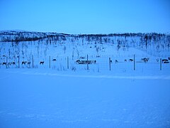
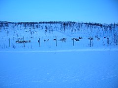
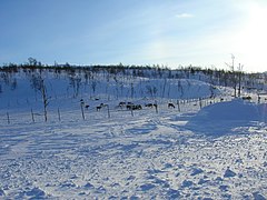
The Dunderland Valley is a valley in the municipality of Rana in Nordland county, Norway. It reaches from just below the eastern Saltfjellet plateau about 8 miles (13 km) south of the Arctic circle. The mountain Bolna is situated in the uppermost boundary of the valley which then proceeds to the southwest all the way down to the Ranfjorden. Some of the minor side valleys include Plurdalen, Røvassdalen, Bjøllådalen, Grønfjelldalen and Virvassdalen. The valley also includes several villages such as Krokstrand, Bjøllånes, Storvoll, Dunderland, Eiterå, Nevernes, Storforshei, Nevermoen and Røssvoll.
Litlumvatnet (Norwegian), Lill-Uman (Swedish), or Jovsjaevrie (Southern Sami) is a lake on the border of Norway and Sweden. The Norwegian side lies in Rana Municipality in Nordland county and the Swedish side lies in Storuman Municipality in Västerbotten County. The lake lies about 40 kilometres (25 mi) southeast of the town of Mo i Rana. The lake is 5.24 square kilometres (2.02 sq mi) and about 1.8 square kilometres (0.69 sq mi) lies inside Norway and the rest lies in Sweden.
Nordre Bjøllåvatnet (Norwegian) or Bajep Ruovdajávrre (Lule Sami) is a lake that lies in the municipality of Saltdal in Nordland county, Norway. The 9.93-square-kilometre (3.83 sq mi) lake is located inside Saltfjellet–Svartisen National Park, about 1 kilometre (0.62 mi) east of the border with the municipality of Beiarn and north of the border with the municipality of Rana. The lake flows out through the river Bjøllåga and ultimately into the river Ranelva.
Ranseren (Norwegian), also known as Bije-Ransarn (Swedish) or Bijjie Raentsere (Southern Sami), is a lake on the border between Norway and Sweden. The Norwegian side lies in Hattfjelldal Municipality in Nordland county. The Swedish side of the lake is called Bije-Ransaren, which means "the upper Ransaren" and this part lies in Vilhelmina Municipality in Västerbotten County.
Reinoksvatnet (Norwegian) or Hierggejávrre (Lule Sami) is a lake in the municipality of Hamarøy in Nordland county, Norway. It is located about 20 kilometres (12 mi) east of the village of Mørsvikbotn and less than 2 kilometres (1.2 mi) west of the border with Sweden.
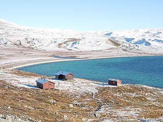
Unkervatnet (Norwegian) or Åanghkejaevrie (Southern Sami) is a lake in the municipality of Hattfjelldal in Nordland county, Norway. It is a good lake for fishing lake trout and Arctic char both during summer and winter. The river flowing into the lake from the east is called Skarmodalselva, and the outflowing river is called Unkerelva. For tourists, there are two places available by the shoreside: Ørnes camping at the eastern end of the lake, and Tjolmen, situated on the north side of the lake's middle. The road from the village of Hattfjelldal to the village of Dikanäs in Sweden runs along the north side of the lake.

Ranelva is a 130-kilometre (81 mi) long river in the municipality of Rana in Nordland county, Norway. It is one of the longest rivers in Nordland county. The catchment area of the river is 3,790 square kilometres (1,460 sq mi). Before the power stations of Reinforsen (1925) and Langvatnet (1964) were built, the catchment area was 3,843 square kilometres (1,484 sq mi).

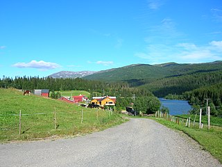
Selfors is a village in the municipality of Rana in Nordland county, Norway. Selfors sits on the northern shore of the river Ranelva and it is a northeastern suburb of the town of Mo i Rana. The European route E06 highway passes through the village. Selfors has been inhabited since the Iron Age.

Bolna (Norwegian) or Bållná (Lule Sami) is a mountain in the Saltfjellet mountain range in the municipality of Rana in Nordland county, Norway. The mountain peak reaches 1,460 metres (4,790 ft) above sea level, and is located just north of the Arctic Circle inside Saltfjellet–Svartisen National Park. The mountain peak is located less than 2 kilometres (1.2 mi) west of the municipal border with Saltdal and about 15 kilometres (9.3 mi) west of the border with Sweden.

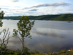
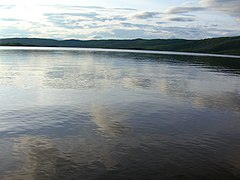
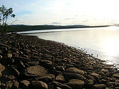
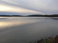
Tverrvatnet or Tvervatnet [tvær'vatne] is a lake in the municipality of Rana in Nordland county, Norway. The European route E12 highway passes along the northern and eastern shores of the lake between the town of Mo i Rana and the border with Sweden. Tverrvatnet gets its name from the fact that it is located "across", in a north–south direction, while most lakes in Rana are located in an east–west direction.

The Vindelfjällen Nature Reserve is a nature reserve located in the municipalities of Sorsele and Storuman in Västerbotten County of Swedish Lapland. It is the largest natural reserve in Sweden and one of the largest protected areas in Europe, totaling 562,772 ha.

Gubbeltåga (Norwegian) or Gubbeltædno (Lule Sami) is a river in the municipality of Rana in Nordland county, Norway, which flows in a southern and southwestern direction. The 15-kilometre (9.3 mi) long river begins at the drainage divide on the Saltfjellet plateau in the north. On its direction mainly southwards, it meets and becomes a part of Randalselva, which has its beginning in the Norwegian-Swedish border regions. At Elvmøthei in the Dunderland Valley, Randalselva then meets Virvasselva and thus forms the beginning of Ranelva.

Sulitjelma is a mountain massif on the Norway-Sweden border in the municipality of Fauske in Nordland, Norway and the municipality of Arjeplog in Norrbotten, Sweden. The massif lies east of the village of Sulitjelma, which takes its name from the mountain. The massif is bordered by Låmivatnet and Muorkkejávrre to the south, and by Bajep Sårjåsjávrre and Vuolep Sårjåsjávrre to the north. About two-thirds of the mountain is in Norway. The Langvann Valley extends toward the massif along a northwest–southeast axis, through which the Sjønstå River flows, forming the Sulitjelma watercourse. The valley starts at the village of Sjønstå on Øvervatnet, which lies about 17 kilometers (11 mi) east of the village of Sulitjelma itself.