Related Research Articles
The Wisconsin Range is a major mountain range of the Horlick Mountains in Antarctica, comprising the Wisconsin Plateau and numerous glaciers, ridges and peaks bounded by the Reedy Glacier, Shimizu Ice Stream, Horlick Ice Stream and the interior ice plateau.
The Deep Freeze Range is a rugged mountain range, over 128 km (80 mi) long and about 16 km (10 mi) wide, rising between Priestley and Campbell Glaciers in Victoria Land, Antarctica, and extending from the edge of the polar plateau to Terra Nova Bay. Peaks in the low and mid portions of the range were observed by early British expeditions to the Ross Sea.
Yoder Glacier is a glacier with abrupt valley walls, 3 miles long, which is a western tributary to Kohler Glacier. Located just southwest of Morrison Bluff in the central part of Kohler Range, Marie Byrd Land. Mapped by United States Geological Survey (USGS) from ground surveys and U.S. Navy air photos, 1959–71. Named by Advisory Committee on Antarctic Names (US-ACAN) for Robert D. Yoder, United States Department of State, Chairman of the Interagency Committee on Antarctica, 1970–73.
Exum Glacier is a small glacier flowing north between Hughes Point and Bonnabeau Dome, in the Jones Mountains of Antarctica. It was mapped by the University of Minnesota – Jones Mountains Party, 1960–61, and was named by the party for Glenn Exum, a mountaineer who provided training in rock and ice climbing for the University of Minnesota field parties of 1960–61 and 1961–62.

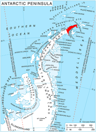
Arena Glacier is a glacier on Trinity Peninsula, the northernmost region of the Antarctic Peninsula. The glacier is 3 miles (5 km) long and flows northeast from Mount Taylor into Hope Bay, 2 miles (3 km) southwest of Sheppard Point. The Falkland Islands Dependencies Survey mapped the area in 1948 and again in 1955. Due to its flat ice floor on the upper half, they named it Arena Glacie, which was surrounded by the steep slopes of the Twin Peaks, Mount Taylor and Blade Ridge, resembling an arena.

Bagshawe Glacier is a glacier which drains the northeast slopes of Mount Theodore and discharges into Lester Cove, Andvord Bay west of Mount Tsotsorkov, on the west coast of Graham Land, Antarctica.

Childs Glacier is a glacier in the Neptune Range of the Pensacola Mountains, draining westward from Roderick Valley to enter Foundation Ice Stream. It was mapped by the United States Geological Survey from surveys and from U.S. Navy air photos, 1956–66, and named by the Advisory Committee on Antarctic Names for John H. Childs, a builder at Ellsworth Station, winter 1958.
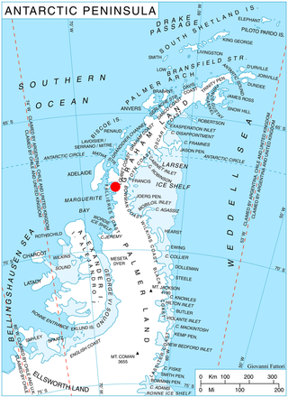
Confluence Cone is a small but conspicuous nunatak 4 nautical miles (7 km) southeast of Sickle Mountain, near the west coast of the Antarctic Peninsula. It was photographed from the air by the Ronne Antarctic Research Expedition in 1947. It was surveyed from the ground by the Falkland Islands Dependencies Survey in 1958, and so named by the UK Antarctic Place-Names Committee because of its position at the confluence of several glaciers which merge with Hariot Glacier to flow into the Wordie Ice Shelf.

Noville Peninsula is a high ice-covered peninsula about 30 nautical miles (60 km) long, between Peale and Murphy Inlets on the north side of Thurston Island in Antarctica. It was delineated from aerial photographs made by U.S. Navy Operation HIGHJUMP in December 1946, and named for George O. Noville, executive officer of the Byrd Antarctic Expedition, 1933–35.

Crosswell Glacier is a glacier 10 nautical miles long, flowing north-northeast from Mount Shinn between Sullivan Heights and Bearskin Ridge, in the central part of the Sentinel Range, Ellsworth Mountains, Antarctica. Together with Patton and Pulpudeva Glaciers, it enters Ellen Glacier northwest of Mamarchev Peak and southeast of Mount Jumper.
Davis Ice Rise is an ice rise, 4 nautical miles (7 km) long, near the terminus of Smith Glacier, 8 nautical miles (15 km) southeast of Mayo Peak, Bear Peninsula, on the Walgreen Coast, Marie Byrd Land. It was mapped by the United States Geological Survey from U.S. Navy aerial photographs taken 1966 and from Landsat imagery taken 1972–73. It was named by the Advisory Committee on Antarctic Names after Commander Arthur R. Davis, U.S. Navy, Supply Officer, Operation Deep Freeze, 1975–76 and 1976–77.

Suárez Glacier also known as Petzval Glacier is a glacier flowing into the small cove between Skontorp Cove and Sturm Cove on the west coast of Graham Land. It was first mapped by Scottish geologist David Ferguson in 1913–14. The 5th Chilean Antarctic Expedition (1950–51) remapped it and named it for Lieutenant Commander Francisco Suárez V., Operations Officer on the transport ship Angamos.

Grubb Glacier is a glacier flowing into Lester Cove, Andvord Bay, to the west of Bagshawe Glacier, on the west coast of Graham Land, Antarctica. The glacier appears on an Argentine government chart of 1952. It was named by the UK Antarctic Place-Names Committee in 1960 for Thomas Grubb, an Irish optician who designed and introduced the first aplanatic camera lens, in 1857.
Dorchuck Glacier is a narrow glacier, 9 nautical miles (17 km) long, flowing northeast from Jenkins Heights between Klinger Ridge and Ellis Ridge into the Dotson Ice Shelf, on Walgreen Coast, Marie Byrd Land. It was mapped by the United States Geological Survey from surveys and U.S. Navy aerial photographs, 1959–67, and from Landsat imagery, 1972–73. It was named by the Advisory Committee on Antarctic Names after Robert E. Dorchuck, U.S. Navy, a nuclear power plant operator with the Naval Nuclear Power Unit at McMurdo Station, summer and winter seasons, Operation Deep Freeze, 1965 and 1969.
Goldsmith Glacier is a glacier flowing west-northwest through the Theron Mountains of Antarctica, 6 nautical miles (11 km) south of Tailend Nunatak. It was first mapped in 1956–57 by the Commonwealth Trans-Antarctic Expedition (CTAE) and named for Rainer Goldsmith, medical officer with the advance party of the CTAE in 1955–56.
Miethe Glacier is a glacier 3 nautical miles (6 km) long, flowing northwest into Gerlache Strait to the south of Mount Banck, on the west coast of Graham Land, Antarctica. The glacier appears on an Argentine government chart of 1952. It was named by the UK Antarctic Place-Names Committee in 1960 for Adolf Miethe, a German chemist who introduced the first panchromatic emulsion for photographic plates in 1903.
Hamblin Glacier is a glacier flowing to the southeast side of Widmark Ice Piedmont, in Graham Land, Antarctica. It was photographed by Hunting Aerosurveys Ltd in 1955–57, and mapped from these photos by the Falkland Islands Dependencies Survey. It was named by the UK Antarctic Place-Names Committee in 1959 for Theodore Hamblin (1873–1952), an English optician who in the 1930s helped in the evolution of the first satisfactory snow goggle design.

Lucchitta Glacier is a glacier about 20 nautical miles (37 km) long flowing south from the Hudson Mountains of Antarctica into Pine Island Bay. It was named by the Advisory Committee on Antarctic Names after geologist Baerbel K. Lucchitta of the United States Geological Survey, Flagstaff, Arizona, a specialist in the use of satellite imagery for geological and glaciological studies from the early 1980s to the early 2000s (decade), and one of the pioneers in the use of imagery for glacier velocity measurements in Antarctica.
Relay Hills is a group of low, ice-covered hills, mainly conical in shape, between Mount Edgell and Kinnear Mountains in western Antarctic Peninsula. First roughly surveyed from the ground by British Graham Land Expedition (BGLE), 1936–37. Photographed from the air by Ronne Antarctic Research Expedition (RARE), November 1947. Resurveyed by Falkland Islands Dependencies Survey (FIDS), November 1958. The name, applied by the United Kingdom Antarctic Place-Names Committee (UK-APC), arose because both the BGLE and the FIDS sledging parties had to relay their loads through this area to the head of Prospect Glacier.
The Blob is a fairly conspicuous, mound-shaped knoll that is almost completely snow-covered, standing midway between Thurston Glacier and Armour Inlet on the north coast of Siple Island. This feature was first plotted by United States Geological Survey (USGS) from air photos taken by U.S. Navy Operation Highjump in January 1947. The descriptive name was suggested by a member of the Advisory Committee on Antarctic Names (US-ACAN) staff on the basis of the appearance of the feature in the aerial photographs.
References
- ↑ "Nereson Glacier". Geographic Names Information System . United States Geological Survey, United States Department of the Interior . Retrieved 2018-01-16.
![]() This article incorporates public domain material from "Nereson Glacier". Geographic Names Information System . United States Geological Survey.
This article incorporates public domain material from "Nereson Glacier". Geographic Names Information System . United States Geological Survey.