Nocoroco

Last updated
Nocoroco
Ormond Beach FL Tomoka SP north end01.jpg
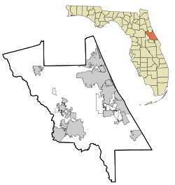
Volusia County Florida No Highlights.svg
Red pog.svg
Nearest city Ormond Beach, Florida
Coordinates 29°21′7″N81°5′14″W / 29.35194°N 81.08722°W / 29.35194; -81.08722 Coordinates: 29°21′7″N81°5′14″W / 29.35194°N 81.08722°W / 29.35194; -81.08722
NRHP reference No. 73000605 [1]
Added to NRHPMay 7, 1973

Nocoroco is the site of a Timucuan village located on the Tomoka River, in Tomoka State Park. [2] The park is located two or three miles north of Ormond Beach, Florida on North Beach Street. [3] [4]
Contents

History

small shell midden at Nocoroco NocorocoOysterMidden.jpg
small shell midden at Nocoroco

Approximately seven thousand years ago, during the Archaic Period, indigenous people found plentiful fish and shellfish at this site in the shelter of a barrier island to the east. [5] [6] The site was inhabited approximately twelve hundred years ago by the Timucuans, whose descendants were discovered there by Europeans. Alvaro Mexia visited Nocoroco in 1605, just as European acculturation had begun. Mexia's expedition explored down the east coast of Florida at the behest of the Spanish governor. [7] This late St. Johns period site represents one of the last Timucuan strongholds in northeastern Florida. The only traces of these native peoples are the shell middens, which help modern archaeologists document their lives. [6]

The British occupation began in 1763 when Great Britain received Florida from Spain in a trade. [8] The site of the village of Nocoroco was part of a British land-grant called Mt. Oswald, held by Richard Oswald. His plantation grew indigo and rice. [9] After its return to the Spanish in 1783, the area was likely cultivated until many plantations were destroyed near the beginning of the Second Seminole War in 1835. [5] [10]

Site Archeology

The midden at Nocoroco is mainly composed largely of a black earth accumulation, with pockets of shell and a few larger shell accumulations. [11] The midden differs from most common middens in the region, which are mostly shell. Shell types include Crassostrea virginica , Mercenaria mercenaria , Tagelus plebeius, Arca sp., Donax variabilis , Geukensia demissa , Sinistrofulgur perversum , and Hexaplex fulvescens . [11] Animal bones were not preserved well and typically were quite fragmentary. [11] Among mammals, the most prevalent source of food seems to have been deer, but other types of bones, such as fish, turtle and alligator remains, were all present. [11]

NRHP listing

On May 7, 1973, it was added to the U.S. National Register of Historic Places [7] as a site significant for its information potential in the area of aboriginal history. [2]

Present day

Today the site of the village of Nocoroco is marked by a large fountain sculpture, called the "Tomokie Fountain", created by Frederick Dana Marsh. [2] [7] [12] The fountain is Marsh's artistic interpretation of the legend of Tomokie, whose arrogance in drinking from a sacred spring was paid for with his life and those of all his band. [12] According to information at the site, references to the legend date back more than one hundred years. [12]

Related Research Articles

Volusia County, Florida County in Florida, United States

Volusia County is located in the east-central part of the U.S. state of Florida, stretching between the St. Johns River and the Atlantic Ocean. As of the 2020 census, the county was home to 553,543 people, an increase of 11.9% from the 2010 census. It was founded on December 29, 1854, from part of Orange County, and was named for the community of Volusia, located in northwestern Volusia County. Its first county seat was Enterprise. Since 1887, its county seat has been DeLand.

Ormond Beach, Florida City in Volusia County, Florida, US

Ormond Beach is a city in Central Florida in Volusia County. The population was 43,080 at the 2020 census. Ormond Beach lies directly north of Daytona Beach and is a principal city of the Deltona–Daytona Beach–Ormond Beach, FL Metropolitan Statistical Area. The city is known as the birthplace of speed, as early adopters of motorized cars flocked to its hard-packed beaches for yearlong entertainment, since paved roads were not yet commonplace.

Ormond-by-the-Sea, Florida CDP in Florida, United States

Ormond-by-the-Sea is a census-designated place and an unincorporated town in Volusia County, Florida, United States. The population was 8,430 as of the 2000 census.

State Road 40 is a 91.832-mile-long (147.789 km) east–west route across central Florida, running from U.S. Route 41 in Rainbow Lakes Estates eastwards through Ocala over the Ocklawaha River and bridge and through the heart of the Ocala National Forest to State Road A1A in Ormond Beach. Names of the road include Silver Springs Boulevard in Ocala, Fort Brooks Road from Silver Springs through Astor, Butler Road in Astor, and Granada Boulevard in Ormond Beach. Former sections in Ormond Beach are named "Old Tomoka Road" and "Old Tomoka Avenue."

Halifax River River in Florida, United States

The Halifax River is part of the Atlantic Intracoastal Waterway, located in northeast Volusia County, Florida. The waterway was originally known as the North Mosquito River, but was renamed after George Montagu-Dunk, 2nd Earl of Halifax, during the British occupation of Florida (1763–1784).

Fort George Island Cultural State Park Florida State Park located on Fort George Island, in Florida, US

Fort George Island State Cultural Site is a Florida State Park located on Fort George Island, about three miles (5 km) south of Little Talbot Island State Park on SR A1A. It is home to the Ribault Inn Club, constructed in 1928 as a winter resort and now used as a visitor's center. The 46,000-acre (190 km2) Timucuan Ecological and Historic Preserve, in Jacksonville, Florida is nearby. Fort George has the highest point along the Atlantic coast south of Sandy Hook, New Jersey, and contains Timucua oyster shell mounds. The park is part of the Talbot Islands GEOpark complex.

The Casements Historic house in Florida, United States

The Casements is a mansion in Ormond Beach, Florida, U.S., famous for being the winter residence of American oil magnate John D. Rockefeller. It is currently owned by the city of Ormond Beach and is used as a cultural center and park. It is located on a barrier island within the city limits, overlooking the Halifax River, which is now part of the Florida Intracoastal Waterway.

Tomoka State Park

Tomoka State Park is an 2,000-acre (8.1 km2) Florida State Park located along the Tomoka River, three miles (5 km) north of Ormond Beach on North Beach Street.

Turtle Mound Prehistoric archaeological site in New Smyrna Beach, Florida, US

Turtle Mound is a prehistoric archaeological site located 9 miles (14 km) south of New Smyrna Beach, Florida, on State Road A1A. On September 29, 1970, it was added to the U.S. National Register of Historic Places. It is the largest shell midden on the mainland United States, with an approximate height of 50 feet (15 m). The mound extends for over 600 feet (180 m) along the Indian River shoreline and contains over 35,000 cubic yards (27,000 m3) of shells. Turtle Mound was estimated to be 75 feet (23 m) high before it was reduced by shellrock mining in the 19th and 20th centuries.

Spruce Creek Mound Complex Archaeological site in Florida, United States

The Spruce Creek Mound Complex is a prehistoric and early historic archeological site in Port Orange, Florida. The mound complex, major earthworks built out of earth and shell middens, was constructed by ancient indigenous peoples. It is located near Port Orange, on the southwest bank of Spruce Creek. On December 3, 1990, it was added to the U.S. National Register of Historic Places.

Anderson–Price Memorial Library Building United States historic place

The Anderson–Price Memorial Library Building is a historic library in Ormond Beach, Florida, United States. It is located at 42 North Beach Street, and was named for the City of Ormond Beach's co-founders John Anderson and Joseph D. Price. It was added to the National Register of Historic Places in 1984.

Ormond Hotel United States historic place

The Ormond Hotel was a historic hotel in Ormond Beach, Florida, United States. It was located at 15 East Granada Boulevard.

Dix House Historic house in Florida, United States

The Dix House is a historic home in Ormond Beach, Florida, United States. On September 6, 1989, it was added to the U.S. National Register of Historic Places.

The Porches Historic house in Florida, United States

The Porches is a historic site in Ormond Beach, Florida, United States. It is located at 176 South Beach Street. On October 6, 1988, it was added to the U.S. National Register of Historic Places.

Rowallan Historic house in Florida, United States

Rowallan is a historic site in Ormond Beach, Florida, United States. It is located at 253 John Anderson Highway. On October 6, 1988, it was added to the U.S. National Register of Historic Places.

National Register of Historic Places listings in Volusia County, Florida

This is a list of the National Register of Historic Places listings in Volusia County, Florida.

Tomoka River River in Florida, United States of America

The Tomoka River is a north-flowing river in Volusia County, Florida, United States. It drains an area of about 110 square miles (280 km2) and has a length of 19.6 miles (31.5 km).

Ormond Mound Historic site in Volusia County, Florida

Ormond Mound is a Pre-Columbian burial mound of the St. Johns culture, in Ormond Beach, Volusia County, Florida, US.

Álvaro Mexía Spanish cartographer and explorer

Alvaro Mexia was a 17th-century Spanish explorer and cartographer of the east coast of Florida. Mexia was stationed in St Augustine and was given a diplomatic mission to the native populations living south of St. Augustine and in the Cape Canaveral area. This mission resulted in a "Period of Friendship" between the Spanish and the Ais native population.

Ormond Scenic Loop and Trail

The Ormond Scenic Loop and Trail is a series of scenic state and county highways in Volusia County, Florida. CR 2002 is the northern leg of the trail. CR 4011(Old Dixie Highway and North Beach Street) is the western leg, with a spur onto Pine Tree Drive. SR 40(East Granada Boulevard) is the southern leg of the trail. CR 2803(John Anderson Drive) is the central leg of the trail, and SR A1A is the eastern leg of the trail. Florida Scenic Highway, designated this route on July 9, 2007.

References

  1. "National Register Information System". National Register of Historic Places . National Park Service. April 15, 2008.
  2. 1 2 3 "Volusia County listings". National Register of Historic Places. National Park Service. 2008-07-29.
  3. "Volusia County listings". MyFlorida.com. Florida's Office of Cultural and Historical Programs. 2008-07-29. Archived from the original on June 5, 2011.
  4. "Nocoroco". MyFlorida.com. Florida's Office of Cultural and Historical Programs. 2008-07-29. Archived from the original on 2007-09-30. Retrieved 2008-07-28.
  5. 1 2 "Tomoka State Park". brochure. Florida Park Service. 2006.{{cite journal}}: Cite journal requires |journal= (help)
  6. 1 2 "Nocoroco". flyer. Tomoka State Park.{{cite journal}}: Cite journal requires |journal= (help)
  7. 1 2 3 "Tomoka Historical Trail". Historic Hiking Trails. 2008-07-29. Archived from the original on 2009-10-26.
  8. "Tomoka State Park". brochure. Florida Park Service. 2006.{{cite journal}}: Cite journal requires |journal= (help)
  9. "Ormond Beach" . Retrieved 17 October 2011.
  10. Volusia County markers "Volusia County markers". MyFlorida.com. Florida's Office of Cultural and Historical Programs. 2008-07-29.{{cite web}}: Check |url= value (help)
  11. 1 2 3 4 , Florida Historical Society. The Florida Historical Quarterly, Vol. 27, No. 4 (April 1949), p344-345
  12. 1 2 3 Boyd, Marie E. M. "The Legend of Tomokie". flyer. Tomoka State Park.{{cite journal}}: Cite journal requires |journal= (help)