Norhill, Houston

Last updated
Norhill sign NorhillHoustonTXSign.jpg
Norhill sign

Norhill, Houston is an historic neighborhood in northwest-central Houston, TX (USA). It is adjacent to the more widely known Houston Heights neighborhood as well as Woodland Heights. Norhill is distinguished by its prevalence of bungalows and the green spaces known as esplanades.

Contents

History

Developed in 1920 by William C. Hogg, Norhill is divided into Norhill, North Norhill, and East Norhill. [1] The pastureland on which the neighborhood was built was originally owned by Henry Stude who purchased the land in 1873. Following Stude's passing in 1905, his widow and children traded the land for stock in the Stude Holding Association which voted shortly thereafter to subdivide the land. By 1920, the Association had teamed with Hogg and changed their name to Varner Realty Company. The name Varner is reported to have come from “Varner Plantation”, the retirement home of Hogg's father James Stephen Hogg, former Texas Governor. William C. Hogg was both Chairman of the City Planning Commission and a wealthy investor. He played an important role influencing the growth of Houston during the 1920s. [1] [2]

Norhill was developed first in 1920 with 388 lots bordered by Studewood, Usener, Michaux, and Pecore Streets. North Norhill was developed next in May 1923 with 555 lots in an area bordered by Studewood, North Main, Michaux, and Pecore Streets. East Norhill was developed in June 1924 with 292 lots bordered by Michaux, Fugate, Moss, and Key Streets. Accessible by both streetcar and auto, Norhill grew with residents at a time when the population in Houston was booming and quality housing was in demand for working-class citizens. [1]

Architecture

Bungalows in Norhill were commonly built from commercially available plans sold through catalogs such as Ladies' Home Journal or Sears Roebuck and Co. and could be easily constructed on 50 by 100 foot lots. [1] With rooms that open up to each other and covered porches that provide an outdoor living space, the bungalow was an ideal home for Houston's often warm and humid climate. As was popular during this time, Norhill homes were often built from a kit shipped directly to the lot containing all of the building materials needed for a particular design. [1]

Today, Norhill remains a “concentrated intact collection of houses built in various bungalow styles, many of which feature low-pitched roofs, simple designs, and trademark porches anchored by brick pillars and tapered wood columns." [3] Represented bungalow styles include Colonial, Spanish, Hipped, English and Craftsman. [4] Whereas the neighboring Houston Heights has many historic homes with Victorian flourishes, Norhill bungalows are generally distinguished by cleaner lines with minimal ornamentation.

Greenspace

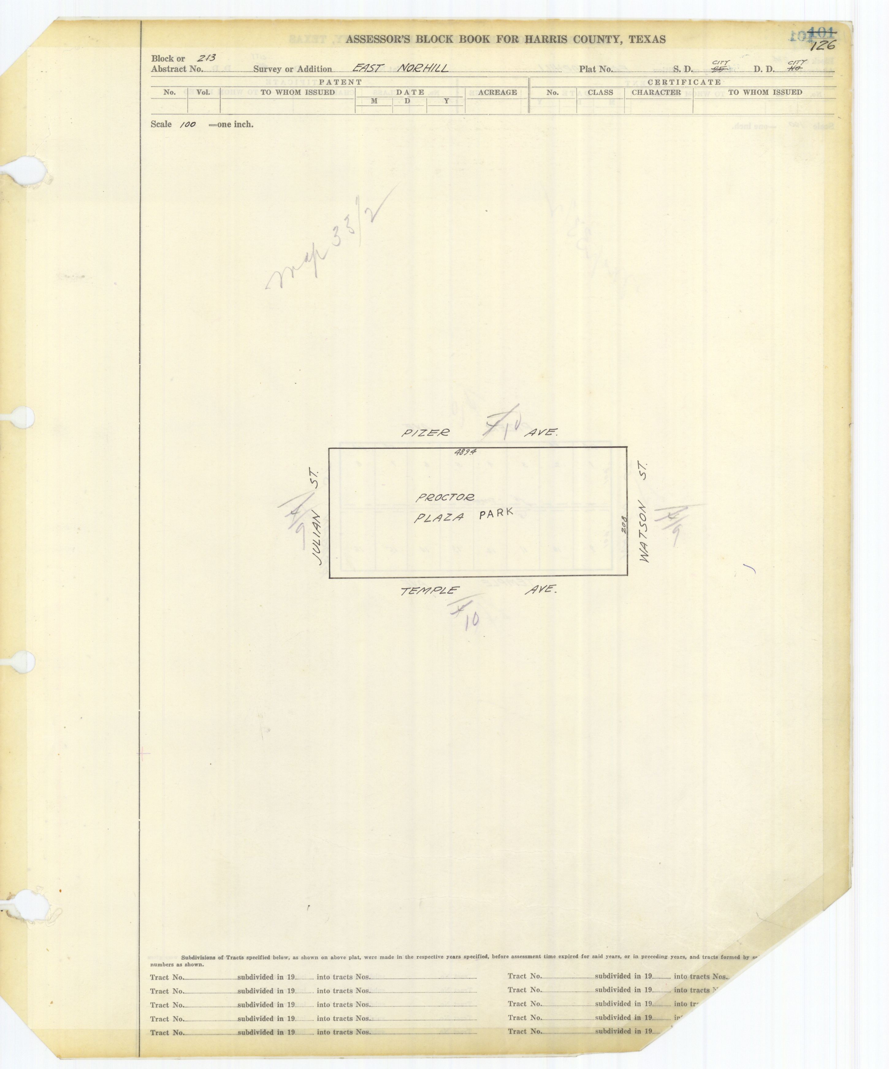
Hogg's interest in weaving green areas into housing developments is apparent. The Norhill esplanades are not unlike those incorporated into Hogg's development of the affluent River Oaks neighborhood. [1] The long green esplanades lend a park-like feel to Norhill Boulevard, a north–south residential street which runs through much of the neighborhood. Hogg also incorporated space for a park into the layout. Sold to the City of Houston for $1.00, this area was developed into Proctor Plaza Park. [1]

Historic District Designation

Through the efforts of Norhill's residents and what is now known as the Norhill Neighborhood Association, (formerly Proctor Plaza Neighborhood Association encompassing North and East Norhill) North Norhill and East Norhill were designated a Historic District in 2000 by the City of Houston and the Houston Archaeological and Historical Commission. [4]

Public schools

Hogg Middle School HoggMS1.jpg
Hogg Middle School

The Norhill neighborhood is within the bounds of the Houston Independent School District. [5]

Elementary schools serving sections of Norhill include Browning (between 11th Street and 14th Street), [6] Field (north of 14th Street), [7] and Travis in Woodland Heights (Norhill areas south of 11th Street). [8] James S. Hogg Middle School, the zoned middle school, [9] offers a magnet program for math, science, technology and robotics,[ citation needed ] while Heights High School (formerly Reagan High School), the zoned high school, [10] features the district's magnet school of computer technology.[ citation needed ]

Infrastructure

Harris Health System (formerly Harris County Hospital District) designated Casa de Amigos Health Center in Northside for the ZIP code 77009. The nearest public hospital is Ben Taub General Hospital in the Texas Medical Center. [11]

Parks and recreation

Proctor Plaza Park is in East Norhill block 213. [12]

Biannual Norhill Bungalow Home Tour

Every other year, the Norhill Neighborhood presents a home tour featuring fine examples of Norhill bungalow architecture as a means to raise funds for the association. The last Norhill Bungalow Home Tour was held on Saturday, October 15, 2022.

Related Research Articles

<span class="mw-page-title-main">Lakewood, Dallas</span>

Lakewood is a neighborhood in East Dallas, Texas (USA). It is adjacent to White Rock Lake and Northeast of Downtown Dallas. Lakewood is bound by Mockingbird Lane to the north, Abrams Road to the west, Gaston Avenue to the south, and White Rock Lake to the east.

<span class="mw-page-title-main">Heights High School</span> Public school (u.s.) school

Heights High School, formerly John H. Reagan High School, is a senior high school located in the Houston Heights in Houston, Texas. It serves students in grades nine through twelve and is a part of the Houston Independent School District.

Houston Heights is a community in northwest-central Houston, Texas, United States. "The Heights" is often referred to colloquially to describe a larger collection of neighborhoods next to and including the actual Houston Heights. However, Houston Heights has its own history, distinct from Norhill and Woodland Heights.

<span class="mw-page-title-main">Rice Military, Houston</span>

Rice Military is a neighborhood in Houston, Texas, United States. The Beer Can House is located in Rice Military.

<span class="mw-page-title-main">Garden Oaks, Houston</span> Place in Texas, United States

Garden Oaks is a neighborhood in Houston, Texas (USA). The neighborhood, located north of Houston Heights, was established in 1937 by Edward L. Crain.

Eastwood is a historic neighborhood in the East End area of Houston, Texas, United States. Eastwood maintains Houston’s largest intact collection of Craftsman, Arts & Crafts, Foursquare and Mission style architecture.

Pecan Park is a neighborhood in Houston, Texas.

<span class="mw-page-title-main">Woodland Heights, Houston</span> Historic Neighborhood in Houston, Texas

The Woodland Heights neighborhood is one of the oldest and most historic in Houston, Texas. It encompasses approximately 2000 homes in the 77009 ZIP code and is bounded on the north by Pecore Street, on the west by Studewood Street, on the east by I-45, and on the south by I-10.

Independence Heights also known as Studewood, is a historic neighborhood in Houston, Texas, bordered by 40th Street east of N. Main and 40th Street west of N. Main to the north, Yale Street to the west, the 610 Loop to the south, and Airline Drive to the east. The Super Neighborhood boundary created by the City of Houston is bordered by Tidwell to the north, Shepherd Drive to the west, the 610 Loop to the south, and Interstate 45 to the east.

<span class="mw-page-title-main">First Ward, Houston</span>

The First Ward of Houston, which is located inside the 610 Loop, is one of the city's historic wards. It was originally the center of the business district for the city, and was strategically located at the intersection of Buffalo Bayou and White Oak Bayou, near an area now known as Allen's Landing. It was one of the original four wards in Houston when it was created in 1840. It was defined as all area within the city limits of Houston north of Congress Street and west of Main Street.

<span class="mw-page-title-main">Montrose, Houston</span> Neighborhood of Houston in Harris, Texas, United States

Montrose is a neighborhood located in west-central Houston, Texas, United States. Montrose is a 7.5-square-mile (19 km2) area roughly bounded by Interstate 69/U.S. Highway 59 to the south, Allen Parkway to the north, South Shepherd Drive to the west, and Taft to Fairview to Bagby to Highway 59 to Main to the east. The area is also referred to as Neartown or Neartown / Montrose.

Near Northside is a historic neighborhood located in Northside, Houston, Texas. Near Northside is primarily occupied by people of Hispanic descent.

<span class="mw-page-title-main">Lindale Park, Houston</span> Neighborhood in Houston, Texas

Lindale Park is a neighborhood in Houston, Texas.

<span class="mw-page-title-main">Harvard Elementary School (Texas)</span> Public primary school in Houston, Texas

Harvard Elementary School is a public primary school in the Houston Heights neighborhood of Houston, Texas, United States. Harvard, a part of the Houston Independent School District, serves grades Pre-Kindergarten through 5.

<span class="mw-page-title-main">Sixth Ward, Houston</span>

The Sixth Ward is a community in Houston, Texas, United States, one of the city's historic wards.

<span class="mw-page-title-main">West End (Houston)</span> Neighborhood in Houston, Texas

West End is a neighborhood in Houston, Texas, United States located along the Washington Avenue Corridor.

Cottage Grove is a community in Houston, Texas.

<span class="mw-page-title-main">Travis Elementary School (Houston)</span> Public elementary school in Texas, USA

William B. Travis Elementary School is a public elementary school in the Woodland Heights area of Houston, Texas. It is a part of the Houston Independent School District (HISD).

Sunset Heights is a neighborhood in northern Houston.

References

  1. 1 2 3 4 5 6 7 City of Houston Historic Designation Report. (1999). Retrieved January 19, 2013 from http://www.norhill.org/wp-content/uploads/2012/02/norhill_historic_designation.pdf Archived 2014-03-03 at the Wayback Machine .
  2. "Texas Archival Resources Online".
  3. Soine, D. (2001, Issue 29). Norhill: Preserving a Piece of Houston's History. American Bungalow. Retrieved January 19, 2013 from http://www.norhill.org/wp-content/uploads/2012/02/Norhill_Bungalow_Magazine_article0001.pdf.
  4. 1 2 Murtha, P. (2010, Vol. 1). Houston’s Norhill Historic District: An Unchanging Neighborhood in Changing Times. Texas Heritage: A Publication of the Texas Historical Foundation. Retrieved January 19, 2013 from http://www.norhill.org/wp-content/uploads/2012/02/Heritage_March_2010_Norhill_article_combined.pdf
  5. "Norhill Historic District" (Archive). City of Houston. Retrieved on February 12, 2016. Text description of the boundaries (Archive) - Inventory of properties (Archive). Some parts of Norhill are not in the historic district: "Historic District Designation Report - Norhill Historic" (Archive). City of Houston. p. 1 states: "The first phase of the develop (which is not part of this Historic District application and is referred to here as South Norhill), included the following boundaries: 11th Street (north); Studewood (west); Michaux (east) and Usener (south)." - Visual boundaries of all of Norhill are seen here: Map of Woodland Heights. Woodland Heights Association. Retrieved on February 12, 2016.
  6. "Browning Elementary School Attendance Zone" (PDF). Houston Independent School District . Retrieved 2019-04-08.
  7. "Field Elementary School Attendance Zone" (PDF). Houston Independent School District . Retrieved 2019-04-08.
  8. "Travis Elementary School Attendance Zone" (PDF). Houston Independent School District . Retrieved 2019-04-08.
  9. "Hogg Middle School Attendance Zone" (PDF). Houston Independent School District . Retrieved 2019-04-08.
  10. "Heights High School Attendance Zone" (PDF). Houston Independent School District . Retrieved 2019-04-08.
  11. "Clinic/Emergency/Registration Center Directory By ZIP Code". Harris County Hospital District. 2001-11-19. Archived from the original on 2001-11-19. Retrieved 2021-04-08. - See ZIP code 77009. See this map for relevant ZIP code.
  12. Harris County Block Book Maps. Volume 62, Page 126. East Norhill, Block 213 (PDF and JPG) - Marked as Proctor Plaza Park

Coordinates: 29°47′24″N95°23′02″W / 29.790°N 95.384°W / 29.790; -95.384