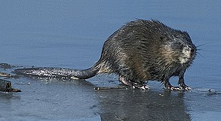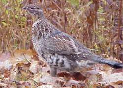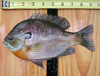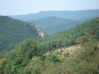
Edwards Run Wildlife Management Area is located on 397 acres (1.6 km2) two miles (3 km) north of Capon Bridge on Cold Stream Road near Cold Stream in Hampshire County, West Virginia. Edwards Run WMA is owned by the West Virginia Division of Natural Resources.

Nathaniel Mountain Wildlife Management Area is located on 10,675 acres (43.20 km2) south of Romney in Hampshire County, West Virginia. The wildlife management area's principle access road is off Grassy Lick Road. Nathaniel Mountain is owned by the West Virginia Division of Natural Resources (WVDNR), and is one of West Virginia's largest wildlife management areas. The WMA was expanded in November 2003 after the WVDNR purchased 1,800 acres (7.3 km2) from the MeadWestvaco Corporation.

The Mingo Oak was a white oak in the U.S. state of West Virginia. First recognized for its age and size in 1931, the Mingo Oak was the oldest and largest living white oak tree in the world until its death in 1938.

The Allegheny Wildlife Management Area is located on 6,202 acres (25.1 km2) on two separate tracts of mixed oak-hickory woodlands in western Mineral County along the Allegheny Front. The large land tract of 5,034 acres (2,037.2 ha) is accessible via Pinnacle Road and Pine Swamp Road four miles (6 km) southwest of Keyser. The smaller tract of 1,168 acres (4.7 km2) is accessed by West Virginia Route 46 and Barnum Road about 6 miles (10 km) north from Elk Garden. The Barnum Road tract consists of old farm fields along the river and the ridgetop, connected by steep slopes.

Anawalt Lake Wildlife Management Area is a 1,792-acre (725 ha) protected area located in McDowell County, West Virginia.The terrain at Anawalt lake is steep, and covered with a second-growth hardwood forest. A mixed oak-hickory forest habitat dominates the drier slopes, with yellow poplar and black cherry in the moister coves.

Beury Mountain Wildlife Management Area is located on 9,232 acres (3,736 ha) near Babcock State Park and New River Gorge National River in Fayette County, West Virginia. Beury Mountain's sloping terrain is covered with mixed hardwoods and oak-hickory second growth woodlands overlooking New River Gorge. Camping is not allowed at Beury Mountain WMA, but is available at nearby Babcock State Park.

T. M. Gathright Wildlife Management Area is a 13,428-acre (54.34 km2) Wildlife Management Area (WMA) in Bath County, Virginia. The property's mountainous terrain includes elevations ranging from 1,400 to 3,600 feet above sea level, and is divided by 2,530-acre (10.2 km2) Lake Moomaw. The northwest boundary is marked at the crest of Allegheny Mountain, along the border between Virginia and West Virginia; additional mountains include Bolar Mountain to the west of the lake, and Coles Mountain to its east. A number of streams flow eastward from the summit, terminating at Mill Creek. The primary habitat is upland hardwood forest including mixed stands of oak and hickory, with tulip poplar in some of the more fertile areas. Small non-forested openings are also maintained for the benefit of wildlife.

White Oak Mountain Wildlife Management Area is a 2,748-acre (11.12 km2) Wildlife Management Area (WMA) in Pittsylvania County, Virginia, United States. More a plateau than a mountain, the area's topography contains elevations ranging from approximately 550 to 900 feet above sea level. The property is nearly two-thirds forest, with timber types including pines and various examples of hardwoods, such as several species of oak. Forest management, annual and perennial plantings, and controlled burns are used to enhance wildlife habitat within the area. The land is dotted with ponds ranging in size from one to five acres, and its northwest boundary is formed by the Banister River.

Burches Run Wildlife Management Area, formerly Burches Run Lake WMA, is located on 55 acres (22 ha) near Wheeling in Marshall County, West Virginia. Until 2005 the wildlife management area contained a lake impounded by a dam at risk of failure. The name change occurred after the dam was removed. The terrain climbs gently above Burches Run and is covered by a mature oak-hickory second-growth forest.

Center Branch Wildlife Management Area is located on 975 acres (395 ha) in Harrison County near Stonewood, West Virginia. The WMA is located on a former strip mine site, and contains several flat benches and high walls. Second growth oak-hickory and mixed hardwoods forests cover much of the land.

Chief Cornstalk Wildlife Management Area is located on 11,772 acres (4,764 ha) in Mason County near Southside, West Virginia. Second growth oak-hickory and mixed hardwoods forests cover much of the rolling and moderately steep slopes. Chief Cornstalk WMA can be reached either on Nine Mile Creek Road off US 35 near Southside, or by Crab Creek Road from State Route 2, south of Gallipolis Ferry.

Peters Mountain is a 52-mile (84 km) mountain in the U.S. states of Virginia and West Virginia. It is located on the border between Alleghany County, VA, Monroe County, WV, Giles Co.,VA, and Craig Co.,VA. Its elevation ranges from 4,073 feet (1,241 m) on the mountaintop to a low of 2,300 feet (700 m). It produces some of the water supply for Monroe County.
Garrett State Forest is a state forest located in the state of Maryland northwest of Oakland.

Hilbert Wildlife Management Area is located in Lincoln County near Sod, West Virginia, less than forty-five minutes drive south of Charleston, the state capital. Located on 289 acres (117 ha), the WMA land is steep and heavily covered with second growth hickory-oak hardwood forest.

Hughes River Wildlife Management Area is located in Wirt County and Ritchie County near Parkersburg, West Virginia. Located on 10,000 acres (4,000 ha) that border both the Little Kanawha River and the Hughes River. The WMA terrain varies from river bottom to steep hillsides covered with second growth oak-hickory hardwood stands and younger pine-hardwood woodlots.

Sand Hill Wildlife Management Area is located near Parkersburg, West Virginia in Wood and Ritchie counties. Sand Hill WMA is located on 1,987 acres (804 ha) of rugged, hilly oak-hickory woodlands interspersed with timber, oil and gas development sites.

Sleepy Creek Wildlife Management Area is located in Morgan and Berkeley Counties in West Virginia's Eastern Panhandle. It encompasses 22,928 acres (92.79 km2), mostly covered with mixed oak and pine forest, although about 3,500 acres (14 km2) are covered with mixed hardwoods. The 205-acre (83 ha) Sleepy Creek Lake is located entirely within the WMA.

Stumptown Wildlife Management Area is located in both Calhoun and Gilmer Counties near the community of Stumptown, West Virginia. Stumptown WMA is located on 1,675 acres (678 ha) of hilly terrain, mostly covered with mixed oak and pine forest, with stands of mixed hardwoods.

Woodrum Lake Wildlife Management Area, is located about 3 miles (4.8 km) east of Romance, West Virginia in Jackson County. Woodrum Lake WMA is located on 1,696 acres (686 ha) of hilly oak-hickory hardwood lots mixed with abandoned farmland.

Spruce Mountain, in eastern West Virginia, USA, is the highest ridge of the Allegheny Mountains. The "whale-backed" ridge extends for only about 16 miles (26 km), from northeast to southwest, but several of its peaks exceed 4,500 feet (1,400 m) in elevation. The summit, Spruce Knob, is celebrated as the highest point in the state as well as the range, which covers parts of four states.


