Mount Pleasant may refer to:

Mason County is a county in the U.S. state of West Virginia. As of the 2010 census, the population was 27,324. Its county seat and largest city is Point Pleasant. The county was founded in 1804 and named for George Mason, delegate to the U.S. Constitutional Convention. Before the Civil War, the county was in the State of Virginia.

Mount Pleasant is a large suburban town in Charleston County, South Carolina, United States. In the Low Country, it is the fourth largest municipality and largest town in South Carolina, and for several years was one of the state's fastest-growing areas, doubling in population between 1990 and 2000. The population was 67,843 at the 2010 census. The estimated population in 2019 was 91,684.

Mount Vernon is an American landmark and former plantation of George Washington, the first President of the United States, and his wife, Martha. The estate is on the banks of the Potomac River in Fairfax County, Virginia, near Alexandria, across from Prince George's County, Maryland. The Washington family had owned land in the area since 1674. Around 1734, they embarked on an expansion of the estate that continued under George Washington, who began leasing the estate in 1754 but did not become its sole owner until 1761.

North Toronto is a former town and informal district located in the northern part of the Old Toronto district in Toronto, Ontario, Canada. Currently occupying a geographically central location within the city of Toronto, the Town of North Toronto was incorporated in 1890, when much of the area was still farmland, and annexed by the old city of Toronto in 1912. The name is still used to refer to the area in general, although Yonge–Eglinton and Midtown Toronto are officially used.

James Pleasants Jr. was an American politician who served in the U.S. Senate from 1819 to 1822 and was the 22nd Governor of Virginia from 1822 to 1825.

Mount Pleasant is a neighborhood in the northwestern quadrant of Washington, D.C. It is bounded by Rock Creek Park to the north and west; Harvard Street NW to the south; and 16th Street NW to the east. It is north of Adams Morgan and west of Columbia Heights. It is home to approximately 10,000 people.

The County of Washington was one of five original political entities within the District of Columbia, the capital of the United States. Formed by the Organic Act of 1801 from parts of Montgomery and Prince George's County, Maryland, Washington County referred to all of the District of Columbia "on the east side of the Potomac, together with the islands therein." The bed of the Potomac River was considered to be part of Washington County as well.

Davisville Village is an area of Toronto near the intersection of Davisville Avenue and Yonge Street. There is a subway station named Davisville at this intersection. The area directly abuts Mount Pleasant Cemetery, and has many massive apartment and condominium complexes built between the 1970s and the 2000s, as well as a number of office buildings. The area is an attractive area in Midtown Toronto between St Clair and Eglinton. Davisville Village is represented at Toronto City Council by Councillor Josh Matlow.

Col. Thomas Lee was a leading political figure in colonial Virginia. He was a member of the Lee family, a political dynasty which included many figures from the colonial era until the late twentieth century. Lee became involved in politics in 1710 and became the resident manager of the Northern Neck Proprietary for Lady Catherine Fairfax. After his father died, Lee inherited land in Northumberland and Charles County. Lee later acquired vast holdings in what are now Arlington, Fairfax, Fauquier, Prince William, and Loudoun Counties. These properties were developed as tobacco plantations.

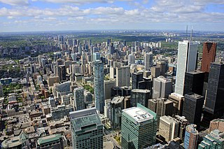
Midtown is one of four central business districts outside the city's downtown core of Toronto, Ontario, Canada. Located in the north of Old Toronto, its borders are roughly defined by St. Clair Avenue to the south and Eglinton Avenue or Lawrence Avenue to the north, Bayview Avenue to the east and Dufferin Street to the west. The central neighbourhood of the area is Yonge–Eglinton.
Robert Selden Garnett was a nineteenth-century politician and lawyer from Virginia. He was the brother of James M. Garnett and the first cousin of Charles F. Mercer. He served as a member of the United States House of Representatives from 1817 to 1827.

Col. Richard Lee II (1647–1715) was a Colonel, planter, politician, and Member of the Upper House and of the King's Council of Virginia.
James Mercer Garnett was a nineteenth-century politician and planter from Virginia. He was the brother of Robert S. Garnett, the first cousin of Charles F. Mercer, and the grandfather of Muscoe Russell Hunter Garnett. He served two terms in the United States House of Representatives from 1805 to 1809.

Kecksburg is an unincorporated community in Mount Pleasant Township, Westmoreland County, Pennsylvania. It is located along PA Route 982 in a heavily wooded area about 30 miles southeast of Pittsburgh at an elevation of 1,209 feet.
Mount Pleasant School or Mt. Pleasant School may refer to:
The Weirton–Steubenville, WV-OH Metropolitan Statistical Area, also known as the Upper Ohio Valley, is a metropolitan statistical area consisting of two counties in the Northern Panhandle of West Virginia and one in Ohio, anchored by the cities of Weirton and Steubenville. As of the 2010 census, the MSA had a population of 124,454. In 2017, the population was estimated to have gone down to 118,250. This puts it at 329th largest in the United States.

John Hartwell Cocke II was an American military officer, planter and businessman. During the War of 1812, Cocke was a brigadier general of the Virginia militia.

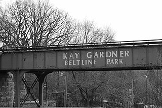
The Beltline Trail is a 9 km cycling and walking rail trail in Toronto, Ontario, Canada. It consists of three sections, the York Beltline Trail west of Allen Road, the Kay Gardner Beltline Park from the Allen to Mount Pleasant Road, and the Ravine Beltline Trail south of Mount Pleasant Cemetery through the Moore Park Ravine. Built on the former right-of-way of the Toronto Belt Line Railway, the linear park passes through the neighbourhoods of Rosedale, Moore Park, Forest Hill, Chaplin Estates, and Fairbank.

The Western Magisterial District is one of three magisterial districts in Jackson County, West Virginia. It was established during a process of redistricting undertaken in the 1990s. In 2010, 10,576 people lived in the district.


