
Frederick County is located in the Commonwealth of Virginia. As of the 2010 census, the population was 78,305. Its county seat is Winchester. The county was formed in 1743 by the splitting of Orange County. It is Virginia's northernmost county.
Mineral County is a county in the U.S. state of West Virginia. It is part of the Cumberland, MD-WV Metropolitan Statistical Area. As of the 2010 census, the population was 28,212. Its county seat is Keyser. The county was founded in 1866.

Bath County is a United States county on the central western border of the Commonwealth of Virginia, on the West Virginia state line. As of the 2010 census, the population was 4,731. In 2018, the population was estimated at 4,292; it is the second-least populous county in Virginia. Bath's county seat is Warm Springs.

Scouting in West Virginia has a long history, from the 1910s to the present day, serving thousands of youth in programs that suit the environment in which they live.

The Monongahela National Forest is a national forest located in the Allegheny Mountains of eastern West Virginia, USA. It protects over 921,000 acres of federally owned land within a 1,700,000 acres proclamation boundary that includes much of the Potomac Highlands Region and portions of 10 counties.

The Eastern Panhandle is the eastern of the two panhandles in the U.S. state of West Virginia. It is a small stretch of territory in the northeast of the state, bordering Maryland and Virginia. Some sources and regional associations only identify the Eastern Panhandle as being composed of Morgan, Berkeley, and Jefferson counties. Berkeley and Jefferson counties are geographically located in the Shenandoah Valley. West Virginia is the only U.S. state with two panhandles; the other is the Northern Panhandle.
Potomac State College is a public college in Keyser, West Virginia. It is part of the West Virginia University system. Potomac State College is located approximately 90 miles east of West Virginia University's campus in Morgantown, West Virginia.

Jennings Randolph Lake is a reservoir of 952 acres (3.85 km2) located on the North Branch Potomac River in Garrett County, Maryland and Mineral County, West Virginia. It is approximately eight miles upstream of Bloomington, Maryland, and approximately five miles north of Elk Garden, West Virginia.
West Virginia Route 972 was a short north–south state highway in Mineral County, West Virginia. It was decommissioned in July 2017, becoming an extension of WV 93. The route connected U.S. Route 220 to U.S. Route 50 in the New Creek Valley. New Creek, West Virginia, the only populated place on the route, is located midway between US 50 and US 220. Route 972 was the highest numbered road in the state of West Virginia. Prior to 1972, WV 972 was part of US 220. In 1972, US 220 was moved to its present alignment east of New Creek.

Minnehaha Springs is an unincorporated community located in Pocahontas County, West Virginia, United States. It was named for the fictional Native American "princess," Minnehaha, and the mineral springs on the Lockridge farm. It is the only community with this name in the United States. On the site of what is now Camp Twin Creeks warm mineral springs can still be found.

The Allegheny Wildlife Management Area is located on 6,202 acres (25.1 km2) on two separate tracts of mixed oak-hickory woodlands in western Mineral County along the Allegheny Front. The large land tract of 5,034 acres (2,037.2 ha) is accessible via Pinnacle Road and Pine Swamp Road four miles (6 km) southwest of Keyser. The smaller tract of 1,168 acres (4.7 km2) is accessed by West Virginia Route 46 and Barnum Road about 6 miles (10 km) north from Elk Garden. The Barnum Road tract consists of old farm fields along the river and the ridgetop, connected by steep slopes.

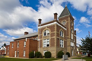
This is a list of the National Register of Historic Places listings in Mineral County, West Virginia.

Botetourt Springs is a mineral spring and was a historical settlement on the border of Roanoke County, Virginia and Botetourt County, Virginia, United States. The spring is located 12 mi (19 km) from Fincastle. Botetourt Springs was originally settled in the mid-18th century, growing as a mineral spring resort during the summer, especially after the 1820s.
The Stony River is a 26.7-mile-long (43.0 km) tributary of the North Branch Potomac River in Grant County in West Virginia's Eastern Panhandle. The Stony River joins with the North Branch at the Mineral County border. Its source lies north of the Dolly Sods Wilderness on the Tucker County border in the Allegheny Front. Tributaries of the Stony River include Mud Run, Red Sea Run, Morgan Run, Helmick Run, Fourmile Run, Laurel Run, and Mill Run.
Mineral City is an unincorporated community in Logan County, West Virginia, United States. Mineral City is located along Huff Creek and West Virginia Route 10 3 miles (4.8 km) east of Man. It is part of the Mallory census-designated place.
The Mineral Daily News-Tribune is an American daily newspaper published in Keyser, West Virginia. It is owned by Gannett.
Society Hill Acres is an unincorporated community in Wood County, West Virginia. It is located within the Mineral Wells CDP, which had a population of 1,870 as of July 1, 2019.

Warwick Village is a neighborhood located in Louisville, Kentucky. Warwick Village is just outside the Watterson Expressway and part of the City of St. Matthews, Its boundaries are roughly New La Grange Rd, Washburn Ave, and Columbia Ave. Many of Warwick Village's streets are surrounded by Warwick Park also known as Warwick-Villa Park Playground.
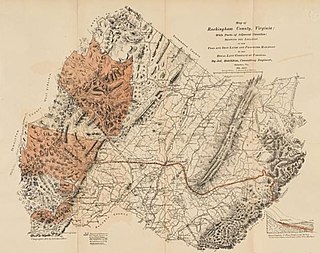
The Royal Land Company of Virginia was set-up in Rockingham County, Virginia, on 27 March 1876, for the purpose of purchasing and developing mineral lands, mines, and manufacturing their products. It purchased, in 1876, from private parties and corporations, the fee simple and leases of numerous tracts of coal, iron, other mineral, and timber lands in Virginia and West Virginia, aggregating 154,997.75 acres (62,725.36 ha).

The Mineral Fire was a wildfire that burned in Coalinga Mineral Springs, west of Coalinga in Fresno, California in the United States. The fire was first reported on July 13, 2020 and burned an estimated 29,667 acres (12,006 ha) and before being fully contained on July 26. The fire threatened the communities of Los Gatos Creek Road from Indian Springs to Union Carbide Road and Bingham Springs. It resulted in the mandatory evacuations of Los Gatos Creek Road and Bingham Springs and led to the complete closure of State Route 198 from Firestone Ave. to the Monterey County Line. They were subsequently lifted on July 20.


