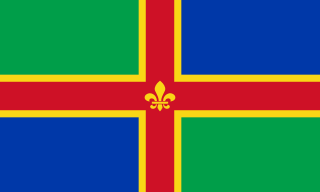
Lincolnshire is a county in eastern England, with a long coastline on the North Sea to the east. It borders Norfolk to the south east, Cambridgeshire to the south, Rutland to the south west, Leicestershire and Nottinghamshire to the west, South Yorkshire to the north west, and the East Riding of Yorkshire to the north. It also borders Northamptonshire in the south for just 20 yards (18 m), England's shortest county boundary. The county town is the city of Lincoln, where the county council has its headquarters.
North Lincolnshire is a unitary authority area in Lincolnshire, England, with a population of 167,446 at the 2011 census. There are three significant towns: Scunthorpe, the administrative centre, Brigg and Barton-upon-Humber.
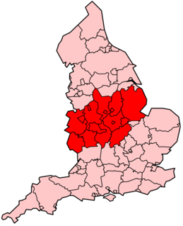
The Midlands is an area of central England that borders the South East, South West, North West, East of England and Yorkshire and the Humber. Its largest city is Birmingham. Broadly corresponding to the early medieval Kingdom of Mercia, it was important in the Industrial Revolution of the 18th and 19th centuries. The Midlands are mostly split between the East Midlands and West Midlands.
The ceremonial counties, also referred to as the lieutenancy areas of England, are areas of England to which a Lord Lieutenant is appointed. Legally the areas in England, as well as in Wales and Scotland, are defined by the Lieutenancies Act 1997 as counties and areas for the purposes of the lieutenancies in Great Britain, in contrast to the areas used for local government. They are also informally known as geographic counties, as often representing more permanent features of English geography, and to distinguish them from counties of England which have a present-day administrative function.

West Lindsey is a local government district in Lincolnshire, England.

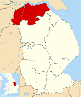
The Parts of Lindsey are a traditional division of Lincolnshire, England, covering the northern part of the county. The Isle of Axholme, which is on the west side of the River Trent, has normally formed part of it. The district's name originated from the Kingdom of Lindsey of Anglo-Saxon times, whose territories were merged with that of Stamford to form Lincolnshire.

The Lincolnshire Wolds is a range of hills in the county of Lincolnshire, England. It is a designated Area of Outstanding Natural Beauty (AONB), and the highest area of land in eastern England between Yorkshire and Kent. They run roughly parallel with the North Sea coast, from the River Humber in the north-west to the edge of the Lincolnshire Fens in the south-east.

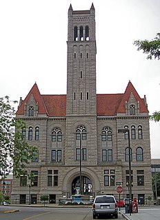
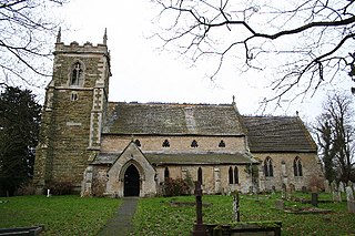
Aswardby is a village situated 4 miles (6 km) north-west from Spilsby, in the East Lindsey district of Lincolnshire, England. It lies north of the A158 and west of the A16 roads. It is in the civil parish of Sausthorpe.
The ceremonial county of Lincolnshire is the second largest of the English counties and one that is predominantly agricultural in character. Despite its relatively large physical area, it has a comparatively small population. The unusually low population density that arises gives the county a very different character from the much more densely populated an urbanised counties of south-east and northern England, and is, in many ways, key to understanding the nature of the county.
Lincolnshire is one of the few counties within the UK that still uses the eleven-plus to decide who may attend grammar school, in common with Buckinghamshire and Kent.
Lincolnshire is a county that is mainly in the East Midlands of, and partly in the Yorkshire and Humber region, England It may also refer to:

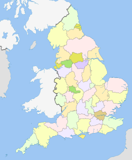
The county of Lincolnshire is divided into nine districts. The districts of Lincolnshire are Lincoln, North Kesteven, South Kesteven, South Holland, Boston, East Lindsey, West Lindsey, North Lincolnshire, and North East Lincolnshire.
Great Carlton is a village and civil parish in the East Lindsey district of Lincolnshire, England. The population of the civil parish at the 2011 census was 136. It is situated 5 miles (8.0 km) southeast from the market town of Louth, Lincolnshire.
The county of Lincolnshire is divided into nine districts. The districts of Lincolnshire are Lincoln, North Kesteven, South Kesteven, South Holland, Boston, East Lindsey, West Lindsey, North Lincolnshire, and North East Lincolnshire.