Southmoor Heights, West Virginia

Last updated
Southmoor Heights
Unincorporated community
USA West Virginia location map.svg
Red pog.svg
Southmoor Heights
Location within the state of West Virginia
Usa edcp location map.svg
Red pog.svg
Southmoor Heights
Southmoor Heights (the US)
Coordinates: 39°13′40″N81°33′29″W / 39.22778°N 81.55806°W / 39.22778; -81.55806 Coordinates: 39°13′40″N81°33′29″W / 39.22778°N 81.55806°W / 39.22778; -81.55806
Country United States
State West Virginia
County Wood
Elevation 814 ft (248 m)
Time zone Eastern (EST) (UTC-5)
  Summer (DST) EDT (UTC-4)
GNIS ID 1556596 [1]

Southmoor Heights is an unincorporated community in Wood County, West Virginia.

Unincorporated area Region of land not governed by own local government

In law, an unincorporated area is a region of land that is not governed by a local municipal corporation; similarly an unincorporated community is a settlement that is not governed by its own local municipal corporation, but rather is administered as part of larger administrative divisions, such as a township, parish, borough, county, city, canton, state, province or country. Occasionally, municipalities dissolve or disincorporate, which may happen if they become fiscally insolvent, and services become the responsibility of a higher administration. Widespread unincorporated communities and areas are a distinguishing feature of the United States and Canada. In most other countries of the world, there are either no unincorporated areas at all, or these are very rare; typically remote, outlying, sparsely populated or uninhabited areas.
Wood County, West Virginia county in West Virginia, United States

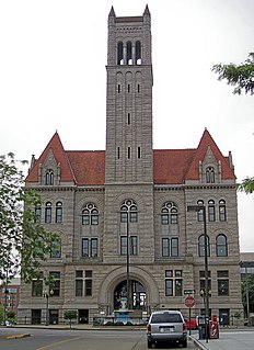
Wood County is a county in the U.S. state of West Virginia. As of the 2010 census, the population was 86,956, making it West Virginia's fifth-most populous county. Its county seat is Parkersburg. The county was formed in 1798 from the western part of Harrison County and named for James Wood, governor of Virginia from 1796 to 1799.

West Virginia State of the United States of America

West Virginia is a state located in the Appalachian region in the Southern United States and is also considered to be a part of the Middle Atlantic States. It is bordered by Pennsylvania to the north, Maryland to the east and northeast, Virginia to the southeast, Kentucky to the southwest, and Ohio to the northwest. West Virginia is the 41st largest state by area, and is ranked 38th in population. The capital and largest city is Charleston.

Related Research Articles

Southmoor village in United Kingdom

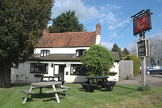
Southmoor is a village in the civil parish of Kingston Bagpuize with Southmoor, about 6 miles (9.7 km) west of Abingdon, Oxfordshire. Historically part of Berkshire, the 1974 boundary changes transferred local government to Oxfordshire.

Kingston Road, Oxford

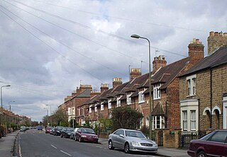
Kingston Road is a road in Oxford, England. It continues north from Walton Street, at the junction with Walton Well Road to the west and St Bernard's Road to the east, running parallel with and to the west of Woodstock Road. Kingston Road is the main road in Walton Manor. At the northern end, there is a staggered junction with Aristotle Lane to the west and Polstead Road to the east. The road continues as Hayfield Road. Southmoor Road and Southmoor Place lead off Kingston Road to the west.

Kingston Bagpuize village in United Kingdom

Kingston Bagpuize is a village in the civil parish of Kingston Bagpuize with Southmoor, about 6 miles (10 km) west of Abingdon. It was part of Berkshire, England, until the 1974 boundary changes transferred it to Oxfordshire.

Kingston Bagpuize with Southmoor is a civil parish in the English county of Oxfordshire, England. The two principal settlements in the parish are the adjacent villages of Kingston Bagpuize and Southmoor. The parish extends north of the villages to the River Thames and south to the River Ock.

Charlton Heights, West Virginia Census-designated place in West Virginia, United States

Charlton Heights is a census-designated place (CDP) in Fayette County, West Virginia, United States. Charlton Heights is located on the north bank of the Kanawha River 4 miles (6.4 km) southwest of Gauley Bridge. Charlton Heights has a post office with ZIP code 25040. As of the 2010 census, its population was 406.

Montgomery Heights, West Virginia Unincorporated community in West Virginia, United States

Montgomery Heights is an unincorporated community in Fayette County, West Virginia, United States. Montgomery Heights is located on the south bank of the Kanawha River 4.5 miles (7.2 km) southeast of Montgomery.

Southmoor Road

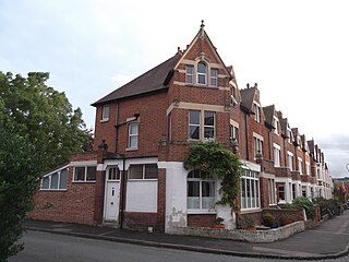
Southmoor Road is a residential road in Walton Manor, north Oxford, England.

Eaton, Oxfordshire human settlement in United Kingdom

Eaton is a hamlet about 4.5 miles (7 km) west of Oxford and about 5 miles (8 km) northwest of Abingdon. Eaton is in the civil parish of Appleton-with-Eaton, which is traditionally part of Berkshire, and now in the ceremonial county of Oxfordshire.

Tyler Heights, West Virginia Unincorporated community in West Virginia, United States

Tyler Heights, also known as Flatwoods, is an unincorporated community in Kanawha County, West Virginia, United States. Tyler Heights is located along West Virginia Route 622 at its junction with West Virginia Route 501, 5 miles (8.0 km) east-northeast of Nitro.

Elmwood Heights, West Virginia Unincorporated community in West Virginia, United States

Elmwood Heights is an unincorporated community in Wood County, West Virginia.

Godby Heights, West Virginia Unincorporated community in West Virginia, United States

Godby Heights is an unincorporated community in Logan County, West Virginia.

Hensley Heights, West Virginia Unincorporated community in West Virginia, United States

Hensley Heights is an unincorporated community in Logan County, West Virginia. The community is located at 758 feet above sea level.

Logan Heights, West Virginia Unincorporated community in West Virginia, United States

Logan Heights is an unincorporated community in Logan County, West Virginia.

Fairview Heights, West Virginia Unincorporated community in West Virginia, United States

Fairview Heights is an unincorporated community in Wood County, West Virginia.

Woodland Heights, West Virginia Unincorporated community in West Virginia, United States

Woodland Heights is an unincorporated community in Wood County, West Virginia.

Sunset Heights, West Virginia Unincorporated community in West Virginia, United States

Sunset Heights is an unincorporated community in Wood County, West Virginia.

Southmoor Academy is a coeducational secondary school and sixth form located in the Grangetown area of Sunderland, Tyne and Wear, England.

References