Okuku, New Zealand

Last updated

Okuku
Okuku, Canterbury.jpg
Okuku countryside
Okuku, New Zealand
Coordinates: 43°14′46″S172°27′07″E / 43.246°S 172.452°E / -43.246; 172.452
Country New Zealand
Region Canterbury
Territorial authority Waimakariri District
Ward
  • Oxford-Ohoka Ward
  • Rangiora-Ashley Ward
Community
  • Oxford-Ohoka Community
  • Rangiora-Ashley Community
Electorates
Government
  Territorial Authority Waimakariri District Council
  Regional council Environment Canterbury
   Mayor of Waimakariri Dan Gordon
  Kaikoura/Waimakariri MPs Stuart Smith/Matthew Doocey
   Te Tai Tonga MP Tākuta Ferris
Area
[1]
  Total834.79 km2 (322.31 sq mi)
Population
 (June 2023) [2]
  Total810
  Density0.97/km2 (2.5/sq mi)

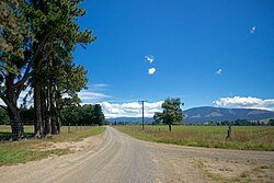
Okuku is a small farming community located in North Canterbury, New Zealand, lying 20 kilometres northwest of Rangiora. Okuku consists of a mix of flat and undulating farmland, and river beds that drain a catchment area in the foothills to the north. Okuku is bounded to the south by the Ashley River / Rakahuri (the major river in the area), to the east by the Okuku River, and to the west by the Garry River. Mount Thomas is the highest point at a height of 1023m. [3]

Demographics

The Okuku statistical area, which also includes Glentui, covers 838.79 km2 (323.86 sq mi). [1] It had an estimated population of 810 as of June 2023, [2] with a population density of 0.97 people per km2.

Historical population
YearPop.±% p.a.
2006495    
2013648+3.92%
2018726+2.30%
Source: [4]

Okuku had a population of 726 at the 2018 New Zealand census, an increase of 78 people (12.0%) since the 2013 census, and an increase of 231 people (46.7%) since the 2006 census. There were 258 households, comprising 360 males and 363 females, giving a sex ratio of 0.99 males per female. The median age was 42.6 years (compared with 37.4 years nationally), with 156 people (21.5%) aged under 15 years, 99 (13.6%) aged 15 to 29, 405 (55.8%) aged 30 to 64, and 66 (9.1%) aged 65 or older.

Ethnicities were 95.5% European/Pākehā, 3.3% Māori, 2.1% Pasifika, 0.8% Asian, and 2.1% other ethnicities. People may identify with more than one ethnicity.

The percentage of people born overseas was 16.9, compared with 27.1% nationally.

Although some people chose not to answer the census's question about religious affiliation, 61.2% had no religion, 28.1% were Christian and 1.2% had other religions.

Of those at least 15 years old, 99 (17.4%) people had a bachelor's or higher degree, and 84 (14.7%) people had no formal qualifications. The median income was $39,400, compared with $31,800 nationally. 117 people (20.5%) earned over $70,000 compared to 17.2% nationally. The employment status of those at least 15 was that 339 (59.5%) people were employed full-time, 96 (16.8%) were part-time, and 18 (3.2%) were unemployed. [4]

Related Research Articles

The Ashley Gorge is a river gorge of the Ashley River / Rakahuri in Canterbury, New Zealand. The river is bridged at the mouth of the gorge by the Inland Scenic Route, formerly designated State Highway 72. A popular picnic ground and camping area is adjacent to the bridge. Upstream of the gorge the river flows through the Lees Valley.

Dipton is a small town in the Southland region of New Zealand. It is located 20 kilometres south of Lumsden and 60 kilometres north of Invercargill. From 20 October 1875 until its closure on 13 December 1982, Dipton was situated on the Kingston Branch railway.

<span class="mw-page-title-main">Maketu</span> Town in the Bay of Plenty, New Zealand

Maketu is a small town on the Western Bay of Plenty coast in New Zealand.

Ōkura is a northern suburb of the North Shore, part of the contiguous metropolitan area in Auckland, New Zealand. It is under the local governance of the Auckland Council. The official name is spelled with a macron.

Wallacetown is a small town in Southland, in the South Island of New Zealand. Wallacetown is to the west of Invercargill, on high ground between the Makarewa and Ōreti rivers, near the Ōreti's estuary. Both rivers are popular for trout and whitebait fishing. It is considered to be a satellite town of Invercargill. It is served by State Highway 99, which skirts the town's northern edge.

Awapuni is a suburb of the New Zealand city of Gisborne, located in the southwest of the city. It is named after the Awapuni lagoon, where the Waipaoa River runs into the ocean. The New Zealand Ministry for Culture and Heritage gives a translation of "blocked-up river" for Awapuni.

<span class="mw-page-title-main">Pataua</span> Place in Northland Region, New Zealand

Pataua is a settlement in Northland Region, New Zealand. It lies at the mouth of the Pataua River on the Pacific Ocean. Pataua North and Pataua South are separated by a footbridge over the estuary.

<span class="mw-page-title-main">Fairy Springs</span> Suburb of Rotorua, New Zealand

Fairy Springs is a suburb of Rotorua in the Bay of Plenty Region of New Zealand's North Island. It is located south of Ngongotahā, west of Koutu, east of Selwyn Heights, and north of Mangakakahi.

Hexton is a village and rural area in the Gisborne District of New Zealand's North Island. It is located north-west of Gisborne City, and includes the settlements of Makauri and Waerengaahika.

Elgin is a suburb of Gisborne, in the Gisborne District of New Zealand's North Island. It is located east and north of Awapuni, south of Te Hapara and west of Gisborne Central.

Maihiihi is a rural community in the Ōtorohanga District and Waikato region of New Zealand's North Island.

<span class="mw-page-title-main">Waitakaruru</span> Locality in Waikato region, New Zealand

Waitakaruru is a rural community in the Hauraki District and Waikato region of New Zealand's North Island. It is situated at the mouth of Waitakaruru River

Kerepehi is a rural community in the Hauraki District and Waikato region of New Zealand's North Island. The alternative spelling Kerepeehi was in use until 1933.

Mararoa is a rural area in New Zealand's Southland District. The area broadly corresponds to the course of the Mararoa River and the eastern part of Te Anau Basin, and includes the Mavora Lakes and the settlement of Manapouri.

<span class="mw-page-title-main">Riversdale, Blenheim</span> Suburb of Blenheim, New Zealand

Riversdale is a suburb of Blenheim, in the Marlborough region of the South Island of New Zealand. Riversdale is separated from the rest of Blenheim by the Ōpaoa River on the north, east and western sides, and by the Main North Line and State Highway 1 on the western side. To the south, Islington is similarly separated on three sides by the Ōpaoa.

Ashley Forest is a forest and a statistical area in the Canterbury Region's Hurunui District on the east coast of New Zealand's South Island. It is located north of the Ashley River / Rakahuri and northeast of the Okuku River.

Levels Valley is a small rural community in the Timaru District, New Zealand. It is located south-west of Pleasant Point and north-west of Timaru. Papaka Stream runs through the area.

Makikihi is a small town in the Waimate District of south Canterbury region of New Zealand's South Island. It is located on State Highway 1 12.2 kilometres south of Saint Andrews, Canterbury, and 15.5 kilometres northeast of Waimate. It is close to the mouth of Makikihi River.

West Plains is a locality in the Southland Region of New Zealand, northwest of Invercargill and north of Otatara. Ōreti River and its tributary Makarewa River flow through the plains. It is part of the Southland Plains.

<span class="mw-page-title-main">Tokerau Beach</span> Place in Northland Region, New Zealand

Tokerau Beach is a settlement on the northwestern side of Doubtless Bay on the Karikari Peninsula of Northland, New Zealand.

References

  1. 1 2 "ArcGIS Web Application". statsnz.maps.arcgis.com. Retrieved 9 January 2024.
  2. 1 2 "Population estimate tables - NZ.Stat". Statistics New Zealand . Retrieved 25 October 2023.
  3. "New Zealand Topographic Map - NZ Topo Map". NZ Topo Map. Retrieved 30 October 2015.
  4. 1 2 "Statistical area 1 dataset for 2018 Census". Statistics New Zealand. March 2020. Okuku (313000). 2018 Census place summary: Okuku