Old Saybrook South Green

Last updated
Old Saybrook South Green
OldSaybrookCT SouthGreenHD 1.jpg
USA Connecticut location map.svg
Red pog.svg
Usa edcp location map.svg
Red pog.svg
Location Old Boston Post Rd., Pennywise Lane, Main St., Old Saybrook, Connecticut
Coordinates 41°17′17″N72°22′36″W / 41.28806°N 72.37667°W / 41.28806; -72.37667 Coordinates: 41°17′17″N72°22′36″W / 41.28806°N 72.37667°W / 41.28806; -72.37667
Area 20 acres (8.1 ha)
Architect Multiple
Architectural style Mid 19th Century Revival, Early Republic, and Colonial
NRHP reference # 76001984 [1]
Added to NRHP September 3, 1976

The Old Saybrook South Green is a 20-acre (8.1 ha) historic district that encompasses the historic town green and nearby streets in Old Saybrook, Connecticut. Established in the 1630s, most of the buildings arrayed around the green were built between 1760 and 1900, and reflect the prosperity of the town, which was a major port and shipbuilding center. The district was listed on the National Register of Historic Places in 1976. [2]

Old Saybrook, Connecticut Town in Connecticut, United States

Old Saybrook is a town in Middlesex County, Connecticut, United States. The population was 10,242 at the 2010 census. It contains the incorporated borough of Fenwick, as well as the census-designated places of Old Saybrook Center and Saybrook Manor.

National Register of Historic Places federal list of historic sites in the United States

The National Register of Historic Places (NRHP) is the United States federal government's official list of districts, sites, buildings, structures, and objects deemed worthy of preservation for their historical significance. A property listed in the National Register, or located within a National Register Historic District, may qualify for tax incentives derived from the total value of expenses incurred preserving the property.

Contents

Description and history

Old Saybrook was founded in 1635 as the starting point of the Saybrook Colony, a Puritan English colonial settlement. It was initially limited to the Saybrook Neck, a peninsula separating North Cove from Long Island Sound on the west side of the Connecticut River. The colony flourished as a shipbuilding and maritime trade center, and its center of civic activity migrated westward to where the town center is now located, on the west side of the cove. The town green was laid out about 1760, and was soon lined with large and architecturally high-quality houses of successful businessmen and politicians. The area saw economic success into the late 19th century, and its architectural heritage reflects this. [2]

Saybrook Colony English possession in North America between 1635 and 1644

The Saybrook Colony was established in late 1635 at the mouth of the Connecticut River in present-day Old Saybrook, Connecticut by John Winthrop, the Younger, son of John Winthrop, the Governor of the Massachusetts Bay Colony. Winthrop the Younger was designated Governor by the original settlers, including Colonel George Fenwick and Captain Lion Gardiner. They claimed possession of the land via a deed of conveyance from Robert Rich, 2nd Earl of Warwick. The colony was named in honor of Lords Saye and Brooke, prominent Parliamentarians and holders of the colony's land grants.

Long Island Sound A tidal estuary on the east coast of the United States

Long Island Sound is a tidal estuary of the Atlantic Ocean, lying between the eastern shores of The Bronx, New York City, southern Westchester County, and Connecticut to the north, and the North Shore of Long Island, to the south. From west to east, the sound stretches 110 miles (177 km) from the East River in New York City, along the North Shore of Long Island, to Block Island Sound. A mix of freshwater from tributaries and saltwater from the ocean, Long Island Sound is 21 miles (34 km) at its widest point and varies in depth from 65 to 230 feet.

Connecticut River river in the New England region of the United States

The Connecticut River is the longest river in the New England region of the United States, flowing roughly southward for 406 miles (653 km) through four states. It rises at the U.S. border with Quebec, Canada, and discharges at Long Island Sound. Its watershed encompasses five U.S. states and one Canadian province, 11,260 square miles (29,200 km2) via 148 tributaries, 38 of which are major rivers. It produces 70% of Long Island Sound's fresh water, discharging at 19,600 cubic feet (560 m3) per second.

The historic district is roughly triangular in shape, bounded by Main Street, Old Boston Post Road, and Pennywise Lane. The oldest building in the district is the c. 1767 Gen. William Hart House, which is also separately listed on the National Register. The c. 1785 Humphrey Pratt Tavern and the James Pharmacy are also individually listed on the National Register. Prominent non-residential buildings include the Gothic Revival Grace Episcopal Church (1872) and the Greek Revival Masonic Hall (c. 1830). [1] [2]

Gen. William Hart House

The Gen. William Hart House is a historic house at 350 Main Street in Old Saybrook, Connecticut. Built in 1767 for a politician and colonial militia leader, it is a good example of Georgian residential architecture. The house was listed on the National Register of Historic Places in 1972, and is a contributing property to the Old Saybrook South Green historic district.

Humphrey Pratt Tavern building in Connecticut, United States

The Humphrey Pratt Tavern is a historic house at 287 Main Street in Old Saybrook, Connecticut. Built in 1785, it was associated with the locally prominent Pratt family for many years, and served as a tavern and stagecoach stop in the 18th and 19th centuries. It was listed on the National Register of Historic Places in 1976.

James Pharmacy building in Connecticut, United States

The James Pharmacy is a historic building at 2 Pennywise Lane in Old Saybrook, Connecticut. Built in an evolutionary manner beginning about 1820, it is significant as the home and workplace of Anna Louise James (1886-1977), who was the first African-American woman pharmacist in the state, and owned the pharmacy for some time. It is also the birthplace and childhood home of author Ann Petry, who was James' niece. The building was listed on the National Register of Historic Places in 1994, and is a contributing element in the Old Saybrook South Green district.

See also

National Register of Historic Places listings in Middlesex County, Connecticut Wikimedia list article

This is a list of the National Register of Historic Places listings in Middlesex County, Connecticut.

Related Research Articles

New Haven Green park in New Haven, Connecticut

The New Haven Green is a 16-acre (65,000 m2) privately owned park and recreation area located in the downtown district of the city of New Haven, Connecticut. It comprises the central square of the nine-square settlement plan of the original Puritan colonists in New Haven, and was designed and surveyed by colonist John Brockett. Today the Green is bordered by the modern paved roads of College, Chapel, Church, and Elm streets. Temple Street bisects the Green into upper (northwest) and lower (southeast) halves.

Gales Ferry, Connecticut human settlement in New London County, Connecticut, United States of America

Gales Ferry is a village in the town of Ledyard, Connecticut, United States. It is located along the eastern bank of the Thames River. The village developed as a result of having a ferry to Uncasville located at this site, and from which the village was named. Gales Ferry was listed as a census-designated place for the 2010 Census, with a population of 1,162.

Poquetanuck, Connecticut human settlement in Connecticut, United States of America

Poquetanuck is a village in the town of Preston, Connecticut, located near the banks of a bay known as Poquetanuck Cove that opens to the Thames River. The village includes the National Register of Historic Places (NRHP)-listed Poquetanuck Village Historic District.

Main Street Historic District (Cromwell, Connecticut) historic district in Cromwell, Connecticut, United States

The Main Street Historic District in Cromwell, Connecticut is roughly bounded by Nooks Hill Rd., Prospect Hill Rd., Wall and West Sts. and New Ln., and Stevens Ln. and Main St.

Brooklyn Green Historic District

Brooklyn Green Historic District is a historic district on Route 169, Route 205, U.S. Route 6, Wolf Den, Brown, Prince Hill, and Hyde Roads in the town of Brooklyn, Connecticut. The district is notable for its Greek Revival, Colonial, and Federal architecture. It was added to the National Register of Historic Places in 1982.

Clinton Village Historic District (Clinton, Connecticut)

The Clinton Village Historic District encompasses the historic portion of the town center of Clinton, Connecticut. It is roughly linear and extends along East Main Street from the Indian River in the west to Old Post Road in the east. The area represents a well-preserved mid-19th century town center, with architecture dating from the late 17th to mid-20th centuries. The district was listed on the National Register of Historic Places in 1994.

The Katharine Hepburn Cultural Arts Center theater in Old Saybrook, Connecticut

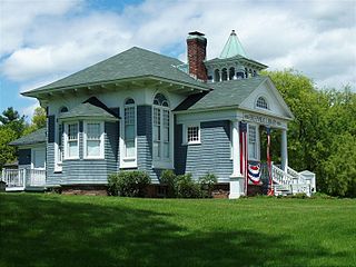
The Katharine Hepburn Cultural Arts Center is a theater in Old Saybrook, Connecticut that opened in 2009. It is the only theater in the world that is named for Katharine Hepburn, the 4-time Academy Award winning actress.

Goshen Historic District (Goshen, Connecticut) human settlement in Connecticut, United States of America

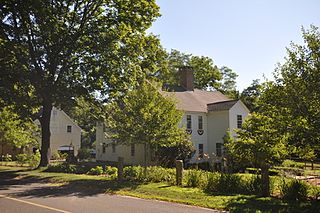
Goshen Historic District is a historic district encompassing the town center village of Goshen, Connecticut. Centered at the junction of Connecticut Routes 4 and 63, the village developed historically as a rural crossroads of two turnpikes, and has retained its rural character. It is dominated by residential architecture from the first half of the 19th century, and includes churches, a store, and the town's former 1895 town hall. It was listed on the National Register of Historic Places in 1982.

Norwichtown human settlement in Connecticut, United States of America

Norwichtown is a historic neighborhood in the city of Norwich, Connecticut. It is generally the area immediately north of the Yantic River between I-395 and Route 169.

Captain Enoch Lord House

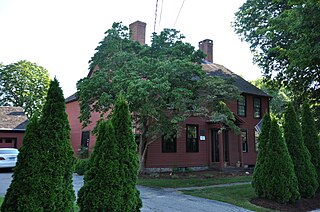
The Captain Enoch Lord House, also known as Red House, is a historic house at 17 Tantummaheag Road in Old Lyme, Connecticut. Built about 1748, the house is significant both for its long historic association with the colonial Lord family, who were influential participants in the founding of both the Connecticut Colony and the Saybrook Colony, and for its transformation in the late 19th century into a summer estate. The house was listed on the National Register of Historic Places in 2007.

Somers Historic District

The Somers Historic District encompasses the historic civic and social center of the town of Somers, Connecticut. It stretches along Main Street, with extensions along Springfield Road and Battle Street, and includes a significant number of vernacular Federal and Greek Revival houses. It includes the town's early churches, as well as important civic buildings, including the town hall and library. The district was listed on the National Register of Historic Places in 1982.

North Cove Historic District

The North Cove Historic District encompasses a historic waterfront community on North Cove Road in Saybrook, Connecticut. Laid out in the 17th century, the area has housing stock mostly built between 1700 and 1855, a period in which it flourished as a port and shipbuilding community. The district was listed on the National Register of Historic Places in 1994.

Black Horse Tavern (Old Saybrook, Connecticut) building in Connecticut, United States

The Black Horse Tavern is a historic building at 175 North Cove Road in Old Saybrook, Connecticut. Built c. 1712 by John Burrows, this 2-1/2 story wood frame structure is one of few early 18th-century buildings still standing in Connecticut, built on land that was among the earliest settled in the area. Now a private residence, it was listed on the National Register of Historic Places in 1978.

Samuel Eliot House

The Samuel Eliot House is a historic house at 500 Main Street in Old Saybrook, Connecticut. Probably built in 1737, it is a well-preserved example of Georgian residential architecture, and one of Old Saybrook's older buildings. The house was listed on the National Register of Historic Places in 1972.

Ambrose Whittlesey House

The Ambrose Whittlesey House is a historic house at 14 Main Street in Old Saybrook, Connecticut that was listed on the National Register of Historic Places in 1985.

Sharon Historic District (Sharon, Connecticut)

The Sharon Historic District encompasses the historic civic center of Sharon, Connecticut. Centered around a mile-long town green are an array of public civic and religious buildings, as well as residences from the 18th to 20th centuries. The area south of the green on South Main Street is lined with country houses developed or improved in the late 19th and early 20th centuries, representing one of the highest concentrations of Colonial Revival estates in the state. The district was listed on the National Register of Historic Places in 1993.

Old Lyme Historic District

The Old Lyme Historic District encompasses the historic village center of Old Lyme, Connecticut. Located mainly on Lyme Street south of Interstate 95, the village, settled in the mid-17th century, has an architectural history dating to the early 18th century, flourishing as a shipbuilding center and home to many ship captains. It was listed on the National Register of Historic Places in 1971.

Westbrook Town Center Historic District historic district on Connecticut, USA

The Westbrook Town Center Historic District encompasses the historic town center of Westbrook, Connecticut. Roughly linear in shape, the district extends along the Boston Post Road, with its focal center at the junction with Essex Road. The area has been a center of civic activity since the early 18th century, even though Westbrook was not incorporated until 1840, and has residential, commercial, civic, and religious architecture covering three centuries. The district was listed on the National Register of Historic Places in 2017.

Guilford Historic Town Center historic district in Connecticut, USA

Guilford Historic Town Center is a large historic district encompassing the entire town center of Guilford, Connecticut. It is centered on the town green, laid out in 1639, and extends north to Interstate 95, south to Long Island Sound, west to the West River, and east to East Creek. It includes more than 600 historic structures, most built between the late 17th and early 20th centuries, reflecting the town's growth and history during that time. It was listed on the National Register of Historic Places in 1976.

North Branford Center Historic District

The North Branford Center Historic District encompasses the historic town center of North Branford, Connecticut. Centered at the junction of North Street and Foxon Road, it has been the center of the town's civic and religious life since the early 18th century. The district includes the town hall, library, Congregational Church, and residential architecture dating to the early days. The district was listed on the National Register of Historic Places in 1999.

References