Outline of Arunachal Pradesh

Last updated

Location of Arunachal Pradesh IN-AR.svg
Location of Arunachal Pradesh

The following outline is provided as an overview of and topical guide to Arunachal Pradesh:

Contents

Arunachal Pradesh northeasternmost state of the Republic of India. Geographically, it is the largest among the North-east Indian states commonly known as the Seven Sister States. As in other parts of Northeast India, the people native to the state trace their origins to the Tibeto-Burman people. Arunachal Pradesh has close to 61,000 square kilometres of forests, and forest products are the next most significant sector of the economy. Among the crops grown here are rice, maize, millet, wheat, pulses, sugarcane, ginger, and oilseeds. Arunachal is also ideal for horticulture and fruit orchards. Its major industries are rice mills, fruit preservation and processing units, and handloom handicrafts. Sawmills and plywood trades are prohibited under law. [1]

General reference

Names

Rankings (amongst India's states and union territories)

Geography of Arunachal Pradesh

Geography of Arunachal Pradesh

Location of Arunachal Pradesh

Environment of Arunachal Pradesh

Natural geographic features of Arunachal Pradesh

Protected areas of Arunachal Pradesh

Regions of Arunachal Pradesh

Ecoregions of Arunachal Pradesh

Administrative divisions of Arunachal Pradesh

Districts of Arunachal Pradesh
Municipalities of Arunachal Pradesh

Cities and towns in Arunachal Pradesh

Demographics of Arunachal Pradesh

Population Growth
YearPop.±%
1961337,000    
1971468,000+38.9%
1981632,000+35.0%
1991865,000+36.9%
20011,098,000+26.9%
20111,382,611+25.9%
Source:Census of India [2]
First ever census was carried out in 1961.

Languages of Arunachal Pradesh in 2001 [3] [4] [5]

  Nyishi (18.94%)
  Adi (17.57%)
  Bengali (8.8%)
  Nepali (8.5%)
  Hindi (7.3%)
  Assamese (4.6%)
  Monpa (5.1%)
  Wancho (4.3%)
  Tangsa (3.1%)
  Mishmi (3.1%)
  Mishing (3.0%)
  Nocte (2.9%)
  Other (11.5%)

Demographics of Arunachal Pradesh according to the 2011 census of India, the total population of Arunachal Pradesh is 13,82,611, of which 21,201,678 (50.54%) are male and 20,745,680 (49.46%) are female, or 978 females per 1000 males.

Religion demographics of Arunachal Pradesh

Religion demographics of Arunachal Pradesh according to the 2011 Indian Census, the religions of Arunachal Pradesh break down as follows: [6]

  • Christian: 418,732 (30.26%)
  • Hindu: 401,876 (29.04%)
  • Others (mostly Donyi-Polo): 362,553 (26.2%)
  • Buddhist: 162,815 (11.76%)
  • Muslim: 27,045 (1.9%)
  • Sikh: 1,865 (0.1%)
  • Jain: 216 (<0.1%)

Language demographics of Arunachal Pradesh

Language demographics of Arunachal Pradesh Arunachal Pradesh is one of the linguistically richest and most diverse regions in all of Asia, being home to at least 30 and possibly as many as 50 distinct languages in addition to innumerable dialects and subdialects thereof.

Government and politics of Arunachal Pradesh

Politics of Arunachal Pradesh

Union government in Arunachal Pradesh

Indian military in Arunachal Pradesh

Branches of the government of Arunachal Pradesh

Government of Arunachal Pradesh

Executive branch of the government of Arunachal Pradesh

Legislative branch of the government of Arunachal Pradesh

Arunachal Pradesh Legislative Assembly

Judicial branch of the government of Arunachal Pradesh

Law and order in Arunachal Pradesh

History of Arunachal Pradesh

History of Arunachal Pradesh

History of Arunachal Pradesh, by period

Prehistoric Arunachal Pradesh

Ancient Arunachal Pradesh

Medieval Arunachal Pradesh

History of Arunachal Pradesh[edit] History of Arunachal Pradesh

History of Arunachal Pradesh, by period[edit] Prehistoric Arunachal Pradesh[edit] Ancient Arunachal Pradesh[edit] Medieval Arunachal Pradesh[edit] Colonial Arunachal Pradesh[edit] Contemporary Arunachal Pradesh[edit] North-East Frontier Agency (1951 to 20 January 1972) – part of Assam Union Territory of Arunachal Pradesh (20 January 1972 to 20 February 1987.) History of Arunachal Pradesh, by region[edit] Historical places in Arunachal Pradesh[edit] Gomsi Ita Fort

Colonial Arunachal Pradesh

Contemporary Arunachal Pradesh

History of Arunachal Pradesh, by region

Historical places in Arunachal Pradesh

History of Arunachal Pradesh, by subject

Culture of Arunachal Pradesh

Culture of Arunachal Pradesh

Art in Arunachal Pradesh

People of Arunachal Pradesh

People of Arunachal Pradesh

Religion in Arunachal Pradesh

Religion in Arunachal Pradesh

Sports in Arunachal Pradesh

Sports in Arunachal Pradesh

Symbols of Arunachal Pradesh

Symbols of Arunachal Pradesh

Economy and infrastructure of Arunachal Pradesh

Economy of Arunachal Pradesh

Education in Arunachal Pradesh

Education in Arunachal Pradesh

See also

Related Research Articles

<span class="mw-page-title-main">Arunachal Pradesh</span> State in northeast India

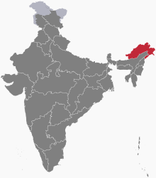
Arunachal Pradesh is a state in northeast India. It was formed from the North-East Frontier Agency (NEFA) region, and India declared it as a state on 20 February 1987. Itanagar is its capital and largest town. It borders the Indian states of Assam and Nagaland to the south. It shares international borders with Bhutan in the west, Myanmar in the east, and a disputed 1,129 km border with China's Tibet Autonomous Region in the north at the McMahon Line. It is disputed by China and claimed as part of Tibet, although this claim is internationally unrecognized and India maintains its control over the state. China occupied some regions of Arunachal Pradesh in 1962 but later withdrew its forces.

<span class="mw-page-title-main">Adi people</span> Ethnic group of Tibet and Northeast India

The Adi people are one of the most populous groups of indigenous peoples in the Indian state of Arunachal Pradesh. A few thousand are also found in the Tibet Autonomous Region, where they are called the Lhoba together with some of the Nyishi people, Na people, Mishmi people and Tagin people.

<span class="mw-page-title-main">Dibang Valley district</span> District of Arunachal Pradesh in India

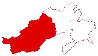
Dibang Valley (Pron:/dɪˈbæŋ/) is a district of Arunachal Pradesh named after the Dibang River or the Talon as the Mishmis call it. It is the least populated district in India and has an area of 9,129 square kilometres (3,525 sq mi).

<span class="mw-page-title-main">Lower Subansiri district</span> District in Arunachal Pradesh, India

Lower Subansiri district (Pron:/su:bənˈsɪɹi/) is one of the 25 administrative districts of the state of Arunachal Pradesh in northeastern India.

<span class="mw-page-title-main">Lohit district</span> District of Arunachal Pradesh in India

Lohit is an administrative district in the state of Arunachal Pradesh in India. The district headquarters is located at Tezu. As of 2011 it is the third most populous district of Arunachal Pradesh, after Papum Pare and Changlang.

<span class="mw-page-title-main">West Siang district</span> District of Arunachal Pradesh in India

West Siang district is an administrative district in the state of Arunachal Pradesh in India.

<span class="mw-page-title-main">Anini</span> District Headquarters in Arunachal Pradesh, India

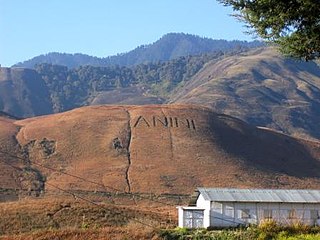
Anini is the headquarters of the Dibang Valley district in the state of Arunachal Pradesh in Northeast India. Anini was also the district headquarters of the undivided Dibang Valley district. Most of this location's population consists of the Idu Mishmi tribal people. Due to its remote location, Anini remains a small and underdeveloped town. However, it still has basic road and air links to the rest of India. The town is fully dependent on the nearest major settlement, Roing, which is in the Lower Dibang Valley District, for most commercial needs.

<span class="mw-page-title-main">Pasighat</span> Town in Arunachal Pradesh, India

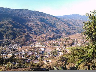
Pasighat is the headquarters of East Siang district in the Indian state of Arunachal Pradesh. Situated at the eastern foothills of the Himalayas at 155 meters (509 ft) above mean sea level, Pasighat is Arunachal's oldest town. The Government of India included Pasighat in the Smart Cities Mission development scheme in June 2017.

Tani, is a branch of Tibeto-Burman languages spoken mostly in Arunachal Pradesh, Assam, and neighboring regions.

The Roman Catholic Diocese of Itanagar in India was created on 7 December 2005 by splitting it from the Diocese of Tezpur. It is a suffragan diocese of the Archdiocese of Guwahati. Its first bishop was John Thomas Kattrukudiyil. The St. Joseph's church in Itanagar is the cathedral of the diocese.

<span class="mw-page-title-main">Raj Bhavan, Itanagar</span> Building

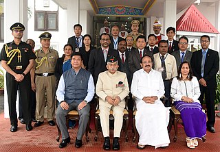
Raj Bhavan is the official residence of the governor of Arunachal Pradesh. It is located in the capital city of Itanagar, Arunachal Pradesh. The present governor of Arunachal Pradesh is Kaiwalya Trivikram Parnaik.

<span class="mw-page-title-main">North-East Frontier Agency</span> Political division in India

The North-East Frontier Agency (NEFA), originally known as the North-East Frontier Tracts (NEFT), was one of the political divisions in British India, and later the Republic of India until 20 January 1972, when it became the Union Territory of Arunachal Pradesh and some parts of Assam. Its administrative headquarters was Shillong. It received the status of State on 20 February 1987.

<span class="mw-page-title-main">Lower Dibang Valley district</span> District of Arunachal Pradesh in India

The Lower Dibang Valley district (Pron:/dɪˈbæŋ/) is an administrative district in the state of Arunachal Pradesh in northeastern India. It is the tenth least populous district in the country.

<span class="mw-page-title-main">Arunachal West Lok Sabha constituency</span> Lok Sabha Constituency in Arunachal Pradesh

Arunachal West Lok Sabha constituency is one of the two Lok Sabha constituencies in Arunachal Pradesh state in northeastern India. This constituency covers the entire Tawang, West Kameng, East Kameng, Papum Pare, Lower Subansiri, Kurung Kumey, Upper Subansiri and West Siang districts.

<span class="mw-page-title-main">Arunachal East Lok Sabha constituency</span> Lok Sabha Constituency in Arunachal Pradesh

Arunachal East Lok Sabha constituency is one of the two Lok Sabha constituencies in Arunachal Pradesh state in northeastern India. This constituency covers the entire Upper Siang, East Siang, Dibang Valley, Lower Dibang Valley, Lohit, Anjaw, Changlang and Tirap districts.

The Trans-Arunachal Highway (TAH), which includes an existing 1,811 km (1,125 mi) route comprising NH-13 and parts of NH-15, NH-215 and SH-25, is an under-construction 2-lane more than 2,407 km (1,496 mi) long highway passing through 16 districts in Arunachal Pradesh state in India. It runs from LAC in Tawang in northwest to Kanubari in southeast at tri-junction of Assam-Nagaland-Arunachal Pradesh. It connects at least 16 districts of Arunachal Pradesh.

<span class="mw-page-title-main">Palin, Arunachal Pradesh</span> City in Arunachal Pradesh, India

Palin is a hill station and the headquarter of Kra Daadi district in Arunachal Pradesh. It is inhabited by Nyishi tribe of Arunachal Pradesh and has a population of 5816 according to the 2001 census. The incumbent MLA from Palin constituency is Balo Raja.

Arunachal Frontier Highway (AFH), officially notified as the National Highway NH-913 and also called Bomdila-Vijaynagar Highway (BVH), connecting Bomdila Airstrip ALG & HQ in northwest to Vijaynagar Airstrip ALG & HQ in southeast via Nafra HQ-Sarli HQ-Huri Helipad ALG & HQ-Nacho HQ-Mechuka Airstrip ALG & HQ-Monigong HQ-Jido -Hunli HQ-Hayuliang Airstrip ALG HQ-Chenquenty-Hawai HQ-Miao HQ including 800 km greenfield section and network of new tunnels & bridges, is a 2-lane paved-shoulder under-construction national highway along the India-China LAC-McMahon Line border in the Indian state of Arunachal Pradesh. The 1,748 km-long (1,086 mi) highway itself will cost 27,000 crore and total cost including 6 additional inter-corridors is 40,000 crore. In some places, this highway will run as close as 20 km from the LAC. To be constructed by MoRTH in 9 packages, all packages will be approved by the end of fy 2024-25 and construction will be completed in 2 years by 31 March 2027. Of the total route, 800km is greenfield, rest brownfield will be upgraded and tunnels will be built. This highway in the north & east Arunachal along the China border, would complement the Trans-Arunachal Highway and the Arunachal East-West Corridor as major highways spanning the whole state, pursuing the Look East connectivity policy.

<span class="mw-page-title-main">Geography of Arunachal Pradesh</span>

Arunachal Pradesh is primarily a hilly tract nestled in the foothills of the Himalayas in northeast India. It is spread over an area of 83,743 km2 (32,333 sq mi). 98% of the geographical area is land out of which 80% is forest cover; 2% is water. River systems in the region, including those from the higher Himalayas and Patkoi and Arakan Ranges, eventually drain into the Brahmaputra River.

References

  1. Arunachal Pradesh Economy, This Is My India
  2. "Census Population" (PDF). Census of India. Ministry of Finance India. Archived from the original (PDF) on 19 December 2008. Retrieved 18 December 2008.
  3. "Distribution of the 22 Scheduled Languages". Census of India. Registrar General & Census Commissioner, India. 2001. Retrieved 4 January 2014.
  4. "Census Reference Tables, A-Series - Total Population". Census of India. Registrar General & Census Commissioner, India. 2001. Retrieved 4 January 2014.
  5. Census 2011 Non scheduled languages
  6. "Census of India – Religious Composition". Government of India, Ministry of Home Affairs. Retrieved 27 August 2015.

Gnome-globe.svg Wikimedia Atlas of Arunachal Pradesh