This article needs additional citations for verification .(May 2011) |

The Pacific Border province is a physiographic province of the Physiographic regions of the world physical geography system. [1]
This article needs additional citations for verification .(May 2011) |
The Pacific Border province is a physiographic province of the Physiographic regions of the world physical geography system. [1]
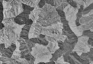
The Pacific Border province encompasses most of the North American Pacific Coast, with the southern end at the start of the Lower California-Peninsular Ranges Province in Southern California. The Pacific Border province is in the larger Pacific Mountain System Division—Region. [1] The region is prone to earthquakes, residing along the eastern edge of the Pacific Ring of Fire.
The Pacific Border province contains seven separate and smaller sections: [1]

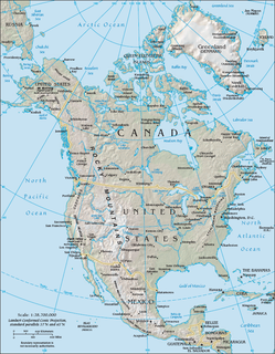
The term "United States", when used in the geographical sense, is the contiguous United States, the state of Alaska, the island state of Hawaii, the five insular territories of Puerto Rico, Northern Mariana Islands, U.S. Virgin Islands, Guam, and American Samoa, and minor outlying possessions. The United States shares land borders with Canada and Mexico and maritime borders with Russia, Cuba, The Bahamas, and other countries, in addition to Canada and Mexico. The northern border of the United States with Canada is the world's longest bi-national land border.

California is a U.S. state on the western coast of North America. Covering an area of 163,696 sq mi (423,970 km2), California is among the most geographically diverse states. The Sierra Nevada, the fertile farmlands of the Central Valley, and the arid Mojave Desert of the south are some of the major geographic features of this U.S. state. It is home to some of the world's most exceptional trees: the tallest, most massive, and oldest. It is also home to both the highest and lowest points in the 48 contiguous states. The state is generally divided into Northern and Southern California, although the boundary between the two is not well defined. San Francisco is decidedly a Northern California city and Los Angeles likewise a Southern California one, but areas in between do not often share their confidence in geographic identity. The US Geological Survey defines the geographic center of the state at a point near North Fork, California.
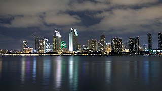
Southern California is a geographic and cultural region that generally comprises the southern portion of the U.S. state of California. It includes the Los Angeles metropolitan area, the second most populous urban agglomeration in the United States. The region generally contains ten of California's 58 counties: Imperial, Kern, Los Angeles, Orange, Riverside, San Bernardino, San Diego, Santa Barbara, San Luis Obispo and Ventura counties.

The Great Basin is the largest area of contiguous endorheic watersheds – those with no outlets – in North America. It spans nearly all of Nevada, much of Utah, and portions of California, Idaho, Oregon, Wyoming, and Baja California, Mexico. It is noted for both its arid climate and the basin and range topography that varies from the North American low point at Badwater Basin in Death Valley to the highest point of the contiguous United States, less than 100 miles (160 km) away at the summit of Mount Whitney. The region spans several physiographic divisions, biomes, ecoregions, and deserts.

The Pacific Coast Ranges are the series of mountain ranges that stretch along the West Coast of North America from Alaska south to Northern and Central Mexico. Although they are commonly thought to be the westernmost mountain range of the continental United States and Canada, the geologically distinct Insular Mountains of Vancouver Island lie further west.

The Basin and Range Province is a vast physiographic region covering much of the inland Western United States and northwestern Mexico. It is defined by unique basin and range topography, characterized by abrupt changes in elevation, alternating between narrow faulted mountain chains and flat arid valleys or basins. The physiography of the province is the result of tectonic extension that began around 17 million years ago in the early Miocene epoch.
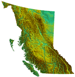
British Columbia is the westernmost province of Canada, bordered by the Pacific Ocean. With an area of 944,735 km2 (364,764 sq mi) it is Canada's third-largest province. The province is almost four times the size of the United Kingdom and larger than every United States state except Alaska. It is bounded on the northwest by the U.S. state of Alaska, directly north by Yukon and the Northwest Territories, on the east by Alberta, and on the south by the U.S. states of Washington, Idaho, and Montana. Formerly part of the British Empire, the southern border of British Columbia was established by the 1846 Oregon Treaty. The province is dominated by mountain ranges, among them the Canadian Rockies but dominantly the Coast Mountains, Cassiar Mountains, and the Columbia Mountains. Most of the population is concentrated on the Pacific coast, notably in the area of Vancouver, located on the southwestern tip of the mainland, which is known as the Lower Mainland. It is the most mountainous province of Canada.
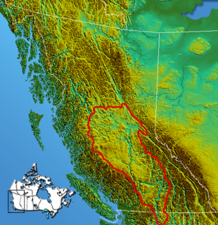
The Interior Plateau comprises a large region of the Interior of British Columbia, and lies between the Cariboo and Monashee Mountains on the east, and the Hazelton Mountains, Coast Mountains and Cascade Range on the west. The continuation of the plateau into the United States is known there as the Columbia Plateau.
The Pacific Cordillera, also known as the Western Cordillera or simply The Cordillera, is a top-level physiographic region of Canada, referring mainly to the extensive cordillera system in Western and Northwestern Canada that constitutes the northern part of the North American Cordillera. The mountain ranges in this region were covered during the Pleistocene by the Cordilleran Ice Sheet, the extent of which gives perspective on the geographic extent of this region. The cordillera extends from the Alaska's Brooks and Alaska Ranges, southeast through most of the Yukon and British Columbia as well as the southwestern fringe of Northwest Territories and Alberta, to stretch its margin beyond the Canada–United States border with five extensive lobes reaching into the mountain valleys of Montana and Washington.

The Boundary Ranges, also known in the singular and as the Alaska Boundary Range, are the largest and most northerly subrange of the Coast Mountains. They begin at the Nass River, near the southern end of the Alaska Panhandle in the Canadian province of British Columbia and run to the Kelsall River, near the Chilkoot Pass, beyond which are the Alsek Ranges of the Saint Elias Mountains, and northwards into the Yukon Territory flanking the west side of the Yukon River drainage as far as Champagne Pass, north of which being the Yukon Ranges. To their east are the Skeena Mountains and Stikine Plateau of the Interior Mountains complex that lies northwest of the Interior Plateau; the immediately adjoining subregion of the Stikine Plateau is the Tahltan Highland. To their northeast is the Tagish Highland, which is a subregion of the Yukon Plateau. Both highlands are considered in some descriptions as included in the Coast Mountains. The Alexander Archipelago lies offshore and is entirely within Alaska.
The North American Cordillera, sometimes also called the Western Cordillera of North America, the Western Cordillera or the Pacific Cordillera, is the North American portion of the American Cordillera, the mountain chain system (cordillera) along the western coast of the Americas. The North American Cordillera covers an extensive area of mountain ranges, intermontane basins and plateaus in Western/Northwestern Canada, Western United States and Mexico, including much of the territory west of the Great Plains.
The Willapa Hills is a geologic, physiographic, and geographic region in southwest Washington. When described as a physiographical province, the Willapa Hills are bounded by the Pacific Ocean to the west, the Columbia River to the south, the Olympic Mountains to the north, and the Cascade Range to the east. Some definitions place the Puget Lowland physiographic province east of the Willapa Hills. Included within the province are the Black Hills, the Doty Hills, and a number of broad river valleys, some of which open up into broad estuaries on the Pacific such as Grays Harbor and Willapa Bay. Other definitions do not include the Black Hills. The USGS GNIS defines the Willapa Hills as bounded by the Columbia River to the south and the Chehalis River to the north, without giving specific east and west bounds. The Willapa Hills are one of the Pacific Coast Ranges, which continue north as the Olympic Mountains and south, across the Columbia River, as the Oregon Coast Range.

The Coast Ranges of California span 400 miles (644 km) from Del Norte or Humboldt County, California, south to Santa Barbara County. The other three coastal California mountain ranges are the Transverse Ranges, Peninsular Ranges and the Klamath Mountains.

The Oregon Coast Range, often called simply the Coast Range and sometimes the Pacific Coast Range, is a mountain range, in the Pacific Coast Ranges physiographic region, in the U.S. state of Oregon along the Pacific Ocean. This north-south running range extends over 200 miles (320 km) from the Columbia River in the north on the border of Oregon and Washington, south to the middle fork of the Coquille River. It is 30 to 60 miles wide and averages around 1,500 feet (460 m) in elevation above sea level. The coast range has three main sections, a Northern, Central, and Southern.

The Rocky Mountain Floristic Region, also known as the Rocky Mountain Floristic Province, is a floristic region within the Holarctic Kingdom in western North America delineated by Armen Takhtajan and Robert F. Thorne. The region extends from Kodiak Island in Alaska to the San Francisco Bay Area and Sierra Nevada in California. The Vancouverian Province comprises the coastal part of the region for its entire length, including the Pacific Coast Ranges, and the Rocky Mountain Province includes the Rocky Mountains and associated ranges. There are no endemic plant families in the region but many endemic genera and species.
The Datil-Mogollon Section is a physiographic section of the larger Colorado Plateau province, which in turn is part of the larger Intermontane Plateaus physiographic division. It is a transitional area between the Basin and Range Province and the Colorado Plateau Province. It is also a newly defined unit that includes the southern part of the area previously designated the Datil Section.

The following outline is provided as an overview of and topical guide to the U.S. state of California.

The Fraser Lowland is a landform and physiographic region in the Pacific Northwest of North America, shared between the Canadian province of British Columbia and the U.S. state of Washington. The region includes much of the Lower Mainland region of British Columbia, and the coastal plains of Washington's Whatcom County. As a physiographic region, the Fraser Lowland is part of the Georgia Depression, which in turn is part of the Coastal Trough.

The Cascade-Sierra province is a physiographic region of mountains in the western United States, east and adjacent to Pacific Border province and west and adjacent to the Basin and Range Province and Columbia Plateau Province.

The San Felipe Fault Zone is an active Quaternary fault zone made up of continuous right-lateral fault strands]. It is a part of the San Andreas fault system and it is located in the western Salton Trough spanning three counties: Imperial, Riverside, and San Diego county, California. It is hypothesized to have originated during the early Pleistocene period.
| Branches |
| ||||||
|---|---|---|---|---|---|---|---|
| Techniques and tools | |||||||
| Institutions | |||||||
| Education | |||||||
 | ||
Coordinates: 42°N124°W / 42°N 124°W
| | This article about a specific United States location is a stub. You can help Wikipedia by expanding it. |