an academic discipline– a body of knowledge given to − or received by − a disciple (student); a branch or sphere of knowledge, or field of study, that an individual has chosen to specialize in. Modern geography is an all-encompassing discipline that seeks to understand the Earth and its human and natural complexities − not merely where objects are, but how they have changed and come to be. Geography has been called 'the world discipline'.[2]
a field of science– widely recognized category of specialized expertise within science, and typically embodies its own terminology and nomenclature. This field will usually be represented by one or more scientific journals, where peer-reviewed research is published. There are many geography-related scientific journals.
a natural science– field of academic scholarship that explores aspects of the natural environment (physical geography).
a social science– field of academic scholarship that explores aspects of human society (human geography).
an interdisciplinary field– a field that crosses traditional boundaries between academic disciplines or schools of thought, as new needs and professions have emerged. Many of the branches of physical geography are also branches of Earth science
Branches of geography
As "the bridge between the human and physical sciences," geography is divided into two main branches:
Physical geography– examines the natural environment and how the climate, vegetation and life, soil, water, and landforms are produced and interact.[5]
Fields of physical geography
Geomorphology– study of landforms and the processes that them, and more broadly, of the processes controlling the topography of any planet. It seeks to understand why landscapes look the way they do, to understand landform history and dynamics, and to predict future changes through field observation, physical experiments, and numerical modeling.
Hydrology– study water movement, distribution, and quality throughout the Earth, including the hydrologic cycle, water resources, and environmental watershed sustainability.
Glaciology– study of glaciers, or more generally ice and natural phenomena that involve ice.
Oceanography– studies a wide range of topics about oceans, including marine organisms and ecosystem dynamics; ocean currents, waves, and geophysical fluid dynamics; plate tectonics and the geology of the sea floor; and fluxes of various chemical substances and physical properties within the ocean and across its boundaries.
Biogeography– study of species distribution spatially and temporally. Over areal ecological changes, it is also tied to the concepts of species and their past, or present living 'refugium', their survival locales, or their interim living sites. It aims to reveal where organisms live and at what abundance.[6]
Climatology– study of climate, scientifically defined as weather conditions averaged over a period of time.[7]
Meteorology is the interdisciplinary scientific study of the atmosphere that focuses on weather processes and short-term forecasting (in contrast with climatology).
Palaeogeography– study of what geography was in times past, most often concerning the physical landscape and the human or cultural environment.
Coastal geography– study of the dynamic interface between the ocean and the land, incorporating both the physical geography (i.e., coastal geomorphology, geology, and oceanography) and the human geography (sociology and history) of the coast. It involves understanding coastal weathering processes, particularly wave action, sediment movement, and weather, as well as how humans interact with the coast.
Quaternary science– focuses on the Quaternary period, which encompasses the last 2.6million years, including the last ice age and the Holocene period.
Landscape ecology– the relationship between spatial patterns of urban development and ecological processes on many landscape scales and organizational levels.[9][10][11]
Human geography– one of the two main subfields of geography is the study of human use and understanding of the world and the processes that have affected it. Human geography broadly differs from physical geography in that it focuses on the built environment and how space is created, viewed, and managed by humans, as well as the influence humans have on the space they occupy.[5]
Fields of human geography
Cultural geography– study of cultural products and norms and their variations across and relations to spaces and places. It focuses on describing and analyzing the ways language, religion, economy, government, and other cultural phenomena vary or remain constant from one place to another and on explaining how humans function spatially.[12]
Children's geographies– study of places and spaces of children's lives, characterized experientially, politically and ethically. Children's geographies rest on the idea that children as a social group share certain characteristics that are experientially, politically, and ethically significant and worthy of study. The pluralization in the title is intended to imply that children's lives will be markedly different in differing times and places and in differing circumstances such as gender, family, and class. The range of foci within children's geographies includes:
Animal geographies– studies the spaces and places occupied by animals in human culture because social life and space are heavily populated by animals of many different kinds and in many differing ways (e.g., farm animals, pets, wild animals in the city). Another impetus that has influenced the development of the field is ecofeminist and other environmentalist viewpoints on nature-society relations (including questions of animal welfare and rights).
Language geography– studies the geographic distribution of language or its constituent elements. There are two principal fields of study within the geography of language:
Geography of languages – deals with the distribution through history and space of languages,[13]
Sexuality and space– encompasses all relationships and interactions between human sexuality, space, and place, including the geographies of LGBT residence, public sex environments, sites of queer resistance, global sexualities, sex tourism,[19] the geographies of prostitution and adult entertainment, use of sexualised locations in the arts,[20][21] and sexual citizenship.[22]
Religion geography– study of the influence of geography, i.e., place and space, on religious belief.[23]
Development geography– study of the Earth's geography concerning its inhabitants' standard of living and quality of life. Measures development by looking at economic, political, and social factors and seeks to understand both the geographical causes and consequences of varying development, in part by comparing More Economically Developed Countries (MEDCs) with Less Economically Developed Countries (LEDCs).
Economic geography– study of the location, distribution, and spatial organization of economic activities worldwide. Subjects of interest include but are not limited to the location of industries, economies of agglomeration (also known as "linkages"), transportation, international trade and development, real estate, gentrification, ethnic economies, gendered economies, core-periphery theory, the economics of urban form, the relationship between the environment and the economy (tying into a long history of geographers studying culture-environment interaction), and globalization.
Marketing geography– a discipline within marketing analysis that uses geolocation (geographic information) in the process of planning and implementation of marketing activities.[24] It can be used in any aspect of the marketing mix – the product, price, promotion, or place (geo-targeting).
Transportation geography– branch of economic geography that investigates spatial interactions between people, freight, and information. It studies humans and their use of vehicles or other modes of traveling and how flows of finished goods and raw materials service markets.
Health geography– application of geographical information, perspectives, and methods to the study of health, disease, and health care, to provide a spatial understanding of a population's health, the distribution of disease in an area, and the environment's effect on health and disease. It also deals with accessibility to health care and spatial distribution of health care providers.
Time geography– study of the temporal factor on spatial human activities within the following constraints:
Authority - limits of accessibility to certain places or domains placed on individuals by owners or authorities
Capability - limitations on the movement of individuals based on their nature. For example, movement is restricted by biological factors, such as the need for food, drink, and sleep
Coupling - restraint of an individual, anchoring him or her to a location while interacting with other individuals to complete a task
Historical geography– the study of the human, physical, fictional, theoretical, and "real" geographies of the past. It seeks to determine how cultural features of various societies across the planet emerged and evolved by understanding how a place or region changes through time, including how people have interacted with their environment and created the cultural landscape.
Political geography– study of the spatially uneven outcomes of political processes and how political processes are themselves affected by spatial structures. The inter-relationships between people, state, and territory.
Electoral geography– study of the relationship between election results and the regions they affect (such as the environmental impact of voting decisions), and of the effects of regional factors upon voting behavior.
Geopolitics– analysis of geography, history, and social science concerning spatial politics and patterns at various scales, ranging from the level of the state to international.
Strategic geography– concerned with the control of, or access to, spatial areas that affect the security and prosperity of nations.
Military geography– applying geographic tools, information, and techniques to solve military problems in peacetime or war.
Population geography– study of how spatial variations in the distribution, composition, migration, and growth of populations are related to the nature of places.
Tourism geography– study of travel and tourism, as an industry and as a social and cultural activity, and their effect on places, including the environmental impact of tourism, the geographies of tourism and leisure economies, answering tourism industry and management concerns and the sociology of tourism and locations of tourism.
Urban geography– the study of urban areas, in terms of concentration, infrastructure, economy, and environmental impacts.
Approaches of human geography
Behavioral geography– Approach to human geography that examines human behavior using a disaggregate approach
Cognitive geography– Interdisciplinary study of cognitive science and geography
Critical geography– Variant of social science that seeks to interpret and change the world
Feminist geography– Approach in human geography which applies the theories, methods and critiques of feminism
Integrated geography– branch of geography that describes the spatial aspects of interactions between humans and the natural world. It requires an understanding of the dynamics of geology, meteorology, hydrology, biogeography, ecology, and geomorphology, as well as the ways in which human societies conceptualize the environment.
Technical geography
Technical geography– branch of geography and the discipline of studying, developing, and applying methods to gather, store, process, and deliver geographic or spatially referenced information. It is a widespread interdisciplinary field that includes the tools and techniques used in land surveying, remote sensing, cartography, Geographic Information Systems (GIS), Global Navigation Satellite Systems, photogrammetry, and related forms of earth mapping.
Cyber geography– study of the physical network of broadband cables
Geospatial– Data and information having an implicit or explicit association with a locationPages displaying short descriptions of redirect targets
Global navigation satellite systems represented by Satellite navigation– Use of satellite signals for navigation or geo-spatial positioning– Any system that uses satellite radio signals to provide autonomous geo-spatial positioning
Navigation– Process of monitoring and controlling the movement of a craft or vehicle
Remote sensing– Obtaining information through non-contact sensors
Surveying– Science of determining the positions of points and the distances and angles between them
Regional geography
Regional geography– study of world regions. Attention is paid to unique characteristics of a particular region such as its natural elements, human elements, and regionalization which covers the techniques of delineating space into regions. Regional geography breaks down into the study of specific regions.
Region– an area, defined by physical characteristics, human characteristics, or functional characteristics. The term is used in various ways among the different branches of geography. A region can be seen as a collection of smaller units, such as a country and its political divisions, or as one part of a larger whole, as in a country on a continent.
Continents
Continent– one of several large landmasses on Earth. They are generally identified by convention rather than any specific criteria, but seven areas are commonly regarded as continents. They are:
Geography of Russia (Outline) (the following parts of Russia are in the North Caucasus: Chechnya, Ingushetia, Dagestan, Adyghea, Kabardino-Balkaria, Karachay–Cherkessia, North Ossetia, Krasnodar Krai, Stavropol Krai)
Exploration– Process of investigating unfamiliar things
Geocode, also known as Geospatial Entity Object Code– Process of turning a place name/address to coordinatesPages displaying short descriptions of redirect targets
Map projection– Systematic representation of the surface of a sphere or ellipsoid onto a plane
Demographics– Science that deals with populations and their structures, statistically and theoreticallyPages displaying short descriptions of redirect targets
Surveying– Science of determining the positions of points and the distances and angles between them
Types of geographic features
Geographic feature– component of a planet that can be referred to as a location, place, site, area, or region, and therefore may show up on a map. A geographic feature may be natural or artificial.
Location and place
Population density per square kilometre by country, 2006
Population– Group of individuals of a species, separated from other groups by in some manner
Demographics– Science that deals with populations and their structures, statistically and theoreticallyPages displaying short descriptions of redirect targets
Population density– Measurement of population per unit area or unit volume
Human overpopulation– Proposed condition wherein human numbers exceed the carrying capacity of the environment
Natural geographic feature – an ecosystem or natural landform.
Ecosystems
Ecosystem– community of living organisms in conjunction with the nonliving components of their environment (things like air, water and mineral soil), interacting as a system. These biotic and abiotic components are regarded as linked together through nutrient cycles and energy flows.
Natural landform– terrain or body of water. Landforms are topographical elements, and are defined by their surface form and location in the landscape. Landforms are categorized by traits such as elevation, slope, orientation, stratification, rock exposure, and soil type. Some landforms are artificial, such as certain islands, but most landforms are natural.
Natural terrain feature types
Continent– Large geographical region identified by convention
Island– Piece of subcontinental land surrounded by water
Mainland– Continental part of any polity or the main island within an island nation
Mountain– Large natural elevation of the Earth's surface
Mountain range– Geographic area containing several geologically related mountains
Peninsula – Landform that extends from a mainland and is surrounded by water on most sides.
Subcontinent– A large, relatively self-contained landmass forming a subdivision of a continent
Natural body of water types
Natural bodies of water– Any significant accumulation of water, generally on a planet's surface
Artificial geographic feature – a thing that was made by humans that may be indicated on a map. It may be physical and exist in the real world (like a bridge or city), or it may be abstract and exist only on maps (such as the Equator, which has a defined location, but cannot be seen where it lies).
Settlement– Community of any size, in which people live
Rural area– Geographic area outside towns and cities
Hamlet (place)– Small human settlement in a rural area– rural settlement which is too small to be considered a village. Historically, when a hamlet became large enough to justify building a church, it was then classified as a village. One example of a hamlet is a small cluster of houses surrounding a mill.
Village– Human settlement smaller than a town– clustered human settlement or community, larger than a hamlet with the population ranging from a few hundred to a few thousand (sometimes tens of thousands).
Town– Type of human settlement– human settlement larger than a village but smaller than a city. The size a settlement must be in order to be called a "town" varies considerably in different parts of the world, so that, for example, many American "small towns" seem to British people to be no more than villages, while many British "small towns" would qualify as cities in the United States.
Urban hierarchy– Rank of cities based on their population– ranks the structure of towns within an area.
1st-order towns– bare minimum of essential services, such as bread and milk.
City– Large permanent human settlement– relatively large and permanent settlement. In many regions, a city is distinguished from a town by attainment of designation according to law, for instance being required to obtain articles of incorporation or a royal charter.
Financial centre– Location with high concentration of commerce activity
Primate city– Disproportionately largest city of a country or region– the leading city in its country or region, disproportionately larger than any others in the urban hierarchy.
Metropolis– Large city or conurbation– very large city or urban area which is a significant economic, political and cultural center for a country or region, and an important hub for regional or international connections and communications.
Metropolitan area– Dense urban core together with its satellite cities– region consisting of a densely populated urban core and its less-populated surrounding territories, sharing industry, infrastructure, and housing.[27]
Global city– City important to the world economy– city that is deemed to be an important node in the global economic system. Globalization is largely created, facilitated and enacted in strategic geographic locales (including global cities) according to a hierarchy of importance to the operation of the global system of finance and trade.
Megalopolis– Grouping of neighbouring metropolisesPages displaying short descriptions of redirect targets– chain of roughly adjacent metropolitan areas. An example is the huge metropolitan area along the eastern seaboard of the U.S. extending from Boston, Massachusetts through New York City; Philadelphia, Pennsylvania; Baltimore, Maryland and ending in Washington, D.C..
Eperopolis– Hypothetical planet-spanning cityPages displaying short descriptions of redirect targets– theoretical "continent city". The world does not have one yet. Will Europe become the first one?
Ecumenopolis– Hypothetical planet-spanning city– theoretical "world city". Will the world ever become so urbanized as to be called this?
Artificial reef– Human-made underwater structure that functions as a reef
Airport– Facility with a runway for aircraft– place where airplanes can take off and land, including one or more runways and one or more passenger terminals.
Aqueduct– Structure constructed to convey waterPages displaying short descriptions of redirect targets– artificial channel that is constructed to convey water from one location to another.
Breakwater– Coastal defense structure– construction designed to break the force of the sea to provide calm water for boats or ships, or to prevent erosion of a coastal feature.
Bridge– Structure built to span physical obstacles– structure built to span a valley, road, body of water, or other physical obstacle such as a canyon, for the purpose of providing passage over the obstacle.
Building– Structure, typically with a roof and walls, standing more or less permanently in one place– closed structure with walls and a roof.
Canal– Artificial channel for water– artificial waterway, often connecting one body of water with another.
Dam– Barrier that stops or restricts the flow of surface or underground streams– structure placed across a flowing body of water to stop the flow, usually to use the water for irrigation or to generate electricity.
Dike– Ridge or wall to hold back waterPages displaying short descriptions of redirect targets– barrier of stone or earth used to hold back water and prevent flooding.
Levee– Ridge or wall to hold back water– artificial slope or wall to regulate water levels, usually earthen and often parallel to the course of a river or the coast.[28]
Farm– Area of land used to produce food and plants– place where agricultural activities take place, especially the growing of crops or the raising of livestock.
Manmade harbor– Sheltered body of water where ships may shelter– harbor that has deliberately constructed breakwaters, sea walls, or jetties, or which was constructed by dredging.
Industrial region– Geographical region with a high proportion of industrial use
Marina– Dock with moorings and facilities for yachts and small boats
Orchard– Intentionally planted trees or shrubs that are maintained for food production
Nation– Community based on common ethnic, cultural or political identity
Administrative division– Territorial entity for administration purposes– a designated territory created within a country for administrative or identification purposes. Examples of the types of administrative divisions:
Alexander von Humboldt, considered to be the founding father of physical geographyRichard Chorley, 20th-century geographer who progressed quantitative geography and who helped bring the systems approach to geography
Eratosthenes (276–194BC) – who made the first known reliable estimation of the Earth's size.[29] He is considered the father of geodesy.[29][30]
Ptolemy (c.90–c. 168) – who compiled Greek and Roman knowledge to produce the book Geographia.
Bernhardus Varenius (1622–1650) – Wrote his important work "General Geography" (1650) – first overview of the geography, the foundation of modern geography.
Mikhail Lomonosov (1711–1765) – father of Russian geography and founded the study of glaciology.
Alexander von Humboldt (1769–1859) – considered the father of modern geography. Published Kosmos and founded the study of biogeography.
Arnold Henry Guyot (1807–1884) – who noted the structure of glaciers and advanced the understanding of glacial motion, especially in fast ice flow.
Louis Agassiz (1807–1873) – the author of a glacial theory which disputed the notion of a steady-cooling Earth.
Sir Nicholas Shackleton (1937–2006) – who demonstrated that oscillations in climate over the past few million years could be correlated with variations in the orbital and positional relationship between the Earth and the Sun.
Stefan Rahmstorf (born 1960) – professor of abrupt climate changes and author on theories of thermohaline dynamics.
Influential human geographers
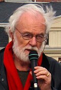
Sketch of Carl RitterDavid Harvey
Carl Ritter (1779–1859) – considered to be one of the founding fathers of modern geography and first chair in geography at the Humboldt University of Berlin, also noted for his use of organic analogy in his works.
Evelyn Stokes (1936–2005). Professor of geography at the University of Waikato in New Zealand. Known for recognizing inequality with marginalized groups, including women and Māori using geography.
Allen J. Scott (born 1938) – winner of Vautrin Lud Prize in 2003 and the Anders Retzius Gold medal 2009; author of numerous books and papers on economic and urban geography, known for his work on regional development, new industrial spaces, agglomeration theory, global city-regions and the cultural economy.
Edward Soja (1941–2015) – noted for his work on regional development, planning, and governance, along with coining the terms synekism and postmetropolis.
Derek Gregory (born 1951) – famous for writing on the Israeli, U.S. and UK actions in the Middle East after 9/11, influenced by Edward Said and has contributed work on imagined geographies.
Gillian Rose (born 1962) – most famous for her critique: Feminism & Geography: The Limits of Geographical Knowledge (1993) – which was one of the first moves towards development of feminist geography.
Geography educational frameworks
Educational frameworks upon which primary and secondary school curricula for geography are based include:
Location– Point or an area on Earth's surface or elsewherePages displaying short descriptions of redirect targets– a position or point that something occupies on the Earth's surface.
Place– Point or an area on Earth's surface or elsewherePages displaying short descriptions of redirect targets
↑Pidwirny, M. (2006). "Elements of Geography". Fundamentals of Physical Geography (2nded.). Physicalgeography.net.
12"What is geography?". AAG Career Guide: Jobs in Geography and related Geographical Sciences. Association of American Geographers. Archived from the original on October 6, 2006. Retrieved October 9, 2006.
↑Wu, J. 2006. Cross-disciplinarity, landscape ecology, and sustainability science. Landscape Ecology 21:1-4.
↑Wu, J. and R. Hobbs (Eds). 2007. Key Topics in Landscape Ecology. Cambridge University Press, Cambridge.
↑Wu, J. 2008. Landscape ecology. In: S. E. Jorgensen (ed), Encyclopedia of Ecology. Elsevier, Oxford.
↑Jordan-Bychkov, Terry G.; Domosh, Mona; Rowntree, Lester (1994). The human mosaic: a thematic introduction to cultural geography. New York: HarperCollinsCollegePublishers. ISBN978-0-06-500731-2.
↑Delgado de Carvalho, C.M. (1962). The geography of languages. In Wagner, P.L.; Mikesell, M.W. Readings in cultural geography. Chicago: University of Chicago Press, 75-93.
↑Pei, Mario (1966). Glossary of linguistic terminology. New York: Columbia University Press. ISBN9780231030120.
↑Trudgill, P. (1974). Linguistic change and diffusion: description and explanation in sociolinguistic dialect geography. Language in Society 3:2, 215-46.
↑Trudgill, P. (1983). On dialect: social and geographical perspectives. Oxford: Basil Blackwell; New York: New York University Press.
↑Trudgill, P. (1975). Linguistic geography and geographical linguistics. Progress in Geography 7, 227-52
↑Withers, Charles W.J. [1981] (1993). Johnson, R.J. The Dictionary of Human Geography, Gregory, Derek; Smith, David M., Second edition, Oxford: Blackwell, 252-3.
↑Pritchard, Annette; Morgan, Nigel J. (1 January 2000). "Constructing tourism landscapes - gender, sexuality and space". Tourism Geographies. 2 (2): 115–139. doi:10.1080/14616680050027851. S2CID145202919.
↑Harrison, Paul; 2006; "Post-structuralist Theories"; pp122-135 in Aitken, S. and Valentine, G. (eds); 2006; Approaches to Human Geography; Sage, London
↑Scott, S. P. (1904). History of the Moorish Empire in Europe. p.461. The compilation of Edrisi marks an era in the history of science. Not only is its historical information most interesting and valuable, but its descriptions of many parts of the earth are still authoritative. For three centuries geographers copied his maps without alteration. The relative position of the lakes which form the Nile, as delineated in his work, does not differ greatly from that established by Baker and Stanley more than seven hundred years afterwards, and their number is the same.
↑Guidelines for Geographic Education—Elementary and Secondary Schools. Joint Committee on Geographic Education of the National Council for Geographic Education and the Association of American Geographers, 1984.
It focuses on what geography students should know to be competent and productive 21st century citizens, and uses three content areas for assessing the outcomes of geography education. These content areas are Space and Place, Environment and Society, and Spatial Dynamics and Connections.
Pidwirny, Michael. (2014). Glossary of Terms for Physical Geography. Planet Earth Publishing, Kelowna, Canada. ISBN9780987702906. Available on Google Play.
Pidwirny, Michael. (2014). Understanding Physical Geography. Planet Earth Publishing, Kelowna, Canada. ISBN9780987702944. Available on Google Play.
This page is based on this Wikipedia article Text is available under the CC BY-SA 4.0 license; additional terms may apply. Images, videos and audio are available under their respective licenses.