This article needs to be updated.(May 2017) |
The following outline is provided as an overview of and topical guide to Nepal:
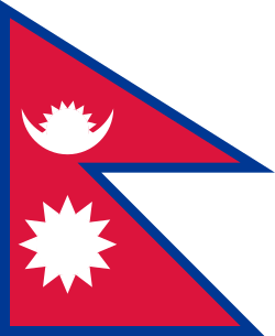
Nepal is a landlocked sovereign state in South Asia. The country is bordered to the north by China, and to the south, east, and west by India. The Himalayas in the country's northern region has eight of the world's ten highest mountains, including Mount Everest, called Sagarmatha in Nepali.
Administrative divisions of Nepal
Judiciary of Nepal
The Federal Democratic Republic of Nepal is a member of: [2]
Law of Nepal
Religion in Nepal – over 30% of the population follow Hinduism (see Hinduism in Nepal below).
Kathmandu, officially "Kathmandu Metropolitan City", is the National Capital Territory and the most populous city of Nepal with 845,767 inhabitants living in 105,649 households as of the 2021 Nepal census and approximately 4 million people in its urban agglomeration. It is located in the Kathmandu Valley, a large valley surrounded by hills in the high plateaus in central Nepal, at an altitude of 1,400 metres.
Lumbinī is a Buddhist pilgrimage site in the Rupandehi District of Lumbini Province in Nepal. It is the place where, according to Buddhist tradition, queen Maya gave birth to Siddhartha Gautama at around 623 BCE. Gautama, who, according to Buddhist tradition, achieved Enlightenment some time around 528 BCE, became Shakyamuni Buddha and founded Buddhism. Lumbini is one of many magnets for pilgrimage that sprang up in places pivotal to the life of the Buddha.
The Sherpas are one of the Tibetan ethnic groups native to the most mountainous regions of Nepal and Tibetan Autonomous Region of China. The term sherpa derives from the Tibetan-language words shar and pa, which refer to their geographical origin in eastern Tibet (Kham).
Rapti Zone was one of the fourteen zones, located in the Mid-Western Development Region of Nepal. It was named after the West Rapti River which drains Rolpa, Pyuthan and part of Dang districts. The remainder of Dang and part of Salyan district are drained by the Babai. The remainder of Salyan and all of Rukum districts are drained by the Bheri.
The culture of Nepal encompasses the various cultures belonging to the 125 distinct ethnic groups present in Nepal. The culture of Nepal is expressed through music and dance; art and craft; folklore; languages and literature; philosophy and religion; festivals and celebration; foods and drinks.
Kavrepalanchok District is one of the 77 districts of Nepal. The district, with Dhulikhel as its district headquarters, covers an area of 1,396 km2 (539 sq mi). It is a part of Bagmati Province and has a population of 364,039.
Rukum District was a "hill" and "mountain" district some 280 km (170 mi) west of Kathmandu partially belonging to Lumbini Province and partially to Karnali Province before split into two districts Western Rukum and Eastern Rukum after the state's reconstruction of administrative divisions in 2017. Rukum covers an area of 2,877 km2 (1,111 sq mi) with population of 207,290 in 2011 Nepal census. Musikot was the district's administrative center.
Baglung is a municipality in Gandaki Province, in western Nepal, 275 km (171 mi) west of Kathmandu. It is the administrative headquarters of Baglung District. Baglung serves as the major center for business, finance, education, service and healthcare for the people of mid-Kali Gandaki valley that encompass Beni, Jaljala, Baglung, Kushma, Kathekhola, Galkot, Phalewas and Jaimuni local bodies. The city is located at the cross-section of Kaligandaki corridor highway and midhill highway that transverse Nepal in north–south and east–west directions respectively.
Bharatpur is a city in south central Nepal. It is the third most populous city of Nepal after Kathmandu and Pokhara with 369,377 inhabitants in 2021. It is also the second largest metropolitan city in Nepal by area. It is the district headquarter of the Chitwan District.
Triyuga is one of the eight municipalities of Udayapur district of the Koshi Pradesh of Nepal. Gaighat is the headquarter of the municipality. According to the 2021 Nepal census the total population of the municipality is 103,475. It is divided into 16 wards. Triyuga Municipality was established on B.S. Chaitra 13, 2053. It was named after Triyuga River. A river which flows through the town. Triyuga is the 3rd largest municipality in Nepal and 1st largest in Koshi Pradesh in term of size (area). The total area of the municipality is 547.43 square kilometres (211.36 sq mi)
Koteshwor is a place, located in Kathmandu District. In 1991, Kathmandu Metropolitan City was expanded by incorporating Koteshwor as Ward No. 32. It encompasses 395 hectares and is bounded by the Manohara river in the east and south, the Bagmati river in the west, and share borders with Gothatar in the north, Madhyapur Thimi municipality of Bhaktapur District in east and Lalitpur metropolitan city in the south. With respect to basic services, almost all homes in the ward have access to electricity, but the same cannot be said about drinking water. At the time of the 1991 Nepal census it had a population of 5,787 living in 1,154 households. The ward contains 8,716 households. The population in 2001 was 35,184.
Mirchaiya formerly known as Ramnagar Mirchaiya is a municipality in Siraha District in the Madhesh Province of south-eastern Nepal. The municipality was established on 18 May 2014 by merging the existing Rampur Birta, Malhaniyakhori, Radhopur, Ramnagar Mirchaiya, Phulbariya, Sitapur PraDa and Maheshpur Gamharia Village Development Committees. At the time of the 2017 municipality records, it had a population of approx. 52,000 people living in approx 8,496 individual households. This is one of the main business markets for Katari and the southern part of the Siraha district. Raw material produced here includes padday, miazem, and sugar cane.
Sagarmatha Television, is a Nepali Television channel established in July 2007. It is a News channel and broadcasts in Nepali language. STV is a leader in live and breaking news telecast and prompt information delivery of current affairs in Nepal. STV uses bureaus in all districts and overseas countries and makes every effort to keep the viewers informing from uniquely different angles. Its headquarters are in Babarmahal, Kathmandu.
Lumbini Province is a province in western Nepal. The country's third largest province in terms of area as well as population, Lumbini is home to the World Heritage Site of Lumbini, where according to the Buddhist tradition, the founder of Buddhism, Gautama Buddha was born.
Eastern Rukum is a mountain district of Lumbini Province of Nepal situated along the Dhaulagiri mountain range. It is also the only mountain district of the province with its tallest mountain Putha Hiunchuli situated in the west end of Dhaulagiri II mountain chain, at an elevation of 7,246 meters. The drainage source of ancient Airavati river, one of the five sacred rivers of Buddhism, lies in the lesser Himalayas of the district. With a Dhaulagiri mountain range, lakes, Magar culture and its political history, Eastern Rukum has been among the top travel destinations of Nepal as designated by the Government of Nepal.
Events in the year 2024 in Nepal.