Related Research Articles
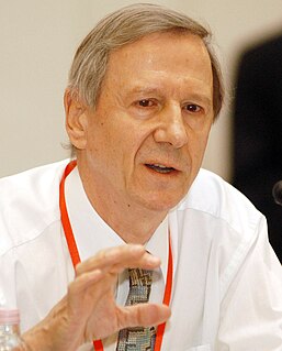
Anthony Giddens, Baron Giddens is an English sociologist who is known for his theory of structuration and his holistic view of modern societies. He is considered to be one of the most prominent modern sociologists and is the author of at least 34 books, published in at least 29 languages, issuing on average more than one book every year. In 2007, Giddens was listed as the fifth most-referenced author of books in the humanities. He has academic appointments in approximately twenty different universities throughout the world and has received numerous honorary degrees.
The theory of structuration is a social theory of the creation and reproduction of social systems that is based on the analysis of both structure and agents, without giving primacy to either. Furthermore, in structuration theory, neither micro- nor macro-focused analysis alone is sufficient. The theory was proposed by sociologist Anthony Giddens, most significantly in The Constitution of Society, which examines phenomenology, hermeneutics, and social practices at the inseparable intersection of structures and agents. Its proponents have adopted and expanded this balanced position. Though the theory has received much criticism, it remains a pillar of contemporary sociological theory.
A study circle is a small group of people who meet multiple times to discuss an issue. Study circles may be formed to discuss anything from politics to religion to hobbies. They are differentiated from clubs by their focus on exploring an issue or topic rather than on activities or socializing. When they emerged in the early twentieth century they were based on a democratic approach to self-education and were often linked to social movements concerned with temperance or working class emancipation.

Alternative media are media sources that differ from established or dominant types of media in terms of their content, production, or distribution. Sometimes the term independent media is used as a synonym, indicating independence from large media corporations, but this term is also used to indicate media enjoying freedom of the press and independence from government control. Alternative media does not refer to a specific format and may be inclusive of print, audio, film/video, online/digital and street art, among others. Some examples include the counter-culture zines of the 1960s, ethnic and indigenous media such as the First People's television network in Canada, and more recently online open publishing journalism sites such as Indymedia.

Henri Lefebvre was a French Marxist philosopher and sociologist, best known for pioneering the critique of everyday life, for introducing the concepts of the right to the city and the production of social space, and for his work on dialectical materialism, alienation, and criticism of Stalinism, existentialism, and structuralism. In his prolific career, Lefebvre wrote more than sixty books and three hundred articles. He founded or took part in the founding of several intellectual and academic journals such as Philosophies, La Revue Marxiste, Arguments, Socialisme ou Barbarie, Espaces et Sociétés.
Domestication theory is an approach in Science and Technology Studies (STS) and media studies that describe the processes by which technology is 'tamed' or appropriated by its users. The theory was originally created by Roger Silverstone, who described four steps that technology goes through when being adapted into peoples' lives:
- First, technologies are integrated into everyday life and adapted to daily practices.
- Secondly, the user and its environment change and adapt accordingly.
- Thirdly, these adaptations feedback into innovation processes in industry, shaping the next generation of technologies and services.
- Fourthly, conversion, signalling what extent and how the technology has the status of reflecting the cultures of a household.
Global citizenship is the idea that one's identity transcends geography or political borders and that responsibilities or rights are derived from membership in a broader class: "humanity". This does not mean that such a person denounces or waives their nationality or other, more local identities, but that such identities are given "second place" to their membership in a global community. Extended, the idea leads to questions about the state of global society in the age of globalization.

Digital rhetoric can be generally defined as communication that exists in the digital sphere. As such, digital rhetoric can be expressed in many different forms—including but not limited to text, images, videos, and software. Due to the increasingly mediated nature of our contemporary society, there are no longer clear distinctions between digital and non-digital environments. This has led to an expansion of the scope of digital rhetoric as there is a need to account for the increased fluidity with which humans interact with technology.
The term sense of place has been used in many different ways. It is a multidimensional, complex construct used to characterize the relationship between people and spatial settings. It is a characteristic that some geographic places have and some do not, while to others it is a feeling or perception held by people. It is often used in relation to those characteristics that make a place special or unique, as well as to those that foster a sense of authentic human attachment and belonging. Others, such as geographer Yi-Fu Tuan, have pointed to senses of place that are not "positive," such as fear. Some students and educators engage in "place-based education" in order to improve their "sense(s) of place," as well as to use various aspects of place as educational tools in general. The term is used in urban and rural studies in relation to place-making and place-attachment of communities to their environment or homeland. The term sense of place is used to describe how someone perceives and experiences a place or environment. Anthropologists Steven Feld and Keith Basso define sense of place as: 'the experiential and expressive ways places are known, imagined, yearned for, held, remembered, voiced, lived, contested and struggled over […]’. Many indigenous cultures are losing their sense of place because of climate change and "ancestral homeland, land rights and retention of sacred places".
Digital literacy refers to an individual's ability to find, evaluate, and clearly communicate information through typing and other media on various digital platforms. It is evaluated by an individual's grammar, composition, typing skills and ability to produce text, images, audio and designs using technology. The American Library Association (ALA) defines digital literacy as "the ability to use information and communication technologies to find, evaluate, create, and communicate information, requiring both cognitive and technical skills." While digital literacy initially focused on digital skills and stand-alone computers, the advent of the internet and use of social media, has resulted in the shift in some of its focus to mobile devices. Similar to other expanding definitions of literacy that recognize cultural and historical ways of making meaning, digital literacy does not replace traditional forms of literacy, but instead builds upon and expands the skills that form the foundation of traditional forms of literacy. Digital literacy should be considered to be a part of the path to knowledge.
Children's geographies is an area of study within human geography and childhood studies which involves researching the places and spaces of children's lives.
The concept of a Geospatial Web may have first been introduced by Dr. Charles Herring in his US DoD paper, An Architecture of Cyberspace: Spatialization of the Internet, 1994, U.S. Army Construction Engineering Research Laboratory.
Digital Earth is the name given to a concept by former US vice president Al Gore in 1998, describing a virtual representation of the Earth that is georeferenced and connected to the world's digital knowledge archives.
Participatory GIS (PGIS) or public participation geographic information system (PPGIS) is a participatory approach to spatial planning and spatial information and communications management.
Religion and geography is the study of the impact of geography, i.e. place and space, on religious belief.
Geographic information retrieval (GIR) or geographical information retrieval systems are search tools for searching the Web, enterprise documents, and mobile local search that combine traditional text-based queries with location querying, such as a map or placenames. Like traditional information retrieval systems, GIR systems index text and information from structured and unstructured documents, and also augment those indices with geographic information. The development and engineering of GIR systems aims to build systems that can reliably answer queries that include a geographic dimension, such as "What wars were fought in Greece?" or "restaurants in Beirut". Semantic similarity and word-sense disambiguation are important components of GIR. To identify place names, GIR systems often rely on natural language processing or other metadata to associate text documents with locations. Such georeferencing, geotagging, and geoparsing tools often need databases of location names, known as gazetteers.

A digital citizen is a person using information technology (IT) in order to engage in society, politics, and government. As defined by Karen Mossberger, one of the authors of Digital Citizenship: The Internet, Society, and Participation, digital citizens are "those who use the internet regularly and effectively." They also have a comprehensive understanding of digital citizenship, which is the appropriate and responsible behavior when using technology. Since digital citizenship evaluates the quality of an individual's response to membership in a digital community, it often requires the participation of all community members, both visible and those who are less visible. A large part in being a responsible digital citizen encompasses digital literacy, etiquette, online safety, and an acknowledgement of private versus public information.
Global citizenship education (GCED) is a form of civic learning that involves students' active participation in projects that address global issues of a social, political, economic, or environmental nature. The two main elements of GCE are 'global consciousness'; the moral or ethical aspect of global issues, and 'global competencies', or skills meant to enable learners to participate in changing and developing the world. The promotion of GCE was a response by governments and NGOs to the emergence of supranational institution, regional economic blocs, and the development of information and communications technologies. These have all resulted in the emergence of a more globally oriented and collaborative approach to education. GCE addresses themes such as peace and human rights, intercultural understanding, citizenship education, respect for diversity and tolerance, and inclusiveness.
Public rhetoric refers to discourse both within a group of people and between groups, often centering on the process by which individual or group discourse seeks membership in the larger public discourse. Public rhetoric can also involve rhetoric being used within the general populace to foster social change and encourage agency on behalf of the participants of public rhetoric. The collective discourse between rhetoricians and the general populace is one representation of public rhetoric. A new discussion within the field of public rhetoric is digital space because the growing digital realm complicates the idea of private and public, as well as previously concrete definitions of discourse. Furthermore, scholars of public rhetoric often employ the language of tourism to examine how identity is negotiated between individuals and groups and how this negotiation impacts individuals and groups on a variety of levels, ranging from the local to the global.

Geography of media and communication is an interdisciplinary research area bringing together human geography with media studies and communication theory. Research addressing the geography of media and communication seeks to understand how acts of communication and the systems they depend on both shape and are shaped by geographical patterns and processes.
References
- ↑ Boscaljon, Daniel (Spring 2014). "The reflexive appropriation of space". Iowa Journal of Cultural Studies. 15: 3–11. doi: 10.17077/2168-569X.1438 .
- ↑ Elwood, Sarah; Mitchell, Katharyne (Winter 2013). "Another politics is possible: neogeographies, visual spatial tactics, and political formation". Cartographica. 48 (4): 275–292. doi:10.3138/carto.48.4.1729. S2CID 39108360.
Recognizing neogeography as a site of political formation paves the way toward realizing its broader potential in the development and practice of a critical spatial citizenship. We develop these arguments from a three-year neogeography project conducted with young teens. [...] As an example of neogeography politics conceived as strategy, Gryl and Jekel (2012) argue that collaborative online "geo-media" (which has been termed neogeography in this article) can be sites for the development and practice of critical spatial citizenship. They argue that this critical spatial citizenship depends upon citizens' abilities to engage in "strategic practices" (de Certeau 1984), such as having the cartographic and spatial thinking skills necessary to use geo-media in ways that will be recognized by policymakers or other citizens and to use these platforms to disseminate their own spatial narratives or challenge those put forth by others.
- ↑ Stephens, Angharad Closs; Squire, Vicki (June 2012). "Politics through a web: citizenship and community unbound" (PDF). Environment and Planning D: Society and Space. 30 (3): 551–567. doi:10.1068/d8511. S2CID 145679558.
What happens to citizenship when the nation and the state are no longer assumed to be the inevitable starting points from which politics is defined? This article considers how a refusal of the nation as political community and a questioning of the state as guarantor of rights and responsibilities reconfigure our understandings of citizenship.
- ↑ Carlos, Vânia; Gryl, Inga (2013). "Where do critical thinking and spatial citizenship meet? Proposing a framework of intersections". In Jekel, Thomas; Car, Adrijana; Strobl, Josef; Griesebner, Gerald (eds.). Creating the GISociety: conference proceedings. Berlin; Offenbach: Herbert Wichmann Verlag. pp. 306–316. ISBN 9783879075324. OCLC 854921245.
Consequently, every citizen can produce own spatial narratives, and can communicate and negotiate them with others in fluent web communities (Closs Stephens & Squire 2012). This links to concepts of emancipated citizenship education (e.g. Bennett, Wells & Rank 2009; Mitchell & Elwood 2012) aimed to challenge existing frameworks of rules, referring to an ideological approach that considers power relations and divergent interests in society as driving forces.
- ↑ Bennett, W. Lance; Wells, Chris; Rank, Allison (April 2009). "Young citizens and civic learning: two paradigms of citizenship in the digital age". Citizenship Studies. 13 (2): 105–120. doi:10.1080/13621020902731116. S2CID 32724864.
The preponderance of school-based civic education programs reflects traditional paradigms of dutiful citizenship (DC) oriented to government through parties and voting, with citizens forming attentive publics who follow events in the news. The authors expand upon these conventional learning categories by identifying additional civic learning opportunities that reflect more self-actualizing (AC) styles of civic participation common among recent generations of youth who have been termed digital natives. Their AC learning styles favor interactive, networked activities often communicated through participatory media such as videos shared across online networks.
- ↑ Gryl, Inga; Jekel, Thomas (2012). "Re-centring geoinformation in secondary education: toward a spatial citizenship approach". Cartographica. 47 (1): 18–28. doi: 10.3138/carto.47.1.18 .
- 1 2 Jekel, Thomas; Gryl, Inga; Schulze, Uwe (2015). "Education for spatial citizenship". In Solari, Osvaldo Muñiz; Demirci, Ali; Schee, Joop (eds.). Geospatial technologies and geography education in a changing world: geospatial practices and lessons learned. Tōkyō; New York: Springer Verlag. pp. 35–49. doi:10.1007/978-4-431-55519-3_4. ISBN 9784431555186. OCLC 900306594.
- ↑ Werlen, Benno (1993). Society action and space: an alternative human geography. London; New York: Routledge. ISBN 978-0415069656. OCLC 25372963.
- ↑ Sbicca, Joshua; Perdue, Robert Todd (2014). "Protest Through Presence: Spatial Citizenship and Identity Formation in Contestations of Neoliberal Crises" (PDF). Social Movement Studies. 13 (3): 309–327. doi:10.1080/14742837.2013.822782. S2CID 143659468.
- ↑ Fischer, Florian (2014). "Everyday geomedia use and the appropriation of space". In Jekel, Thomas; Sanchez, Eric; Gryl, Inga; Juneau-Sion, Caroline; Lyon, John (eds.). Learning and teaching with geomedia. Newcastle upon Tyne, UK: Cambridge Scholars Publishing. pp. 10–28. ISBN 9781443862134. OCLC 885014629.
- ↑ Harley, John Brian (Summer 1989). "Deconstructing the map". Cartographica. 26 (2): 1–20. doi:10.3138/E635-7827-1757-9T53.
- ↑ MacEachren, Alan M.; Buttenfield, Barbara P.; Campbell, James B.; DiBiase, David W.; Monmonier, Mark (1992). "Visualization". In Abler, Ronald; Marcus, Melvin G.; Olson, Judy M. (eds.). Geography's inner worlds: pervasive themes in contemporary American geography. Occasional publications of the Association of American Geographers. Vol. 2. New Brunswick, NJ: Rutgers University Press. pp. 99–137. ISBN 978-0813518299. OCLC 25008961.
- ↑ "SPACIT: education for spatial citizenship". European Commission . Retrieved 2012-10-29.
- ↑ "Digital-earth.eu". European Commission. Archived from the original on 2015-09-10. Retrieved 2016-04-04.
- ↑ "Europe2020: Europe's growth strategy". European Commission . Retrieved 2012-11-04.